• ⚠️ Emergency contact in Spain - Dial 112 and AlertCops app. More on this here.
  • Remove ads on the forum by becoming a donating member. More here.

Search 74,075 Camino Questions

Le Puy Route - the variants!?

irishgurrrl

Active Member
Time of past OR future Camino
Camino Frances Sept/Oct 2012
Camino Finisterre Oct 2012
Le Puy Route (Le Puy-en-Velay to St Jean Pied de Port) April/May 2014
[Kilimanjaro Sept 2014]
Le Puy Route (Le Puy-en-Velay to St-Chely d'Aubrac) May 2015
[Stevenson Route, France - April 2016]
The Way of St Francis (Sansepolcro to Assisi) May 2016
[The West Highland Way, Scotland - Sept 2016]
[The Kerry Way, Ireland - March 2017]
Next up:
Camino Primitivo (Oviedo-Lugo) end April-mid May 2017
[Everest Base Camp Trek, Nepal -- October 2017]
Hey All,

I have a question on all the variants along the Le Puy Route - we plan to do the Cele Route all things going well - but I noticed there are a few mini 'alternative' routes along the way.

We don't necessarily want to add extra days to the route - but which ones should we consider doing if any?

Thanks in advance? :)
 
€2,-/day will present your project to thousands of visitors each day. All interested in the Camino de Santiago.
The only detour I know of is that to Rocamadour. Does anyone know how far it is off the main route? If the journey from Figeac is to be broken up where would one stay and where would one stay on the return to the main route at Cahors?
 
The only detour I know of is that to Rocamadour. Does anyone know how far it is off the main route? If the journey from Figeac is to be broken up where would one stay and where would one stay on the return to the main route at Cahors?

You can get a train from Figeac which, as far as I know, stops a few km short of the town.
 
Ideal sleeping bag liner whether we want to add a thermal plus to our bag, or if we want to use it alone to sleep in shelters or hostels. Thanks to its mummy shape, it adapts perfectly to our body.

€46,-
There is a short variant the day after Conques that avoids Decazeville. Take it- otherwise you will have to do what I did- go steeply downhill into Decazeville, and steeply uphill out of it! I didn't take the variant, but I think it stays at a higher level.
Margaret

And Decazeville is a mining town, so the one town on the Le Puy that I'd happily miss.

You can catch the train from Fijeac to Rocamadour and back in one day, I think - we didn't but I wish we had.
 
There is a short variant the day after Conques that avoids Decazeville. Take it- otherwise you will have to do what I did- go steeply downhill into Decazeville, and steeply uphill out of it! I didn't take the variant, but I think it stays at a higher level.
Margaret

Thanks Margaret - I will make a note of it!
 
Holoholo automatically captures your footpaths, places, photos, and journals.
And Decazeville is a mining town, so the one town on the Le Puy that I'd happily miss.

You can catch the train from Fijeac to Rocamadour and back in one day, I think - we didn't but I wish we had.

Thanks too Kanga - are the variants obviously marked along the way so we will know where to turn off (and how to get back on the GR65 after Decazeville)?
 
Thanks too Kanga - are the variants obviously marked along the way so we will know where to turn off (and how to get back on the GR65 after Decazeville)?

I did not take the variant because we had to go into Decazeville for my partner to catch the train. Which is how I know it is definitely missable. So I wasn't looking for or aware of the bypass. But generally all the options are very well marked.

I use one of the topo map apps on an iPhone or iPad as a fallback. It has made it impossible to get lost - rather encourages me to wander off the path if feeling inclined! GPS positioning is a marvellous thing.

I must have a look at the maps then to see where it is... I won't have anything as high tech as GPS with me... just bringing an old Nokia phone to book reservations but I tend to like to stay as disconnected as possible en route if I can help it :) Thanks again Kanga :)
 
The one from Galicia (the round) and the one from Castilla & Leon. Individually numbered and made by the same people that make the ones you see on your walk.
I must have a look at the maps then to see where it is...
I'm looking myself. I wonder if you take the route to Agnac, which seems to by-pass the centre of Decazeville.
The description of the turn off depends on what route you take out of Conques after Chapelle Sainte-Foy (cf Miam Miam Plan 23), the turn off point looks like it follows the D580 (cf Miam Miam Plan 24).
Please let me know if anyone thinks this is incorrect.
Colin

Hi Colin - yes that looks correct to me :)
 
Last edited:
I can see the variant through Noailhac, which follows a minor road along the ridge, but it rejoins the GR65 before Decazeville. Still looking for a way to avoid Decazeville.
 
A selection of Camino Jewellery
Yes, I also think the D580 past Agnac would do. You still need to skirt Decazeville to cross the bridge to Livinhac-Le-Haut.
 
Yes, I also think the D580 past Agnac would do. You still need to skirt Decazeville to cross the bridge to Livinhac-Le-Haut.

Yep that looks like its the variant alright... will go with that me thinks!
 
Yes, I also think the D580 past Agnac would do. You still need to skirt Decazeville to cross the bridge to Livinhac-Le-Haut.

Funny...last fall four of us were walking together and three of us went into Decazeville ...big down and up. The young
guy in the group took the variant and beat us to Livinhac by an hour or so. We had a great laugh over this and ribbed the young guy about taking the shortcut yet us older pilgrims paid the price...but we were proud!
 
Train for your next Camino on California's Santa Catalina Island March 16-19
There are two bits to the variant from Conques. The first variant cuts off to the left soon after you climb out of Conques. I did take this- it passes near Noailhac. I took it as I heard it had some spectacular views, but I hadn't been on it long before the mist came down, and I saw nothing. Then a thunderstorm arrived, and the rain poured down. (It turned into my 'day from hell' for a variety of reasons actually- makes a good story in hindsight, but not at the time!) There weren't a lot of markings on this variant, but enough so you didn't get lost, and it rejoined the GR65 not far from where the other shortcut towards Livinhac leaves the GR.

I didn't take the second bit of the variant (to avoid Decazeville) mainly because it was raining so hard where the routes diverged that I couldn't get my MMDD maps out of my bag to look at properly. So I decided to take the 'main' route. I arrived at Saint-Roch where the routes join together again looking like a drowned rat- while a couple of people strolled along easily from the direction of Agnac, looking quite relaxed.) It was also a steep, sloshy muddy descent in the wet conditions after Saint-Roch down to Livinhac, and I didn't meet anyone else much on the descent. I suspect French-speakers might have acquired more local knowledge and perhaps went a little to the right at Saint-Roch to take the D21 road downhill towards Livinhac, given the wet conditions.
Margaret

I'll check both out - looks the the second part of the variant is a short cut of sorts.... would be curious whether the Noaihac variant is longer or shorter too?
 
The second part of it has the word "Raccourci" on the MMDD map- which means shortcut- which would explain why the young fellow GuyA talked about got there an hour before them! As far as I can tell from MMDD the first variant is about the same length as the main GR route- but it is hard to be sure across pages. However, if it looks like there might be mist about, you won't see any of the hoped-for views on the variant.

Another short variant comes after Lectoure and Marsolan where you can choose to go via La Romieu or not. I did go there, and was glad I did- I found the village very interesting with the Collegiale and all the cat sculptures.
Margaret
 
The 2024 Camino guides will be coming out little by little. Here is a collection of the ones that are out so far.
I'll check both out - looks the the second part of the variant is a short cut of sorts.... would be curious whether the Noaihac variant is longer or shorter too?

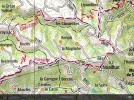
The variant along the D580 through Noaihac I think is shorter. It certainly avoids a few ups and downs. But it is road walking. Here's a screen shot of the Topo map
ImageUploadedByCamino de Santiago Forum1396658304.873803.webp
 
There are two bits to the variant from Conques. The first variant cuts off to the left soon after you climb out of Conques. I did take this- it passes near Noailhac. I took it as I heard it had some spectacular views, but I hadn't been on it long before the mist came down, and I saw nothing....
Yes, when we talk about variants and options, so much depends on the conditions. Had a good chuckle at the story of your day, had the odd day like that myself.
Do you remember if the route via Noailhac was mostly road walking, if so, what was it like?
Colin
 
There is a short variant the day after Conques that avoids Decazeville. Take it- otherwise you will have to do what I did- go steeply downhill into Decazeville, and steeply uphill out of it! I didn't take the variant, but I think it stays at a higher level.
Margaret
We took an even higher route, skirting the north side of the MMD map. Definitely stay up on top the hill. The French route-makers have a disgusting predilection for going up and down hills just for the sake of going up and down. Remember, most French just walk the long weekends, or a week or two at a time, rather than through-hiking as pilgrims.
 
Holoholo automatically captures your footpaths, places, photos, and journals.
Do you remember if the route via Noailhac was mostly road walking, if so, what was it like? Colin
I walked this section back in 2008, and it didn't actually quite pass through Noailhac itself- the chemin cut off along the D580 a short distance before that- but the markings may have been changed since then. It was along a road , but the road was actually very quiet- I can't remember any traffic- I would have tried to flag some down to get out of the thunderstorm if any had passed! The countryside was very peaceful- (not that I could see a lot of it because of the fog.) As I say, the reason I took the variant was because I read somewhere about the great views on the variant, but once the weather closed in, there was only enough of a view for me to see there was nowhere suitable for sheltering from the storm!
Margaret
(who hopes to walk the Cele Valley and go to Rocamadour one day!)
 
CELE ROUTE - I've just spotted you can hire canoes now from the camp site at Brengue (just after Espagnac) and paddle along the Cele River - read info on it and watched a lovely video of a family that did it - what a great way to get to Marchilhac! Would be so tempted if the weather was nice but I will have to have a chat with my camino compadre! :)

Here's a link to where the video is posted: http://www.songofthepaddle.co.uk/fo...497-River-Cele-Brengues-to-Marcilhac-sur-Cele
 
Ideal sleeping bag liner whether we want to add a thermal plus to our bag, or if we want to use it alone to sleep in shelters or hostels. Thanks to its mummy shape, it adapts perfectly to our body.

€46,-
CELE ROUTE - I've just spotted you can hire canoes now from the camp site at Brengue (just after Espagnac) and paddle along the Cele River - read info on it and watched a lovely video of a family that did it - what a great way to get to Marchilhac! Would be so tempted if the weather was nice but I will have to have a chat with my camino compadre! :)

Here's a link to where the video is posted: http://www.songofthepaddle.co.uk/fo...497-River-Cele-Brengues-to-Marcilhac-sur-Cele

We actually stayed in that camp site but the river was far too high for canoeing. We were a bit concerned about getting flooded out (it was spring). Lovely irises everywhere. The path is along the hillside so above the river but there is a road that runs pretty much right beside the river. We did walk the road when we thought the path would be very wet and muddy. The houses built into the cliffs are fascinating.
 
I did not take the variant because we had to go into Decazeville for my partner to catch the train. Which is how I know it is definitely missable. So I wasn't looking for or aware of the bypass. But generally all the options are very well marked.

I use one of the topo map apps on an iPhone or iPad as a fallback. It has made it impossible to get lost - rather encourages me to wander off the path if feeling inclined! GPS positioning is a marvellous thing.

Hi Kanga! What was the name of the topo map app you used. I have an iPhone and will be walking the LePuy starting April 2015. Thanks
 
Join the Camino cleanup. Logroño to Burgos May 2025 & Astorga to OCebreiro in June
Thanks Kanga I will check it out and give it a go. Your assistance is greatly appreciated.
 
Thanks for responses to my last queries. I am leaving next week and am still wondering about investing in a cheap telephone. I was hoping to do the reservations on-line with my iPad or using local phones. I am walking from Le Puy to Conques on my own. Great conversations!!
 
Thanks for responses to my last queries. I am leaving next week and am still wondering about investing in a cheap telephone. I was hoping to do the reservations on-line with my iPad or using local phones. I am walking from Le Puy to Conques on my own. Great conversations!!
We buy a local SIM card for our phone, and it would probably be good value to get your phone from the same place. Just make sure it is all set up and you know how to recharge before you leave the store. Often we asked our hosts to make the call for us to the next gite - they are usually very helpful.
 
The one from Galicia (the round) and the one from Castilla & Leon. Individually numbered and made by the same people that make the ones you see on your walk.
Thanks Kanga! You offer a lot of great tips so I will consider this very seriously especially as I am on my own!
 

❓How to ask a question

How to post a new question on the Camino Forum.

Most read last week in this forum

Hi there, I'm considering walking from Le Puy to St. Jean next spring if I can get my French up to par. I'm looking on advice on a few things: - Would it be too cool and rainy to start walking...

Featured threads

❓How to ask a question

How to post a new question on the Camino Forum.

Featured threads

Forum Rules

Forum Rules

Camino Updates on YouTube

Camino Conversations

Most downloaded Resources

This site is run by Ivar at

in Santiago de Compostela.
This site participates in the Amazon Affiliate program, designed to provide a means for Ivar to earn fees by linking to Amazon
Official Camino Passport (Credential) | 2024 Camino Guides
Back
Back
Top