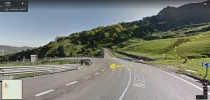
As some of you know, I'm in the process of updating the Confraterity's online Salvador guide. I am pretty well done, but some recent comments have left me a bit confused about the segment between Puerto de Pajares and the Pueblo de Pajares. I apologize if this is extremely detailed and confusing -- probably only those who have walked the route recently will be able to understand what I'm talking about.
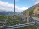
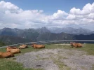
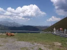
The Puerto de Pajares (which is the mountain pass, where there is an empty shuttered parador, a bar with good food, and great views) is about 5 kms along the N-630 highway to the Town of Pajares (where there is a great albergue, a Casa Rural, and a bar/restaurante). I do NOT recommend walking those 5 kms along the side of the highway. This is a very busy truck route.
In the old version of our online guide, these were the directions:
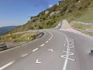
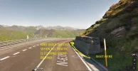
If you would rather escape the roaring traffic, follow the N-630
highway a half km or so from the Puerto until you spot an
emergency gravel stop lane for trucks with failing brakes, and a
sign that warns of a 15% grade descent. To your LEFT is a
marked Camino path, an overland alternative that is longer, but
much more pleasant and safe.
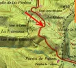
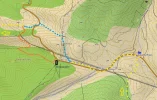
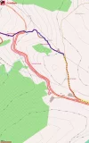
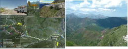
On page 35 and p. 36 of Ender's new guide in English, http://caminodelsalvador.net/?cat=13 he describes a way to get to that emergency warning without walking on the N-630 highway. This option seems to involve walking along a path on the RIGHT side of the N-630 for a while, dropping down to the N-630 at the point where the emergency warning is, crossing the N-630, and getting on the path we describe as being 1/2 km along the N-630 and off to the left.
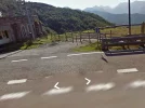
When I walked the Salvador in 2012, though, I could have sworn that there is a new turn-off on the LEFT side of the N-630 not very far from the parador. In other words, I'm pretty sure that I didn't stay on the N-630 for that 1/2 km of death-defying traffic before getting to the turnoff on the left, but that rather there was a much earlier turn-off, which no doubt joins up with the path that the other two options are talking about.
Can anyone help me out here? I would really like to have clear instructions for this segment because the N-630 is very busy with trucks and would be extremely dangerous to walk on.
Thanks, everyone, buen camino, laurie


