• ⚠️ Emergency contact in Spain - Dial 112 and AlertCops app. More on this here.
  • Remove ads on the forum by becoming a donating member. More here.

Search 74,075 Camino Questions

GR10/GR11 West to East

  • Thread starter Thread starter Deleted member 3000
  • Start date Start date
The focus is on reducing the risk of failure through being well prepared. 2nd ed.
No info on the group but can recommend a good guide called Trekking in the Pyrenees by Douglas Streatfield-James and covers both the GR10 and GR11. You can walk West East or East West. The trail head for the East West starts in Banyuls, France, a few km from where I holiday. This walk was on my wish list when I was younger.
 
Ideal pocket guides for during & after your Camino. Each weighs only 1.4 oz (40g)!
I have suddenly changed my plans for the Camino in 2016 to celebrate my 70th birthday. I have so many friends in Biarritz who ask me why I do the Camino, and I answer, because. Then they ask me why I haven't done GR10 and I say because. Now I know why they ask me that question. Thank you for the video.
 
Pfffff, lost for words. Aaaaaamazing! Count me in :)
 
Join the Camino cleanup. Logroño to Burgos May 2025 & Astorga to OCebreiro in June
This is the equivalent of summiting Everest six times! It's on my to-hike list before I get too old. Wonderfully inspirational pictures (I've only ever read about it before - never *seen* it)
Looks like a series of the Primitivo's Hospitales days on steroids.
 
We crossed it a few times stumbling around (literally - I was almost crawling up a rocky path) in the Pyrenees a few years ago. It always seemed impossibly difficult. I vaguely remember "Monte Perdito" or possibly "Diablo". Enough to scare me off.
 
I was torn between the GR11 and the VdlP this year and even bought the cicerone guide. I was drawn by the stunning pictures on this blog.

http://gr11blog.blogspot.co.uk/

It seems though that he did quite a bit of wild camping, some of it at high altitude. After thinking of adding a tent, hard weather gear, a heavier sleeping bag, food, etc. then facing these climbs, I've chickened out. I'm 67, and the VdlP won, but if I were younger...............it would be great.
 
A selection of Camino Jewellery
This is what Douglas Streatfield-James's Guide to the GR10 says,

"EXPERIENCE
No great level of experience is required to walk the GR10 - its well marked and there is plenty of shelter along the way. If your thinking of doing the HRP or of going off the beaten track, you will definitely need to be a confident map reader with a sound knowledge of high-level trekking.
Do make sure you are fit. The GR10 may not be technically difficult but there's an awful lot of climbing and decending and, if your body isn't used to it, the first few days will be painful.
One of the Golden rules of mountain walking is that you always walk in company if at all possible."

The HRP (Haute Randonnee Pyrenees) is a higher route than the GR10, a bit like the PCT and requires one to carry enough food and equipment for several days hike, apart from that it is thought to be easier as you walk the ridges so there is no daily climbing and descending to shelters or villages in the valleys, the weather on the other hand may be more extreme even in Summer.
This thread has again awoken a yen to walk this route but alas the state of my poor ticker (and probably my wife) would not allow it now. I have walked a little bit of it from the Mediterranean (Banyuls) end as day walks and it is beautiful.
 
Thanks Wayfarer, I've done a lot of Mountain walking, have got the experience and the skills............its my engine that is starting to misfire.

I'm led to believe that GR11 tends get less rainfall than the GR10 which was another of it's atractions for an already Soggy Scot.
 
Thanks Wayfarer, I've done a lot of Mountain walking, have got the experience and the skills............its my engine that is starting to misfire.

I'm led to believe that GR11 tends get less rainfall than the GR10 which was another of it's atractions for an already Soggy Scot.
The GR11 runs through Navarra, Aragòn and Catalonia and is supposed to be far wilder and more remote than the GR10 so camping and carrying several days provisions is necessary. The weather probably would be a bit better. It is also said to be a beautiful hike.
 
The one from Galicia (the round) and the one from Castilla & Leon. Individually numbered and made by the same people that make the ones you see on your walk.
We will be starting our pilgrimage on May 26, and hike from SJPdP to Irun on the GR-10.
(From there, we will do the Norte to Oviedo/Salvador from Leon to Oviedo/Primitivo to Santiago/Fistera & Muxia/reverse Portuguese to Porto.)
80 days en camino.

But we're really looking forward to this beautiful, mountainous start.
We'll be sure to report back when we're home late August.
 
I walked it about 20 years ago over a number of summers. A lovely walk and completely different from the Camino. Its pretty hard going in places as weather is unpredictable, you have to carry substantial loads - food, equipment and be prepared for the unexpected. But its a great place to go!
 
Holoholo automatically captures your footpaths, places, photos, and journals.
Thanks Wayfarer, I've done a lot of Mountain walking, have got the experience and the skills............its my engine that is starting to misfire.

I'm led to believe that GR11 tends get less rainfall than the GR10 which was another of it's atractions for an already Soggy Scot.

Houlet

your welcome to borrow my maps for the Gr11.

sounds like your a munro bagger.. being one of Glenmore lodges finest I was looking forward to doing the GR11 with a view to taking a small group the following year with me.

I have completed the GR11 in its entirety..there is less rain than the GR10,(not that a Scot would worry about that) you need to be spot on with your Navigational skills..undertaking this route solo..I used 1:40:000 scale maps, (there was sporadic sections with a good snow covering so no visual on the ground for the markers) and when there was a lot of snow melt the very few people I did come across turned back due to the fastness of the water run off and the swollen stream coming of the mountains...time and patience finding a suitable spot to cross...

maps
which consists of 46 maps divided onto 23 maps pages using both sides..compared to being spoilt using the OS maps in Scotland the prames maps need some work.
I encountered a few areas where snow was still lying around even in August at a lower level... on one occasion I arrived at a huge cornice which delayed me having to take a very long detour going back down and around taking a day out of my food supplies..not being able to reach my days intended destination. I carry one Days extra emergency food ration anyway for unexpected delays...and seeing that there was still a lot of snow in a few areas I decided the next day reaching Puigcerda to resupply food wise and rest for a day or so. preparing my maps for the next day I discovered map 37/38 was missing, these maps come in a sealed cover..I was fortunate enough after asking many people in Pugcerda to be able to find a older version of the map I need... the timing of arriving and staying in Pugcerda was for me a blessing in disguise...that evening into the early hours there were some serious storms raging in the mountains

I never bothered with the huts,instead camping all the way and working my way down every four or five days depending to resupply and continue.....the wildlife and scenery reminded me of New Zealand...everyday was stunning... passing through Andorra I took two days off and decided I want to move there,which is now happening early 2016.

I took four and half weeks to complete ....

books

I read a cicerone guide by Paul lucia through the Pyreness:GR11 who had done this before. a good read..included are basic map pages..did not take guide with me.
The prames 7a edition GR11 senda pirenaica comes with a heavy guide book in Spanish...

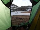
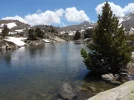
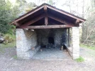
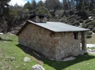
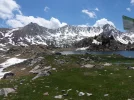
view from my tent at a summer camp.? note the other tent opposite..
SAM_0382 - Copy (2).webp

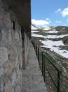
SAM_0381.webp
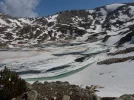
SAM_0384.webp
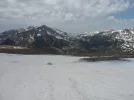
SAM_0395.webp
 
WOW! now this is what I'm talking about!!! haha!
So can you post a map shot of your trail?
Thanks!
 
I took very few photos..if you create a gmail address and PM me I can send you the ones I have of the trail..

I have visited a lot of mountain ranges including America.. the downside for me now doing these solo you do not have someone to say "look at that scene etc)

the GR11 has a lot of wow factor

I am concerned about taking up space by adding more..here
 
Last edited:
Get a spanish phone number with Airalo. eSim, so no physical SIM card. Easy to use app to add more funds if needed.
I took very few photos..if you create a gmail address and PM me I can send you the ones I have of the trail..

I have visited a lot of mountain ranges including America.. the downside for me now doing these solo you do not have someone to say "look at that scene etc)

the GR11 has a lot of wow factor

I am concerned about taking up space buy adding more..here

Thanks, I understand! I will PM you as soon as I figure out how/where to go lol! I'm new to this software ...
 
I took very few photos..if you create a gmail address and PM me I can send you the ones I have of the trail..

I have visited a lot of mountain ranges including America.. the downside for me now doing these solo you do not have someone to say "look at that scene etc)

the GR11 has a lot of wow factor

I am concerned about taking up space buy adding more..here

Haha, ok, I started a conversation inbox to you ... not sure if that's the PM is! geezzz lol!
 
The focus is on reducing the risk of failure through being well prepared. 2nd ed.
OK I will send you my camino kit list and Gr11 list..which were not the same....not the same bags.

this will require some time...so I will gmail you..with list.....will start on that now
 
Train for your next Camino on California's Santa Catalina Island March 16-19
There is some great info and pics there mg999, thank you for them.

I think I'm probably going to "chicken out" I did the VdlP last year instead and probly will go for the Camino Norde this year, although not easy probably more appropriate for a wrinkly like myself. :)
 
Hou
There is some great info and pics there mg999, thank you for them.

I think I'm probably going to "chicken out" I did the VdlP last year instead and probly will go for the Camino Norde this year, although not easy probably more appropriate for a wrinkly like myself. :)

Houlet

if you fancy a no "way marking trail" on the west coast of Scotland the trek from Fort william to Cape wrath is a hardy trek.. north to the cape might is the book might interest you.......or the west highland way for a warm up waymarked...

Larig ghru is nice in summer or challenging in winter

regarding wrinkly as you put it...you have more life experience than others.....;)
 
Ideal pocket guides for during & after your Camino. Each weighs only 1.4 oz (40g)!
Hi mg999,

The Cape Wrath trail is on my bucket list, I did the WHW plus Ben Nevis and the Great Glen Way couple of years ago so that would tie in nicely.

I was only pup, it was more than 50 years ago, when I walked the Larig ghru so maybe it's time I repeated it. I always thought that when I retired I would have sooooooo much time for these things but my brat's brats and my brat's dogs seem to steal a lot of my time.

There are some great bothys on the Cape Wrath trail
 
I have just discovered this thread. Reading about the GR 10 makes my heart go very fast. I have walked it from start to finish words fail me in describing how beautiful it is. My introduction to it was by accident. I was walking the Le Puy Camino and had teemed up with a Swiss lady who was walking from Geneva to Santiago and on to Finisterre. She wanted to do the Del Norte and was going to get a bus from St Jean Pied de Port to Irun. I had walked the complete Camino Francis a few months earlier so the Del Norte sounded good for me. Both of us had never hiked real mountains or even heard of the gr 10 but we asked was it possible to walk from St Jean on a marked route to Irun someone said the gr 10, but it was dangerous. Like kids that word made us want to do it. I went into the tourist office in St Jean and persuaded them to photocopy a few pages of a guide and off we went. I said goodbye to my Swiss friend near Bilbao and come back to Ireland.

The gr 10 bug had taken hold. The next year I started in St Jean Pied de Port and walked for 36 consecutive days to Bolquere. The next year from Bolquere to Banyuls sur Mer on the Mediterranean. I included a four day detour to the Glacier of Vignemale and Garvanie. It took a total of 50 days. It has a total accent of 50,000 meters and decent of 50,000 meters, that is an average of 1,000 meters up and down every day.I did not bring a tent, I slept in Gites, Mountain Refuges both manned and unmanned. Ciceronne has a guidebook by the late Paul Lucia whic I sometimes used, but really the only guidebooks to use are the French Topo guides, I was able to follow them with hardly any French, there are 4 guides that cover the gr 10 and their maps are excellent. I also brought a small gas stove. Eatinf tips, mix a good bag of Muesli with powdered milk, you will get several days out of a kilo, also a Quino pasta mixed with good quality cup of soup. Most days you will be able to get a proper hot meal.

I have a special section of my website dedicated to the gr10 with about 80 photographs here is a direct link to it http://www.caminogallery.com/galleries/?id=13 also photos in my blog http://www.dermotdolan.blogspot.ie/2013/09/pyrenees-photographs-collection.html (last section of the Pyrénées) also http://dermotdolan.blogspot.ie/2013_08_01_archive.html and http://dermotdolan.blogspot.ie/2013_09_01_archive.html
There is also an excellent book (not a guidebook) called If you only walk far enough by Steve Cracknell about his journey.

It is a tough walk and bears no direct resemblance to a Camino, but is worth doing it is unbelievable. I have also put a lovely one hour video together of it, but due to music copyright can not yet post it to You tube.
Pm me and I will answer any questions you may have. I will post one photograph here. This is taken on the detour near Vignemale.

Regards Dermot (Nalod)
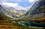
Near Vignemale (2000x1329) (1024x680).webp
 
Last edited:
...and ship it to Santiago for storage. You pick it up once in Santiago. Service offered by Casa Ivar (we use DHL for transportation).
I know it is not about the camera you use, but your eyes/vision, but still what was the equipment you used to capture this image? It is seriously one of the best landscapes I have seen in a very long time! SY
 
Perfect memento/gift in a presentation box. Engraving available, 25 character max.
I know it is not about the camera you use, but your eyes/vision, but still what was the equipment you used to capture this image? It is seriously one of the best landscapes I have seen in a very long time! SY
Hello and thanks again ST. I use a Nikon d 80 with a standard 18 to 135 lens. It is now 7 years old badly needs upgrading. It is heavy 1.2 kg but I use an optech harness which I wear all day every on the trail. Regards Dermot
 
Yes William, good suggestion I read it good read, I have read many book about the Pyrénées namely about the GR10. Steve Cracknell is an Englishman who moved to Carcasonne region many years and is probably not a well know author but is well know in relation to the GR 10. His book "If you only walk long enough" is by far the best book I have read about the GR 10, it is also written in French, it is not a guidebook, it is Diary style, it is so easy to read, funny and informative. Steve also runs a very good website about the gr 10 and the Pyrénées in general here is the link.http://www.pyreneanway.com/if-you-only-walk-long-enough-exploring-the-pyrenees/?lang=en

Regards Dermot (Nalod)
 
3rd Edition. More content, training & pack guides avoid common mistakes, bed bugs etc
So thrilled to have found this thread on our forum! An internet search brought me right back here to our forum that I didn't know had a discussion of this route. We are doing either the GR10 or the GR11 this summer. Still not certain which one to do. I will be with atleast three of my six children and we have done five days of the GR10 connecting SJPP to the Norte two years ago. My daughters were 9,11 then... It was stunning.
My concerns are getting food, being warm enough...and the cost if we do the French side. I am wondering if the Spanish side holds to the tradition of things being way less expensive in Spain than in France, does it still apply in the Pyrenees I wonder...
 

❓How to ask a question

How to post a new question on the Camino Forum.

Featured threads

❓How to ask a question

How to post a new question on the Camino Forum.

Featured threads

Forum Rules

Forum Rules

Camino Updates on YouTube

Camino Conversations

Most downloaded Resources

This site is run by Ivar at

in Santiago de Compostela.
This site participates in the Amazon Affiliate program, designed to provide a means for Ivar to earn fees by linking to Amazon
Official Camino Passport (Credential) | 2024 Camino Guides
Back
Back
Top