• Remove ads on the forum by becoming a donating member. More here.

Search 74,075 Camino Questions

GPS vs Apps

Doogman

Active Member
Time of past OR future Camino
?
Hello All: As someone that is technologically challenged, I have always relied on guidebooks, maps, signs, etc. to get me where I am going. However, I am becoming more and more intrigued by some of the more modern technologies available. However, as I read about them, I am getting more confused. On the one hand there are GPS devices (i.e. Garmin) that cost $300-$400 or more. On the other hand there are iPhone apps like Maps.me that are free (I think). What is the difference? They sound the same to me. What I would be looking for is something that supports a GPX or KML file that would allow me to see the route I should be following vs where I actually am at any point in time. Thanks in advance for any help!
 
Get a spanish phone number with Airalo. eSim, so no physical SIM card. Easy to use app to add more funds if needed.
The real question is - what do you want it for and what do you already have? If you own already a Smartphone and just want to check your location occasionally and/or record your way for further use an app like MotionGPS on your Smart- or iPhone is completely sufficient. Buen Camino, SY
 
In due course, I am hoping to get off the beaten track a bit more onto trails that are not signposted as well as the Camino trails. Instead of carrying bundles of maps with me, or a bulky guidebook (if one exists), I was hoping on downloading a pre-determined route onto some sort of device, and then checking that device throughout the day to figure out where I am and confirm that I am (or not) actually on that route. I currently have an iPhone, but I do not use that for navigation. I usually just follow the yellow arrows or whatever form the signage is in.
 
€2,-/day will present your project to thousands of visitors each day. All interested in the Camino de Santiago.
I agree with @SYates about starting out with a GPS app on your smartphone to see if it meets your functional and performance requirements. Most smartphone GPS apps can do the things you have described and more. The disadvantages are in areas like battery life, start-up times, accuracy and waterproofing. Modern smartphones are improving in some of these areas, but so are the dedicated GPS units. Overall, it is becoming less clear cut, even for long term users of dedicated GPS devices like me, that on trails like the Camino a dedicated unit offers substantial advantages.
 
The main difference between GPS and iphone apps

-GPS relies on maps you have loaded onto the GPS. It uses GPS to provide grid locations anywhere in the world and plots them on your maps.

-iphone apps rely on wifi connectivity to show a google map for your area. If you didn't set up the map the last time you were near wifi ... then you don't have a map. The iphone uses GPS (or glonass) to provide grid coordinates anywhere in the world. The grid coordinates are not much use without a map.
 
3rd Edition. More content, training & pack guides avoid common mistakes, bed bugs etc
The main difference between GPS and iphone apps

-GPS relies on maps you have loaded onto the GPS. It uses GPS to provide grid locations anywhere in the world and plots them on your maps.

-iphone apps rely on wifi connectivity to show a google map for your area. If you didn't set up the map the last time you were near wifi ... then you don't have a map. The iphone uses GPS (or glonass) to provide grid coordinates anywhere in the world. The grid coordinates are not much use without a map.
I cannot speak for iphone apps, but there are now plenty of Android GPS apps where the mapping can be downloaded in advance and they then don't rely on a persistent connection to the internet over a data connection.
 
Just out of information: There are GPS apps that work offline, without using wifi connectivity or any other data... Just like any other GPS does.

You can put your iphone inside a cheap water proof cover ( costs like 5 bucks) and off you go!


The disadvantages are in areas like battery life

Now... for the battery life issue.... Unless you want to carry extra juice with you, you might have a problem.


;)
 
Just out of information: There are GPS apps that work offline, without using wifi connectivity or any other data... Just like any other GPS does.
You can put your iphone inside a cheap water proof cover ( costs like 5 bucks) and off you go!
Now... for the battery life issue.... Unless you want to carry extra juice with you, you might have a problem.
;)

Map and compass works all the time.
 
Holoholo automatically captures your footpaths, places, photos, and journals.
I use Maps.me for my last few Caminos. It's the best app for me (free). It supports both iOS and Android. It is best for the less trodden Caminos where it can be easy to get lost or when leaving a big city (hard to find the arrows). Works really well for me on the Camino Levante and Camino Vasco del Interior. Here's what you do.

1. Install the Maps.me app.
2. Find the kml file of the Camino you are walking to load the overlay.
3. Zoom in to Spain. If successful you should see a line (camino) overlayed on the Spain Map.
4. Further zoom towards the line to see the details. Once that happens the app is going ask you if you want to download the offline map for that region. Agreed and follow the route to download the other regions along the track.
5. If you have 600 meg free space you have the option of just download the whole offline map of Spain so you can skip point 4.

This app saves me a bit of time. When lost I use it get back on the path further up without backtracking.

* Important note. GPS really sucks battery when using it to find your location. It takes half a minute or more to locate where you are and can only work outdoor. You will have none of these problems with this app or other location apps at home. That is due to the app using cellular towers instead of GPS.

So basically you should have a SIM card in your iPhone (from home or local Spanish SIM card). I have done it before with both SIM card from home roaming and also with local SIM card. Finding the current location is almost instantaneous (just like home) due to cellular towers instead of GPS.

The best part is we do not have to pay for any data used for this cellular location communication.
 
5. If you have 600 meg free space you have the option of just download the whole offline map of Spain so you can skip point 4.

Many thanks for the recommendation. Just downloaded the app and it looks very useful. When I went to download maps for Spain it gave me the option of selecting only the specific regions which would be of use to me. Much less than 600MB required, with the possibility of adding/deleting stored maps as the journey goes on. A big saving on space for those of us using older phones with very limited memory and smaller SD cards.
 
I have a Motorola Moto G2 with only 8Gb of storage,supplemented with a 32Gb microSD card. I use MapFactor's Navigator for "where am I?" and MapMyWalk to track where I've been/ am going which also tells me time and distance via voice. (My wife calls the voice "Sonya", 'cos it gets on ya nerves after a while). MapFactor.Navigator allows one to specify offline maps be stored on an expansion card, thus saving space on the phone.
Navigator uses offline maps (which can be loaded via wifi) - either the default OSM maps, or purchased TomTom maps. I've found no problems with the OSM maps, and currently have AU, NZ, GB, ES, & PT maps loaded, and several tracks also added to investigate options.
I tried a while back using Navigator to track my travels, but found it to be a battery hog - a problem MapMyWalk doesn't seem to have. MapMyWalk will happily track 20km of walking using less than half my battery. When I've gone bush, Navigator helps me work out where I should head to from where I am.
MapMyWalk uses some data to upload completed "workouts", but otherwise seems to be no data hog, certainly doesn't require a cellular connection to record where you are as you go.
These are my options, obviously YMMV applies...
 
The 2024 Camino guides will be coming out little by little. Here is a collection of the ones that are out so far.
Maps.me for Android also allows one to download the maps to expansion card. Unfortunately no option for expansion card on iPhones.
 
I've never come anything near a full memory on my iPhone. Plenty of room for all the offline maps - plus a full Shorter English Dictionary and numerous other databases. I use maps.me or Iphigènie. The only problem is battery life when the smartphone uses GPS continually.
 
The only problem is battery life when the smartphone uses GPS continually.

Unless you have some compelling need to keep a precise record of your route why would you need continuous gps updates? On the whole I prefer paper maps but reasonable alternatives on occasion are cached map files or screenshots saved in advance when wifi or 3G data is available. Neither of which need either constant gps updating or phone signal. Switching off gps and using airplane mode saves a great deal of battery power. If I find myself uncertain of my location it only takes a few seconds to turn on gps and get a positive fix. Then I can go back to my low power settings.
 
€2,-/day will present your project to thousands of visitors each day. All interested in the Camino de Santiago.
Yes I agree @Bradypus, but sometimes I've used a gps to direct me to a specific place (usually my accommodation in a city) and that requires the gps staying on. It is not critical, but fun.
 
Unless you have some compelling need to keep a precise record of your route why would you need continuous gps updates?
They are very helpful if you make a mistake and get off the trail; you can easily backtrack.
 
They are very helpful if you make a mistake and get off the trail; you can easily backtrack.
Backtracking is the last thing that I would want to do. I would rather use a GPS to find a way forward to rejoin the trail. If the GPS has reasonable mapping loaded and you can set a final or intermediate destination, I have found I have been able to identify alternatives that don't require backtracking in all but a few cases.
 
Train for your next Camino on California's Santa Catalina Island March 16-19
I have found I have been able to identify alternatives that don't require backtracking in all but a few cases.
Ah, but in those few cases it sure is nice to know where you went wrong and how to get back on track. It's also nice to be able to compare the distance of a "solution" to the distance of backtracking.
 
Hello All: As someone that is technologically challenged, I have always relied on guidebooks, maps, signs, etc. to get me where I am going. However, I am becoming more and more intrigued by some of the more modern technologies available. However, as I read about them, I am getting more confused. On the one hand there are GPS devices (i.e. Garmin) that cost $300-$400 or more. On the other hand there are iPhone apps like Maps.me that are free (I think). What is the difference? They sound the same to me. What I would be looking for is something that supports a GPX or KML file that would allow me to see the route I should be following vs where I actually am at any point in time. Thanks in advance for any help!

Thanks very much to everyone that has replied so far. There are some good suggestions here and I am going to try out a few of the Apps before considering the investment in a GPS. It sounds like these Apps should do the trick. I was happy to see the response from dougfitz that the lines between the Apps and GPS are becoming more blurred for some of the simpler applications. I was afraid it might be a stupid question to ask!
 
Hi, I did walk the Camino Frances from Fromista to Santiago de Compostela this summer.
On my smartphone there is a GPS.
I did download the app Camino Pilgrims.
When you are online there is a map with all routes and Albergues.
It is possible to download the map for free. I did so, it took more than an hour
but it was really worth it.
So when walking I was offline but turned on the GPS.
The camino was a red line on the map and I was the blue dot on the red line.
I never had problems with not enough
battery, even if I took a lot of pictures and videos with my phone.
I think the app was free or maybe 2 euro.
Since all the Albergues were on the map.
I always found the way.
One day I manage to walk wrong.
I left the albergue in the morning and was supposed to walk 4 km and have breakfast there with a fast walking caminofriend.
The nature was so exstremly beautiful and suddenly I thought, I must have walked much more than 4 km.
I turned on the gps and there I was far away from the red line.
Since all the tiny small villages was named on the red line, I could see that it would be better not to turn around and walk back, but much shorter to walk on some other small roads.
So I really recomend this app and downloading the off line map.
Its also so usefull in the very big cities.
Buen Camino
 
Join the Camino cleanup. Logroño to Burgos May 2025 & Astorga to OCebreiro in June
I'm a fan of Motion-X GPS for the iPhone. I've used a Garmin in the past but one advantage I really liked was being able to enter an address in the search function of my app so I could be guided right to my Albergue/hostel/hotel or any other POI. Easy to download 2-3 days worth of maps when you have wifi at night and also enables one to send a live update to people you choose at home and sends a GPX and KML file easily at the end of the day that others at home can open in Google Earth and see your progress.

As other said above, battery power is an issue if use all day to record your whole track (which I did because it's a nice thing to show other at home exactly where we went) so I bought a battery pack that gives me up to an extra 120% battery power for my iPhone that was more than enough to get me through even the longest days. The one I use is from a company called Mophie and here is a LINK for the model I use.
 
Hola
I always walk with a GPS continuously monitoring my position. I don't use a dedicated GPS because it would represent an extra weight to carry.
As far as the battery life is concerned I carry a lightweight power bank with, and so this problem is solved too. I had to use the power bank only at the end of a very long day. Normally I don't have to use it.
The app I use is Oruxmap (Android only) which is an excellent free product. One of the interesting features is that a map of the entire Spain can be downloaded (800 MB circa) through the app by "freizeikarte-osm.de".
This map has all major Caminos on it (inc Sureste, Levante, Mozarabe, Madrid, etc) so downloading somebody else route in order to follow it, is no longer required. I just follow the Camino on the map.
In countless occasions the GPS was extremely useful so I could not think to walk without it in particular alone and on the most solitary caminos.
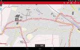
The image I uploaded shows an example of the map I'm talking about. Here is Sahagun with the Camino Frances, Camino Francese ruta alternativa and Camino madrileno. No need to download from Wikiloc any more.
Buen Camino.
 
Last edited:
image:70221.webp
Hola
I always walk with a GPS continuously monitoring my position. I don't use a dedicated GPS because it would represent an extra weight to carry.
As far as the battery life is concerned I carry a lightweight power bank with, and so this problem is solved too. I had to use the power bank only at the end of a very long day. Normally I don't have to use it.
The app I use is Oruxmap (Android only) which is an excellent free product. One of the interesting features is that a map of the entire Spain can be downloaded (800 MB circa) through the app by "freizeikarte-osm.de".
This map has all major Caminos on it (inc Sureste, Levante, Mozarabe, Madrid, etc) so downloading somebody else route in order to follow it, is no longer required. I just follow the Camino on the map.
In countless occasions the GPS was extremely useful so I could not think to walk without it in particular alone and on the most solitary caminos.
The image I uploaded shows an example of the map I'm talking about. Here is Sahagun with the Camino Frances, Camino Francese ruta alternativa and Camino madrileno. No need to download from Wikiloc any more.

Buen Camino.
 
Train for your next Camino on California's Santa Catalina Island March 16-19
I cannot speak for iphone apps, but there are now plenty of Android GPS apps where the mapping can be downloaded in advance and they then don't rely on a persistent connection to the internet over a data connection.

I found that using my iPhone and ether Apple "Maps" or "Google Maps" in cites did not work as well as expected. Maybe it was the narrow streets, maybe the iPhone GPS just doesn't work well in Spain because I use it all the time in the US and find it indispensable. I had the best luck with the "Wise Pilgrim" apps. I found the Camino Franćes very helpful. After getting to Santiago I purchased the "Camino Finisterre" app. That turned out to be extremely helpful, because I walked to Muxia first, then down to Fisinterra and then back to Santiago. The only route that is marked in both direction for Pilgrims is the route between Muxia and Finisterre. Because the route from Santiago to Finisterre is only mark in the western direction, the Camino Finisterre app helped me three or four time get back to the Camino as I traveled east to Santiago.
 

❓How to ask a question

How to post a new question on the Camino Forum.

Most read last week in this forum

I saw a video with a rather harsh criticism of a small, municipal albergue on one of the less traveled caminos. They paid 9€. I thought: What does it cost a small municipality to renovate and keep...
On my last Camino (2023) I noticed that there were lots of tourists. It reminded me of a couple of quotes that I have read since my first Camino (2015) “A tourist demands, a pilgrim is grateful”...
"A complete guide to the world's greatest pilgrimage"[sic] by Sarah Baxter. In a British newspaper, The Telegraph. A right wing daily that does print interesting articles and essays...
Day 42 Week 6 460km walked (give or take) Today I had a revelation, an epiphany and a Divine Intervention... all in one day. Today the exreme pain in my soul is dissipating some... healed by the...
There was a recent thread about EST (Erhard Seminars Training) which I have to say I have never hear of, but it got me thinking. I undertook some rather 'left field' training about 10 years ago...
I've been trying to figure out how to use the Gronze app and as a first step I need to translate into English - I searched topics on the Forum, thought I found what I was looking for, and Yay! I...

Featured threads

❓How to ask a question

How to post a new question on the Camino Forum.

Featured threads

Forum Rules

Forum Rules

Camino Updates on YouTube

Camino Conversations

Most downloaded Resources

This site is run by Ivar at

in Santiago de Compostela.
This site participates in the Amazon Affiliate program, designed to provide a means for Ivar to earn fees by linking to Amazon
Official Camino Passport (Credential) | 2024 Camino Guides
Back
Back
Top