Hi Laurie,
Thanks so much for your response! I'm starting from Bilbao and only walking 10-11 days, aiming to get to Puente Almuhey or Cistierna. I'd love to take the mountain alternative if the weather holds, but you've convinced me I need to learn to use the wikiloc tracks or stick to the road. I've been following some Spanish pilgrims on the route now and the section I'll walk looks clear of snow, but the forecast does look a bit dicey further out. My mountain Camino weather luck seems to be running out at last.
~Heather
Hello Heather, I'm a bit confused, are you on a Camino now following some Spanish pilgrims or are you following some Spanish pilgrims on their Blog? And if the latter are you still planning to do this Camino in early April?
A knowledgeable person told me after the 15th of April it should be snow free. That's why I left Bilbao on the 2nd of May. Some of the roads have 4m high posts painted red and white either side of the road. This is to indicate where the edges of the road are when there are heavy snow falls. See my photo signature that shows one of the two patches of snow I encountered.
When HIKING in an area that you don't know a map and compass is necessary. Modern technology now allows us to use a Track on a GPS. Saying that it is still recommendable to bring a map and compass in case there is a problem with the GPS. Guides and info sheets are not maps and by maps I mean good quality detailed maps like the Ordnance Survey Maps I have in England.
The signage on the Camino Olvidado in general is good. Being lost on some of the more common Caminos at times is part of the adventure, ( or for me it is ) where, for whatever reason, we miss a sign. My analogy for getting out of this is the 3,4,5 right-angled triangle, where we should be walking the 5 units of the triangle but we miss a sign and end up walking the 3 and 4 units of the triangle. 1/2 to 1 hour longer. You deduce this by instinct or by a local telling you. Nowadays using a GPS now and again is a great aid in this matter if you are having doubts about a route.
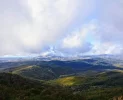
The mountain sections on this route are a different kettle of fish, you don't want to be lost here at all. Highest peak is just short of 1700 metres. ( Even in the smaller mountains in England you can experience all the seasons in 1 minute ). It is possible you could do the mountain tracks without a GPS but I wouldn't do it.The trails in the mountains with a GPS as a backup gives you that added confidence. The GPS Tracks also helped me when the weather changed for 30 minutes and visibility was very bad, in the mountains between ARROYO AND OLEA, (YOU'LL BE WALKING THROUGH THIS SECTION) where, when the clouds came down it was like pea soup.
So to summarise, in my opinion, GPS tracks are ESSENTIAL FOR THE MOUNTAIN SECTIONS ON THIS CAMINO. Don't be scared of the mountains just give them respect and you will thoroughly enjoy this Camino. Also start doing NOW all the techy stuff with the GPS and Tracks using the free software - it takes a long time. Cheers,Mick


