• Remove ads on the forum by becoming a donating member. More here.

Search 74,075 Camino Questions

GPS accuracy?

Orafo

Member
Time of past OR future Camino
Past: Camino Francés, SJPP to Santiago and Finisterre (Sept.-Oct. 2013); Planned: Camino del Salvador-Camino Primitivo-Camino Francés-Camino Finisterre (Sept.-Oct. 2014)
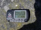
I recall that some have posted suggestions for various apps that work with the iPhone or other teléfonos inteligentes, so I thought I would share the results of an experiment I did yesterday while on a training hike for the Camino. I hiked a mountainous section of a trail here in Western North Carolina using a handheld Garmin GPS as well as these apps on my iPhone: GPS Kit, Runkeeper, MapMyHike, and ViewRanger. After something less than four hours of hiking, I could see that I was losing battery power in the iPhone and that it would not last for the duration of the hike, so I wrote down the readings at that particular point in the trail. The results were not very consistent:
Garmin: 8.56 miles
GPS Kit: 10.82 miles
Runkeeper: 9.94 miles
ViewRanger: 9.05 miles
MapMyHike: 12.18 miles (!) (This could be an aberration explained by not clearing the data from a previous walk; I will try the experiment again on my next hike, making sure all data has been cleared).
So how does one know which is the more accurate? The Garmin has what seems to be a better antenna and was on my belt as I walked, more exposed to the sky. The iPhone was in my pocket, though of course all the apps on it were subjected to the same conditions.
I don't really plan to use any of these for my Camino trek next month, but I know some people like to use a GPS, so I thought there may be interest in such a wide variation among devices.
 
€2,-/day will present your project to thousands of visitors each day. All interested in the Camino de Santiago.
GPS is accurate to about 8 meters; your apps are manipulating the data inaccurately. I would go with the Garmin rather than the iPhone apps. It may give you straight line data rather than a track, but you will know how far you have come since the last position.
Real-world data collected by the FAA show that some high-quality GPS SPS receivers currently provide better than 3 meter horizontal accuracy.
 
Given that three of the programs are using the same source - your apple iphone GPS receiver, it clearly indicates that there each have different calculation algorithms. It could be as simple as how often they sample the GPS feed and calculate the distance between each point. Other rounding errors could also be cumulative.

I have observed similar affects with other GPS enabled smartphones, with one app recording nearly 50% higher than my Garmin.

Perhaps its bias, but I have used several different Garmin handheld models over about a decade, and would be inclined to trust the Garmin over a smartphone.

Falcon - GPS accuracy of less than 3m is only available with the WAAS network, ie in the continential US. Elsewhere, the stated signal accuracy is 15m, e.according to the Garmin site. The other issue is that this is a spot accuracy, and tracks made up of a series of spot readings can have other errors related to how often the spots are recorded, and how the distances are calculated.
 
Last edited:
Get a spanish phone number with Airalo. eSim, so no physical SIM card. Easy to use app to add more funds if needed.
My Garmin Forerunner 310xt shows 470,9 km here in Mansilla de los Mulas and the JB books says 453 and I have done the Eunate detour (by choice) and a detour to Sotès (not by choice). But I know GPS:es can have issues in towns and mountains as the signal bounces and read more than the actual way. But it seems odd that it differs so much (17,9 km). I don't really know when it started to differ as the numbers are right now when I walk. If the book says 5 km the GPS shows the same. It might have been in the mountains as it tries to calculate mine distance going up/down. Maybe I forgot to reset/calibrate something.

I have the GPS-logs from that new Camino book that was newly released in my Android phone in Maverick GPS app and it seams to place me correctly at least. Helping me when I'm lost in places like Sotès ;)
 
North Carolina is in the United States WAAS network the last time I checked the map (not the electoral map, of course). Yes, Europe is once again behind Uncle Sam...
Galileo is a global navigation satellite system (GNSS) currently being built by the European Union (EU) and European Space Agency (ESA). The €5 billion project is named after the Italian astronomer Galileo Galilei. One of the aims of Galileo is to provide a high-precision positioning system upon which European nations can rely, independently from the Russian GLONASS, US GPS, and Chinese Compass systems, which can be disabled in times of war or conflict.

When in operation, it will use two ground operations centres near Munich in Germany and in Fucino in Italy. In December 2010, EU ministers in Brussels voted Prague in the Czech Republic as the headquarters of the Galileo project.

On 21 October 2011, the first two of four operational satellites were launched to validate the system. The next two followed on 12 October 2012, making it "possible to test Galileo end-to-end". Once this In-Orbit Validation (IOV) phase has been completed, additional satellites will be launched to reach Initial Operational Capability (IOC) around mid-decade. Full completion of the 30-satellite Galileo system (27 operational and three active spares) is expected by 2019.

Basic navigation services will be free of charge. Galileo is intended to provide horizontal and vertical position measurements within 1-metre precision, and better positioning services at high latitudes than other positioning systems.
 
I have never seen results that poor from multiple GPS units and phones. Something went wrong. Perhaps they were not initialized, so they tacked on some extra distance, or they lost the signal here and there, or they are set on far too coarse a sample rate. My iphone with motion x GPS , my garmin Dakota 20 , and my wife's Garmin Dakota 10m are always within 1% of each other.

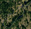
Here's a photo of the track from a Garmin Dakata, an iphone, and a Samsung phone. The tracks vary in sample rate, and could give different info over a short route, but would average out close to the same over several kilometers.
gps\'s.webp
 
A selection of Camino Jewellery
Falcon, I took your original comment to be a reference to GPS accuracy generally, not just in the US. For horizontal location accuracy, the enhancements provided by WAAS significantly improve accuracy over what can be achieved without it.

But the issue that is in question here is really about what happens when those individual locations are aggregated into a track, rather than the accuracy of any individual point on track. That appears to be a whole lot more complex than just the signal accuracy itself. Having tried GPS applications on two different smartphones, I am just not convinced that they are good enough all the time to replace a dedicated GPS unit.
 
Two points to add to the discussion: (1) GPS was designed for position accuracy; the route-distance algorithms vary with the device software. Frequency of position sampling is the chief cause of distance variation. This is similar to the frequency of sampling for converting analog audio to digital audio. (2) Given the weight of dedicated GPS units, and the frequency of route marking on the pilgrim routes, my personal tradeoff is in favor of the smartphone app.
 
If the OP is asking about which total distance is most accurate the answer is it likely doesn't matter. If it does go to something like google maps and plot out the route.

My polar heart rate monitor /GPS and my smartphone GPS routinely differ about 500meters after a 20km stroll.

I think the distance is based on the sum of various points along the route. Right? Each one of those points has a +/- of some distance. So the total distance is the sum of all those errors.

For Android users the new OS and map release seem to have really improved battery life. On my Nexus 4 I think five hours of hiking with everything running ends up using between 20-30% of battery life.
 
Perfect memento/gift in a presentation box. Engraving available, 25 character max.
I did a lot of research on iPhone cartography/GPS apps last year in regard to my speleological activities. What I found is that they can be just as accurate as dedicated units, with "dedicated" being the operative word here. It wasn't clear, but I think Orafo was running a number of GPS apps at the same time. That would effectively undermine any battery-saving techniques built into any particular app by keeping the GPS circuitry active all the time, and could introduce latency issues in the various apps causing some of the discrepancy between recorded distances.

I don't know about the particular GPS unit that was compared to the apps, but many GPS units make use of the Russian GPS network as a complement to the US network because, unlike the US network, it doesn't introduce random noise into the readings. The original argument for that inaccuracy was to keep the Russians from shooting a missile down the White House's chimney. Apparently, the Kremlin didn't have any chimneys to worry about. :)

One consideration on smartphone apps and GPS units is the availability of detailed topo maps. I chose an app called iPhiGeNie (their capitalization). It's primarily for France, but also has all the topo maps for Spain too (and now much of Europe). It can store your tracks on iCloud so they can't be lost (if you have a data connection).

Given a desire to reduce weight and time to recharge multiple devices, I feel using a smartphone makes the most sense.
 
My father-in-law used Map My Walk on an old phone a few months ago to track a little trail we walk regularly. It came out at 14km with 149m elevation gain, which seemed about right. We walked most of it on Saturday (minus the steep 2.5km there and back section) and my husband used a newer version Map My Walk on his Iphone - it told us we made a gain of 496m and walked 10km. We did it again on Sunday just to see what was going on and our elevation was even greater on the identical path! In the interests of science father-in-law went out and did the full walk today. He lost his old phone lat week and so had a new one and the new download of Map My Walk. This time he had an elevation gain of 1200m - he hopes his grandchildren will read through his records when he is dead and buried, and be impressed!
Let's just say, it would appear the latest Map My Walk is none too accurate. I'm going to look at whatever distances the gronze site gives and say that's how far I've walked each day when I next hit the camino. One less gadget to carry.
 
From my Diary Pilgrimage 1: "I checked the GPS and was amazed to see that I’d actually walked 4,666 kms in just under three hours. Which was actually good going, but rather annoying, as it meant I’d actually passed Santiago, and was somewhere in the far East. I contemplated changing my destination to maybe Jerusalem…or Mecca.

I’d obviously been walking at just over 1,500 k.p.h. Is that permitted on Spanish roads? P1090029.webp
 
The one from Galicia (the round) and the one from Castilla & Leon. Individually numbered and made by the same people that make the ones you see on your walk.
Who actually relies on their GPS? I certainly don't,I use it as a backup to more reliable map & compass. Has anyone thought it could be operator error that might be causing unusual readings etc.? ......Vicrev
 
I don't know about the particular GPS unit that was compared to the apps, but many GPS units make use of the Russian GPS network as a complement to the US network because, unlike the US network, it doesn't introduce random noise into the readings.
This is just plain wrong. Selective availability has been turned off since 2000, and the latest GPS satellites are not fitted with selective availability hardware. Garmin's public position on using the GLONASS network is that it reduces the time required to acquire satellites. I haven't looked at what other GPS makers say about their dual GPS/GLONASS enabled devices, but it clearly won't be about overcoming something that isn't there any longer.

Regards,
 
The one from Galicia (the round) and the one from Castilla & Leon. Individually numbered and made by the same people that make the ones you see on your walk.
The only reason for me to use my GPS watch is to sync the geoposition to photos later. And for that it works a position at a specific time is quite accurate.
 
Who actually relies on their GPS? I certainly don't,I use it as a backup to more reliable map & compass. Has anyone thought it could be operator error that might be causing unusual readings etc.? ......Vicrev
There is a wikipedia article on GPS errors that gives a rather technical explanation of where they arise. I rather suspect there would be a greater chance of operator error with a map and compass, given the relatively little operator input most GPSs have that would affect positional accuracy.
 
Does that mean map & compass is now considered obsolete by some ??? I would never do real walking with anyone relying solely on a GPS !!!! .......Vicrev
 
The focus is on reducing the risk of failure through being well prepared. 2nd ed.
If I am bushwalking, I tend to carry both paper map and GPS, but not always. I still find it difficult to visualize the terrain even with relatively good contour maps zooming in and out on a GPS, and prefer to use a paper map for that. Your comment makes me wonder what you think is 'real walking'. I walked across Spain with a Brierley guide, which is almost the next best thing to walking without a paper map, and walked across Norway with mapping stored as saved web pages on a Nokia smartphone. Was that not real walking?

Regards,
 
There seems to be confusion on this thread about GPS.........I don't see any on Map & Compass,probably too simple to use,not enough knobs & things............;)......Vicrev
 
Dougfitz....did I say you didn't do real walking ?? I am talking about the difference between a series of walk in the park day walks and a get lost in the bush walk (relying on a GPS) where you can die !!! You know as I do it can and does happen in OZ............Vicrev
 
Holoholo automatically captures your footpaths, places, photos, and journals.
I am just not convinced that they are good enough all the time to replace a dedicated GPS unit.
I agree!!!
Who actually relies on their GPS?
Mine got me out of a eucalyptus forest after I took a wrong turn. While it did not have the forest trails in it, it had the road maps for Spain, so I could follow the arrow to get to one. A topo map would have been of less use since I did not know where I was in the woods...

Yes, GPS has replaced maps, just as the compass and map were partially replaced by LORAN, VOR's, and sextants.
 
Looks like I'll have to throw away my maps & compass & rely on a couple of batteries my next three week bushwalk.........hope they last..........or I can carry a 2 kilo brass sextant..:(:(.........Vicrev
 
This is just plain wrong. Selective availability has been turned off since 2000, and the latest GPS satellites are not fitted with selective availability hardware. Garmin's public position on using the GLONASS network is that it reduces the time required to acquire satellites. I haven't looked at what other GPS makers say about their dual GPS/GLONASS enabled devices, but it clearly won't be about overcoming something that isn't there any longer.

Regards,

Well, at least a bad joke on my part.
 
Perfect memento/gift in a presentation box. Engraving available, 25 character max.
Perhaps its bias, but I have used several different Garmin handheld models over about a decade, and would be inclined to trust the Garmin over a smartphone.
see http://blogs.esri.com/esri/arcgis/2013/07/15/smartphones-tablets-and-gps-accuracy/ for an up-to-date assessment of smartphone accuracy. For me, the key difference is that gps is not a smartphone's primary purpose, so the aim is not accuracy but producing something that's good enough for everyday purposes without chewing up the batteries
Falcon - GPS accuracy of less than 3m is only available with the WAAS network, ie in the continential US. Elsewhere, the stated signal accuracy is 15m
http://www.egnos-portal.eu/discover-egnos/about-egnos
The other issue is that this is a spot accuracy, and tracks made up of a series of spot readings can have other errors related to how often the spots are recorded, and how the distances are calculated.
indeed. To reduce this ad absurdum, take a reading, walk round the block, return to where you started, then take another reading, and ask it how far you've walked: it'll tell you you haven't gone anywhere, your position hasn't changed. This has nothing to do with accuracy of GPS. A GPS app doesn't measure how far you've walked; it measures the straight-line distance between points.
go to something like google maps and plot out the route.
There's an identical issue if you measure distances on a map, either using the good old-fashioned piece of string, or clicking on an online map. The more detailed the map, the more points you will use, and the longer will be the distance. This is similar to the celebrated 'coastline paradox' http://en.wikipedia.org/wiki/Coastline_paradox - how long is the coastline? Depends. There is no definitive answer. How long is this route? Depends. There is no definitive answer.

To measure exactly how far you walked, you would have to measure each step you take; you can't use GPS for that because it isn't accurate enough. Even you did that, it wouldn't apply to someone else, because they would take different steps and cover a different distance.

Btw, reverting to GPS, there's also the fact that it can take the receiver several seconds to get a fix on the satellites. If you're on the move, your position will change and confuse the calculations. If you want optimum accuracy, you should stand still every time you take a reading. :)
 
Is google map calculating with elevation. That I find the hardest on paper maps 1 km over a mountain is not 1 km in reality unless you fly. You have to read and understand elevation curves.
 
Maybe I am totally off subject here (most likely – smiley). But my head is kind of reeling at the thought of the necessity of bringing a GPS to the Camino which is so well marked?

Yes, I admit I missed a sign or two – but only because I was in deep thought – no problem, - my deviations when realized (no pilgrims in sight!) were only a couple of kms and the landscape was always great. – I wonder what I would have missed if I had regularly/constantly felt a need to consult a GPS.
annelise
 
€2,-/day will present your project to thousands of visitors each day. All interested in the Camino de Santiago.
Maybe I am totally off subject here (most likely – smiley). But my head is kind of reeling at the thought of the necessity of bringing a GPS to the Camino which is so well marked.
I carried a hand-held GPS to record my track and allow me to geo-tag my photos when I returned home. There are smaller, specialist GPS loggers available that can do the same thing. I think I used it for navigation twice - when I got lost leaving SJPP and later leaving Foncebadon when I went of a ridge line the wrong way, and followed one of the GR trails for a while.
It was more valuable walking St Olavs Way, but even then the way-marking is generally good enough not to need much more than the maps available from the Pilgrim's Office website.
I think the point is that relying on the GPS can be fraught with danger, particularly if one is unaware that there are a variety of errors that can and will occur irrespective of how good the technology is behind these devices.
Otherwise, as falcon notes, it's a toy.
 
Last edited:
A selection of Camino Jewellery
Maybe I am totally off subject here (most likely – smiley). But my head is kind of reeling at the thought of the necessity of bringing a GPS to the Camino which is so well marked?

Yes, I admit I missed a sign or two – but only because I was in deep thought – no problem, - my deviations when realized (no pilgrims in sight!) were only a couple of kms and the landscape was always great. – I wonder what I would have missed if I had regularly/constantly felt a need to consult a GPS.
annelise


You can use it for pacing. If you notice you've slowed down a lot it can be a reminder you should rest. You can use it to look ahead and decide if you want to keep going.

The smart phone ones have various other features. If you need to find an ATM/pharmacy/shop near you then can do that. You can use something like mytrack to record your route and upload it for others to see. It'll even link up to Google earth so people can virtually follow you from home.

I think most people keep it in their pockets. Taking it out only if they need it. Think of it like a super duper paper map that doesn't need to be unfolded and manages to find your position on the map.
 
I'm going to upset a few people here ,I just realized maybe some don't know HOW to read map & compass in conjunction ? Yes NicoZ,Gps is great as a pedometer,speedometer& to track back if you get lost ( that includes the people following behind you who have lapsed into the sheep syndrome) but, I would never rely on it 100% :)........Vicrev
 
It's gone from a virtual replacement of map & compass to a toy !!!......Amazing !!! :confused:......Vicrev
As an alternative to a paper map and magnetic compass, a GPS is quite real - nothing virtual about it at all. But an essential tool for use on the CF it isn't. Therefore, it's a toy in that context.
 
€2,-/day will present your project to thousands of visitors each day. All interested in the Camino de Santiago.
Of course a GPS is quite real:rolleyes:.......didn't think it was anything else!!!!!Getting tired of this , I will say it again, I would only use (and I do) aGPS as a back up to map & compass .........That is my personal opinion.........If you consider aGPS sometimes a toy ,other times quite real,that's yours............:confused:.......Vicrev
 
The focus is on reducing the risk of failure through being well prepared. 2nd ed.
yes and I can even text the person alongside me I am walking with........I feel all of a sudden I have jumped into the 21st century......:eek:.... wow..........thanks for that:)..........Vicrev
 
Who actually relies on their GPS? I certainly don't,I use it as a backup to more reliable map & compass. Has anyone thought it could be operator error that might be causing unusual readings etc.? ......Vicrev
I absolutely rely on my GPS. I don't even bring a map and compass ( I have all of those in my phone and GPS). And yes, I know how to use a map, I have spent my life as a geologist working with them, drawing them, recreating with them.

I don't trust the one in the car to pick my routes, but hiking and biking I frequently download a route or draw one on google earth, and my GPS will keep me right on route.

As far as accuracy, I have a little $99 unit which stars off measuring distance travelled in centimeters. I once measured a meter and moved it back and forth 10 times. It measured anything from 97 to 103 centimeters. You won't find that accuracy all the time, but it can be scary how exact it can be.
 
I would like to use Android Smartphone to track my route, and as a backup in case I get lost.

Is there an App / Website where I can access (or download in advance) maps of the Camino Frances ?

Enabling data roaming would be expensive, so these maps need to be available offline.

Any advice would be much appreciated, thanks !
 
€2,-/day will present your project to thousands of visitors each day. All interested in the Camino de Santiago.
OsmAnd is the Open Street Maps android app available in the PlayStore. The free version has limits on the number of offline data sets that can be stored, but the application is not all that expensive to purchase.

I use a Medion E4002 and it came with a mapping application which also uses OSM mapping.

Regards,
 
I would like to use Android Smartphone to track my route, and as a backup in case I get lost.

Is there an App / Website where I can access (or download in advance) maps of the Camino Frances ?

Enabling data roaming would be expensive, so these maps need to be available offline.

Any advice would be much appreciated, thanks !

If by track you mean record your trip then Googles MyTracks is free and will track things. Recording distance,speed,altitude and time. Then when you have a data link (WiFi or other) you can upload all the data. It'll even generate a Google Earth link that you can review or share.

If you mean normal GPS function. Google maps lets you download all the maps in advance. So assuming you have enough storage no reason you couldn't just use the stock app after downloading the maps at home.

There have been threads discussing the path and Google maps. I'm fairly sure that the trails are already marked some place on Google maps. Even if I can't remember which thread -(

The nice thing that comes with just using the base Google maps is all your devices sync up the moment you log into your Google account. I'm going on a trip next week. Both my phone and my tablet have all the POIs marked. This was all done using my computer and it's large screen. My tablet is just WiFI and it'll do everything but turn by turn directions without a data connection. If I wander by a WiFI location it'll even do that. But I've predownloaded all the maps.
 
NicoZ is right, Google is another option. OSM will give directions in off-line mode, which is a significant advantage most of the time, but hardly likely to be an advantage on the Camino.
 
Join the Camino cleanup. Logroño to Burgos May 2025 & Astorga to OCebreiro in June
"...There have been threads discussing the path and Google maps. I'm fairly sure that the trails are already marked some place on Google maps. Even if I can't remember which thread ..."

For a discussion with links to the Camino Frances on Google maps see this encyclopedic site of veteran Forum poster Peter Robins >>http://pilgrim.peterrobins.co.uk/routes/details/frances.html. Scan to the bottom of his page to choose and view the relevant maps.

MM
 
For what it's worth, I have been using a mini iPad with Motion-X software with no internet connection only satellite. The comparison results have all been remarkably close to my Geo maps...
 
"...There have been threads discussing the path and Google maps. I'm fairly sure that the trails are already marked some place on Google maps. Even if I can't remember which thread ..."

For a discussion with links to the Camino Frances on Google maps see this encyclopedic site of veteran Forum poster Peter Robins >>http://pilgrim.peterrobins.co.uk/routes/details/frances.html. Scan to the bottom of his page to choose and view the relevant maps.
there is an offline mobile version of all my maps; with the GPS option it fetches all the routes that are in your vicinity. That is online though. See my blog post for more on the issues with this http://blog.peterrobins.co.uk/2012/08/maps-on-mobile-devices-current-status.html
In practice, what I do these days is use screen capture when I have a (generally wifi) connection, and then use those images in the field. I've been surprised how well this works even on a small screen.

I would not recommend using a phone for gps tracking; your battery will be flat in no time.
 
Holoholo automatically captures your footpaths, places, photos, and journals.
I recall that some have posted suggestions for various apps that work with the iPhone or other teléfonos inteligentes, so I thought I would share the results of an experiment I did yesterday while on a training hike for the Camino. I hiked a mountainous section of a trail here in Western North Carolina using a handheld Garmin GPS as well as these apps on my iPhone: GPS Kit, Runkeeper, MapMyHike, and ViewRanger. After something less than four hours of hiking, I could see that I was losing battery power in the iPhone and that it would not last for the duration of the hike, so I wrote down the readings at that particular point in the trail. So how does one know which is the more accurate? The Garmin has what seems to be a better antenna and was on my belt as I walked, more exposed to the sky. The iPhone was in my pocket, though of course all the apps on it were subjected to the same conditions.
I don't really plan to use any of these for my Camino trek next month, but I know some people like to use a GPS, so I thought there may be interest in such a wide variation among devices.
One small question: are the GPS and all the iPhone Apps reading the same lat/long and altitude at the start? If not then they can never produce similar distance data. Cheers
 
One small question: are the GPS and all the iPhone Apps reading the same lat/long and altitude at the start? If not then they can never produce similar distance data. Cheers
Distance measurement is a relative measure, and won't rely on the absolute position at the start or end point being the same on two devices. There are many reasons why the difference measured by two devices might vary, but differences in indicated absolute start position shouldn't be one of them.
 
Just finished the CF on Thursday and can say that having MotionX-GPS on my iPhone was very helpful. I downloaded maps for the length of the CF so I did not have to rely on having any cellular access, and downloaded a track of the CF.

Once, it saved me from going way out ofy way. There was a Camino post clearly marking a turn, but a pilgrim was sitting on it and leaned his pack on it, completely hiding it. Several walkers before me, and my wife and I, missed the turn and kept walking. I happened to wonder how far I had left to walk, checked on MotionX, and discovered the error less than a kilometer later.

I also used it to track each day's walk, and have enjoyed reviewing the tracks. I checked my position 2 or 3 times a day. Even with tracking on, I never arrived with less than 20% battery power. It was certainly more than accurate enough for my purposes; occasionally it might show me as 20 - 30 feet from where I knew I was, but that was fine. Since I was carrying the iPhone anyway, it was no extra weight. I'm glad I had it.
 
...and ship it to Santiago for storage. You pick it up once in Santiago. Service offered by Casa Ivar (we use DHL for transportation).
One small question: are the GPS and all the iPhone Apps reading the same lat/long and altitude at the start? If not then they can never produce similar distance data. Cheers

They should be showing same lat/long ... if they are not then the datum on one (or both) needs to be changed to the local datum.
 
They should be showing same lat/long ... if they are not then the datum on one (or both) needs to be changed to the local datum.
You might find that changing datums is not an option on smartphone apps. Certainly I cannot find a way of doing this on the OSM and Google android apps installed on my phone.

It is an option for dedicated GPS units, and for Spain, European 1979 would be the local datum of preference. If that is not available, the earlier European 1950 or WGS84 are good alternatives.

I don't own a smartphone so I don't know how apps work ... perhaps the app is location specific ... ie if you buy the app in Oz then its good for Oz datum only. So perhaps an app that works on Spains datum might be needed too. Of course it might just be a matter of being satisfied with the GPS reading showing you 100 meters or more from where you are on the map ... As pointed out GPS accuracy is not needed on the camino.
 
Join the Camino cleanup. Logroño to Burgos May 2025 & Astorga to OCebreiro in June
I don't own a smartphone so I don't know how apps work ... perhaps the app is location specific ... ie if you buy the app in Oz then its good for Oz datum only. So perhaps an app that works on Spains datum might be needed too. Of course it might just be a matter of being satisfied with the GPS reading showing you 100 meters or more from where you are on the map ... As pointed out GPS accuracy is not needed on the camino.
I haven't used my current smartphone outside of Australia, but didn't find there were problems with my previous Nokia app once it had acquired sufficient satellites. I didn't need a different app just because I was travelling.

I agree with your assessment of the accuracy needed for walking the camino - using a GPS to figure out where one might be on Brierley's strip maps would have been pretty futile!
 
I'm not sure what you mean by datum. If it's the map data with the google app you can download it in advance storing it on the device. That allows you to turn off the phone data if you don't have a local sim.

OTOH the phones acquire sat lock much quicker if they can use the mobile to speed up things. The first time after a long plane flight can be an issue. Especially if you happen to be in a large city with tall buildings. Less of an issue in an open space but it can still take awhile
 
I'm not sure what you mean by datum.

not all lat/longs are the same. There are hundreds of different datums (dati?) used in the map world, and a serious GPS program allows you to designate one. If you just input the numbers from one datum hoping to find a spot on a map from a different datum, you can be off by nearly a kilometer.

all good topo maps list their datum at the bottom. you need to set your GPS to the same.
 
The 2024 Camino guides will be coming out little by little. Here is a collection of the ones that are out so far.
The datum relates to (a) the fixed point from which distance measurements in that datum are taken and (b) the assumptions about the nature of the earth's spheroid in the area the datum covers. The need for different datums arises from the fact that the earth is not a perfect spheroid, and approximating it mathematically is difficult the larger the area.

As @newfydog says, if you are using a topographic map and a GPS, then making sure that the datum set on the GPS is the same as the map datum if you want the grid references to be the same on both.
 
The problem for navigators is that every region has used a different datum in preparing maps. They don't match with datums in other regions because of inaccuracies in making determinations of Altitude, Latitude, and Longitude prior to GPS. So a GPS set to the datum in USA won't work with maps that use the datum in Spain. Its changing since GPS came into being but changing all the maps to reflect a standard world wide datum is a long way off. Here in Canada the datum for topographical maps and charts was changed by 200 meters in 1983 (NAD 83)as a result of GPS information. Anything printed before that means the GPS unit used with the map must use a different datum.
 
iPhiGeNie, available on iPhones and dddddroids, offers the European 1950 UTM Datum grid reference system, and a number of others, including the Lambert 93 datum, needed in France if you access any government databases.
 
3rd Edition. More content, training & pack guides avoid common mistakes, bed bugs etc
You might find that changing datums is not an option on smartphone apps. Certainly I cannot find a way of doing this on the OSM and Google android apps installed on my phone.
it's not necessary. GPS, OSM and Google all use WGS84

not sure people aren't confusing different things. The GPS system uses WGS84. GPS devices (and apps) may convert data from one datum/projection to another to be compatible with maps using a different one, but that has nothing to do with GPS itself.
I think the point being made about changing the datum was in the context of relating a GPS position to a topographic map. Certainly here in Australia, it can be important if one is using older maps. For modern Australian mapping, it appears that there is marginal difference (for handheld GPS use by walkers) between WGS84 and GDA, but the national mapping authority states that for older mapping the difference is about 200m compared to WGS84.

It is possible that the app developers of OSM and Google didn't think that this was important - if you have their maps loaded, you wouldn't also be using paper based topo maps. If so, I think they might be right.
 
I use GPS Essentials on an Android phone. It allows you to change the datum easily, it's just in the settings menu.
 
Perfect memento/gift in a presentation box. Engraving available, 25 character max.
I think the point being made about changing the datum was in the context of relating a GPS position to a topographic map. Certainly here in Australia, it can be important if one is using older maps. For modern Australian mapping, it appears that there is marginal difference (for handheld GPS use by walkers) between WGS84 and GDA, but the national mapping authority states that for older mapping the difference is about 200m compared to WGS84.

It is possible that the app developers of OSM and Google didn't think that this was important - if you have their maps loaded, you wouldn't also be using paper based topo maps. If so, I think they might be right.
yes, if you want to use non-wgs84 latlon coordinates on paper maps with the gps readings from a phone/tablet, you would use one of the various apps that can display the readings in a different datum. However, as I say, this is not changing the GPS datum per se, but converting the GPS reading into a different datum.

There's the same issue with my maps. The Spanish IGN maps I currently use, for example, are based on the old European datum, so when I display WGS84 route lines on top, I have to add an extra parameter to the conversion or they'll all be out by 100m or so (the so-called datum shift). I'll probably convert to ETRS89 at some point and remove this extra calculation.

We don't really have this problem in Britain, as nobody much uses OSGB latlons anyway. Maps are printed with a grid of projected metre coordinates, which makes calculating distance much simpler: if position 1 is at 123400 and position 2 is at 123500, you don't need a computer to tell you how far apart they are.

As whariwharangi says, mapping agencies have largely converted to more standardised systems, but I'm not sure there will ever be one worldwide system used by everybody, as different parts of the world have different needs. The N American Datum, the European ETRS, and GDA are all based on the same ellipsoid model (GRS80) as WGS84, but fixed to different plates. ETRS89 (the current EU-recognised standard) is fixed to the Eurasian plate, which diverges from WGS84 by about 2.5cm a year. This is a lot for some uses, but for most purposes, such as GPS, makes little practical difference.

It's a bit like clothing. If you really want a perfect fit, you have to have made-to-measure, but for most people off-the-shelf is good enough.
 
I use GPS Essentials on an Android phone. It allows you to change the datum easily, it's just in the settings menu.
I have downloaded this app onto two different Android devices just to see what it can do. It's certainly one of the better smartphone/tablet apps I have used, although I have my doubts about the accuracy of the compass, which I could not get to calibrate properly at all. It works pretty well with my Asus Google 7, less well on a Medion smartphone. Getting an initial fix is slow on both, many times that of my Garmin eTrex30 or even an older Garmin eTrex Legend Cx.

You are right, changing the datum is easy, and it appears to have a wide selection. Oddly, the one that I found missing was GDA, the one datum I would use regularly as an alternative to WGS84 here in Australia.

Regards,
 
Leaving aside using a smart phone for navigation (I'm comfortable with maps), how does one solve the battery problem? I thought it might be nice to have a track recorded of my actual journey...wrong turns and all.

As an experiment I took a walk today and pulled the SIM to shut off the cellular antenna, turned off WiFi and Bluetooth. I then ran the Endomondo app while walking (display shut off). After an hour, I had a nice track on the map but 15% of my battery was gone. Battery-based rechargers are heavy and solar rechargers probably couldn't keep up. My phone is an iPhone 4S; are the 5 models a lot better at battery usage such that one could use it an entire day?

If not, are the phones simply limited to spot checks, i.e., navigation?
 
Perfect memento/gift in a presentation box. Engraving available, 25 character max.
Leaving aside using a smart phone for navigation (I'm comfortable with maps), how does one solve the battery problem? I thought it might be nice to have a track recorded of my actual journey...wrong turns and all.

As an experiment I took a walk today and pulled the SIM to shut off the cellular antenna, turned off WiFi and Bluetooth. I then ran the Endomondo app while walking (display shut off). After an hour, I had a nice track on the map but 15% of my battery was gone. Battery-based rechargers are heavy and solar rechargers probably couldn't keep up. My phone is an iPhone 4S; are the 5 models a lot better at battery usage such that one could use it an entire day?

If not, are the phones simply limited to spot checks, i.e., navigation?
This is where dedicated GPS units come into their own. My Garmin eTrex30 runs for about 16 hours on two good AA batteries, a little less on cheaper ones. None of the smartphones that I have carried would be able to keep a day's track, and I wasn't prepared to take the risk that I would not be able to recharge at night.

The other approach if you are keen to keep a track record is to get a simple GPS logger like Phototrakker (?sp). Some have an internal battery, others use a single AA cell and have enough endurance for up to eight hours of track recording.

Regards,
 
@dougfitz - That last is something I'll look at. Beyond simply being able to look back at the actual walk, geo-tagging photos was another reason I may want a track. If I use my phone as a camera, it tags the pictures automatically. But if I carry a separate point-and-shoot, it doesn't. I'm not sure which way I'm leaning at this point.

I did a quick search and the GiSTEQ Photo Trackr Lite gets 22 hours out of an AA battery under "normal use" (whatever that is) or 17 in continuous use. It weighs 69 grams, which isn't too bad. I don't really mind not having it be able to provide maps.
 
As an experiment I took a walk today and pulled the SIM to shut off the cellular antenna, turned off WiFi and Bluetooth. I then ran the Endomondo app while walking (display shut off). After an hour, I had a nice track on the map but 15% of my battery was gone. Battery-based rechargers are heavy and solar rechargers probably couldn't keep up. My phone is an iPhone 4S; are the 5 models a lot better at battery usage such that one could use it an entire day?

If not, are the phones simply limited to spot checks, i.e., navigation?

If I'm reading that right you used 15% of the battery after one hour. So figure close to seven hours of battery life if we simply assume linear battery use. Not that the world is linear. You can get a little USB charger that weighs next to nothing. I have one that is 2200mAH. I think that's bigger then the Iphone internal battery. No idea what it weighs but you don't notice it in your pocket. They tend to sell for €20 or so. Charge via an USB charger just like modern phones. So a combination of a dual USB wall charger,two cables ,battery and the phone is all you need. None of it is heavy or that bulky even.
 
Train for your next Camino on California's Santa Catalina Island March 16-19
I think the most famous case was the Chinese embassy. Seems to me the problem wasn't the cruise missle but the person who decided it was a good
Don't cruise missiles often miss the target they are intended for with disasterous consequences!

http://en.wikipedia.org/wiki/U.S._bombing_of_the_Chinese_embassy_in_Belgrade

I guess that's the most infamous case. The problem wasn't missing it's target it was the wrong target. The GPS guided the bomb exactly towards the point it was programmed.

The GPS will go in the direction you ask it. If there is a human problem in the programing then you'll have problems. There are some fairly famous cases of people forgetting a letter in a city name and ending up hundreds of kms in the wrong direction.

Just like any wood worker. Measure twice cut once.
 
Leaving aside using a smart phone for navigation (I'm comfortable with maps), how does one solve the battery problem? I thought it might be nice to have a track recorded of my actual journey...wrong turns and all.

As an experiment I took a walk today and pulled the SIM to shut off the cellular antenna, turned off WiFi and Bluetooth. I then ran the Endomondo app while walking (display shut off). After an hour, I had a nice track on the map but 15% of my battery was gone. Battery-based rechargers are heavy and solar rechargers probably couldn't keep up. My phone is an iPhone 4S; are the 5 models a lot better at battery usage such that one could use it an entire day?

If not, are the phones simply limited to spot checks, i.e., navigation?
I walked the Camino from SJPdP to Santiago this fall, using an iPhone 5 and the MotionX GPS app. I downloaded all the maps in advance and used MotionX GPS to track each day's walk. Did fairly typical distances, 20 - 30 k, turned off cellular data, and never ran out of battery. At the end of a long day, I'd still have at least 15 - 20%.

That said, I did carry a Zagg 6,000, which reduced the stress about recharging. My wife and I could go 2 - 3 days without recharging if we had to, didn't have to worry about getting an outlet each night, etc. When it was convenient, we'd plug the Zagg in and plug our 2 iphones into the Zagg (it charges the iPhones first, then charges itself). It weighs nearly half a pound, but for two of us, we felt it was well worth its weight. There are other, smaller and lighter, models.

But, I never had to use the Zagg during the day.

Karl
 
A selection of Camino Jewellery

❓How to ask a question

How to post a new question on the Camino Forum.

Most read last week in this forum

Greetings all While travelling from Camponaraya to Cacabelos I stumbled this nice little park area with benches and a BBQ area, right past the Wine factory and next to a Car Wash and Gas Station...
I saw a video with a rather harsh criticism of a small, municipal albergue on one of the less traveled caminos. They paid 9€. I thought: What does it cost a small municipality to renovate and keep...
On my last Camino (2023) I noticed that there were lots of tourists. It reminded me of a couple of quotes that I have read since my first Camino (2015) “A tourist demands, a pilgrim is grateful”...
"A complete guide to the world's greatest pilgrimage"[sic] by Sarah Baxter. In a British newspaper, The Telegraph. A right wing daily that does print interesting articles and essays...
Day 42 Week 6 460km walked (give or take) Today I had a revelation, an epiphany and a Divine Intervention... all in one day. Today the exreme pain in my soul is dissipating some... healed by the...
I've been trying to figure out how to use the Gronze app and as a first step I need to translate into English - I searched topics on the Forum, thought I found what I was looking for, and Yay! I...

Featured threads

❓How to ask a question

How to post a new question on the Camino Forum.

Featured threads

Forum Rules

Forum Rules

Camino Updates on YouTube

Camino Conversations

Most downloaded Resources

This site is run by Ivar at

in Santiago de Compostela.
This site participates in the Amazon Affiliate program, designed to provide a means for Ivar to earn fees by linking to Amazon
Official Camino Passport (Credential) | 2024 Camino Guides
Back
Back
Top