Erromesa
New Member
- Time of past OR future Camino
- Barnealdeko Donejakue Bidea (Basque Country interior)
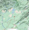
Aside from the Via de la Plata and Via de la Estrella, there's apparently another Camino that passes parallel to the Via de Plata, but goes through the area of Las Hurdes before entering Castilla y León.
The towns on the way are:
Galisteo
Valdeobispo
Montehermoso
Aceituna
Santa Cruz de Paniagua
El Bronco
Casar de Palomero
Ribera Oveja
Caminomorisco
Cambrón
Cambroncico
Arrolobos
Riomalo de Abajo. Ending in Meandro del Melero, in the Sierra de Francia.
I've been waiting for a week for the rain to stop and it looks like I have a good week of clear skies ahead of me. I'll start in Caceres tomorrow morning and follow the Via de la Plata up until Galisteo, then ask for more information at the town hall.
I don't even know if there are arrows. Apparently they're supposed to be doing something to equip the route, but I haven't found a map or any publicity yet, just news that it's going to be done:
I'm going to be taking my tent and don't plan on sleeping in albergues, if there are any.
Why am I doing a route I know nothing about? I live in Extremadura, so the route is relatively close to me. Everyone I talk with tells me that the region of Las Hurdes is beautiful, one of the most beautiful regions in all of Extremadura. Also one of the most culturally interesting, thanks to its isolation, it has many interesting customs and traditions. The Extremaduran language is strong here. I've been meaning to visit for a long time, so why not.
The towns on the way are:
Galisteo
Valdeobispo
Montehermoso
Aceituna
Santa Cruz de Paniagua
El Bronco
Casar de Palomero
Ribera Oveja
Caminomorisco
Cambrón
Cambroncico
Arrolobos
Riomalo de Abajo. Ending in Meandro del Melero, in the Sierra de Francia.
I've been waiting for a week for the rain to stop and it looks like I have a good week of clear skies ahead of me. I'll start in Caceres tomorrow morning and follow the Via de la Plata up until Galisteo, then ask for more information at the town hall.
I don't even know if there are arrows. Apparently they're supposed to be doing something to equip the route, but I haven't found a map or any publicity yet, just news that it's going to be done:
La actuación más singular es la recuperación del antiguo camino jacobeo que parte de la Vía de la Plata o Camino Mozárabe, a la altura de Galisteo, y va cruzando la zona norte de la provincia por Las Hurdes hasta conectar con Salamanca para continuar hasta Galicia. Se trata de un camino natural, con grandes posibilidades turísticas, que atraviesa Galisteo, Valdeobispo, Montehermoso, Aceituna, Santa Cruz de Paniagua, El Bronco, Casar de Palomero, Ribera Oveja, Cambrón, Cambroncino, Arrolobos y Riomalo de Abajo. De ahí conduce hacia la Peña de Francia, ya en Salamanca, y sigue el rumbo hacia Santiago de Compostela.
I'm going to be taking my tent and don't plan on sleeping in albergues, if there are any.
Why am I doing a route I know nothing about? I live in Extremadura, so the route is relatively close to me. Everyone I talk with tells me that the region of Las Hurdes is beautiful, one of the most beautiful regions in all of Extremadura. Also one of the most culturally interesting, thanks to its isolation, it has many interesting customs and traditions. The Extremaduran language is strong here. I've been meaning to visit for a long time, so why not.
Last edited:


