• ⚠️ Emergency contact in Spain - Dial 112 and AlertCops app. More on this here.
  • Remove ads on the forum by becoming a donating member. More here.

Search 74,075 Camino Questions

Does Brierley's Camino Ingles Guide Show the 'Old' Route as Options?

  • Thread starter Thread starter Deleted member 67185
  • Start date Start date
D

Deleted member 67185

Guest
In looking thru the Brierley's Ingles guidebook, I am wondering if any of the 'optional' paths that he shows are part of the 'Old' Ingles route? Having reviewed several other resources, it seems that at least two of his 'stages' do that. Does anyone familiar with the Ingles and Brierley have any view on this?

I appreciate the input. :)
 
A selection of Camino Jewellery
Dave; I haven’t seen the new Brierley guide, so I don’t know, but when we walked the Ingles last June, the only guidebook that had been updated was the CSJ guide, meaning if you find a guide prior to 2018, it will show the original route. For example, the Brierley guide dated 1/9/18 still shows the old route. (This is the one I had). It is still available on Amazon:

https://www.amazon.com/dp/1912216027/?tag=casaivar02-20

At the time we walked the Ingles, the Wise Pilgrim and Cicerone guides still showed the old route, too. I just checked on the Apple app. store, and the Wise Pilgrim app. for the Ingles (for $1.99) is still the one from 2015, meaning it will show the old route. That might be your best bet (assuming you can’t determine whether the new Brierley shows the old route as an alternative).

A further suggestion is to have maps.me on your phone. The beauty of maps.me (unlike google.maps) is that it also shows dirt walking paths, and farm tracks, so if you’re walking down a busy road, it will show you less-travelled alternative paths right nearby.
 
Thanks for the tips, Andy, especially for the older edition guides.
Dave
 
Get a spanish phone number with Airalo. eSim, so no physical SIM card. Easy to use app to add more funds if needed.
Hi, If you go onto one of the mobile phone mapping applications like Viewranger ( other applications are available ! )you can find GPS routes that were uploaded when the English route was the original and so download the old route
 
One way to know if the new Brierley contains both routes: In the stretch between Betanzos and Hospital de Bruma, the old camino will stay on or near the DP-0105 through Leiro and into Vilacoba, where the Casa Julia is. The new route, which we followed, turns right (west) shortly after Leiro and bypasses Vilacoba entirely. That was the biggest of the differences we noted.
 
One way to know if the new Brierley contains both routes: In the stretch between Betanzos and Hospital de Bruma, the old camino will stay on or near the DP-0105 through Leiro and into Vilacoba, where the Casa Julia is. The new route, which we followed, turns right (west) shortly after Leiro and bypasses Vilacoba entirely. That was the biggest of the differences we noted.

Thanks for that specific way mark. Interestingly, the new 2019 edition does indeed show that section of old route as an Option. As far as I can tell for each of his 'stages, the old route is similarly noted as an Option, although it never states that the Option is the old route itself.
 
A selection of Camino Jewellery
Hi, If you go onto one of the mobile phone mapping applications like Viewranger ( other applications are available ! )you can find GPS routes that were uploaded when the English route was the original and so download the old route

Thanks, Mike. :)
 
In looking thru the Brierley's Ingles guidebook, I am wondering if any of the 'optional' paths that he shows are part of the 'Old' Ingles route? Having reviewed several other resources, it seems that at least two of his 'stages' do that. Does anyone familiar with the Ingles and Brierley have any view on this?

I appreciate the input. :)
If it would be of any help I can search for my 2016 "old route" GPS Wikiloc track...
 
If it would be of any help I can search for my 2016 "old route" GPS Wikiloc track...

I very much appreciate your kind offer, Thank you.

I hadn't planned to make use of GPS. . . yet. :-) I think that between the CSJ guide, and the stuff compiled from other threads on about the 'Old Route', as well as Brierley, it should be fine. Besides I am sure there are still visible markings, too.

That might be a desirable reference for the Forum's Resources section, though, if there is a way of putting it there. It does seem that there is periodic interest in locating the 'old' route by those doing the Ingles.
 
3rd Edition. More content, training & pack guides avoid common mistakes, bed bugs etc
I hadn't planned to make use of GPS. . . yet. :)
And you wouldn't need it on the Ingles, anyway, Dave. That's definitely overkill.
Of course, the new route is well marked. And if you want to follow the older path, why not just print out screenshots of Wikiloc tracks and take them with you?
 
And you wouldn't need it on the Ingles, anyway, Dave. That's definitely overkill.
Of course, the new route is well marked. And if you want to follow the older path, why not just print out screenshots of Wikiloc tracks and take them with you?

Ok, I get it now, duh.... 😵

That's a good idea, thanks. Please, pass it on :)
 
...and ship it to Santiago for storage. You pick it up once in Santiago. Service offered by Casa Ivar (we use DHL for transportation).
Dave: Actually, I don’t think you’ll find visual markings of the old route. At least where the old and new diverge, the old markings have been removed, so unless you have a good gps track (such as kinky one offered you), or the new Brierley guide gives you specific directions, you’ll be hard pressed to find the old route. I don’t think Brierley’s maps, by themselves, will be enough to indicate the precise point of divergence.

I’m a troglodyte myself, but sometimes we have to accept the benefits of the 21st century.
 
Thanks Dave for asking this question - I'm starting the Ingles on May 5th and with everything I've been reading about the route, I wanted to walk the "old" route as some members have mentioned the "new" route is not as peaceful, etc., as the old route.

I was hoping to not use GPS on my camino as one of the things I want to do is to disconnect/unplug from the outside world while on my pilgrimage; I want (and NEED) some peace and quiet from all the daily noise in my life. But as andycohn mentioned, I've also read the old markings for the Camino have been removed...:(

I guess I'll know soon enough how difficult tracking the old route will be....
 
Dave and Drew: I just downloaded from Amazon the sample that they’ll let you download for free of the new Brierley edition for the Ingles (dated January, 2019). Unlike the older edition I have (which is maps only), the new edition gives point-to-point directions, and at least with respect to the stage between Betanzos and Bruma, he gives you both the old and new routes. (I assume he does this throughout, but from the limited, free sample I could download, I couldn’t tell for sure). Given that Brierley’s directions have always been pretty good, this means you can now pick and choose your route without worrying about gps. Plus, what I always like about Brierley is that he describes the alternatives, so you can make an informed choice.
 
The one from Galicia (the round) and the one from Castilla & Leon. Individually numbered and made by the same people that make the ones you see on your walk.
I received the 2016 edition of Brierley's guide which is based on the OLD route. I then looked at the 2019 edition which is based on the NEW route.

The 2019 edition includes Optional routes on some of the listed 'stages'. Those Optional routes seem to be identical -- both in the directions given, and what is drawn on his maps -- to the OLD routing that appears in the 2016 edition.

It appears that the 2019 Brierley's has BOTH routes in this edition: the primary route which incorporates the new changes, along with those portions of the Old route that the New route replaced and are now listed as Optional routes. As stated above, the Optional routes, AKA Old route, incorporates the same basic (but abbreviated) descriptions and directions, and map drawings that appear in the 2016 edition. It seems that if one could follow the Camino from the 2016 guide, one should be able to do the same with the 2019 guide as well.

The missing piece is the question of how necessary the way-markings of yellow arrows and monuments were in order to supplement Brierley for navigation along the Old route.

Interestingly, I noticed that unlike the 2019 edition, the 2016 Brierley, doesn't have much Optional routing on any stage. For example, on the 'stage' going between Betanzos and Hospital de Bruma, there are no Optional routes listed like in the 2019 edition.
 
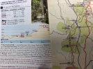
So when I got home from work yesterday, I dug through my pile of Camino stuff and found my John Brierly book and the Camino Ingles book I just received from the Confraternity of St. James and compared the two in regards to the route between Betanzos to Hospital de Bruma. The new Brierly book does show the old and new routes as Dave mentions, but the Confraternity book makes no mention of it - I’ve attached screenshots of both. That said, the Confraternity book does a great job of describing the route - literally turn by turn. If I was walking the Frances this might not be that big of a deal but since I’ll be walking at the beginning of May and I have read that it could be possible that I might not see another Pilgrim on the Camino (which is a plus for me since it’s such a short walk), I’m glad I ordered the Confraternity book. It describers the landmarks, houses, etc., that one passes along the Camino and also includes where to get a sello - worth the shipping price from the UK.

Regarding the old route, in Brierly’s book at the Leiro option he writes that the original route (in grey) avoids the “busy AC-542 into Bruma but in time the waymarks will fade and so it is not recommended.” I’m guessing then that they are still visible and since I doubt I’ll walk the Ingles again I might walk the old route so I can at least past by Bar Julia. I don’t know exactly how busy the AC-542 will be, but the idea of walking along a highway here in SoCal isn’t high on my list of things to do. And if the weather is bad making visibility poor for drivers, well..... no thanks. CP book.webpJB book.webp
 
...
Interestingly, I noticed that unlike the 2019 edition, the 2016 Brierley, doesn't have much Optional routing on any stage. For example, on the 'stage' going between Betanzos and Hospital de Bruma, there are no Optional routes listed like in the 2019 edition.
Because there were none in 2016 on that stretch :D
 
Train for your next Camino on California's Santa Catalina Island March 16-19
...
I’m guessing then that they are still visible and since I doubt I’ll walk the Ingles again I might walk the old route so I can at least past by Bar Julia. I don’t know exactly how busy the AC-542 will be, but the idea of walking along a highway here in SoCal isn’t high on my list of things to do. And if the weather is bad making visibility poor for drivers, well..... no thanks.
Don't worry about the "highway" (which is not). In US terms this AC-542 so-called highway is just a minor road if it comes to poor weather even more. Real, multi lanes highways in Spain are marked either with A (free) or AP (private, toll), they are fenced and walking on them is highly forbidden. In this case AC means A Coruna and it's local road. Which of course can be busy too. I wouldn't know because in 2016 I walked the old route between Presedo and Bruma:
 
I received the 2016 edition of Brierley's guide which is based on the OLD route. I then looked at the 2019 edition which is based on the NEW route.

The 2019 edition includes Optional routes on some of the listed 'stages'. Those Optional routes seem to be identical -- both in the directions given, and what is drawn on his maps -- to the OLD routing that appears in the 2016 edition.

It appears that the 2019 Brierley's has BOTH routes in this edition: the primary route which incorporates the new changes, along with those portions of the Old route that the New route replaced and are now listed as Optional routes. As stated above, the Optional routes, AKA Old route, incorporates the same basic (but abbreviated) descriptions and directions, and map drawings that appear in the 2016 edition. It seems that if one could follow the Camino from the 2016 guide, one should be able to do the same with the 2019 guide as well.

The missing piece is the question of how necessary the way-markings of yellow arrows and monuments were in order to supplement Brierley for navigation along the Old route.

Interestingly, I noticed that unlike the 2019 edition, the 2016 Brierley, doesn't have much Optional routing on any stage. For example, on the 'stage' going between Betanzos and Hospital de Bruma, there are no Optional routes listed like in the 2019 edition.
As I said above, we walked the new route last June from Betanzos to Bruma. I have no specific recollection of whether the old marker was still visible where the new route diverges near Leiro. HOWEVER, in general the old markers had been removed at the divergence points. I know this because we were often walking with other pilgrims who had only old guidebooks, and they were thoroughly confused at all the points where the routes diverged, because their guidebook pointed one way and the new (and only) markers pointed in a different way. I seemed to be the only one with an updated guidebook, so I frequently had to explain that the routing had been changed, and that the markers were correct.

So — if the new Brierley doesn’t include specific directions at the divergence points, AND if it’s really important to you to walk the old route, I would take a gps back-up, or an older guidebook with specific directions.

In the end, it shouldn’t be a big deal either way. The new routing in that section is quite nice, and the 2 k along the road is not a big deal. It’s also several kilometers shorter and involves less climbing, so it turns that stretch from a fairly difficult day to an ordinary one.
 
So — if the new Brierley doesn’t include specific directions at the divergence points, AND if it’s really important to you to walk the old route, I would take a gps back-up, or an older guidebook with specific directions.

Thanks for those observations, Andy. Brierley does indeed provide specific directions, so we'll see how adequate they actually are :-)
 
€2,-/day will present your project to thousands of visitors each day. All interested in the Camino de Santiago.
Has anyone thought of contacting Brierley and asking him? I'm sure he would indeed tell us if the old route is indeed now listed as an optional route?

I'm willing to email him if it has not yet been done.
 
In looking thru the Brierley's Ingles guidebook, I am wondering if any of the 'optional' paths that he shows are part of the 'Old' Ingles route? Having reviewed several other resources, it seems that at least two of his 'stages' do that. Does anyone familiar with the Ingles and Brierley have any view on this?

I appreciate the input. :)

Hi! I walked it last August and none of the guide books had been changed as there was no time before publication. It wasn’t a problem as the ‘new’ path was well indicated with signs.
However, I did choose one day to walk the ‘old’ way.... which was shown on my guide book. Half way through a forest and a big climb, locals (who had been involved in redesigning the path, apparently) stopped by and told me I should turn back as I would not be able to get through a bit later. It looked like they were doing some big work in the forest!
I’m sorry, I don’t have my guide book here so can’t be more specific as to where it was (approx. the last day of walking or so).
Just to make you aware that maybe, the old path at times isn’t practicable any more....
 
Has anyone thought of contacting Brierley and asking him? I'm sure he would indeed tell us if the old route is indeed now listed as an optional route?

I'm willing to email him if it has not yet been done.

You can, but there is no doubt that the Optional routes are, or include, the 'Old' route. :)
 
€2,-/day will present your project to thousands of visitors each day. All interested in the Camino de Santiago.
Hi! I walked it last August and none of the guide books had been changed as there was no time before publication. It wasn’t a problem as the ‘new’ path was well indicated with signs.
However, I did choose one day to walk the ‘old’ way.... which was shown on my guide book. Half way through a forest and a big climb, locals (who had been involved in redesigning the path, apparently) stopped by and told me I should turn back as I would not be able to get through a bit later. It looked like they were doing some big work in the forest!
I’m sorry, I don’t have my guide book here so can’t be more specific as to where it was (approx. the last day of walking or so).
Just to make you aware that maybe, the old path at times isn’t practicable any more....

Temporary disruptions are very possible; I remember seeing areas of logging near to, but not right by, Camino Frances last fall. I know in the US temporary closures happen all the time on wilderness trails, like the Pacific Crest Trail, for various reasons every year.

I just hope that the fire danger this year stays at a minimum, so that the Caminos can avoid THAT disruption. :eek:
 
Hi! I walked it last August and none of the guide books had been changed as there was no time before publication. It wasn’t a problem as the ‘new’ path was well indicated with signs.
However, I did choose one day to walk the ‘old’ way.... which was shown on my guide book. Half way through a forest and a big climb, locals (who had been involved in redesigning the path, apparently) stopped by and told me I should turn back as I would not be able to get through a bit later. It looked like they were doing some big work in the forest!
I’m sorry, I don’t have my guide book here so can’t be more specific as to where it was (approx. the last day of walking or so).
Just to make you aware that maybe, the old path at times isn’t practicable any more....

domigee -
You are probably right about the new route on the last day - the Confraternity/Johnnie Walker book states that the most major changes in the Camino are between Betanzos/Bruma and Sigueriro/Santiago.
 
I did the old way. I was totally confused with Bar Julia deal and walked passed it in a freezing/driving rain storm. Just down the road I turned right and started walking up a hill and suddenly discovered my water bottle was empty. I stopped and asked a home owner if I could fill my bottle and btw, where is the hill?
Minutes later I realized I was there and the path was a raging river of water. I made it to the top and started walking on paved road towards Bruma. Some very kind sheep herder stopped and asked me if I needed a ride. Understand, I could not see more than 50 meters in front of me and I was freezing. I said yes, and there we went. He stopped at the first bar to buy me a drink and then another, to celebrate he had met a true ancient pilgrim. Meanwhile I was shivering and soaking wet. I said I need to find a hotel, albergue or anyplace I can dry out, get warm and sleep. He was a remote relative of the hotel owner in the Bruma. So I ended up in a very pricey ensuite which was large enough for me to unpack everything and lay it out to dry. The food was dreadful It was basically a truck stop, but there were altenative places to eat in the small town but it must have a Sunday night because everything was closed.
 
Perfect memento/gift in a presentation box. Engraving available, 25 character max.
I did the old way. I was totally confused with Bar Julia deal and walked passed it in a freezing/driving rain storm. Just down the road I turned right and started walking up a hill and suddenly discovered my water bottle was empty. I stopped and asked a home owner if I could fill my bottle and btw, where is the hill?
Minutes later I realized I was there and the path was a raging river of water. I made it to the top and started walking on paved road towards Bruma. Some very kind sheep herder stopped and asked me if I needed a ride. Understand, I could not see more than 50 meters in front of me and I was freezing. I said yes, and there we went. He stopped at the first bar to buy me a drink and then another, to celebrate he had met a true ancient pilgrim. Meanwhile I was shivering and soaking wet. I said I need to find a hotel, albergue or anyplace I can dry out, get warm and sleep. He was a remote relative of the hotel owner in the Bruma. So I ended up in a very pricey ensuite which was large enough for me to unpack everything and lay it out to dry. The food was dreadful It was basically a truck stop, but there were altenative places to eat in the small town but it must have a Sunday night because everything was closed.

Jeez, Don, what an ordeal. :eek: I'll bet that made most of your other days on the Ingles seem quite balmy by comparison. ;)
 
You can, but there is no doubt that the Optional routes are, or include, the 'Old' route. :)
Sent it off on a whim... @davebugg , are you walking the Ingles this year? I leave from Ferrol on Sept 16th... (I'm longing to do a much much longer route again, as soon as health issues resolve )
 
Sent it off on a whim... @davebugg , are you walking the Ingles this year? I leave from Ferrol on Sept 16th... (I'm longing to do a much much longer route again, as soon as health issues resolve )

I am. :-) My wife, Jill, and I will depart Ferrol on October 18.

I will be also walking the Camino Aragones with my son, Caleb.

I will fly to Paris about 11 days before Jill departs for Madrid. Once Caleb and I finish Aragones where it joins onto the Frances at Obanos or Puenta la Reina (still deciding since I've been at Puenta la Reina and Obanos twice and Caleb once) we will taxi into Pamplona.

The plan will be to fly from Pamplona to Madrid where we will meet Jill at Madrid airport on October 17. Then Caleb will catch a flight back to Denver.

If the flight schedules don't change radically, Jill and I will likely fly to A Coruna. We'll catch a taxi into Ferrol. Based on current airline schedules, it will be late morning by then. Once we get checked into our hotel, we can rest a bit, and then spend most of the afternoon wandering around Ferrol for Jill's first taste of Spain.

The nice thing is that we will be flying Jill business class, so hopefully that will make the 12 hour flight more relaxing and restful, giving her a bit of a head start against jet lag. Neither of us are affected much by 'jet lag' as Jill works four, 12-hour overnight shifts as a Pediatric Charge nurse on Pediatrics at our hospital. And I also have varied sleep shifts in my schedule due to my consulting practice, a lot of which is with clients overseas.

It is only a nine hour time difference. We will sleep really well that night. We'll start Camino the next morning.
 
A selection of Camino Jewellery
I am. :) My wife, Jill, and I will depart Ferrol on October 18.

I will be also walking the Camino Aragones with my son, Caleb.

I will fly to Paris about 11 days before Jill departs for Madrid. Once Caleb and I finish Aragones where it joins onto the Frances at Obanos or Puenta la Reina (still deciding since I've been at Puenta la Reina and Obanos twice and Caleb once) we will taxi into Pamplona.

The plan will be to fly from Pamplona to Madrid where we will meet Jill at Madrid airport on October 17. Then Caleb will catch a flight back to Denver.

If the flight schedules don't change radically, Jill and I will likely fly to A Coruna. We'll catch a taxi into Ferrol. Based on current airline schedules, it will be late morning by then. Once we get checked into our hotel, we can rest a bit, and then spend most of the afternoon wandering around Ferrol for Jill's first taste of Spain.

The nice thing is that we will be flying Jill business class, so hopefully that will make the 12 hour flight more relaxing and restful, giving her a bit of a head start against jet lag. Neither of us are affected much by 'jet lag' as Jill works four, 12-hour overnight shifts as a Pediatric Charge nurse on Pediatrics at our hospital. And I also have varied sleep shifts in my schedule due to my consulting practice, a lot of which is with clients overseas.

It is only a nine hour time difference. We will sleep really well that night. We'll start Camino the next morning.
Very nice ! And a well thought out plan as expected. Our paths won’t cross, I’ll be home before you leave . Enjoy every minute ! Buen Camino :)
 
I was there during the wrong season. Not one balmy day although I did enjoy an enjoyable day at one town where the albergue was just a short walk to the beach and I was the only one there that night.
 
Ideal sleeping bag liner whether we want to add a thermal plus to our bag, or if we want to use it alone to sleep in shelters or hostels. Thanks to its mummy shape, it adapts perfectly to our body.

€46,-
I walked the Inglés in 2004, I believe, so I guess that was the “old route.” Can anyone tell me why they changed the route and what the major differences are? Less road perhaps? Is it a major re-routing? Are all the major stopping points still the same?
 
I walked the Inglés in 2004, I believe, so I guess that was the “old route.” Can anyone tell me why they changed the route and what the major differences are? Less road perhaps? Is it a major re-routing? Are all the major stopping points still the same?
From what I have gathered it wasn't a major re-routing overall. Some of the changes sounded like they involved shifts from busier roads to farm roads.

It looks like the single biggest change was made at Leiro, changing the path from there all the way into Hospital de Bruma. No more Casa Julia on the New route.

But Brierley does keep the Old route and Casa Julia as an Option in the 2019 edition of his guide.
 
Last edited by a moderator:
Good, Dave. I had the impression from your previous post that Brierley indicated the old route on the map only, but the sample I downloaded did indeed seem to have specific directions. As to the suggestion to contact Brierley directly that was made, above, that's a good idea. I emailed him a few years ago with some corrections, and he got back to me pretty quickly. On the other hand, I think we seem to have collectively established that Brierley's alternatives are indeed the old route. I've used him on the Frances, the Portuguese, and to Finisterre / Muxia, and his directions have always been good.
 
Ideal sleeping bag liner whether we want to add a thermal plus to our bag, or if we want to use it alone to sleep in shelters or hostels. Thanks to its mummy shape, it adapts perfectly to our body.

€46,-
John Brierley's reply:

Dear Sophie

Thank you for your enquiry. The 2019 edition of the guide shows the new waymarked route in the familiar yellow colour. The former route is marked in grey and is shown in case a pilgrim should stray off the new path and inadvertently find themselves following arrows on the old route. Old waymarks have been removed from the first few hundred meters but confusion may still arise and old waymarks will disappear in time.

The camino routes are constantly changing (not, in my opinion, always for the best). These changes occur for a variety or reasons (not necessarily all logical but mostly around safety and improved facilities). To minimise the chances of getting lost I suggest pilgrims stay on the newly waymarked route. The 2019 guide includes one suggestion to follow a short alternative (green) route through woodland (rather than the new route parallel to the motorway into Sigueiro) and this is shown on the stage 5 map (p.43) with details in the text.

I hope this helps in your planning and wish you an uplifting journey along the beautiful pathways that make up the camino Inglés.

Many blessings and 'Bo camino'…

John (Brierley)
 
The biggest changes on the Ingles route are as follows:

Ferrol / Neda to Pontedeume section - at Vilar do Colo, the new route goes off right after passing under the motorway, and goes through the countryside till it comes to Cabanas and then comes down a very steep hill to the river estuary where you walk over the bridge to Pontedeume. The old route went off right before the motorway junction and came down onto the beach at Cabanas which you walked the full length of before you come to the Pontedeume bridge. I walked the old route, due to an absence of markers and a friendly local directing where the old route was. I think the old route was better.

Betanzos to Hospital de Bruma - two main changes. The first at Cos, you turn left and walk along a pavement on a road and follow this for about 2km down to Presedo. The old route somehow walked through fields to the north of the road. the new route was not signposted well with waymarks and you needed to trust that walking along the road was the correct way. For the last 1km, the pavement stops and you do need to walk along the actual side of the road, down a hill and round some bends where there path then branches off left to Presedo. Walking on the road was not too pleasant, but there was not too much traffic to both
Later, at Leiro, the new route branches off and misses out the fearsome hill up to Hospital de Bruma and Bar Julia. Most of the walk is unpaved forest road with a long gradual incline. You keep wondering where the fearsome hill is, but it never comes. At the top, you join a fairly large raod where the Ingles from La Coruna joins and you need to walk on the side of the road (pavement half and half) for about 2km, including passing a quite large electricity substation. This is where Bar Avelina is, which was not too welcoming.

Hospital de Bruma to Sigueiro - when you pass over the motorway, the new Ingles route takes you right and down onto the motorway embankment. What you do not realise at that point is that you walk alongside the motorway for a good 4km, albeit separated from the motorway by a metal fence. But walking alongside a motorway for over 45 minutes is so depressing, seeing cars do what you are doing in an hour, in a matter of minutes. The road is also noisy. If you can, do not turn right, but carry on the road and then take the second road on the right. You then walk along a country road (no pavement, but you can see and hear the occasional car that comes) all the way to Sigueiro. This is the one time when walking on tarmac beats walking on a grass path.

Sigueiro to Santiago - the new route, for the better, takes the Ingles off the main Sigueiro to Santiago road and onto country roads which run parallel about half a kilometre away. You need to be on the right hand side of the main road in Sigueiro as you walk over the river.


On guides, if you look a the CSJ guide, it is so detailed, in terms of exactly where to turn right, left or go straight on. Invaluable if you are lost, but if you have it open when you walk, you will be worrying when the next turn comes and literally walking with your nose in the book, instead of watching and enjoying the camino. Also, your judgement of what is 100, 200 or 400 metres (for when you need next to turn left, reading the guidebook), invariably turns out to be half of what it is in reality, especially when you are tired, meaning that if you are actively walking with the guidebook, you are stressed half the time that you have missed where to go.

You needn't be. The Ingles, generally, is well marked by the triangular waymarks, which appear, as and when there is a junction, fork or a place you should change direction (or carry on straight when other roads / tracks appear left and right. I think having a guide is good, but I would carry it in your pocket, for reference when things are confusing, not to get you along the way. The waymarks do that. Unfortunately, unlike more popular caminos, there is not the pilgrim traffic to look ahead and follow. I saw no more than 10 other pilgrims per day, and therefore, a guidebook is handy to have, when you are confused.
 
John Brierley's reply:

Dear Sophie

Thank you for your enquiry. The 2019 edition of the guide shows the new waymarked route in the familiar yellow colour. The former route is marked in grey and is shown in case a pilgrim should stray off the new path and inadvertently find themselves following arrows on the old route. Old waymarks have been removed from the first few hundred meters but confusion may still arise and old waymarks will disappear in time.

The camino routes are constantly changing (not, in my opinion, always for the best). These changes occur for a variety or reasons (not necessarily all logical but mostly around safety and improved facilities). To minimise the chances of getting lost I suggest pilgrims stay on the newly waymarked route. The 2019 guide includes one suggestion to follow a short alternative (green) route through woodland (rather than the new route parallel to the motorway into Sigueiro) and this is shown on the stage 5 map (p.43) with details in the text.

I hope this helps in your planning and wish you an uplifting journey along the beautiful pathways that make up the camino Inglés.

Many blessings and 'Bo camino'…

John (Brierley)

Please thank John for us - and thanks for emailing him.
 
...and ship it to Santiago for storage. You pick it up once in Santiago. Service offered by Casa Ivar (we use DHL for transportation).
John Brierley's reply:

Dear Sophie

Thank you for your enquiry. The 2019 edition of the guide shows the new waymarked route in the familiar yellow colour. The former route is marked in grey and is shown in case a pilgrim should stray off the new path and inadvertently find themselves following arrows on the old route. Old waymarks have been removed from the first few hundred meters but confusion may still arise and old waymarks will disappear in time.

The camino routes are constantly changing (not, in my opinion, always for the best). These changes occur for a variety or reasons (not necessarily all logical but mostly around safety and improved facilities). To minimise the chances of getting lost I suggest pilgrims stay on the newly waymarked route. The 2019 guide includes one suggestion to follow a short alternative (green) route through woodland (rather than the new route parallel to the motorway into Sigueiro) and this is shown on the stage 5 map (p.43) with details in the text.

I hope this helps in your planning and wish you an uplifting journey along the beautiful pathways that make up the camino Inglés.

Many blessings and 'Bo camino'…

John (Brierley)
Sophie: Thanks for doing this. This is good knowledge that a lot of people will want to know (beyond the few of us who have been following this thread).

Would you consider posting his response, and your question to him, as a separate thread? That way more people will see it, and it will come up more easily when someone is searching the forum.

Done...Posted as new thread in Camino Ingles
 
John Brierley's reply:

Dear Sophie

Thank you for your enquiry. The 2019 edition of the guide shows the new waymarked route in the familiar yellow colour. The former route is marked in grey and is shown in case a pilgrim should stray off the new path and inadvertently find themselves following arrows on the old route. Old waymarks have been removed from the first few hundred meters but confusion may still arise and old waymarks will disappear in time.

The camino routes are constantly changing (not, in my opinion, always for the best). These changes occur for a variety or reasons (not necessarily all logical but mostly around safety and improved facilities). To minimise the chances of getting lost I suggest pilgrims stay on the newly waymarked route. The 2019 guide includes one suggestion to follow a short alternative (green) route through woodland (rather than the new route parallel to the motorway into Sigueiro) and this is shown on the stage 5 map (p.43) with details in the text.

I hope this helps in your planning and wish you an uplifting journey along the beautiful pathways that make up the camino Inglés.

Many blessings and 'Bo camino'…

John (Brierley)

Great job, Sophie; thank you for doing the email. :-)
 
A selection of Camino Jewellery
The biggest changes on the Ingles route are as follows:

Ferrol / Neda to Pontedeume section - at Vilar do Colo, the new route goes off right after passing under the motorway, and goes through the countryside till it comes to Cabanas and then comes down a very steep hill to the river estuary where you walk over the bridge to Pontedeume. The old route went off right before the motorway junction and came down onto the beach at Cabanas which you walked the full length of before you come to the Pontedeume bridge. I walked the old route, due to an absence of markers and a friendly local directing where the old route was. I think the old route was better.

Betanzos to Hospital de Bruma - two main changes. The first at Cos, you turn left and walk along a pavement on a road and follow this for about 2km down to Presedo. The old route somehow walked through fields to the north of the road. the new route was not signposted well with waymarks and you needed to trust that walking along the road was the correct way. For the last 1km, the pavement stops and you do need to walk along the actual side of the road, down a hill and round some bends where there path then branches off left to Presedo. Walking on the road was not too pleasant, but there was not too much traffic to both
Later, at Leiro, the new route branches off and misses out the fearsome hill up to Hospital de Bruma and Bar Julia. Most of the walk is unpaved forest road with a long gradual incline. You keep wondering where the fearsome hill is, but it never comes. At the top, you join a fairly large raod where the Ingles from La Coruna joins and you need to walk on the side of the road (pavement half and half) for about 2km, including passing a quite large electricity substation. This is where Bar Avelina is, which was not too welcoming.

Hospital de Bruma to Sigueiro - when you pass over the motorway, the new Ingles route takes you right and down onto the motorway embankment. What you do not realise at that point is that you walk alongside the motorway for a good 4km, albeit separated from the motorway by a metal fence. But walking alongside a motorway for over 45 minutes is so depressing, seeing cars do what you are doing in an hour, in a matter of minutes. The road is also noisy. If you can, do not turn right, but carry on the road and then take the second road on the right. You then walk along a country road (no pavement, but you can see and hear the occasional car that comes) all the way to Sigueiro. This is the one time when walking on tarmac beats walking on a grass path.

Sigueiro to Santiago - the new route, for the better, takes the Ingles off the main Sigueiro to Santiago road and onto country roads which run parallel about half a kilometre away. You need to be on the right hand side of the main road in Sigueiro as you walk over the river.


On guides, if you look a the CSJ guide, it is so detailed, in terms of exactly where to turn right, left or go straight on. Invaluable if you are lost, but if you have it open when you walk, you will be worrying when the next turn comes and literally walking with your nose in the book, instead of watching and enjoying the camino. Also, your judgement of what is 100, 200 or 400 metres (for when you need next to turn left, reading the guidebook), invariably turns out to be half of what it is in reality, especially when you are tired, meaning that if you are actively walking with the guidebook, you are stressed half the time that you have missed where to go.

You needn't be. The Ingles, generally, is well marked by the triangular waymarks, which appear, as and when there is a junction, fork or a place you should change direction (or carry on straight when other roads / tracks appear left and right. I think having a guide is good, but I would carry it in your pocket, for reference when things are confusing, not to get you along the way. The waymarks do that. Unfortunately, unlike more popular caminos, there is not the pilgrim traffic to look ahead and follow. I saw no more than 10 other pilgrims per day, and therefore, a guidebook is handy to have, when you are confused.

Peb: This is terrific. I took the liberty of pasting it in to the new thread started today by KJF Sophie with John Brierley’s response to her question about the new edition of his guidebook. Along with Brierley’s response, I think your post gives people all the information they would want if they’re considering the new vs. the old ingles, or some combination of both. Thanks!
 
Walked the alternative / old route to sigueiro today used Brierley. It was a bit worrying at first but instructions good then old yellow arrows became visible on the trees.
 
...and ship it to Santiago for storage. You pick it up once in Santiago. Service offered by Casa Ivar (we use DHL for transportation).

❓How to ask a question

How to post a new question on the Camino Forum.

Most read last week in this forum

Hey I am just trying to put together a Camino for my family (2 adults & 2 kids <10). I am thinking of doing the Camino Ingles in the Easter holidays next year. Currently researching ferry times V...
@Peterexpatkiwi and a few others have mentioned this place on the Ingles, and a know a few folks are planning an Ingles Camino so I though I would share the tip. Just a place with a real buzz and...

Featured threads

❓How to ask a question

How to post a new question on the Camino Forum.

Featured threads

Forum Rules

Forum Rules

Camino Updates on YouTube

Camino Conversations

Most downloaded Resources

This site is run by Ivar at

in Santiago de Compostela.
This site participates in the Amazon Affiliate program, designed to provide a means for Ivar to earn fees by linking to Amazon
Official Camino Passport (Credential) | 2024 Camino Guides
Back
Back
Top