Search 74,075 Camino Questions

Crossing from coast to central route

gevalia

New Member
Time of past OR future Camino
2021
Hello all
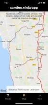
The Camino Ninja app shows a trail crossing from the coast at Gafa which is before Vila do Conde to join the central route at Vairao.
My question is has any one here taken this route? Is it on a road, is it marked?
Any info would be helpful.

Thank you
 
...and ship it to Santiago for storage. You pick it up once in Santiago. Service offered by Casa Ivar (we use DHL for transportation).
Ideal sleeping bag liner whether we want to add a thermal plus to our bag, or if we want to use it alone to sleep in shelters or hostels. Thanks to its mummy shape, it adapts perfectly to our body.

€46,-
Hello all
The Camino Ninja app shows a trail crossing from the coast at Gafa which is before Vila do Conde to join the central route at Vairao.
My question is has any one here taken this route? Is it on a road, is it marked?
Any info would be helpful.

Thank you
This is a normal road and not waymarked but does not mean you can‘t walk from there to Vairão you only have to accept that you have to find out your way yourself i.e.with a navigation app or a roadmap.
The original waymarked connections between the coastal and the central route are in Vila do Conde and in Caminha
 
Last edited by a moderator:
Hello all
The Camino Ninja app shows a trail crossing from the coast at Gafa which is before Vila do Conde to join the central route at Vairao.
My question is has any one here taken this route? Is it on a road, is it marked?
Any info would be helpful.

Thank you
I'm wondering how you see that on the Camino Ninja app. Which route did you choose?
 
Holoholo automatically captures your footpaths, places, photos, and journals.
Vila do Conde is a nice place to visit 😎
From there one can switch to central route via Junqueira to Arcos.

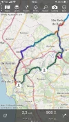
View attachment 120263 View attachment 120262
That is correct. There are two possibilities. One follows the aquaduct in Vila do Conde and leads through Arcos up to São Pedro de Rates and the other one follows the river Ave in Vila do Conde and goes directly to São Pedro de Rates. The distances in kms or miles are about the same.
 
The focus is on reducing the risk of failure through being well prepared. 2nd ed.
I'm wondering how you see that on the Camino Ninja app. Which route did you choose?
On the central route with map view there is a brown line between those two towns. I assumed they were showing it as a connection between the two routes
 
That is correct. There are two possibilities. One follows the aquaduct in Vila do Conde and leads through Arcos up to São Pedro de Rates and the other one follows the river Ave in Vila do Conde and goes directly to São Pedro de Rates. The distances in kms or miles are about the same.

I took the lower green one:

6E3A4D24-A33E-4622-BB96-E39A007557ED.webp
 
Ideal sleeping bag liner whether we want to add a thermal plus to our bag, or if we want to use it alone to sleep in shelters or hostels. Thanks to its mummy shape, it adapts perfectly to our body.

€46,-
As we did and I have to correct myself . the one starting along the aquaduct is not hitting Arcos but the one along the river. I walked both . So mixed it up.
in Arcos is an old medieval bridge I remember.
Hello Albertinho, I have heard of the aquaduct, but have not been able to find a good resource/map that shows the route using the aquaduct. We are going from Vila do Conde to Rates. Is the aquaduct better/safer that using the green route to Arcos? Do you know where the aquaduct route starts and where joins the central Way? Thanks so much.
 
Hello Albertinho, I have heard of the aquaduct, but have not been able to find a good resource/map that shows the route using the aquaduct. We are going from Vila do Conde to Rates. Is the aquaduct better/safer that using the green route to Arcos? Do you know where the aquaduct route starts and where joins the central Way? Thanks so much.
I would also like the answer. So many pilgrims talk about the dangerous traffic from Vila do Conde to Arcos, I wondered if there was a safer, marked route.
 
Ideal pocket guides for during & after your Camino. Each weighs only 1.4 oz (40g)!
Hello Albertinho, I have heard of the aquaduct, but have not been able to find a good resource/map that shows the route using the aquaduct. We are going from Vila do Conde to Rates. Is the aquaduct better/safer that using the green route to Arcos? Do you know where the aquaduct route starts and where joins the central Way? Thanks so much.
Olá Esteban. Entering Vila do Conde on thebridge over the Ave river you can turn right to Arcos and São Pedro de Rates by following the waymarkers
But looking ahead in front of you is a big building on to of a cliff
so when you cross the road and pass the cliff at the left side , soon you will see the aquaduct. The road leads to Póvoa da Varzim bus at a certain time you have to leave this road to continue to São Pedro.
i have to look at the map to see where it was.
i’ll let you know
 
The building on top of the cliff is sanctuario Santa Clara
shortly after you‘ll see the aquaduct at your left side. It starts at the backside of the Sanctuary . I suggest you look at Google maps from the sanctary follow the road northwards and find the metro station. Vila do Conde ( not SantaClara - that’s on the way to Arcos) a bit northwards is a road, the N 206. This road is the alternative to São Pedro de Rates and comes together after about 7 kms with the waymarked caminho from Arcos.
the N206 is a bad alternative.
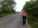
Anyway keep at the left side so you see thecars coming towards you what does not mean that it is safe because cars coming from behind you and overtake and come close to you. We used our poles to keep them a bit further away from us. And wore fluoriscent safety jackets. Better its to take the waymarked path because drivers expect pilgrims there however this does not guarantee nothing. You have to take care all the time
 
3rd Edition. More content, training & pack guides avoid common mistakes, bed bugs etc
Most of the truck drivers are Formula 1 participants as well and their draft can suck you right into the road after they pass.
 
I don’t recall that there was a dangerous traffic between VDC - Arcos. I turned to the right after crossing the bridge, before Santa Clara sanctuario. The gpx track to Arcos attached.

IMG_1656.JPGIMG_1668.webp
 

Attachments

Last edited:
Most of the truck drivers are Formula 1 participants as well and their draft can suck you right into the road after they pass.
That is true . The average truck drives 95 kms per hour while legaly is permitted 80 kms per hour .
But in common it is not that busy on the roads there compared with the Netherlands where I live and nearly only transito and heavy traffic is with fast and aggressive truck drivers, mostly from eastern Europe.
I don’t recall that there was a dangerous traffic between VDC - Arcos. I turned to the right after crossing the bridge, before Santa Clara sanctuario. The gpx track to Arcos attached.

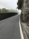
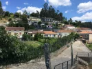
View attachment 120340View attachment 120342
when you arrive in the rural area after Vila do Conde the roads are smaller .And you walk aside the road. you have to take care for cars coming onto you and from behind especially when they are overtaking
 

Attachments

  • 16730ED5-33CE-42D1-A69B-47D18AEC9EFB.webp
    16730ED5-33CE-42D1-A69B-47D18AEC9EFB.webp
    483.2 KB · Views: 31
  • F6E0D692-E3D6-4A36-ADB3-29494E6503DD.webp
    F6E0D692-E3D6-4A36-ADB3-29494E6503DD.webp
    776.8 KB · Views: 29
  • ED1B7E38-C31B-4C0C-B060-E8C924BD91D5.webp
    ED1B7E38-C31B-4C0C-B060-E8C924BD91D5.webp
    1.2 MB · Views: 24
  • 573A476E-6C16-4EF4-B68F-54B1D463E617.webp
    573A476E-6C16-4EF4-B68F-54B1D463E617.webp
    1.1 MB · Views: 28
  • B561F741-F808-4C30-984D-E04D69090903.webp
    B561F741-F808-4C30-984D-E04D69090903.webp
    915.6 KB · Views: 27
Join the Camino cleanup. Logroño to Burgos May 2025 & Astorga to OCebreiro in June
when you arrive in the rural area after Vila do Conde the roads are smaller .And you walk aside the road. you have to take care for cars coming onto you and from behind especially when they are overtaking
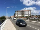
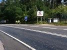
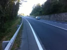
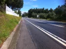
Certainly, there are some unpleasant parts on CP with a nasty traffic. Are those pics above from the VDC-Arcos stage?
 
Last edited:
Certainly, there are some unpleasant parts on CP with a nasty traffic. Are those pics above from the VDC-Arcos stage?
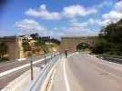
No.they aren’t but give an idea what you can encounter.
i remember lots of roadwalking to Arcos and São Pedro de Rates with narrow roads .
in São Pedro is a logistic center of a transport company so there even were some heavier transport movements going onwhile pilgrims walk aside the road on the very small hard shoulder.
The last time I was there in 2018 we came from a different direction, from Vairão That was a more rural and quieter area to walk through until Arcos.

Notorious is the road to Barcelos where it is dangerous around Pedra Furada .Special big signs warn drivers that they can encounter pilgrims walking on the road.

and in Spain between Redondela and Pontevedra the second picture is taken there.
some where on the trail between Lisbon and Porto
 
That's the route we took.
 
3rd Edition. More content, training & pack guides avoid common mistakes, bed bugs etc

❓How to ask a question

How to post a new question on the Camino Forum.

Featured threads

❓How to ask a question

How to post a new question on the Camino Forum.

Featured threads

Forum Rules

Forum Rules

Camino Updates on YouTube

Camino Conversations

Most downloaded Resources

This site is run by Ivar at

in Santiago de Compostela.
This site participates in the Amazon Affiliate program, designed to provide a means for Ivar to earn fees by linking to Amazon
Official Camino Passport (Credential) | 2024 Camino Guides
Back
Back
Top