• ⚠️ Emergency contact in Spain - Dial 112 and AlertCops app. More on this here.
  • Remove ads on the forum by becoming a donating member. More here.

Search 74,075 Camino Questions

LIVE from the Camino Caryn on the Aragonés

Time of past OR future Camino
Most recent: Fall 2023 Aragonés, Frances
How I traveled to Candanchú (2 km from Somport) in one day.

From Madrid:
-10:35am Renfe Train from Atocha Rail Station, arrive 1:45pm Pamplona Iruna Rail Station.

-3:30pm La Burendesa Bus from Pamplona Bus Station, arrive 5:25pm Jaca Bus Station.

-7:30pm Mavaragon Bus from Jaca Bus
Station, arrive 8:10pm Candanchú. The driver dropped me off in front of the hotel where I was staying that night.

Day 1: (Wed Aug 30) Somport to Canfranc Pueblo
I had planned to walk the 2 km up the hill to Somport but was offered a ride from an employee at the hotel. I stopped in at the Aysa hostel in Somport to get the first stamp in my credential. The trail begins in front of the hostal.
IMG_9264.jpeg
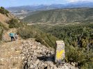
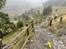
A heavily misty morning without the spectacular mountain views I’d been looking forward to! Still, it was beautiful and I was happy to finally be taking first steps on this camino, watching the mist drift, revealing bits of colour, trees and the contours of the slopes and ridge lines. The lovely trail winds down the slope above the Aragón river, sometimes very steep and eroded in places but staying sure-footed helps to keep it manageable. Grateful for my walking poles!

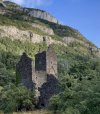
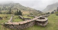
Just before Candanchú are the ruins of the 13th century hospital of Santa Christina, a hugely important place of refuge for pilgrims.
IMG_9266.jpeg
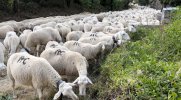
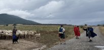
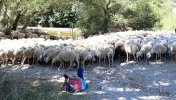
The trail ends at the road which winds around and away from Candanchú with dramatic mountain slopes on either side. On the right slope, above the river, I watched and listened to 4 shepherds and 3 dogs as they managed a massive flock of sheep.

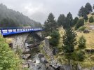
Very soon, a yellow arrow led me off the road to the right and onto a dirt path which continued to run parallel with the road until the Santa Christina Bridge. I was following Gronze route info and was a bit confused at this point. The bridge that I assumed was the Santa Christina is on the road and crossing it would have you continue on the road.
IMG_9267.jpeg
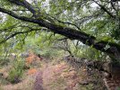
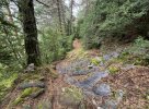
On the parallel dirt path I was following was a wooden bridge that once crossed, had me continue on an uphill path (noted by Gronze) which is what I did. I continued along the path climbing up a bit more and then along the slope, following yellow arrows and looking for the point where the path would descend to cross the national road (Gronze). Arrows stopped, I retraced my steps to the last arrow, looking down to the road and any indication of where the crossing should be. I finally saw a camino marker and arrow across the road but it took a while to find a place to descend and cross the road which led to the beginning of a long winding, sometimes steep and rocky descent through a lovely aromatic fir and pine forest.
IMG_9270.jpeg
Every so often, I could hear sheep bells in the distance ahead. Evidence on the path led me to believe that they had descended this path not to long before me!

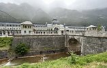
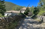
The path led to the national road again and a parallel dirt path for the final push into Canfranc Estación and the first views of the phenomenal restoration of the train station.
IMG_9271.jpeg
I don’t know why I thought it would be possible for a weary muddy shoed pilgrim to sit in their bar or cafe and enjoy a cafe von leche. 🤣 Very quickly I saw it was clearly not possible. I could enter the lobby, have a look, take a photo in the centre and then exit either front or back. All other areas are roped off with signs stating “for guests only”. I can understand why - hundreds of curious people passing through the revolving doors under the watchful eye of a security guard. Directly across from the station is a wonderful cafe - Cafeteria El Andén. A great place for lunch!

Skies were clearing as I made my way out of town. I stopped at the new pilgrim office / info centre. Got a stamp and had a nice chat.

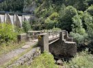
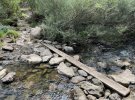
Very quickly along the extremely busy road road, you cross through a short tunnel and then descend steps to the left and on to a dirt path leading to the broken bridge over the Aragón. As I reached the bottom of the steps, 2 pilgrims coming toward me told me the bridge wasn’t passable. I told them there was a board placed for crossing the river. I had seen the notice in Gronze. It is confusing though. Arrows still lead to the bridge which is blocked off but there is no info about the alternative, There is a slope down to the river but the board can’t be seen immediately from the top.
IMG_9272.jpeg IMG_9273.jpeg
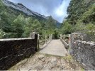
Once across the wonderful board bridge, the path continues all the way, mostly through a beech forrest, across another bridge, through more forest and into Canfranc Pueblo.
IMG_9274.jpeg IMG_9276.jpeg
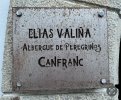
I made my way to the absolutely beautiful donativo Elias Valina Albergue de Peregrinos Canfranc and a very warm welcome from hospitaleras Vitoria and Therese.
IMG_9277.jpeg
 
Last edited:
...and ship it to Santiago for storage. You pick it up once in Santiago. Service offered by Casa Ivar (we use DHL for transportation).
Following you on this special Camino! We've been hospitaleros at both Canfranc and Arres on this route and walked from Canfranc to Artieda. You can also take the train from Atocha to Zaragoza and then switch to a media-distance train to Canfranc Estacion and then a bus to Somport.

Hope you will be able to take some of the special places along the way...
 
Last edited:
€2,-/day will present your project to thousands of visitors each day. All interested in the Camino de Santiago.
How I got to Candanchú (2 km from Somport) in one day.

From Madrid:
-10:35am Renfe Train from Atocha Rail Station, arrive 1:45pm Pamplona Iruna Rail Station.

-3:30pm La Burendesa Bus from Pamplona Bus Station, arrive 5:25pm Jaca Bus Station.

-7:30pm Mavaragon Bus from Jaca Bus
Station, arrive 8:10pm Candanchú. The driver dropped me off in front of the hotel where I was staying that night.

Day 1: (Wed Aug 30) Somport to Canfranc Pueblo
I had planned to walk the 2 km up the hill to Somport but was offered a ride from an employee at the hotel. I stopped in at the Aysa hostel in Somport to get the first stamp in my credential. The trail begins in front of the hostal.
View attachment 155718
A heavily misty morning without the spectacular mountain views I’d been looking forward to! Still, it was beautiful and I was happy to finally be taking first steps on this camino, watching the mist drift, revealing bits of colour, trees and the contours of the slopes and ridge lines. The lovely trail winds down the slope above the Aragón river, sometimes very steep and eroded in places but staying sure-footed helps to keep it manageable. Grateful for my walking poles!

Just before Candanchú are the ruins of the 13th century hospital of Santa Christina, a hugely important place of refuge for pilgrims.
View attachment 155721
The trail ends at the road which winds around and away from Candanchú with dramatic mountain slopes on either side. On the right slope, above the river, I watched and listened to 4 shepherds and 3 dogs as they managed a massive flock of sheep.

Very soon, a yellow arrow led me off the road to the right and onto a dirt path which continued to run parallel with the road until the Santa Christina Bridge. I was following Gronze route info and was a bit confused at this point. The bridge that I assumed was the Santa Christina is on the road and crossing it would have you continue on the road.
View attachment 155734
On the parallel dirt path I was following was a wooden bridge that once crossed, had me continue on an uphill path (noted by Gronze) which is what I did. I continued along the path climbing up a bit more and then along the slope, following yellow arrows and looking for the point where the path would descend to cross the national road (Gronze). Arrows stopped, I retraced my steps to the last arrow, looking down to the road and any indication of where the crossing should be. I finally saw a camino marker and arrow across the road but it took a while to find a place to descend and cross the road which led to the beginning of a long winding, sometimes steep and rocky descent through a lovely aromatic fir and pine forest.
View attachment 155735
Every so often, I could hear sheep bells in the distance ahead. Evidence on the path led me to believe that they had descended this path not to long before me!

The path led to the national road again and a parallel dirt path for the final push into Canfranc Estación and the first views of the phenomenal restoration of the train station.
View attachment 155736
I don’t know why I thought it would be possible for a weary muddy shoed pilgrim to sit in their bar or cafe and enjoy a cafe von leche. 🤣 Very quickly I saw it was clearly not possible. I could enter the lobby, have a look, take a photo in the centre and then exit either front or back. All other areas are roped off with signs stating “for guests only”. I can understand why - hundreds of curious people passing through the revolving doors under the watchful eye of a security guard. Directly across from the station is a wonderful cafe - Cafeteria El Andén. A great place for lunch!

Skies were clearing as I made my way out of town. I stopped at the new pilgrim office / info centre. Got a stamp and had a nice chat.

Very quickly along the extremely busy road road, you cross through a short tunnel and then descend steps to the left and on to a dirt path leading to the broken bridge over the Aragón. As I reached the bottom of the steps, 2 pilgrims coming toward me told me the bridge wasn’t passable. I told them there was a board placed for crossing the river. I had seen the notice in Gronze. It is confusing though. Arrows still lead to the bridge which is blocked off but there is no info about the alternative, There is a slope down to the river but the board can’t be seen immediately from the top.
View attachment 155738 View attachment 155737
Once across the wonderful board bridge, the path continues all the way, mostly through a beech forrest, across another bridge, through more forest and into Canfranc Pueblo.
View attachment 155739 View attachment 155740
I made my way to the absolutely beautiful Elias Valina Albergue de Peregrinos Canfranc and a very warm welcome from hospitaleras Vitoria and Therese.

View attachment 155741
Love those pictures that I don’t have Even though I walked that part of the Camino…Thanks
 
Last edited:
Ideal pocket guides for during & after your Camino. Each weighs only 1.4 oz (40g)!
A few notes:

The new albergue in Canfranc Pueblo is a donativo: give generously!!!

Sadly, the bridge was recently damaged and while there are plans to restore it, it’ll take awhile. If high waters prevent crossing the river on that board, the temporary route is to continue along the highway after the tunnel until you reach Pueblo. Sadly, this skips what may be the prettiest part of that entire Camino.

The route below Somport has been moved to follow closer to the roadway. The old route is still there and much prettier, but not recommended when the weather is poor. As you leave the ruins of the hospital, do NOT cross the road immediately, but instead follow it across the small road bridge and you will see signs for a GR route on your left which quickly climbs up the hill. Until very recently, this was the official route. You’ll see the traditional yellow arrows once you are on it for a short bit.

Train service directly into Canfranc Estacion either has been or soon will be due to track upgrades. Anyone hoping to reach this area can take the replacement bus as part of the train service (Madrid-Zaragoza-Huesca-Jaca-Canfranc) or take a regional bus to Jaca and then the local one up the hill.
 
Perfect memento/gift in a presentation box. Engraving available, 25 character max.
A few notes:

The new albergue in Canfranc Pueblo is a donativo: give generously!!!

Sadly, the bridge was recently damaged and while there are plans to restore it, it’ll take awhile. If high waters prevent crossing the river on that board, the temporary route is to continue along the highway after the tunnel until you reach Pueblo. Sadly, this skips what may be the prettiest part of that entire Camino.

The route below Somport has been moved to follow closer to the roadway. The old route is still there and much prettier, but not recommended when the weather is poor. As you leave the ruins of the hospital, do NOT cross the road immediately, but instead follow it across the small road bridge and you will see signs for a GR route on your left which quickly climbs up the hill. Until very recently, this was the official route. You’ll see the traditional yellow arrows once you are on it for a short bit.

Train service directly into Canfranc Estacion either has been or soon will be due to track upgrades. Anyone hoping to reach this area can take the replacement bus as part of the train service (Madrid-Zaragoza-Huesca-Jaca-Canfranc) or take a regional bus to Jaca and then the local one up the hill.
MUCHAS gracias for this information. Buen Camino
 
An afternoon and evening in Canfrac Pueblo.

When I arrived at this jewel of an albergue, (around 3:10pm) Vitoria told me that if I wanted to eat I should go immediately to the Casa Restaurant down the street because they close at 3:30. I didn’t as I had stopped at a grocery store in Canfranc Estación and had food for dinner. There is a (very friendly and fun) bar - El Mentidero - next to the albergue - they had snacks - mostly fried items and tortilla.
IMG_9686.jpeg IMG_9684.jpeg
There is a full kitchen with fridge, microwave, stove with oven, plates and cutlery but if you bring food to prepare, please note that there aren’t pots for cooking. A washer and dryer is available for use in the kitchen area.
IMG_9683.jpeg
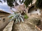
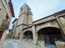
I enjoyed a walk around the village in the evening and as always I like to check out the route out of town for clarity the next morning. I stopped to look at the ruins of the Church of La Trinidad.
IMG_9685.jpeg
I heard bells and suddenly I was trapped by the AC Gang! Had a chat with one of the shepherds. The flock (along with 8 goats) was indeed the one I was following the signs of, the day before after Candanchú.
IMG_9682.jpeg
The flock were allowed to stop for about 5 min before 3 dogs kept them moving along the camino path out of town.
 
Train for your next Camino on California's Santa Catalina Island March 16-19
Following you on this special Camino! We've been hospitaleros at both Canfranc and Arres on this route and walked from Canfranc to Artieda. You can also take the train from Atocha to Zaragoza and then switch to a media-distance train to Canfranc Estacion and then a bus to Somport.

Hope you will be able to take some of the special places along the way...
I enjoyed your posts about your time at Canfranc and Arres!
 
Laurie and I walked the Aragonés a few years too early, Canfranc Estación was not yet renovated and there was no lovely new albergue. I guess that we'll just have to walk it again! We did wander around the train station with its abandoned train cars which was actually a bit spooky!

Ultreia!
I saw a short documentary about Canfranc Estación a few years ago. I would have like to have seen it in it’s abandoned state as well!
 
if you bring food to prepare, please note that there aren’t pots for cooking
What?!? I can personally attest to their presence when my wife and I opened the albergue earlier this spring. Did you ask the hospitaleros about this? Perhaps they had accidentally had them all in downstairs kitchen and didn’t realize it. 🤔. The goal of that albergue is provide for the needs of pilgrims and given its location, pots and pans certainly are necessary.
 
Get a spanish phone number with Airalo. eSim, so no physical SIM card. Easy to use app to add more funds if needed.
I agree with @Vacajoe. There were plenty of pots, pans, dishes, and silverware when Janet and I were there. They may have been in the downstairs kitchen. Please check with the hospitaleros.

Phil
 
I agree with @Vacajoe. There were plenty of pots, pans, dishes, and silverware when Janet and I were there. They may have been in the downstairs kitchen. Please check with the hospitaleros.

Phil
Maybe @Theatregal was cooking in the upstairs kitchen which had no pots and pans when we were there. They were in the downstairs kitchen which we opened to pilgrims. Maybe that one is not open with the current hospitalero.
 
...and ship it to Santiago for storage. You pick it up once in Santiago. Service offered by Casa Ivar (we use DHL for transportation).
Caryn, thanks for sharing your experiences on the Camino Aragones. I walked it in late April from Canfranc Station. There is very little information about it, even on this forum. So everything you write will be helpful to someone.

I am in the process of writing a book about my experience on the Aragones, and am looking for stories to supplement my own and jog my memory of the places I passed through. Please keep telling your story.

Stay well and have a Buen Camino!
 
Day 2: (Thurs Aug 31) Canfrac Pueblo to Jaca
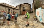
After breakfast and a warm farewell from Vitoria and Therese, four well rested pilgrims set out.
IMG_9718.jpeg
An quick and easy exit from Canfranc at the end of town passing the ruins of the Church of la Trinidad on the left and following the path of the flock the evening before. Soon, passing a cemetery on the right and across the 16th century Canfranc or “Pon Nu” bridge and on to a stony path alongside the Aragón river on the right, through the valley

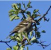
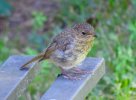
It was a breezy fresh morning with the sun just beginning to illuminate the peaks and top ridges of the mountains. Bird song all around. Using the Merlin sound app and field guide visuals, I identified Common Chiffchaff, European Pied Flycatcher, European Robin and a Common Chaffinch who was the only one who paused long enough for a photo.
IMG_9736.jpeg
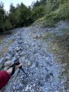
I didn’t mention it in my Day 1 post but the word for these first two stages is ROCKS ! Of course there are rocky roads on every camino route but so far on the Aragonés they have been a dominant feature - some imbedded and a natural part of the path but many spread to cover the surface. I assume to help prevent erosion? Manageable but sometimes very slippery and hard underfoot. Slow and sure-footed is the way again today.
IMG_9706.jpeg
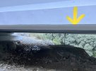
The trail meanders along in it’s rocky way through the valley. I hear the sound of a very busy highway ahead and eventually, turning a corner an overpass appears with traffic whizzing by. At first it doesn’t look like there is a way to cross or go under - there is an arrow but from my elevated position on the path, it looks like I might have to crawl under!
IMG_9720.jpeg
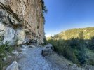
The overhead is low but passable and path muddy as I bend and cross through with my backpack just brushing the underside. Once through, the landscape shifts dramatically with the path hugging high rocky cliffs on the left and river below on the right. It is stunning!
IMG_9707.jpeg
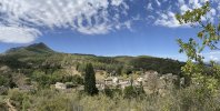
Nearing Villanúa, the landscape becomes gentler with trees lining the path - some with fruit - a variety of crabapple maybe and attracting many birds.

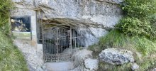
I notice stone steps ascending on my left and an iron gate across an opening in the rock. I step up.
IMG_9708.jpeg
This the Cueva de las Güixas. Full of stalactites, stalagmites, lava flows and several different species of bats. Archeological investigations have revealed remains from the Neolithic and Roman eras. Tours can be booked. I would have loved to do one but alas… walking on!

The camino enters and continues on the outskirts of Villanua, following around a recreational area and then along the left side of the highway and eventually across the highway and onto a dirt path.
IMG_9709.jpeg
The path ascends gently, and at the top a panoramic view of Mount Collarada, Villanúa and the area surrounding the city.

Continuing along the same path and eventually entering the upper part of Castiello de Jaca, an incredibly steep descent begins through the town, giving ( for those who know) the descent into Ponte Ulla a run for it’s money :)

Crossing the highway there are two great places for coffee. I had a lively conversation with a group of 6 women at the next table, who meet for lunch twice a week. Lots of curiosity about where I was from and why I would come all this way alone to walk.

Continuing on I crossed a bridge over the Aragón river again. I should count how many times I’ve crossed the river during these first two stages!

A little further on another river crossing over a wooden bridge but this time over the Ijuez River and onto a path with the Aragón continuing on the right.

Approaching an underpass I hear bells, turn a corner and see my friends, the AC gang, goats, their 3 shepherds and dogs all settled in for a good rest along the river.
IMG_9714.jpeg
They’re completely blocking the path between a hill and the river. It takes a few minutes to slowly make my through. I’m confused as to which direction the camino continues but the shepherd who I spoke with in Canfranc Pueblo points the way. I say “we meet again”. He laughs and says it will be the last time as they are leaving the camino path.

The path ends shortly and the camino turns right, along a dirt path with the highway on the left, leading to the Hotel Charle. It looks closed but there is a nice shaded garden area with a bench. I stop for a rest and almost immediately a European Robin appears and hops up on the bench beside me a few times, flying out to snatch bugs.
IMG_9717.jpeg
The camino turns off the highway to the right after the hotel along a dirt path, passing the hermitage and bridge of San Christóbal.
IMG_9715.jpeg
A little further on, one last short steep climb and I arrive on Avenida de Francia, leading to the centre of Jaca where I stay at the Hotel Ciudad de Jaca.
 
Last edited:
The 2024 Camino guides will be coming out little by little. Here is a collection of the ones that are out so far.
Great photos and narrative - keep it up! 👍. Post Jaca, the path is completely different, yet equally beautiful in a different way. Enjoy.
 
Day 3 (Fri Sept 1) Jaca to Monasterio San Juan de la Peña then Santa Cilia then, surprise! Arrés.

Un día épico!


I took the 9:20am White Bus with the San Juan de la Peña logo on the side, from the Jaca bus station along with 2 other peregrinas (Cynthia and Lin) who I had met in Canfranc. This bus transports the staff to the monastery and then shuttles visitors back and forth between the two sites every 20 min or so and doesn’t return to Jaca until 6pm. We were planning to walk on to Santa Cilia from the old monastery. A man on the bus, who works as a guide told us that we would pay the 3 euro bus fare when we purchased a ticket for both monasteries at the site. The bus also stopped at Santa Cruz de la Serós to pick up more staff.

It’s a steep, twisting, narrow road up the mountain with beautiful views. I must say that I was happy to be on the bus and not walking it! A quick tantalizing glimpse of the old monastery as we stopped briefly to drop off staff, arriving 1.5 km later at the new monastery.
IMG_9888.jpeg
I enjoyed the exhibits at the new monastery. Permanent archeological installations and most especially a photographic exhibition, ‘Travelers and Photographers in San Juan de la Peña 1840-1980', that documents the history of the two monasteries, their restorations, their natural environment, and provides an account of how, for scholars, photographers, artists and architects it has long been a place of admiration and a focus of study. It’s a remarkable and beautiful archive.
IMG_0718.jpeg
We took the shuttle bus down to the old monastery. A tour bus had just arrived and about 40 people we making their way inside. I decided to explore the outside first. There are steps to the right and climbing up gives a wonderful closeup overview and detail of the precision of the rooflines built snugly into the overhanging rock.
IMG_9883.jpeg
The tour group was in and out quickly! Over the course of the 90 min or so that we were there, 3 more groups arrived. An overview from their guide, quick walk-through, some photos and back on the bus. Most of the time we had the site to ourselves.
IMG_9884.jpeg
Much has been written about San Juan de la Peña and many photos posted, so all I’ll add is ‘astonishing and remarkable’. I was very happy to have seen the photo exhibit at the new monastery first. It provided context and understanding to all I was seeing. An incredibly special place and time spent exploring there.

The 7 km descent from San Juan to Santa Cruz de la Serós begins gently along a lovely forest path.
IMG_9887.jpeg
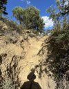
And very quickly becomes a rocky descending / ascending twisty turning path that is quite deteriorated in places. There are long gullies due to recent heavy rain, but all manageable staying sure-footed and slow. The views are breathtaking with many Griffon Vultures gliding above.
IMG_9878.jpeg
Arriving in Santa Cruz de la Serós, we stop to visit the Romanesque church of Santa Maria, a temple that belonged to the monastery of Santa Maria de la Serós, founded in 1059 by Ramiro 1, the first king of Aragon and inhabited by Benedictine nuns who provided refuge for many daughters of nobility, including the king’s three daughters, one of whom never left and became a nun.
IMG_9019.jpeg
We had a delicious lunch at the Hostal Santa Cruz in their lovely garden terrace restaurant, gathering energy for another 7 km ascent / descent to Santa Cilia where we would stay the night in the municiple albergue.

The day had become very hot and almost immediately this next stretch of the walk felt extra challenging with a long steep ascent out of Santa Cruz. At first a wider dirt road that, nearing the top, became narrow, uneven and rocky. My friends were moving faster than me at this point and soon disappeared far ahead. There were some challenging deteriorated parts of the path and at one point the path had completely fallen away and I was faced with a wall!
IMG_9879.jpeg
I began to laugh! There was a little yellow arrow painted on a rock that must have tumbled down with the collapsing path but still managed to land with the arrow visible and pointing more or less up! And up I scrambled, slowly on all fours.

At the top I found a flat rock under a shady tree to sit on for a bit. A very vocal flock of birds flew into a tree further ahead. They were against the sun and I couldn’t see them clearly but they stayed, chattering for a bit. I turned on my bird sound app. European bee-eaters!! Off they flew, which I took as my cue to keep moving.

The narrow descending path ended and continued on a wider dirt road, arriving with a last extra steep ascent into the village of Binacua. I had run out of water and hoped for a fuente but none to be found. Sat in the shade of the little churchyard for a bit and then continued along the paved road leading out of town, eventually turning off and onto a steep rocky descent. I could see Santa Cilia, another 2.2 km away. A deep breath and down I went. The sun was intense. The final 1 km was along the road.

Entering the village, the streets were deserted but I could hear brass band music somewhere ahead. I came to a bar and went in. It was empty and a man seemed startled to see me. I asked for a Kas Limón. He said okay but I would have to leave with it because the bar was closed. I found the albergue. My two friends, Cynthia, Lin and another woman named Astrid were there, already showered and doing laundry. They said it was very strange, when they arrived the door was open but no hospitalero was in attendance. It looked like the place hadn’t been cleaned.

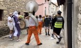
While I showered, the three others went off to see where we could have dinner. I started laundry and suddenly heard loud brass band music in front of the albergue. The previously deserted street was full of people dancing and singing along with the band who were dressed in a variety of costumes. Must be a fiesta!
IMG_9881.jpeg
Lin, Cynthia and Astrid returned. They found another bar but were told that there was no service and nothing was open because there was a fiesta in town. A woman in the bar asked if they were peregrinas. She said she was the hospitalera and told them the albergue was closed to pilgrims, the band was staying in the albergue and there was nowhere else for us to stay. Cynthia told her we’d already been in, showered, laundry done and settled in. The woman said that we had to leave. Cynthia said no, they were tired and couldn’t walk on. The hospitalera told them to pay her then but we would be sharing with the band.

By now it was just before 8:00pm and the four of us sat upstairs sharing the little bits of food we had. We heard a voice downstairs calling hello. A woman appeared and introduced herself as the manager of the Ayuntamiento. She apologized profusely for what had happened and said it would be an absolutely awful experience for us to stay at the albergue tonight. Not only was the band staying there but there would be a big party in the common room. She proposed that we pack up and she would drive us to Arrés. She had contacted the hospitaleros, they had beds and would make dinner for us when we arrived!

We were packed and in Carmen’s car by 8:30, a quick stop at the bar while she went in to get Lin, Cynthia and Astrid’s accommodation money back from the hospitalera, and on our way roaring down the highway to Arrés like we were making a getaway!

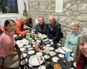
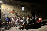
It was dark and as the village came into view, the lights of Arrés looked magical. Pulling up to the albergue, the hospitaleros Maria & Timon and pilgrims were all outside to greet us. A beautifully warm welcome and a delicious dinner of ham and cheese omelettes, salad, bread and wine was waiting. A lovely evening sitting around that table.
IMG_9882.jpeg
Tucked into our beds later that night, an intense thunder, lightening and rain storm began with flashes of light through the window playing across the stones of the walls in our room. A perfect end to an epic day. I slept so well!
 
The 2024 Camino guides will be coming out little by little. Here is a collection of the ones that are out so far.
Day 3 (Fri Sept 1) Jaca to Monasterio San Juan de la Peña then Santa Cilia then, surprise! Arrés.

Un día épico!


I took the 9:20am White Bus with the San Juan de la Peña logo on the side, from the Jaca bus station along with 2 other peregrinas (Cynthia and Lin) who I had met in Canfranc. This bus transports the staff to the monastery and then shuttles visitors back and forth between the two sites every 20 min or so and doesn’t return to Jaca until 6pm. We were planning to walk on to Santa Cilia from the old monastery. A man on the bus, who works as a guide told us that we would pay the 3 euro bus fare when we purchased a ticket for both monasteries at the site. The bus also stopped at Santa Cruz de la Serós to pick up more staff.

It’s a steep, twisting, narrow road up the mountain with beautiful views. I must say that I was happy to be on the bus and not walking it! A quick tantalizing glimpse of the old monastery as we stopped briefly to drop off staff, arriving 1.5 km later at the new monastery.
View attachment 156622
I enjoyed the exhibits at the new monastery. Permanent archeological installations and most especially a photographic exhibition, ‘Travelers and Photographers in San Juan de la Peña 1840-1980', that documents the history of the two monasteries, their restorations, their natural environment, and provides an account of how, for scholars, photographers, artists and architects it has long been a place of admiration and a focus of study. It’s a remarkable and beautiful archive.
View attachment 156618
We took the shuttle bus down to the old monastery. A tour bus had just arrived and about 40 people we making their way inside. I decided to explore the outside first. There are steps to the right and climbing up gives a wonderful closeup overview and detail of the precision of the rooflines built snugly into the overhanging rock.
View attachment 156612
The tour group was in and out quickly! Over the course of the 90 min or so that we were there, 3 more groups arrived. An overview from their guide, quick walk-through, some photos and back on the bus. Most of the time we had the site to ourselves.
View attachment 156611
Much has been written about San Juan de la Peña and many photos posted, so all I’ll add is ‘astonishing and remarkable’. I was very happy to have seen the photo exhibit at the new monastery first. It provided context and understanding to all I was seeing. An incredibly special place and time spent exploring there.

The 7 km descent from San Juan to Santa Cruz de la Serós begins gently along a lovely forest path.
View attachment 156610
And very quickly becomes a rocky descending / ascending twisty turning path that is quite deteriorated in places. There are long gullies due to recent heavy rain, but all manageable staying sure-footed and slow. The views are breathtaking with many Griffon Vultures gliding above.
View attachment 156617
Arriving in Santa Cruz de la Serós, we stop to visit the Romanesque church of Santa Maria, a temple that belonged to the monastery of Santa Maria de la Serós, founded in 1059 by Ramiro 1, the first king of Aragon and inhabited by Benedictine nuns who provided refuge for many daughters of nobility, including the king’s three daughters, one of whom never left and became a nun.
View attachment 156694
We had a delicious lunch at the Hostal Santa Cruz in their lovely garden terrace restaurant, gathering energy for another 7 km ascent / descent to Santa Cilia where we would stay the night in the municiple albergue.

The day had become very hot and almost immediately this next stretch of the walk felt extra challenging with a long steep ascent out of Santa Cruz. At first a wider dirt road that, nearing the top, became narrow, uneven and rocky. My friends were moving faster than me at this point and soon disappeared far ahead. There were some challenging deteriorated parts of the path and at one point the path had completely fallen away and I was faced with a wall!
View attachment 156616
I began to laugh! There was a little yellow arrow painted on a rock that must have tumbled down with the collapsing path but still managed to land with the arrow visible and pointing more or less up! And up I scrambled, slowly on all fours.

At the top I found a flat rock under a shady tree to sit on for a bit. A very vocal flock of birds flew into a tree further ahead. They were against the sun and I couldn’t see them clearly but they stayed, chattering for a bit. I turned on my bird sound app. European bee-eaters!! Off they flew, which I took as my cue to keep moving.

The narrow descending path ended and continued on a wider dirt road, arriving with a last extra steep ascent into the village of Binacua. I had run out of water and hoped for a fuente but none to be found. Sat in the shade of the little churchyard for a bit and then continued along the paved road leading out of town, eventually turning off and onto a steep rocky descent. I could see Santa Cilia, another 2.2 km away. A deep breath and down I went. The sun was intense. The final 1 km was along the road.

Entering the village, the streets were deserted but I could hear brass band music somewhere ahead. I came to a bar and went in. It was empty and a man seemed startled to see me. I asked for a Kas Limón. He said okay but I would have to leave with it because the bar was closed. I found the albergue. My two friends, Cynthia, Lin and another woman named Astrid were there, already showered and doing laundry. They said it was very strange, when they arrived the door was open but no hospitalero was in attendance. It looked like the place hadn’t been cleaned.

While I showered, the three others went off to see where we could have dinner. I started laundry and suddenly heard loud brass band music in front of the albergue. The previously deserted street was full of people dancing and singing along with the band who were dressed in a variety of costumes. Must be a fiesta!
View attachment 156614
Lin, Cynthia and Astrid returned. They found another bar but were told that there was no service and nothing was open because there was a fiesta in town. A woman in the bar asked if they were peregrinas. She said she was the hospitalera and told them the albergue was closed to pilgrims, the band was staying in the albergue and there was nowhere else for us to stay. Cynthia told her we’d already been in, showered, laundry done and settled in. The woman said that we had to leave. Cynthia said no, they were tired and couldn’t walk on. The hospitalera told them to pay her then but we would be sharing with the band.

By now it was just before 8:00pm and the four of us sat upstairs sharing the little bits of food we had. We heard a voice downstairs calling hello. A woman appeared and introduced herself as the manager of the Ayuntamiento. She apologized profusely for what had happened and said it would be an absolutely awful experience for us to stay at the albergue tonight. Not only was the band staying there but there would be a big party in the common room. She proposed that we pack up and she would drive us to Arrés. She had contacted the hospitaleros, they had beds and would make dinner for us when we arrived!

We were packed and in Carmen’s car by 8:30, a quick stop at the bar while she went in to get Lin, Cynthia and Astrid’s accommodation money back from the hospitalera, and on our way roaring down the highway to Arrés like we were making a getaway!

It was dark and as the village came into view, the lights of Arrés looked magical. Pulling up to the albergue, the hospitaleros Maria & Timon and pilgrims were all outside to greet us. A beautifully warm welcome and a delicious dinner of ham and cheese omelettes, salad, bread and wine was waiting. A lovely evening sitting around that table.
View attachment 156613
Tucked into our beds later that night, an intense thunder, lightening and rain storm began with flashes of light through the window playing across the stones of the walls in our room. A perfect end to an epic day. I slept so well!
Wow! There were quite a few complaints about Santa Cilia from pilgrims when we served last summer at Arres. Several said it was dirty and that the hospitalera didn't even come to stamp their credentials and she was more concerned with running the bar. Glad you met the other city official and she took care of you. You probably missed the church and tower tour at Arres, but sounds like it was a happy ending.
 
Wow! There were quite a few complaints about Santa Cilia from pilgrims when we served last summer at Arres. Several said it was dirty and that the hospitalera didn't even come to stamp their credentials and she was more concerned with running the bar. Glad you met the other city official and she took care of you. You probably missed the church and tower tour at Arres, but sounds like it was a happy ending.

It was all a bit perplexing. The Santa Cilia albergue is certainly a well thought out facility. Lovely painted camino themed murals. The bunk rooms are well laid out, bathrooms great, a comfortable communal area and useful kitchen with dishes, pots and pans. But everything was very dirty. The woman from the council was wonderful and very concerned . She is new to the job and she’s very aware of the problem and is trying to work with the hospitalera to bring about better communication and make some needed changes.
 
Sad to hear that about Santa Cilia - we had a lovely stay there in 2018 including a dinner of Aragon specialities made with local products. The hospitalera then was great, too.
 
3rd Edition. More content, training & pack guides avoid common mistakes, bed bugs etc
It was all a bit perplexing. The Santa Cilia albergue is certainly a well thought out facility. Lovely painted camino themed murals. The bunk rooms are well laid out, bathrooms great, a comfortable communal area and useful kitchen with dishes, pots and pans. But everything was very dirty. The woman from the council was wonderful and very concerned . She is new to the job and she’s very aware of the problem and is trying to work with the hospitalera to bring about better communication and make some needed changes.
Yes, the first two times I stayed there it was wonderful. However, the last time matches other experiences. It was dirty and the hospitalera didn't really seem to care much about us or the facility.
Hopefully the changes will come
 
Day 4 (Sat Sept 2) Arrés to Artieda

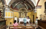
After breakfast, hospitaleros Maria and Timon offered a tour of the church to the 4 of us who had arrived late the evening before. I was surprised at how light and airy the interior was with it’s colourful frescoes. Grateful to have a chance to see it before setting off for Artieda.
IMG_2396.jpeg IMG_2392.jpeg
After the stormy night we knew there was more rain ahead but for the moment, as Maria and Timon saw us off, the sun was finding its way through the dark clouds.
IMG_2397.jpeg
A steep muddy descent on a path from the albergue which rejoined the road . Beautiful views ahead.
IMG_2398.jpeg
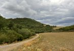
Our rain gear came out pretty quickly as we continued for several km’s along a dirt road surrounded by agricultural land. The rain was intermittent - pouring then stopping - repeat.
IMG_2399.jpeg
Looking back, we continued to have views of Arrés for some time.
IMG_2400.jpeg
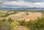
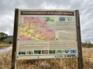
Some time after views of the village of Berdún on its hilltop to our right, we came to a crossroads, and this sign.
IMG_9065.jpeg
From this website: https://turismojacetania.com/lugares.php?Id=105
The Berdún Canal enjoys a great ornithological richness as a result of the great variety of habitats that surround it. The aquatic ecosystem of the Yesa reservoir, the high Pyrenean valleys, the Mediterranean understory of oaks and holm oaks, the outer mountains of San Juan de la Peña and Santo Domingo with immense masses of pine forests and boxwood, or the cereal-growing plains of the Berdún Canal produce this rich biodiversity. It is possible to see species such as the bearded vulture, the kite or the griffon vultures. In addition, this area is a must for many migratory birds, such as cranes, which during the spring move to central Europe and return in the fall.

Also at this crossroads, the waymarking was confusing. Arrows pointed straight ahead to the village of Martes, which according to the Gronze map, is off camino and without services. We found another arrow (slightly obscured) pointing to the road on the right which made more sense. As we were about to turn right, we could see two pilgrims coming toward us along the Martes road. They caught up with us and had indeed followed the wrong waymark, so backtracked about a km.

Now we were a band of 6, treking along a muddy dirt road, enjoying a lull in the rain and soon meeting and stopping to chat with a shepherd and his flock
IMG_2402.jpeg
At some point we left the province of Huesca and enterd the province of Zaragoza.
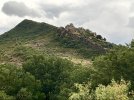
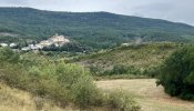
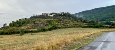
We leave the dirt path and follow a tarmac road leading to the hilltop village of Mianos.
IMG_9076.jpeg
The camino leaves the road and follows a path to the right. The path ahead was in rough shape, almost immediately I could see large parts of it were flooded. I had thoughts of staying on the road, but stuck with the group, who were all forging ahead.

At first I could find fairly stable ground around the edges of the flooding but soon it became impossible. The water was covering my shoes as I sloshed on. Then some moments of optimism as a dry path emerged, leading through a very pretty wooded area. Short lived as the path ended at a creek. Again, doing my best to skirt the edges which were thick with clay / mud, probing for solid ground with my sticks. I stepped on a rock and suddenly in a hard fall I was down, banging my left knee on something and landing on my hip in mud and prickly bushes.

Stunned for a moment and then I just started to laugh. When my companions heard me laughing they turned and saw my predicament and Lin came back to help. I tried getting up but couldn’t get leverage with my feet in the mud. I couldn’t brace myself with my hands because of the prickly foliage. Lin helped me get my pack and altus off. I took my fleece off and used it as ground cover to put my hands down to push myself up. It was such a comedy - soon we were all laughing.

Absolutely soaked and covered in mud and with 2 km still to go to Artieda, I told the others to keep going. I would get to the road and continue slowly from there. I didn’t feel like I’d seriously hurt my knee or hip but was sure there would be some bruising!

When I arrived at the albergue in Artieda, it was 2:40pm and the man checking me in said if you want to eat lunch, the restaurant closes at 3 so you need to go now. I said “like this?” He said “maybe you can wait until dinner” 🤣
 
Last edited:
Train for your next Camino on California's Santa Catalina Island March 16-19
The path through Martes is a variant of the route and has waymarking that would lead you onward towards Artieda. As it’s higher up the hillside than the path you chose, it tends to be a bit drier, too.
 
Holoholo automatically captures your footpaths, places, photos, and journals.
Day 5 (Sun. Sept. 3) Artieda to Sanguesa

Clothing and shoes are clean and dry and I feel well rested after the rain, mud and calamity of the day before. Rain in the forecast again but not starting till mid morning. After a good breakfast in the pilgrim’s lounge at the Artieda Hostel, Lin, Christine and I take a walk around the lovely village before beginning the day’s walk. The hostel is next to the Iglesia de San Martin de Artieda, which unfortunately wasn’t open the evening before or in the morning.
IMG_9081.jpeg
We leave the village on a quiet asphalt road that descends and continues straight for a short while before turning left onto a dirt road. I look back for a last view of Artieda. Lin and Christine are fast walkers and are quickly well ahead of me.
IMG_9094.jpeg
The dirt road soon turns onto a quiet asphalt road with little traffic and I follow it for some time. At some point along the way, there are views in the distance of the Yesa Reservoir. The camino turns off and onto a path that continues for an hour or so through a beautifully scented, predominantly oak forest. Rain begins but the tree canopy keeps it light overhead. Birdsong all around. I see flashes of yellow but can't get a clear view of the bird. The Merlin sound ID app identifies it as a Cirl Bunting.
IMG_9098.jpeg
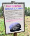
When I was on the bus from Jaca to Candanchú, we traveled alongside the Yesa Reservoir. Along the way were protest signs "Yesa No", which I also saw painted in beautiful murals in a couple of villages along the Aragonés. As the path emerged today from the woods into a clearing, there was this sign:
IMG_9103.jpeg
FLOOD ZONE
DEFEND THE WAY
This Jacobeo 2010 must be a year to especially ensure the protection of the Camino de Santiago and avoid destruction such as those that occurred in the past before its cataloging.
The regrowth of the current Yesa reservoir means the physical destruction of almost 5 km of Camino, the disappearance of tangible heritage elements that punctuate it (fountains, watering holes, bridges,) and the serious threat to such important monuments as the hermitages of San Jacobo or San Juan de Maltray in Ruesta. The condition is much more important if we consider that, in addition, the Camino is legally protected with a band of 30 meters on both sides.
Little can be done with the sections flooded in the past, but the deliberate destruction of what has been considered World Heritage since 1993, First European Cultural Itinerary since 1987 and Asset of Cultural Interest, then replacing it with a "false" path is meaningless.
For all this and given that there are alternatives to the regrowth of Yesa that are more environmentally sustainable and socially just, we must fight to achieve: The paralysis of any regrowth of the Yesa reservoir and oblige the Government to the conservation, recovery and improvement of the entire Camino de Santiago as it passes through Aragon.
THE BLUE STONE IS A SYMBOL.
AGAINST REGROWTH
OF YESA
PUT YOURS ON THE ROAD AND MAKE THEM ARRIVE.
TO SANTIAGO

An earlier thread with interesting links about the Yesa No project and the Blue Stones initiative: https://www.caminodesantiago.me/com...-deep-into-an-abandoned-village-ruesta.73205/

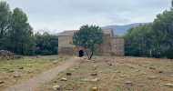
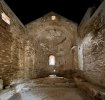
In the clearing beyond the sign is the ruin and preservation of the 12th century Romanesque hermitage of San Juan Bautista de Maltray. The stones laid out in front of the hermitage are stones that were removed from the structure during the preservation. You can step into the quiet cool interior and sit along the wall on a stone bench opposite the door, sheltering from the sun or as on this day, from the rain and have a good view of the hermitage on either side of the door.

IMG_9114.jpeg IMG_9108.jpeg IMG_9111.jpeg
I sat and rested here. I was feeling some discomfort in my knee. Not particularly painful but something developing.

Continuing on, with rain intermittent, the path led once again to the quiet asphalt road and on to Ruesta. Wonderful first views of the remains of its castle tower and lower buildings and then along the road and into the village. I had coffee at the outdoor bar, watching the people of this little community prepare for the day before continuing on.
IMG_9118.jpeg IMG_9123.jpeg
About a km after leaving Ruesta, I started to have muscle cramping along my thigh and a bit of pain in my knee. I decided it would be best to return to Ruesta and stay the night. When I arrived at the hostel, I was told that they were completo! I was surprised - there were 52 beds and I certainly hadn't seen that many pilgrims over the past few days. They had a group booked in for a conference.

The safest thing to do would be to take a taxi to Sangüesa, get a room there and be close to a clinic if need be. A man at the bar called a taxi for me which arrived quickly. The driver, Elena lived in Artieda. She asked if I minded if she took the back route and not the main road as she thought I would find it more interesting.

I told her that I had stayed in Artieda the night before and thought it was a beautiful village. She was very proud of her home and said the community had worked hard to keep the village vital and alive with elder support programs and by working together to stop depopulation. To attract young families back to the village, they had improved and upgraded services (like high speed internet) to make it possible for people to work from home.
An interesting article here:

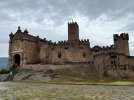
Elena was also a local historian. Along our drive she told me things about the landscape, history of the hilltop villages and nearby archeological sites. She said if I had time, she could take a short detour to show me the Castillo de Javier (at no extra charge :) ) She parked at the plaza in front of the castle and said I was welcome to walk down to see it. I didn't want to walk far but went to the steps of the Basilica. The bells were ringing. Elena said it was a very special place to her as she had been married in the church.
IMG_9127.jpeg
Continuing on the Sangüesa she told me a little more about the history of the castle and its connection to Japan.

Despite my worries about my leg and disappointment at having to jump a stage by taxi, this had again been one of those rich camino days that unfolds in unexpected ways. Meeting Elena was a truly a gift.
 
Last edited:
The path through Martes is a variant of the route and has waymarking that would lead you onward towards Artieda. As it’s higher up the hillside than the path you chose, it tends to be a bit drier, too.
Vacajoe, where did you find out about the variant? I was following the route in Gronze. As far as I could tell, Gronze doesn't show it.
 
The one from Galicia (the round) and the one from Castilla & Leon. Individually numbered and made by the same people that make the ones you see on your walk.
Day 5 (Sun. Sept. 3) Artieda to Sanguesa

Clothing and shoes are clean and dry and I feel well rested after the rain, mud and calamity of the day before. Rain in the forecast again but not starting till mid morning. After a good breakfast in the pilgrim’s lounge at the Artieda Hostel, Lin, Christine and I take a walk around the lovely village before beginning the day’s walk. The hostel is next to the Iglesia de San Martin de Artieda, which unfortunately wasn’t open the evening before or in the morning.
We leave the village on a quiet asphalt road that descends and continues straight for a short while before turning left onto a dirt road. I look back for a last view of Artieda. Lin and Christine are fast walkers and are quickly well ahead of me.
The dirt road soon turns onto a quiet asphalt road with little traffic and I follow it for some time. At some point along the way, there are views in the distance of the Yesa Reservoir. The camino turns off and onto a path that continues for an hour or so through a beautifully scented, predominantly oak forest. Rain begins but the tree canopy keeps it light overhead. Birdsong all around. I see flashes of yellow but can't get a clear view of the bird. The Merlin sound ID app identifies it as a Cirl Bunting.
When I was on the bus from Jaca to Candanchú, we traveled alongside the Yesa Reservoir. Along the way were protest signs "Yesa No", which I also saw painted in beautiful murals in a couple of villages along the Aragonés. As the path emerged today from the woods into a clearing, there was this sign:
View attachment 158006
FLOOD ZONE
DEFEND THE WAY
This Jacobeo 2010 must be a year to especially ensure the protection of the Camino de Santiago and avoid destruction such as those that occurred in the past before its cataloging.
The regrowth of the current Yesa reservoir means the physical destruction of almost 5 km of Camino, the disappearance of tangible heritage elements that punctuate it (fountains, watering holes, bridges,) and the serious threat to such important monuments as the hermitages of San Jacobo or San Juan de Maltray in Ruesta. The condition is much more important if we consider that, in addition, the Camino is legally protected with a band of 30 meters on both sides.
Little can be done with the sections flooded in the past, but the deliberate destruction of what has been considered World Heritage since 1993, First European Cultural Itinerary since 1987 and Asset of Cultural Interest, then replacing it with a "false" path is meaningless.
For all this and given that there are alternatives to the regrowth of Yesa that are more environmentally sustainable and socially just, we must fight to achieve: The paralysis of any regrowth of the Yesa reservoir and oblige the Government to the conservation, recovery and improvement of the entire Camino de Santiago as it passes through Aragon.
THE BLUE STONE IS A SYMBOL.
AGAINST REGROWTH
OF YESA
PUT YOURS ON THE ROAD AND MAKE THEM ARRIVE.
TO SANTIAGO

An earlier thread with interesting links about the Yesa No project and the Blue Stones initiative: https://www.caminodesantiago.me/com...-deep-into-an-abandoned-village-ruesta.73205/

In the clearing beyond the sign is the ruin and preservation of the 12th century Romanesque hermitage of San Juan Bautista de Maltray. The stones laid out in front of the hermitage are stones that were removed from the structure during the preservation. You can step into the quiet cool interior and sit along the wall on a stone bench opposite the door, sheltering from the sun or as on this day, from the rain and have a good view of the hermitage on either side of the door.

I sat and rested here. I was feeling some discomfort in my knee. Not particularly painful but something developing.

Continuing on, with rain intermittent, the path led once again to the quiet asphalt road and on to Ruesta. Wonderful first views of the remains of its castle tower and lower buildings and then along the road and into the village. I had coffee at the outdoor bar, watching the people of this little community prepare for the day before continuing on.
About a km after leaving Ruesta, I started to have muscle cramping along my thigh and a bit of pain in my knee. I decided it would be best to return to Ruesta and stay the night. When I arrived at the hostel, I was told that they were completo! I was surprised - there were 52 beds and I certainly hadn't seen that many pilgrims over the past few days. They had a group booked in for a conference.

The safest thing to do would be to take a taxi to Sangüesa, get a room there and be close to a clinic if need be. A man at the bar called a taxi for me which arrived quickly. The driver, Elena lived in Artieda. She asked if I minded if she took the back route and not the main road as she thought I would find it more interesting.

I told her that I had stayed in Artieda the night before and thought it was a beautiful village. She was very proud of her home and said the community had worked hard to keep the village vital and alive with elder support programs and by working together to stop depopulation. To attract young families back to the village, they had improved and upgraded services (like high speed internet) to make it possible for people to work from home.
An interesting article here:

Elena was also a local historian. Along our drive she told me things about the landscape, history of the hilltop villages and nearby archeological sites. She said if I had time, she could take a short detour to show me the Castillo de Javier (at no extra charge :) ) Yes! She parked at the plaza in front of the castle and said I was welcome to walk down to see it. I didn't want to walk far but went to the steps of the Basilica. The bells were ringing. Elena said it was a very special place to her as she had been married in the church.
Continuing on the Sangüesa she told me a little more about the history of the castle and its connection to Japan.

Despite my worries about my leg and disappointment at having to jump a stage by taxi, this had again been one of those rich camino days that unfolds in unexpected ways. Meeting Elena was a truly a gift.
Elena drove us 3 days 2 years ago. First when I was having a heat injury while walking this route, she picked us up while I was lying in the ditch by the cemetery below Artieda and transported us to the albergue. (Best 3 euros I ever spent!) The next day we abandoned our Camino due to my illness and she took us from Artieda to Monasterio de Leyre where we had a lovely day and evening. The next day she came back after us and took us to Javier where we spent another great day. She is a true gem.
 
Vacajoe, where did you find out about the variant? I was following the route in Gronze. As far as I could tell, Gronze doesn't show it.

Walked that route twice (once in each direction) and followed the signs you saw. It’s not in the Buen Camino app I use, but it’s definitely signposted! Between Arres and Artieda, it takes the higher route closer to the mountain range and goes through Martes and Mianos. It’s drier than on the valley floor but there are zero services except one working fountain we found. Very quiet.
 
Thanks Vacajoe. If I remember correctly, there aren't any services between Arress and Artieda...I guess whichever way you go. It's a beautiful walk, but as you say very quiet. I don't think I saw one car, except off in the distance on the major highway. It was like having the whole valley all to yourself.
 
The focus is on reducing the risk of failure through being well prepared. 2nd ed.
Sunday Sept 3, Monday September 4, Tuesday September 5.

I spent three nights in Sangüesa, staying at the JP Hostel, a quiet, comfortable place to rest and recover from my fall the previous Saturday. Perfect location - just across the bridge from the central town area and on the camino with a lovely view of the Iglesia de Santa Maria la Real and the Puente de Hierro over the Aragón river.
IMG_9139.jpeg IMG_9290.jpeg IMG_9134.jpeg
By the morning of Tuesday the 5th, I was feeling much better after 2 nights and a full day Monday of rest, gentle stretching, KT tape and an ibuprofen. The tape in particular was a tremendous help in easing the muscles along the side of my knee up to my hip and lower back. I walked into town for breakfast and was feeling good. I decided I would take a taxi to the trail head of the Foz de Lumbier (Lumbier side), and walk through the gorge to Liédena - about 4 km. If my leg was feeling okay in Liédena, I would continue on to Sangüesa and if not, could take a taxi the rest of the way.

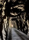
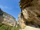
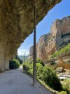
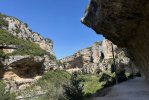
The gorge is spectacular with the wind, bird calls and the sound of the river Irati cutting through the vertical walls on either side far below. The path, through the grandeur of the tunnels and cliffs, follows the route of the Irati electric train line that linked Pamplona with Sangüesa, which was closed in 1942.

IMG_9348.jpeg IMG_9299.jpeg IMG_9302.jpeg IMG_9329.jpeg IMG_9332.jpeg

Griffon Vultures circling high above - there are an estimated 200 nesting pairs and I was able to find a few nests easily by watching the vultures fly and land on the cliff ledges.

DSC05347.jpeg DSC05333.jpeg

Many other birds I couldn't see - some only quick glimpses, but could identify using the Merlin sound ID app. Common and Alpine Swifts, White Wagtails, European Pied Flycatchers, Black Redstarts, European Goldfinches, Common Chaffinches, Sardinian Warblers and Eurasian Tree Sparrows. Hundreds of Common House Martin nests under ledges over the paths - easy to observe them closely. It was nice to see dozens of Rock Pigeons actually nesting on rocks and not in the eaves of buildings : )
There was a breathtaking moment when a huge flock of Red-billed Choughs suddenly flew out of holes high on a cliff face, calling and sounding exactly like a light sabre battle!

My walk through the gorge was slow and easy and then continuing on the very pleasant path following the river to Liédena and then back to Sangüesa, with my leg feeling good. It was a wonderful day.
 
Last edited:
Caryn, thanks for sharing your experiences on the Camino Aragones. I walked it in late April from Canfranc Station. There is very little information about it, even on this forum. So everything you write will be helpful to someone.

I am in the process of writing a book about my experience on the Aragones, and am looking for stories to supplement my own and jog my memory of the places I passed through. Please keep telling your story.

Stay well and have a Buen Camino!
I started walking from Oloron 5 days ago and arrived in Jaca today. I am so surprised how few pilgrims there are on this route and have had some pretty funny experiences so far… I would love to contribute if I can be helpful and this is inspiring me to write some of it down!!!
 
Lovely description of the route. I was a hospi at Canfranc Pueblo for the first two weeks of July 2023, the kitchen on the 3rd floor was fully equipped then. I actually contributed a new cookpot for pasta or soup that would work on the electric burners, so we didn't have to keep sharing the one pot from kitchen to kitchen. It is a shame that Gronze seems to be the only messenger about bringing food supplies when you go there. The bar next door is great for drinks but it is only serves deep fried foods and closes on Sunday afternoon and does not open until Tuesday. The other place you mentioned is not open to the public in the summer because it caters to groups of school children. I was there when the herds were being moved to higher pastures, obviously you were there when it was contra-herding time. There is nothing like standing in the doorway of the albergue when a hundred or so sheep come passing by every 2 or 3 days headed up hill.
 
A selection of Camino Jewellery
3rd Edition. More content, training & pack guides avoid common mistakes, bed bugs etc
I managed the route to the monastery yesterday and stayed in Santa Cruz de la seros. I think someone was asking about how possible the path is there… I followed the one on all trials and it was completely fine and did not disappoint. Not sure I would want to do it in the pouring rain though! I met a couple last night walking the aragonese route taking paths north of the river… Am in Arres tonight and what an auberge this is…

Aragonese Way: The Way of Arles via GR®653 on AllTrails
 
Lianna, Julien and I are in Tiebas tonight. Very nice. Tomorrow night Obanos then we turn north and walk the Frances backwards to St. Jean. Buen Camino
Ps there will be mud
 
I am just trying to decide if I go direct to Montreal or via lumbier tomorrow… I think I will miss you by a day! Shame.
 
The 2024 Camino guides will be coming out little by little. Here is a collection of the ones that are out so far.
Where did you stay / how did you break up your route, or did you do a mega day of walking and start in sanguesa and end in Montreal on the same day?
I stayed at Leyre monastery (having walked the north side of the reservoir) and then through the Foz and on to Sangüesa.
 
Get a spanish phone number with Airalo. eSim, so no physical SIM card. Easy to use app to add more funds if needed.
I stayed at Leyre monastery (having walked the north side of the reservoir) and then through the Foz and on to Sangüesa.
Interesting. I would be curious to hear more about your route and where you started and finished each day… I would have loved to have done the north side of the Yesa so I could have had a dip!
 
Join the Camino cleanup. Logroño to Burgos May 2025 & Astorga to OCebreiro in June
LOST AND FOUND: picked these glasses up just before arriving in ruesta yesterday. They didn’t look like they had been there long ...
I found an iPhone along the Aragonese a few years ago. It still had some charge and the lockscreen had Catalan text. I passed it on to a Spanish pilgrim headed to SdC and he called albergues ahead but he was not able to find the owners. Somewhat simpler as this was November and there were fewer albergues open.
 
Lake level really affects whether you walk the roadways or the old Camino paths. When we did it, we walked a combination of both but there were zero services for most of the route unless you detoured quite a bit.

From Ruesta, you can walk to Sanguesa and stay the night, then head through the Foz and stay at the hotel in the village of Lumbier itself (there’s only one!). They have a pilgrim discount and the food is really quite good.

Another option is to hike to the village of Yesa from Ruesta, bypassing Sanguesa entirely but getting a chance to take in Javier Castle. Then onto Lumbier through the Fox the next day. Yesa is a short ways from Leyre, but much cheaper than staying at the monastery unless you happen to score a monk’s room there (which requires that you be a man and they have the room).
 
€2,-/day will present your project to thousands of visitors each day. All interested in the Camino de Santiago.
I'm finding this thread very interesting. I walked the Aragones last April and except for the variants to the Javier Castle and Lumbier, was unaware of the route north of Yesa.

I walked Foz de Lumbier early on a Sunday morning., and stayed at the hotel in Lumbier...very nice. The Foz is beautiful. However, by 9 am, locals started arriving for a Sunday outing. The parking lot at the Lumbier end of the trail was filled with cars, and a line of cars looking for a place to park. I'm glad I walked it early.
It is a shame indeed. I have met a grand total of zero pilgrims in 10 days! Every night had the place to myself, and often the keys. I did meet some Spanish folk yesterday who were walking a day at the weekend over the course of the year, but that is it!!! What a few days it has been though. Really grateful for this quiet start before joining the Frances…
 
€2,-/day will present your project to thousands of visitors each day. All interested in the Camino de Santiago.
Buen Camino a tu también!

I tell a lie… I did meet two people in the hostal in Santa Cruz who had been walking from Barcelona but they were taking a very different route from me. I have loved every minute and sorry to have missed you!!
 
Lianna, I had a similar experience. In April there were very few pilgrims, and no native English speakers, except in a cafe in Canfranc (and they weren't pilgrims). My Spanish improved immensely. There's no other choice but to practice your Spanish.

Keep on loving it! Buen Camino.
 
Join the Camino cleanup. Logroño to Burgos May 2025 & Astorga to OCebreiro in June
Day 8 (Wed. Sept. 6) Monreal to Tiebas

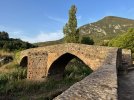
I jump ahead from Sangüesa to Monreal, meeting up with my Aragonés friends Lin and Christine. After coffee and a second breakfast at a wonderful café (wish I could remember its name) I take a short walk in the village and cross and admire the fine stone bridge with it's evocative setting that for centuries, has been the main access point for pilgrims arriving in Monreal.

IMG_9524.jpeg
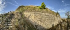
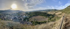
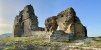
We take a detour before leaving, to see the ruins of the Castillo de Monreal which stands on the hill overlooking the town. The path is accessed on the right, from the road leading to the cemetery. Built on the remains of an Iron Age fort, the 13th century fortress was home to the monarchs of Navarra. After numerous sieges, destruction, abandonment and centuries of overgrowth, residents of Monreal in the 1960's, led by the parish priest, carried out a clean-up of the area which led to an archeological excavation. Bases of circular towers, wall structures and a cistern with staircase were found along with ironwork and ceramics. From an upper path, a panoramic view of Monreal and surrounding area.

IMG_9535.jpeg IMG_9531.jpeg

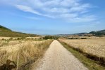
Leaving Monreal, it's a calm beautiful morning and the path long and straight which eventually winds through a pretty wooded area and crosses a bridge over the Elorz River before cutting through wide open crop land leading to the slopes of the Sierra de Alaiz mountain range.

IMG_9537.jpeg IMG_9549.jpeg
This path (for the most part) gently roller coasters up and down along the mountain slopes for the rest of the day, arriving first at the end of a descent into the village of Yárnoz where we find some shade to stop for a rest and top up our water bottles from a fuente beside the Iglesia de la Natividad (of medieval origin from the 13th century). Dozens of Barn Swallows swoop and glide around us, busy snatching insects. The eaves of the church and nooks and cranies of the adjacent tower are filled with nests. All quiet in the village, not a soul to be seen.

IMG_9557.jpeg IMG_9559.jpeg
We continue along the up and down path that alternates between challenging /rocky /eroded with lovely stretches that are soft and even with welcome tree shade. The temperature has risen and it's become a very hot day. Lin and Christine move quickly and soon are far ahead. After the village of Guerendiain, through a forested area, the black flies are thick, flying into my face and my eyes in particular. I take my hat off to use as a fan which helps. I run out of water and regret that I didn't fill up my two water bottles instead of just one in Yárnoz. Suddenly, after about 30 minutes, the flies disappear! Relief!

I begin to hear loud machinery / grinding sounds. The path ends at a wide dirt road covered thickly with a gravel surface that descends steeply to the right. As it winds down the mountain, there is a view up and to the left of a massive rock quarry, the source of the sounds I was hearing earlier.

IMG_9587.jpeg

Later, when looking for information about this quarry, I came across an interesting article about an archeological site very near the quarry. In my photo, to the left of the edge of the quarry, there is a half circle dark area. This is the Alaiz Cave.
http://arqueologianavarra.blogspot.com/2014/03/cueva-de-alaiz-cueva-lezea-Tiebas-magdaleniense.html

At the bottom of the gravel road the path turns left, up a steep ascent and into the village of Tiebas with the remains of the Castillo de Tiebas on a hill to the right.

IMG_9595.jpeg

I make my way to the very welcoming Tiebas Pilgrim Hostel (a beautiful facility) and spend the afternoon exploring and researching the castle and surrounding area. A very good dinner at the nearby bar with Lin, Christine and two other pilgrims, followed by an evening walk in the village. At the end of this day my recovering leg is a bit tired but all will be well after a good nights rest.

IMG_9618.jpeg
 
Last edited:
Day 8 (Thurs. Sept. 7) Tiebas to Iglesia de Santa Maria de Eunate to Puente la Reina

My last Camino Aragonés post on this now "not so live" thread : )

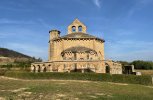
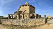
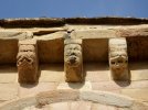
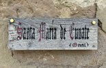
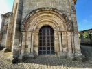
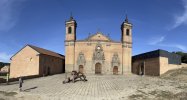
On this morning, one of my friends was under the weather and planned to take a taxi to Santa Maria de Eunate. I joined her. I had regretted not visiting the church during my first camino in 2012 and it was a priority this time! We had confirmation from the hospitalera in Tiebas that Eunate would open at 10:00am.

In the taxi, our driver told us that she had a friend who led a beautiful tour of the church. The tour had to be reserved in advance and she asked us if we would like her to call her friend to inquire if it would be possible today. Yes! The tour guide said that she was already booked to give a tour to two pilgrims at 10:30 and we were welcome to join. The cost was 10 euros. Confirmed!

Arriving at 9:30am, we were the only ones there and had time to quietly explore the exterior of this beautiful temple and its setting. Visitor reception is housed in the building that was once the albergue. I would have loved to have the chance to stay here. There is a small gallery of great historical and restoration photos displayed on the walls. I had my credential stamped and backpacks can be left here while visiting the church.

IMG_9626.jpeg IMG_9641.jpeg DSC05415.jpeg
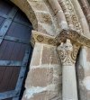
Our guide, Maite, was wonderful. She has long family history with Santa Maria de Eunate and had been married in the church. The tour was very detailed - she gave us historical and modern history along with interesting visuals using photos from archeological excavations. After, Maite stayed a while longer for conversation and questions. Listening to her speak and share the meaning and significance of the symbolic and architectural details of the church was a special experience.

IMG_9659.jpeg IMG_9656.jpeg IMG_9657.jpeg IMG_9648.jpeg IMG_9667.jpeg DSC05422.jpeg
Walking on, I stopped for coffee in Obanos, joining about 30 other Camino Frances pilgrims who were already there. After a very quiet camino, I enjoyed the energy : ) I continued on to Puenta la Reina, where I stayed at the Albergue Jakue.

I had a decision to make. At the end of the Aragonés, my planned routes were the Vasco and then, after Burgos, walking to Leon and continuing on the San Salvador. I was having doubts due to the fall I'd had a few days before. My leg was stronger every day but not 100% and I was feeling uneasy about the planned routes with longer, more remote stages in the mountains.

I had been thinking about alternative routes and a choice became clearer as I walked from Eunate to Puente la Reina, enjoying the memories of my first camino. I had not considered the Frances but I suddenly felt very curious to see it now, 11 years later. And that's what I did. I walked my remaining four weeks along favourite stages of the Frances, arriving in Santiago de Compostela after a very rich, remarkable journey.

IMG_2702.jpg

I have unfinished business with the Aragonés (stages I missed) so my possible next camino will be to walk those stages, perhaps from Jaca, re-visit the Lumbier Gorge to explore more fully, visit the Monastery of Leyre and then continue with my happily already planned Caminos Vasco & San Salvador. Ultreia y Suseia!
 
Last edited:
Train for your next Camino on California's Santa Catalina Island March 16-19
Thank you so much for your account. I’m planning to walk the Aragonés in May. This has been extremely useful.
You have MADE my day, dear Margaret! So pleased you are planning another hike in Spain.
FYI When I was on the Aragones, I hiked from Jaca to Santa Cruz de la Serós, took a room at the fabulous inn and after a late lunch made it up to the Monastery (sans backpack) for a visit and back down. The next morning they had prepared a packed breakfast for an early start. A highlight. I then took the southern route thus missing the Monastery at Leyre (same architect..) so plan to return when I hike from Montserrat.
I stayed at Ruesta.. not exactly my style. The next day I looked in at the Albergue at Undués de Lerda and highly recommend.
 
€2,-/day will present your project to thousands of visitors each day. All interested in the Camino de Santiago.
...and ship it to Santiago for storage. You pick it up once in Santiago. Service offered by Casa Ivar (we use DHL for transportation).
You have MADE my day, dear Margaret! So pleased you are planning another hike in Spain.
Thank you so much @filly - you have just made my day. 😍. I shall be walking with my camino pal Paul who has walked many camino routes and rates the Aragones worthy of a second go but wants to start in Jaca as he has cranky knees (as have I) and wants to avoid the descent from Somport.

So we decided to walk the camino Catalan from Montserrat and join with the Aragonés at Jaca. I am busy checking out all relevant threads on the forum and downloading Wikiloc tracks.
When in May? I'm planning to start walking from Oloron-Sainte-Marie on May 14
We haven’t firmed up on a start date yet but will probably fly into Barcelona around 10 May.

Am thinking we may take public transport side trips from Huesca to Zaragoza and from Jaca to Somport and Canfranc. My purist camino days are behind me now - am happy to take an easy option here and there! I haven’t managed to finish either of my last two caminos - hip fracture on the Lana in 2019 and knee issues on the Norte/Primitivo in 2022. So I’m hoping that as I enter a new decade in a few months I’ll have at least one more camino left in me.
 
Ideal sleeping bag liner whether we want to add a thermal plus to our bag, or if we want to use it alone to sleep in shelters or hostels. Thanks to its mummy shape, it adapts perfectly to our body.

€46,-

❓How to ask a question

How to post a new question on the Camino Forum.

Most read last week in this forum

I have had several conversations on various threads about these options, and I thought I’d put it all in one place for anyone who is contemplating the same thing or who might be enticed to...

Featured threads

❓How to ask a question

How to post a new question on the Camino Forum.

Featured threads

Forum Rules

Forum Rules

Camino Updates on YouTube

Camino Conversations

Most downloaded Resources

This site is run by Ivar at

in Santiago de Compostela.
This site participates in the Amazon Affiliate program, designed to provide a means for Ivar to earn fees by linking to Amazon
Official Camino Passport (Credential) | 2024 Camino Guides
Back
Back
Top