• ⚠️ Emergency contact in Spain - Dial 112 and AlertCops app. More on this here.
  • Remove ads on the forum by becoming a donating member. More here.

Search 74,075 Camino Questions

Detailed Stage Planning — Camino de Levante - Camí de Llevant

Day 8: Moixent to La Font de la Figuera

This is the 4th stage of the Camino de Levante. It's a 17.6 km walk
Leaving Moixent, after approximately 4 km, the track climbs to a plateau. I found the best description of this stage in @peregrina2000 's blog:
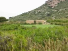
The terrain is changing. The coastal plains filled with orange groves, rice paddies, and fruit orchards, are giving way to hillier land with olive trees, vineyards, and even some fields of grain. It was a beautiful walk, pure Camino. Frogs croaking in a marsh, birds, and oh the wildflowers are out in force. Purple, red, yellow, white, you name it. Just beautiful.

The Amigos list three options for accommodation in La Fuente de la Figuera:
- the municipal albergue, the keys of which you can get either at the local police or at the town hall. In 2018, @Ernesto.IT had a bad experience there in June, but @alansykes had a good one earlier in April, and it looks like things were cleaned up in July when Hugh McMullan went through.
- the Casa rural Ca l'Amable
- the Hotel rural L'Amable
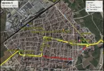
I downloaded this town map (below) from https://lafontdelafiguera.net/es/turismo-1/descarga-de-mapas/, and it shows the albergue in the lower left corner (number 17):
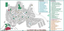
La Font de la Figuera.jpg
But I think number 31 should be 25 and vice versa 🤨

If you're walking early September, you might be able to see the festivities for the patron saint, la Mare de Déu dels Xics. This includes dances in the Plaza Mayor. I'll leave you with this video (Note: you only need to watch the first 8.5 minutes, as it is repeated)

We won't be staying up late any way, we have a big day ahead tomorrow!
 
Holoholo automatically captures your footpaths, places, photos, and journals.
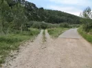
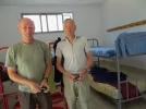
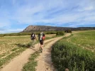
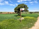
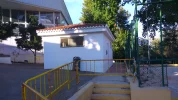
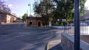
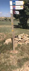
The two most important things that happened on the day I walked into Font de la Figuera was that the camino finally turned to dirt (if you look closely at the picture, you can see the post with the arrow and the GR marks on the left), and I walked into town with my new French buddies. We went to the albergue, which was in a small cement building near the polideportivo. Not sure if it’s still in that location, but this vimeo shows the place I slept. There were only a couple of small windows, but in my experience no self-respecting French man or woman would ever sleep with the windows open anyway, so it really didn’t matter. Far be it from me to be confrontational on the first night of our acquaintance. And anyway, I was outnumbered. :p
 

Attachments

  • 3AF0930C-06E8-472F-B093-41F222046258.webp
    3AF0930C-06E8-472F-B093-41F222046258.webp
    71.1 KB · Views: 30
  • F9A795ED-C7B7-4A26-942E-AA4EF3610D41.webp
    F9A795ED-C7B7-4A26-942E-AA4EF3610D41.webp
    25 KB · Views: 31
This sounds really lovely, and Laurie's description brings the landscape alive.
Even small places have things of interest; I found this:
(And as an aside: I clearly turned into a ageist snob researching the Viejo; this is by contrast not a part of Spain for old churches! Of course not - it makes total sense why not...and fortunately there are other old things.)

no self-respecting French man or woman would ever sleep with the windows open anyway, so it really didn’t matter. Far be it from me to be confrontational on the first night of our acquaintance. And anyway, I was outnumbered.
Gaah. This brings back bad memories of sharing stuffy albergue rooms with French pilgrims who made darned sure they get the places next to the windows. 🤪🤣
 
...and ship it to Santiago for storage. You pick it up once in Santiago. Service offered by Casa Ivar (we use DHL for transportation).
no self-respecting French man or woman would ever sleep with the windows open anyway, so it really didn’t matter.
Gaah. This brings back bad memories of sharing stuffy albergue rooms with French pilgrims who made darned sure they get the places next to the windows. 🤪🤣
Hmmm... should I make it clear that despite my surname, which is William in French, I am not French? ;) 😜😂
 
I liked la Font de la Figuera: very friendly police holding the keys to the albergue, slightly weird concrete bunks in the albergue and very good bars, including one open before dawn for breakfast, also the harsh strong tasty heavily oaked local red Venta del Puerto wine - some of that with my dinner and I slept soundly even on the dodgy mattress of the concrete bunk.

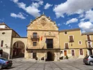
There's also a bust honouring Vicente Rojo Lluch, born here in 1894 and one of relatively few senior army officers who remained loyal to their elected government in 1936, the hero of the siege of Madrid.
 
Holoholo automatically captures your footpaths, places, photos, and journals.
slightly weird concrete bunks in the albergue

Alan, based on that comment I think it must be the case that they have moved the albergue (see the picture in my post— traditional bunks behind the peregrinos). But when I look at the location on google maps, it looks to me like it is still near the polideportivo. The little albergue I stayed in was actually on the grounds of the polideportivo, behind a very long old lavadero if memory serves.

But in any event, the important thing is that there is an albergue in Font!
 

Attachments

  • E30C3A13-526C-4DE3-B6CE-B7D780E3BC48.webp
    E30C3A13-526C-4DE3-B6CE-B7D780E3BC48.webp
    162.9 KB · Views: 19
I am still straggling along behind, for several reasons. I have discovered that I did not fully see all the resources available on the vieiragrino English website, maps.me is out of date, and there are two versions of the spelling of local addresses for Moixent/Mogente, so I can search one and just not find the other. I am trying to make a list of all available accommodation suitable for my needs, since I do not know how far I will be able or willing to walk in a day. I am discovering that most accommodation outside of major cities is in the countryside out of the towns. making it more challenging to find on maps.me, especially where addresses are not clear. And I am beginning to suspect that the actual route of the Levante has been changed since I downloaded a version onto maps.me. Can anyone help me to find Corral de Pablanch? The map on WebRural.com does not work and Google.maps sends me to a building labelled Mogente Industrial S. A. in central Moixente.
Fortunately for me, bringing up the rear is exactly where I need to be at present. I have now found the new pilgrim albergue in Moixent, although it is not marked on maps.me and the street name is spelled differently from what is on my map. So that may do for a place for me to stay at the end of Stage 3, and I shall carry on staggering forward virtually into Stage 4. Thanks again to all.
 
...and ship it to Santiago for storage. You pick it up once in Santiago. Service offered by Casa Ivar (we use DHL for transportation).
Not to worry, Albertagirl, We Got This!

there are two versions of the spelling of local addresses for Moixent/Mogente,

This is not going to last too much longer. This is the Valencian/Castilian name game. It looks to me that soon after Font de la Figuera, the camino enters Castilla-La Mancha, so only one name per town from here on!

Can anyone help me to find Corral de Pablanch?

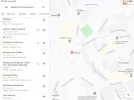
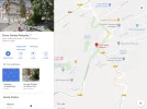
I think @AJ is right that it has closed. Its address was Ctra. Navalón 7, which is out of town a bit, just a few minutes walk beyond the Red Cross, which is where the albergue used to be. But the new albergue is in the center: Carrer Santes Reliquies, 1. That’s the Valencian version, so maybe you are seeing Castilian, but I assume the names are virtually identical. And the google map I’ve attached shows its exact location (red dot). The Amigos website says it is small, basic and has all you need.

And I am beginning to suspect that the actual route of the Levante has been changed since I downloaded a version onto maps.me.

I think the best bet would be to have the amigos’ tracks downloaded, they are likely to be the most up to date. But I have found over the years that the slight variations among versions rarely matter much (UNLESS you are trying to leave Zaragoza on tracks that were loaded years before the entire multi-level road system around the train station had been built :p ).

Stagger on, amiga!
 

Attachments

  • 6A1058B9-47D3-40A0-B459-53A15244AA67.webp
    6A1058B9-47D3-40A0-B459-53A15244AA67.webp
    244 KB · Views: 11
Thank you. I had figured out the town name(s). But there are also two different spellings for the street names, which is why I could not find the new pilgrim albergue by searching for the street name, although street names are searchable on maps.me. And to make matters even more interesting, the older albergue in the Red Cross building is next to a different local police station on maps.me, while the new albergue is not marked on the maps.me location of the larger downtown station. It is a perfect setup for wandering around town asking for help to find the albergue, while half the locals would be sending me to the Red Cross building and the other half wouldn't speak Castillano.
I prefer to follow recent camino route markings if there is any difference from direction indications on maps.me. As maps.me directs towards La Font de la Figuera from Mogente/Moixent, I am happy to follow it. And I am more than happy to rely on your experience for assisting my accommodation finding capacity, as you did when I was planning my walk on the Invierno.
 
I have caught up. Here I am in La Font de la Figuera, and I have found the location of the albergue, as described by @peregrina2000 , as well as that of the Hostal Rural Amable (info. from AJ Guillaume) and have marked both on maps.me for consideration as accommodation, depending on the situation when I arrive. It seems so strange to actually have a choice in town, after the effort that I have made so far to find anywhere. Maybe when I get to Valencia I shall visit a tourist office and see what accommodation exists in these locations and is open whenever I get to walk through (besides the albergues, which I have heard about through the Association).
 
...and ship it to Santiago for storage. You pick it up once in Santiago. Service offered by Casa Ivar (we use DHL for transportation).
From La Font de la Figuera I shall be going on the 26.7 km to Almansa, where there is an albergue, and two hotels recommended by the Association, plus other choices, so there should not be a problem for accommodation. From there to Alpera (on the Lana) is about 23 km, and a one day detour from the Levante. I have sorted out the route to Alpera, which has an albergue, as well as a recommended Hostal, Hostal El Cazador: https://hostalelcazador.es/inicio.html . As the price is very reasonable (25 euros single, or ask for pilgrim prices), I shall probably spend a night there, or two nights if I need a rest.
 
Last edited:
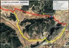
Day 9: La Font de la Figuera – Almansa

This is stage 5 of the Levante, which is described on the website of the Amigos, with a length of 27.6 km.
I recall on the VdlP where there were a couple of stages that were long and could not be broken up into two days. The option was to look for a ride. So it is interesting that the Amigos' accommodation list has this entry for La Font de la Figuera:
Taxi de Pepe: 607 321 422
We wouldn't be the first ones to call on Pepe for a ride out of La Font de la Figuera for a few km. Alternatively, as Almansa is a reasonably sized town, we could start walking towards Almansa, and when my darling Rachel says she can't go any further, we could call a taxi from Almansa.
Most pilgrims will probably walk this stage without any issues.

Today, we cross from the Comunidad Valenciana to Castilla-La Mancha. Don Quixote, here we come...

You will have figured out by now that we are not Camino purists, and as I was looking at the map of this stage, I found an alternate track on Wikiloc:
It shortens the walk by about 6 to 7 km, but (and this could be perceived as a big negative), a fair portion of the walk follows the A-35 highway, but not too close. I'd be interested in hearing from anyone who has walked that alternative.

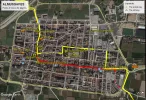
In Almansa, we can join @Albertagirl at the Albergue Esclavas de María. It's a donativo albergue, and we need to call Sor Maria beforehand, bearing in mind that she could be at one of the prayer services during the day.

There are 4 hotel alternatives:
Hotel Encasa (on the edge of town), Hostal El Estudio, Hostal Casa Almántica (both closer to the town centre) and Hotel Blu (not far from the Encasa).

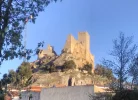
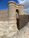
I duly made notes of the castles on this Camino, and Almansa has one! Have a look:
This is also the site of a major battle in the War of Spanish Succession in 1707. During the weekend closest to 25 April, there are festivities, with an annual commemoration. I guess if you're walking at that time of the year, it might be wise to book ahead.

There are quite a few things to see here, according to the Almansa tourism website. So we are going to have a rest day here.

Day 10: Almansa, rest day
 
Alternatively, as Almansa is a reasonably sized town, we could start walking towards Almansa, and when my darling Rachel says she can't go any further, we could call a taxi from Almansa.
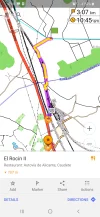
A third alternative, which involves a wee detour, is to divert from the camino to where you might be able to hop on a train; the added advantage is that there are restaurants nearby, next to the autovia:Screenshot_20200830-100859_OsmAnd.jpg
Unfortunately, that spot is only 8.7kms from La Font, and I haven't checked to see if there are actually trains. But it's a potential way to break that stage in two if necessary. I was actually looking for a place to eat near the camino, but it's a bit too long of a detour for that.

That's some castle. So much fighting, over...what? Sigh.
 
Get a spanish phone number with Airalo. eSim, so no physical SIM card. Easy to use app to add more funds if needed.
Sorry, I don’t know anything about the alternative.

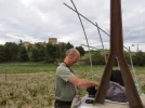
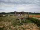
I am having a hard time remembering a lot of details from this stage. My blog notes that it was very pleasant, though. With the help of my pictures, I do remember that there were some abandoned towers along the way. The picture shows my French pal making coffee with his jet boil (they stopped to make an espresso at precisely 10 am every morning, no matter where we were), and we typically left between 6:30 and 7 am. That suggests that this castle (which must be the Torre Chica referred to on the amigos website) is about 12 km from Font.

The amigos guide also indicates a crossing with the N-430 at 21.5 kms from Font, about 6 before Almansa. That might be a good place to get a cab. But maybe Casas de Campillo would be easier to arrange in advance. Do you generally have a preference for taking the cab at the beginning of the walk, or is it better for you to leave flexibility for deciding how far to walk and then calling when you are ready? If so, you could start near the espresso bar :) near Torre Chica. My pictures show the walk from there is green fields, wild flowers, pretty.

Almansa is definitely a good choice for a rest stop — it is a bigger place with more things of interest than the stages before and after. Some good baroque architecture and the castle give you a nice relaxing rest day!
 

Attachments

  • ECB5BD1D-DFAD-49BC-8CC9-6643CA3E1850.webp
    ECB5BD1D-DFAD-49BC-8CC9-6643CA3E1850.webp
    49.8 KB · Views: 20
  • 4B8D0867-2C53-4E83-8741-3BAB2FF3F970.webp
    4B8D0867-2C53-4E83-8741-3BAB2FF3F970.webp
    53.2 KB · Views: 18
  • 7215AA07-C7E7-4E51-A8C2-EF3B07C21195.webp
    7215AA07-C7E7-4E51-A8C2-EF3B07C21195.webp
    70.7 KB · Views: 17
  • 4A782DEE-5AF8-4B4E-8CDC-5265CBD2508D.webp
    4A782DEE-5AF8-4B4E-8CDC-5265CBD2508D.webp
    50.7 KB · Views: 17
  • FFF6E18D-8708-427B-8BD1-6ECD5A543AC6.webp
    FFF6E18D-8708-427B-8BD1-6ECD5A543AC6.webp
    32.8 KB · Views: 17
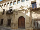
Some good baroque architecture
I'm very opinionated about this, but I will own It: that's an oxymoron. :p😇

The amigos guide also indicates a crossing with the N-430 at 21.5 kms from Font, about 6 before Alamansa
A much better option then only eight kilometers in. And there's an Espresso Bar means that a long detour is unnecessary for refreshment!
 
Get a spanish phone number with Airalo. eSim, so no physical SIM card. Easy to use app to add more funds if needed.
There's a fairly sharp rise up the Puerto de Almansa into La Mancha near the start of the day - nothing too bad on fresh legs, perhaps 100m of ascent over a km or so.

You cross the battlefield on the way into Almansa, and there is a little information centre about the battle, with a reproduction of Ricardo Balaca's panoramic battle scene.

The Bourbon general in 1707 was my ancestor James Fitzjames, commanding a mixed bunch of French, Spanish, German and Irish troops, defeating Henri de Ruvigny, commanding an assortment of English, Austro-Hungarian, Catalan, Portuguese, Italian and Dutch troops (presumably the Poles and Danes etc had better things to do). Thought to be the only time an Englishman commanding a French army fought with an English army commanded by a Frenchman. The Englishman won (or the Englishmen lost, according to preference).

Almansa also boasts a two Michelin star restaurant, the Maralba, whose prices appear to have risen a lot since my first visit in 2014. The Hogar del Productor, by the back door of the albergue, is a lot cheaper and was excellent value last time I passed through in 2018.
 

Attachments

  • IMG_20180417_194232.webp
    IMG_20180417_194232.webp
    411 KB · Views: 18
The one from Galicia (the round) and the one from Castilla & Leon. Individually numbered and made by the same people that make the ones you see on your walk.
Baroque churches may not be worth a rest day, but history and a decent restaurant? Sign me up
. :cool:
I am afraid that my choice of Alpera as a possible rest day was based solely on my attraction to the hotel. In fact, I take very few rest days and am most likely to do so when I feel that I really need a rest. A pleasant hotel is a necessity, since I am assuming that the municipal albergues on this route permit only a one night stay.
 
That alternative route on the Camino de Alba is very attractive to me, as a way to shorten the day to a pleasant 21 km. It seems to have about 10 km on an old road beside the A-35. I don't mind that.

It is funny to be minutely investigating these routes. I was looking at the track on Google Earth, following the exit from La Font to the right/north. I saw the track cross the A-35 so I zoomed down to look at the crossing. I was getting a bit concerned - I could accept stepping over the barrier on the first side to get on the road, even watch for traffic and cross the lanes, but I didn't like the look of the scramble down the other side. I zoomed back to contemplate the options. Then I realized that there was an underpass just ahead. Of course the track appeared to go over the highway, but we would go under!
 
I liked la Font de la Figuera: . . . There's also a bust honouring Vicente Rojo Lluch, born here in 1894 and one of relatively few senior army officers who remained loyal to their elected government in 1936, the hero of the siege of Madrid.
Thank you for the mention of Vicente Rojo Lluch. Until recently, I knew nothing about the Spanish Civil War, and now I know next to nothing about it. I spent some time reading about Vicente Rojo Lluch since I saw this reference, and was most impressed with his life. Thanks to being in the process of reading Michener's Iberia, I was absorbing his perspective that Spain is essentially Fascist (or at least was when Michener wrote, and Franco was still in power). I suppose that, as a foreigner visiting Spain, I was more committed to my project of walking caminos than to understanding the history of the country where I was walking. Thank you for sharing your broader perspective.
 
3rd Edition. Vital content training & pack guides avoid common mistakes, bed bugs etc
That alternative route on the Camino de Alba is very attractive to me, as a way to shorten the day to a pleasant 21 km.
That would be my choice too. The CdA webpage is very well done, BTW - it's worth a look.

It is funny to be minutely investigating these routes.
Haha...I got around to looking up the map legand for my OSMand app only today, after 3 years of using it. That was in the context of seeing unfamiliar shading a liitle farther along. It turned out to be military land...
 
I'm very opinionated about this, but I will own It: that's an oxymoron.

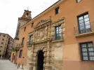
Ok,VN, I will admit to some of the same feelings, but the Almansa Baroque I was referring to is on the exterior, which I find pretty satisfying sometimes. (See the facade of the Municipal Museum of Madrid, over the top but a very positive contribution to the streetscape, IMO).

Almansa has some good examples.
 

Attachments

  • 68C649CF-6300-4B24-B5AD-F60D9BB8E3C9.webp
    68C649CF-6300-4B24-B5AD-F60D9BB8E3C9.webp
    50.7 KB · Views: 20
  • 585CE450-F865-41B3-9997-32FC4CFE81B3.webp
    585CE450-F865-41B3-9997-32FC4CFE81B3.webp
    89.3 KB · Views: 20
€2,-/day will present your project to thousands of visitors each day. All interested in the Camino de Santiago.
Haha....
Egad. Just...no, thank you. (shudder...)
Someone had more money than restraint.
😱🤣

Though admittedly the Alamansa versions are much more toned down and palatable.
Well, I am not going to try to convince you, but I will say that walking on the Calle Fuencarral in Madrid, past hundreds of small stores, bars, consumer heaven, and coming upon a facade that was built to honor something other than consumerism is a huge relief. And it kind of takes your breath away with its permanence and how it splashes out in the streetscape.
 
will say that walking on the Calle Fuencarral in Madrid, past hundreds of small stores, bars, consumer heaven, and coming upon a facade that was built to honor something other than consumerism is a huge relief. And it kind of takes your breath away with its permanence and how it splashes out in the streetscape.
You definitely have a point...very true. You don't have to like the aesthetic to appreciate that, deeply.
It may just be that in comparison to today’s standards, they seem quaint and simple.
Heee heee. Yes. No opulent towers trumping everything nearby.🙂;)

Edit to say I am playing here, exaggerating my distate a bit for laughs. And editing again to smooth out potential over-the-line posts...
 
Last edited:
...and ship it to Santiago for storage. You pick it up once in Santiago. Service offered by Casa Ivar (we use DHL for transportation).
That alternative route on the Camino de Alba is very attractive to me, as a way to shorten the day to a pleasant 21 km. It seems to have about 10 km on an old road beside the A-35. I don't mind that.
I have just discovered the Camino de Alba, thanks to your comment here, and have investigated it to the point that I know where it is going, in relation to the Levante. What with the intersection with the Lana coming up so soon, I am a little overwhelmed by the complexities of this route. However, I see that I shall soon have to get used to the ongoing dance between the Levante and the Sureste, so this is just an introduction to the fun. I don't know how I would ever plan this camino without all the help given by experienced walkers. Thanks to all.
 
@Albertagirl, welcome to the bumbling peregrinas club. The sighted ones around here who've walked this before are absolutely worth their weights in gold. I add my thanks.

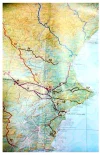
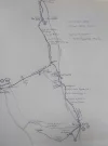
The confusion you're feeling is justified - there's a plethora of options here. Here's a screenshot of a really helpful overview map of this part of the camino that I found in the link I posted above (in post #125); I think what's labeled as '13' is the alternate way to Alamansa:20200901_112540.jpg
(One thing I'm more deeply appreciating this summer as I virtually walk all sorts of caminos is how our modern routes are actually best approximations of a route, based on what was once a web of ways headed to Santiago - so we don't need to slavishly follow one thread of that net. Of course, we need to keep our general bearings and know where we're going...that's another story.)
 
The confusion you're feeling is justified - there's a plethora of options here.

Just to reassure folks who reacted to the above map with a :eek: —the main route is very well marked, and you will not be confused or heading off in the wrong direction with your head spinning. The few places (three or four) where Levante walkers have to make a choice are well-marked. One is coming up, stay tuned.
 
Fail to prepare? reduce your risk by buying this book full of practical info.
2nd ed.
Just to reassure folks who reacted to the above map with a :eek:
I'm relieved to know that, Laurie. Getting lost never crosses my mind so I'm sorry if I caused alarm. :oops:When I saw the map, I realized the confusion I'd been blaming on a mental block (or something) is actually justified: it IS confusing! In fact it looks like spaghetti in places. It doesn't really matter as far as this walk is concerned, but I do wonder why.
 
That alternative route on the Camino de Alba is very attractive to me, as a way to shorten the day to a pleasant 21 km.
That would be my choice too. The CdA webpage is very well done, BTW - it's worth a look.
For the purpose of this virtual Camino, we'll be following the arrows of the Levante, but after reading more about the Camino del Alba (thank you for the link, @VNwalking ), in real life we'll be following that section from La Font de la Figuera to Almansa.

What's more, we are now hatching another plan (for the year 2024?): we have a very dear friend who lives in Calp, close to where the Camino del Alba starts. So we could visit her, and then walk the Camino del Alba, followed by the Camino de la Lana.
 
Day 11: Almansa to Alpera

The official stage leaving Almansa is 38.4 km to Higueruela. @peregrina2000 wrote in her blog:
Now the dilemma is tomorrow. There is a 42-44 km stage from here to Higuruela. With a two km detour at about km 23, you can break it into two. The French guys had planned to walk the whole way, but they were under the impression it was 38 km. Upon hearing from the tourist office that it is in fact at least 42, they are having doubts. When I thought it was 38, I was considering getting up with them at 4 and giving it a try. Now that it´s clear that it´s 42-44, I´m probably going to be sensible and only do the first half.

The nice thing, is that the Camino de la Lana crosses the Levante around here. @peregrina2000 alluded to a detour, which @JLWV also mentioned earlier.
Today we'll walk 23 km to Alpera, which is on the Camino de la Lana. There, according to the Amigos' accommodation list, we'll have the choice of a municipal albergue, or two hotels: Hotel El Stop, and Hotel El Cazador. The Alpera ayuntamiento website lists another two casa rurales.

In Alpera, there is a Pozo de la Nieve, an ice and snow warehouse, dating back from the 16th century. It's about 1 km from the town centre.

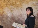
Another curiosity here is the Cueva de la Vieja, with prehistoric rock paintings. The paintings are very faint, as you will see on the video, but you can call 967330555 to organise a visit, as it is 5 km away from the town, and you'll probably need a guide like Rafael to explain what you're seeing:
 
Ideal pocket guides for during & after your Camino. Each weighs only 1.4 oz (40g)!
The nice thing, is that the Camino de la Lana crosses the Levante around here. @peregrina2000 alluded to a detour, which @JLWV also mentioned earlier.
Today we'll walk 23 km to Alpera, which is on the Camino de la Lana.
So now I'm surprised, because the track of this Camino that I downloaded from Wikiloc takes the route that goes through Alpera.

Well...what's in a name? No matter what it's called, I would be going that way. I could do 40k if I had to, but why?

Either way this looks to be another day to pack a lunch!
 
My bragging rights in Alpera — my French buddies and I were the very first pilgrims to stay in the albergue. It’s small, above a social center, but peregrinos can store food in the refrigerator downstairs and enjoy the outdoor seating area with wisteria all over. I believe there were two bedrooms with two single beds in each room.

The walk is very nice, along the base of the Sierra de Mugrón with some civil war bunkers still in tact. The turn-off to Alpera is crystal clear.

I’m glad we had the distance wrong and decided to take the detour because the people in this place are absolutely wonderful. How can I count the ways—

1. The concejala insisted on taking us to the albergue herself.
2. She arranged for a guide, María, to take us up to the drawings. They are VERY VERY faint, almost invisible to the naked eye. They are about 7,000 years old and had survived fine till their “discovery” in 1910, when people flocking to see them decided that throwing water on them would make the painting sharper.
3. I left my hat in the van, and later that afternoon called the city building. Ayuntamientos are closed in the afternoon but the maintenance guy picked up the phone and told me he would go find the hat and drop it off at the albergue.
4. In the late afternoon, city workers came to install an outside mailbox, so we could drop the key there rather than walking back to the town hall to deposit it.
5. The family business at the Stop was a three generation loving affair. Kids doing homework at the back of the seating area, grandma coming out from the kitchen to check, mom and dad arriving and sitting down with kids to ask about their day, it was really heartwarming. And the food was good!

Not a lot going on in Alpera, maybe, but it was one of those visits that filled us with appreciation and a general sense of well-being.
 

Attachments

  • 2B970192-8960-49AC-BB91-C45DB0071E18.webp
    2B970192-8960-49AC-BB91-C45DB0071E18.webp
    67 KB · Views: 24
  • B5DA01DC-5741-465E-B390-028402B43E6A.webp
    B5DA01DC-5741-465E-B390-028402B43E6A.webp
    80.8 KB · Views: 19
  • F20C955C-9157-41DE-B676-44E85F830C2B.webp
    F20C955C-9157-41DE-B676-44E85F830C2B.webp
    81 KB · Views: 16
  • BC0B3A59-3B6D-4E59-93A4-3F5C29EDF918.webp
    BC0B3A59-3B6D-4E59-93A4-3F5C29EDF918.webp
    75.9 KB · Views: 17
So now I'm surprised, because the track of this Camino that I downloaded from Wikiloc takes the route that goes through Alpera.

Well...what's in a name? No matter what it's called, I would be going that way. I could do 40k if I had to, but why?
I guess that not many pilgrims walk the 40 km (and we would definitely not be able to do so!), which is why you have a track that goes via Alpera.
The official track from the Amigos' website shows the direct route, without the detour.

Either way this looks to be another day to pack a lunch!
Ah, yes, I forgot to mention that! Thank you for reminding me, @VNwalking !
 
...and ship it to Santiago for storage. You pick it up once in Santiago. Service offered by Casa Ivar (we use DHL for transportation).
I’m glad we had the distance wrong and decided to take the detour because the people in this place are absolutely wonderful.
Not a lot going on in Alpera, maybe, but it was one of those visits that filled us with appreciation and a general sense of well-being.
That's one of the things what makes a Camino wonderful: the people you meet, their kindness and hospitality.
 
Perhaps you should follow Ernest Hemingway's example: "In Valencia it's damned stupendous at the beach or in the city to eat a melon washed down with a real cold jug of beer". He stayed at the Reina Victoria, ...
If you go to the beach, North beach, you can eat a ''paella'' at the restaurant ''La Pepica'' as did Hemingway, and many other illustrious people. They have a collection of photographies of those people.
Better ask for a ''Paella valenciana'', as there are many variants that we, people from Valencia, call 'rice with things'

I walked through Almussafes on a late Sunday morning and it struck me as a lively friendly place. Where else can you find a Moorish tower embedded in the town hall?!
Oh!!! the Moorish tower embedded in the town hall is not in Almussafes, but in Benifaió, 1 km ahead (where I live)
Almussafes has also a moorish tower, but aislated (look to the left at the first streets' cross after the market).
.

Shortly after Carcaixent, there is the Ermita de Sant Roc de Ternils, built in the 13th century, at the end of the Romanesque
Good place for a break (rest or lunch)

I think the pavement finally gave way to dirt after Moixent.
After Vallada there are some kilometers on dirt along the river's bed. Then again pavement until Moxent.


Maybe I shall try to be in Valencia for Holy Week
If so, don't lost the religious precessions in the ''barrios maritimos'' (maritime districts)
 
But I think number 31 should be 25 and vice versa
As far as I read well the numbers, the map is correct.
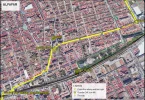
I join a copy of the map with notes. (titteld 'Plano La Font)
The yellow line is the official way; the orange one the way from the Hostal.
The manager of the hostal is Victor, very helpfuff to us.


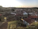
We went to the albergue, which was in a small cement building near the polideportivo.
I think it must be the case that they have moved the albergue
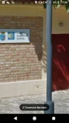
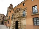
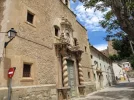
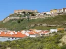
Yes it was moved between 2014 and 2016. The old one was in the sports area, I think a former changing room, the new one is 100 m ahead on the way.
See attached pictures (first=old, second=new)
2017 04 13 1911 DSC_0031.JPG2017 04 13 1924 DSC_0034.JPG

Vicente Rojo Lluch, born here in 1894 and one of relatively few senior army officers who remained loyal to their elected government in 1936
Thank you for the mention of Vicente Rojo Lluch.
General Rojo and General Franco have their portraits next one to the other in the Museo Histórico Militar de Burgos. I am not sure if the were at the same class in the military academy, but any way the were at the same time.


That alternative route on the Camino de Alba is very attractive to me, as a way to shorten the day to a pleasant 21 km. It seems to have about 10 km on an old road beside the A-35. I don't mind that.
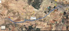
Victor at the Hostal l'Amable in La Font told me about the alternative route to Almansa by the option of the Camino del Alba, and he does not like it. I didn't walk it so I cannot have an opinion, but I drived a lot of time the parallel higway, and prefer the landscape of the Levant way. Of course it is some 7-8 km shorter...
See map.
La Font - Almansa - Variantes.png
 

Attachments

Last edited:
A selection of Camino Jewellery
You cross the battlefield on the way into Almansa, and there is a little information centre about the battle, with a reproduction of Ricardo Balaca's panoramic battle scene.

The Bourbon general in 1707 was my ancestor James Fitzjames, commanding a mixed bunch of French, Spanish, German and Irish troops, defeating Henri de Ruvigny, commanding an assortment of English, Austro-Hungarian, Catalan, Portuguese, Italian and Dutch troops (presumably the Poles and Danes etc had better things to do). Thought to be the only time an Englishman commanding a French army fought with an English army commanded by a Frenchman. The Englishman won (or the Englishmen lost, according to preference).
Nice to see that our history is known out of the country.
This was the war of succesion of Spain, 1701-1714, when the last Habsburg king of Spain, Carlos II died without succesor. The two postulants were Philippe d'Anjou, gran-son of king Luis XIV of France, and Karl, archiduque of Austria. The Bourbon at last was the winner, and became Felipe V of Spain.
The little museum of the battle next to the tourism office is interresting
 
Yes it was moved between 2014 and 2016. The old one was in the sports area, I think a former changing room, the new one is 100 m ahead on the way.
See attached pictures (first=old, second=new)

Thanks so much for clearing that up. I think I was confused because the new albergue is such a small building, just as the old one was, and I thought there couldn’t be two such similar buildings so close to each other!
 
Fail to prepare? reduce your risk by buying this book full of practical info.
2nd ed.
I guess that not many pilgrims walk the 40 km (and we would definitely not be able to do so!), which is why you have a track that goes via Alpera.
The official track from the Amigos' website shows the direct route, without the detour.


Ah, yes, I forgot to mention that! Thank you for reminding me, @VNwalking !

This is the point where you have to make a decision, stay on the Levante and cover the full 40 klm to Higueruela, or divert on the Camino de la Lana to Alpera, considerably shorter on the day. I stayed with the Levante, having thought about it for quite a while, and I was walking into a strong headwind. It was a long and isolated day for sure. Didn't meet a single person while walking that day. Levante.webp
 
I would like to know what all those numbers on the signs mean. I don't recognize anything that could indicate kilometres to the destination indicated on the sign.
 
I was wondering that too.

The nice thing about short day is that there's no time stress that comes with trying to arrive in time to find a place serving lunch. Alpera's not a huge place, but on Googlemap there's a bodega, a Caferteria-pub, a Co-op, and a panaderia. So...choice. And the panaderia means maybe breakfast is available in the morning.
 
Get a spanish phone number with Airalo. eSim, so no physical SIM card. Easy to use app to add more funds if needed.
I would like to know what all those numbers on the signs mean. I don't recognize anything that could indicate kilometres to the destination indicated on the sign.
Assuming you are referring to @murraydv 's photo, I think it says that Alpera is at an altitude of 840 m, it is a 3.6 km walk from the sign to Alpera, and it would take 55 minutes.
Interesting that on the second sign, the word Desvío (Detour) has been painted over 🤨
 
It was a long and isolated day for sure. Didn't meet a single person while walking that day.
Levante is quite unpredictable: the first time I met a pilgrim in La Font de la Figuera (Valencia) and the next one in Torrijos (Toledo), but the second time we stayed 6 pilgrims the same night in Almansa.
 
Assuming you are referring to @murraydv 's photo, I think it says that Alpera is at an altitude of 840 m, it is a 3.6 km walk from the sign to Alpera, and it would take 55 minutes.
You are right

Interesting that on the second sign, the word Desvío (Detour) has been painted over
Exact.
This is due to the fact that the Camino de Levante has been officially approved as GR239 (i.e, Sendero de Gran Recorrido) by FEDME (Federación Española de Deportes de Montaña y Escalada). This gives to the way an official protection, but at the same time prevents changes without project and reapproval. It seems that somebody had a special interest in this detour.
 
Ideal pocket guides for during & after your Camino. Each weighs only 1.4 oz (40g)!
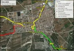
Back to VALLADA.
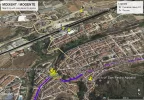
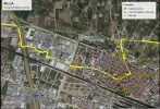
Here is a map of this city
Vallada.png
Just entering the village, there is a bar at right hand where we have a pilgrims's book. This is a way for us to have an idea of the number of pilgrims on this way. I know that the owner of the bar have sometimes given accomodation's information.

I have painted the way to the albergue on the map. It has no more direction than 'Paraje de las ermitas', and anyone there can direct you.

When leaving, be carefull. After the church you walk by the 'Carrer del mig' until you see on the right a street which goes down and obliquely. This street, 'Calle Santa Teresa', is the right way wich goes to the river bed (dirt way). If you miss this street (I did it twice) you will walk the old way, nice too, but all pavement. Last time the Amigos repainted the arrows we payed attention to the marks, but be carefull.....

p.s.: 'carrer' is Valencian for 'calle'
 
I think it says that Alpera is at an altitude of 840 m, it is a 3.6 km walk from the sign to Alpera, and it would take 55 minutes.

Thanks for this. This does look fairly clear, once I understand it. I do not find estimates of time to cover a distance useful, since the speed of walkers is not uniform. At some locations, it would be useful to know the altitude change over the distance. I find it reassuring when I see a sign, to know the distance to the next town, as I cannot determine this in any detail from what I see on maps.me .
 
Back to MOIXENT (Valencian) / MOGENTE (Castillan)
Here is a map of the city.
Moixent GoogleEarth.webp
Forget the albergue which was the barracks of Cruz Roja, on the main road, next to the Guardia Civil's barracks. The new one is just near the Police Station, on the way, after crossing most of the village.

The Casa Rural La Bodega is near the way, 3,3 km ahead, with good signalisation on the way, but call before arriving to be sure it is open. (Tel. 962 132 289)

About Corral de Pablanch I had no answer to a phone call, so I sent two e-mail. I will transmit answer if i get one.
 
The 2024 Camino guides will be coming out little by little. Here is a collection of the ones that are out so far.
About Corral de Pablanch I had no answer to a phone call, so I sent two e-mail. I will transmit answer if i get one.


@JLWV, I wish I could start a forum-wide round of thankful applause. Or award you a 5 ***** badge of honor. Your participation on this thread is so very helpful, many thanks.

BTW, are you seeing any Levante traffic these days? I suppose the heat of summer is still too blazing, but it will be interesting to see if people head out in fall.
 
At some locations, it would be useful to know the altitude change over the distance

Mundicamino has the elevation profile for each stage. Go to an individual stage, and then click on perfil. Spoiler alert — there’s virtually no elevation till you leave Toledo;)


@JLWV, I wish I could start a forum-wide round of thankful applause. Or award you a 5 ***** badge of honor. Your participation on this thread is so very helpful, many thanks.
I'll add my Thanks, Gracias, Merci ! 🌟🌟🌟🌟🌟

Day 12: Alpera to Higueruela

This morning we have the same choice @peregrina2000 had back in 2013:
Either to backtrack the 4 kms to the turn-off or to take a direct road route to the next stop of Higueruela. Backtracking meant a 25 km day with 11 kms on highway. Going the shorter route was 20 kms all on the side of the road. I was willing to go either way, but was quite happy to hear that the Frenchmen wanted to backtrack. This meant more walking through empty spaces and fields of green, and it was very nice.
Depending on how Rachel feels, we might try backtracking. There is a GPX track on Wikiloc:

Otherwise, the Alpera-Higueruela road, according to the Amigos' notes on this stage, has "little traffic", and the satellite imagery seems to indicate that there is sometimes an off asphalt shoulder.

I tried looking for an alternative which would avoid the road, until we join the Levante after Casillas de Marín de Abajo:
Alpera - Casillas de Marin de Abajo.webp
It looks feasible...

Today is definitely another day when you have to take a packed lunch. No bars along the way!

In Higueruela, there's a municipal albergue, and the Hostal la Posada. Judging from @peregrina2000 's appraisal of the albergue in 2013:
The albergue isn´t bad, but there were only two beds and a bunch of old furniture, a small bathroom and that´s about it.
She stayed at La Posada. Apparently, and she mentioned this in her notes on this forum:
I later learned that the floor above the albergue is a music school at night, and my two friends who stayed there said the music blared till well after midnight.
:eek:
 
€2,-/day will present your project to thousands of visitors each day. All interested in the Camino de Santiago.
thankful applause
Thank you, but no needs for that. As I live in this area and participate in the maintenance of that way, it is easy for me, and for me too it is a virtual way...

are you seeing any Levante traffic these days?
Really no!
Last years at this date we had expanded some 6.000 credencials, mainly for people of our region, and some foreign people, but this year we remain at 2.000 credencials, only for people living here (some of them no Spanish).
What we see is that Valencians who don't dare to walk far from home are walking some legs of the Camino de Levante on week-ends and turn back to sleep at home.
Also we have seen some Valencians bikers beginning our way.
Other years I used to cross in the streets of my city pilgrims of the Camino de Levante, and sometimes walkers of the Camino del Cid, most of them foreigners, but from March NONE:
 
Last edited:
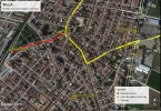
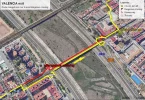
As ALMUSSAFES is one of the possible stops on the long way to Algemesi, here is map of the village with the position of accommodations and other places of interest.
Plano Almussafes.png
The way has been changed on request of the Ayuntamiento, officialy to avoid a dangerous cross when arriving, and also to cross the center of Almussafes. Lots of bars in the center.

I also join a map of the next village, BENIFAIÓ.
I painted on it an alternative route for bikers, as the two main streets of the way are 'one-way streets', just contrary to our direction. If bikers want to see the center they must walk in those streets (about 1 km)
Plano de Benifaió.png
Lots of bars specially in the center
There are two drinking fountains just before exiting, one in the center of the 'parque' , and the other in a little white building on the left (this one is osmosed water)
 
Last edited:
...and ship it to Santiago for storage. You pick it up once in Santiago. Service offered by Casa Ivar (we use DHL for transportation).
This is interesting, if you walk it thanks for reporting.

Tomas, at the Hostal el Cazador, suggests a fifth option (the indication 'Camino de Levante' is of his own, not official)
View attachment 82347:
I had seen this track on Wikiloc:
It's longer than following the road, or my alternative, as it is 28 km.
However, am I right in assuming that the diagram shows a casa rural at Las Fuentes (Casa de la Peña)? That could make this alternative interesting.
 
However, am I right in assuming that the diagram shows a casa rural at Las Fuentes (Casa de la Peña)
I didn't know, but I have seen it on the map, located it on Google Earth, and seen it is on Booking.

also on Tripadvisor and http://alperarural.es/
 
The 2024 Camino guides will be coming out little by little. Here is a collection of the ones that are out so far.
@JLWV, I wish I could start a forum-wide round of thankful applause. Or award you a 5 ***** badge of honor. Your participation on this thread is so very helpful, many tha
Thank you, but no needs for that.
Well we will clap in unison anyway. Just because.☺
👏👏👏
the member of the association who checked the tracks for the web uploaded them on wikiloc. He is Aurelio Belenguer.
Oh, this is very good to know. Gracias!

Edit: Searching for information about the area around Alpera for the virtual Lana thread, I found this:

Screenshot_20201204-164737_Firefox.webp
 
I am pretty sure that I will follow the most direct route from Alpera to Higueruela, which follows the AB216 all the way from Alpera to near Higueruela, Maps.me shows the Levante merging with the AB216 about halfway to Higueruela, then the AB216 merging with the CM3209 about a km before Higueruela. If this is correct, this is the shortest route, but also the most direct. There are a couple of hamlets indicated along the way, which may assist me in identifying my location as I am walking. If the information about the AB216 having little traffic is correct, I anticipate no challenges on this section (weather excluded: but if it is unpleasant, the faster I can walk it the better). I also plan to stay at the Hostal la Posada in Higueruela.
 
Heads up for anyone staying in La Posada, which is quite nice by the way. Here’s what happened to me (from my blog):

One daily ritual familiar to everyone who walks a Camino is that before you go to bed, you scout out the way out of town. Knowing where you are headed reduces early morning hassles. So yesterday after we arrived in Higueruela, we found that the arrows went very close to the albergue. Since the French guys (who were staying in the albergue) had to return the key to the same place I was staying, we arranged to meet in front of my place at 6:30. What I didn't realize until 6:30 was that I had forgotten to scout out the way out of my hotel. I had one of those "card keys" and for the life of me I couldn't find anywhere inside to swipe it, and the door was firmly locked. Etienne showed up, and with some uncharacteristically deft and agile movements on my part, I was able to weave the card through several iron grilles and a window that I could crack open. Once the card was outside, Etienne was able to swipe it on the outside pad, and voila I was free! Important lesson: When you check out the route to leave town the next day, make sure you can get out of the place where you are going to sleep!!

The town itself is small and probably won’t stand out in too many memories, but I think I remember that there was at least one small church up on a little hill and that we had a very wonderful chat with two old men sitting out taking in the sunshine. As you’ve commented before, AJ, these encounters are always such a treat, and I think the townsfolk enjoy them just as much as we do.
 
€2,-/day will present your project to thousands of visitors each day. All interested in the Camino de Santiago.
I am pretty sure that I will follow the most direct route from Alpera to Higueruela, which follows the AB216 all the way from Alpera to near Higueruela, Maps.me shows the Levante merging with the AB216 about halfway to Higueruela, then the AB216 merging with the CM3209 about a km before Higueruela. If this is correct, this is the shortest route, but also the most direct. There are a couple of hamlets indicated along the way, which may assist me in identifying my location as I am walking. If the information about the AB216 having little traffic is correct, I anticipate no challenges on this section (weather excluded: but if it is unpleasant, the faster I can walk it the better). I also plan to stay at the Hostal la Posada in Higueruela.
Stayed in Hostel la Posada last June. It's fine, but the cafe might not be open too early in the morning before you leave. However, there is another cafe down the hill from La Posada and turn right. This will be open early in the morning.
 
Stayed in Hostel la Posada last June. It's fine, but the cafe might not be open too early in the morning before you leave. However, there is another cafe down the hill from La Posada and turn right. This will be open early in the morning.
Sun sets in Higueruela1VxMKEhwT0utUFidxJ3eHg.webp
 
Stayed in Hostel la Posada last June. It's fine, but the cafe might not be open too early in the morning before you leave.
In 2014 I also stayed there, and as the cafe opens after the hour of leaving, and the breakfast was included in the price, at night the owner let at my door a bag with breakfast (with fruit juice instead of cofee).

In 2017 I only stoped at the Posada for lunch, as I was coming from Alpera, by the direct route, and continued to Hoya Gonzalo where there is a good albergue (for 16 pilgrims!). It was a 30 km's day, and next day others 30 to Albacete, with no stop in Chinchilla which I had visited several times before. In my opinion pilgrims who do not know Chinchilla should spend time visiting it, smaller, but more attractive than Albacete.
 
Get a spanish phone number with Airalo. eSim, so no physical SIM card. Easy to use app to add more funds if needed.
After that beautiful sunset in Higueruela (thank you @murraydv !), we're on our way again!

Day 13: Higueruela – Hoya-Gonzalo

The next official stage is from Higueruela to Chinchilla, with a distance of 28.8 km. A distance which is quite manageable for the able bodied pilgrim, and no doubt the majority of pilgrims will walk this in one day.

If I may remind readers (and new ones joining us), we're slow walkers, and there are limitations which lead us to explore shorter stages where possible. And on this stage, it so happens that there is a near mid point which appears after 11 km, leaving another 17.8 km on the next day.

That mid point is the village of Hoya-Gonzalo (village, as I don't think it is large enough to be a town?) with its 800 inhabitants. It has its own website, where I found more information.

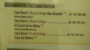
The village has a municipal albergue, and in the same building, a casa rural, the Casa del Médico. The Amigos' accommodation list also has the Casa Rural Don Gonzalo, for pilgrims looking for a bit of luxury ;) In 2017, @JLWV stayed at the albergue, walking from Alpera. I think this is your tracks, @JLWV :

In Hoya-Gonzalo, there is an old windmill, dating back to 1340, as well as the Museo etnológico "Camino de la Cruz":

There is a bakery and a butcher, as well as a cheese shop, but we're not sure if we will need to bring food with us from Higueruela. The alternative will be to have a meal at one of the 3 cafés.

While we're having our evening meal, we'll be discussing our next destination, Chinchilla de Montearagón. There's a castle there, and @JLWV has just recommended:
In my opinion pilgrims who do not know Chinchilla should spend time visiting it, smaller, but more attractive than Albacete.
So, should we plan a second night in Chinchilla when we'll get there?
 
@JLWV , I have been mainly using two documents for distances, one being the Amigos del Camino de Santiago Comunidad Valenciana's website, the other being the accommodation list you have kindly uploaded to the Resources section of this Forum.
I am noticing some discrepancies between the two, and sometimes on the one source. For example, the 20th stage (San Martín de Valdeiglesias – Cebreros) indicates that the distance is 14.27 km in the title of the page, but 17.2 km in the profile diagram, as well as in the list of accommodation.
I recall you mentioned earlier, that you might give some clarification on distances.

¡Gracias! Thank you! Merci!
 
In my opinion pilgrims who do not know Chinchilla should spend time visiting it, smaller, but more attractive than Albacete.
Good to know, because it lokks really interesting on my map.
If I may remind readers (and new ones joining us), we're slow walkers, and there are limitations which lead us to explore shorter stages where possible
Gracias! And I am really appreciating the pace of your posts, AJ. They are regular but with plenty of time in between each one to explore options, discuss, and digest (not to mention, to walk!).
 
Get a spanish phone number with Airalo. eSim, so no physical SIM card. Easy to use app to add more funds if needed.
I notice that Hoya-Gonzalo also has a municipal pool big enough to do some lap swimming. ☺

There's nothing like a few hundred meters in the pool to work out the kinks - especially in the long-suffering feet and lower legs.

(I also see a 'Casa & Spa Don Gonzalo.' This could be a sybaritic stop!)
 
(I also see a 'Casa & Spa Don Gonzalo.' This could be a sybaritic stop!)
Assuming 'sybaritic' also means wealthy: I looked at the rates, and for starters, they will charge for a minimum of 6 people, even if you're a couple, let alone if you're single :eek:
 
Join the Camino cleanup. Logroño to Burgos May 2025 & Astorga to OCebreiro in June
I have to confess I have no memory of Hoya Gonzalo, and my blog doesn’t jog my memory either. But I do have a memory of Kinky saying that the albergue is great. And the other places in town you have mentioned seem quite nice, so I would also be tempted to stop there.

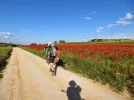
Myy blog reminds me there were fields after fields of red poppies with green crops all around. It’s one of my strong Levante memories — green fields blowing in the wind and huge poppy fields.

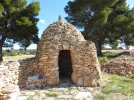
And I learned a word in French that has stuck with me — bourris, a mortar-less beehive hut. These date from centuries past when there was a lot of livestock grazing in these parts. Now it is all fields of grain.

In Chinchilla we stayed in one of two trucker stops on the highway, because there is nothing (or was nothing) up in the old town. But it’s a glorious old town, so if you want a rest day, this is a good place for one.
 

Attachments

  • BC03ED03-D2C1-49A7-AF79-985A7C429990.webp
    BC03ED03-D2C1-49A7-AF79-985A7C429990.webp
    77.4 KB · Views: 18
  • AB6FCA9C-7DF3-4550-9B7B-5A62CEF9E0DE.webp
    AB6FCA9C-7DF3-4550-9B7B-5A62CEF9E0DE.webp
    59.7 KB · Views: 15
  • 0718D7C3-6A9B-4B50-9AAE-F4F1C8B99BDB.webp
    0718D7C3-6A9B-4B50-9AAE-F4F1C8B99BDB.webp
    50.7 KB · Views: 15
  • EB113931-35B0-4F76-8A4D-1EAEE7A9661D.webp
    EB113931-35B0-4F76-8A4D-1EAEE7A9661D.webp
    76.3 KB · Views: 16
  • 0E76EF78-0F4F-4EEE-BBA6-65B1ABB766F6.webp
    0E76EF78-0F4F-4EEE-BBA6-65B1ABB766F6.webp
    53.4 KB · Views: 15
  • 13762A6F-E713-4065-81D7-4DD5A4DA6CD2.webp
    13762A6F-E713-4065-81D7-4DD5A4DA6CD2.webp
    102.6 KB · Views: 15
In Chinchilla we stayed in one of two trucker stops on the highway
I have tried, without success, to find information about the trucker stops. All that I could find was that Hostal El Volante appears to be closed, while Restaurante El Volante is still open. I hope that this closure is a temporary result of the pandemic, but I think it probable that some of the many locations suffering financial losses will not re-open.
 
There is apparently also now lodging up in the old town of Chinchilla, looks very nice.That’s where I would go now if I had the opportunity!

I don’t know which place we stayed in, but there were two on the highway coming into town on the Camino, and they were right next to each other. We stayed in the second one. I can’t imagine that both will close due to whatever recession is coming, but I would not be surprised if one ot them did. Truckers will keep on driving, and they will keep on needing places to stay.
 
The one from Galicia (the round) and the one from Castilla & Leon. Individually numbered and made by the same people that make the ones you see on your walk.
Thank you for all the information!
I know you're all fast walkers ☺ ;), but I'm not in Chinchilla de Montearagón yet 😜
 
Good, all good. We will behave. 😇
We're sitting around the table in Hoya Gonzalo jumping ahead already to the next place.

So it turns out there is a bar at the pool. Anyone?

And looking at places to eat in HG, it looks like there are duelling restaurants in the plaza - the Cafe-Bar Lucimar and the Cafe-Bar Marin...with the CafePub Nuevo right around thr corner. People mention Snails in their reviews as being very nice. Ummmmm.... 🤔
 
3rd Edition. Vital content training & pack guides avoid common mistakes, bed bugs etc
Thank you for all the information!
I know you're all fast walkers ☺ ;), but I'm not in Chinchilla de Montearagón yet 😜

OK, Let’s go back to Hoya de Gonzalo. :)

The albergue looks very nice!

And to eat, you have Café Bar Lucimar, and then there is the Cafe Pub Nuevo. I would roll the dice and pick the Lucimar, since anything with a ”pub” in the title is likely to be more into mixed drinks than good food.
 
We're sitting around the table in Hoya Gonzalo jumping ahead already to the next place.
So are we! Mind if we join you at your table? :)

So it turns out there is a bar at the pool. Anyone?
Yep, count us in! Anything to help relax those leg muscles...

I would roll the dice and pick the Lucimar, since anything with a ”pub” in the title is likely to be more into mixed drinks than good food.
I had the same thought!!!
 
Please.
Have a seat!

So the snails were at the pub.
The Marin and the pub have the most reviews; the Lucimar has only two reviews, and looks like a much smaller place. Which could be a good thing.
 
Train for your next Camino on California's Santa Catalina Island March 16-19
Does anyone know if there is anywhere in the village to buy food? The albergue seems to be set up with a kitchen, but I don't see any food shop.
 
Ideal pocket guides for during & after your Camino. Each weighs only 1.4 oz (40g)!
Does anyone know if there is anywhere in the village to buy food? The albergue seems to be set up with a kitchen, but I don't see any food shop.
In Hoya-Gonzalo, there are two bakeries, a cheese shop and a butcher shop. I believe there is a grocery store, but I couldn't find it on any map.
 
Not on mine, either, @Albertagirl, but there is one back in Higueruela. I find two panaderia, one pharmacy, a carcineria and a cheese shop. (The albergue is kitty-corner to the pool, by the way, which is a bonus.)
 
Perfect memento/gift in a presentation box. Engraving available, 25 character max.
Hoya Gonzalo is a very small place, so I would not have too many expectations. But in my experience, it is not infrequent for the carnicería (butcher shop) to carry a few non-meat items (cans, jars, pastas, etc), but its hours seem to be morning only.

And according to the ayuntamiento’s webpage, the three eating places list “tapas” but not meals. You won’t starve, but if you want a real meal, bringing food from Higueruela is probably the best bet.

For those with a sweet tooth, at least one of the panaderías has a wide selection of pastries.
 
But in my experience, it is not infrequent for the carnicería (butcher shop) to carry a few non-meat items (cans, jars, pastas, etc), but its hours seem to be morning only.
yes, when I went to buy at the butcher shop they had other products tan their speciality, but only packed or canned, no fresh vegetabes.
post scriptum: if closed for the time it is, why not try to ring the bell and explain we are a pilgrim arrived late...?

the three eating places list “tapas” but not meals.
I had a meal at the bar Marín

I was going to send some pictures of the albergue, but I see that in the ayuntamiento’s webpage, indicated by Laurie there are pictures enough.

I have to confess I have no memory of Hoya Gonzalo
Don't you remember this Santiago cruceiro:
 
Last edited:
The village has a municipal albergue, and in the same building, a casa rural, the Casa del Médico. The Amigos' accommodation list also has the Casa Rural Don Gonzalo
Information I pictured in 2018:
Hoya Gonzalo DSC_0079.JPGHoya Gonzalo DSC_0080.JPG

I think this is your tracks, @JLWV :
Yes, it's mine.
Do not forget the note in the text: I forgot to initiate the GPS when leaving Alpera, so you have to add 2 km at the indicated distancy.

So, should we plan a second night in Chinchilla when we'll get there?
Well, Chinchilla is to be seen, but may be one and a half day is much. Depends at what time you arrive there.

I am noticing some discrepancies between the two
Yes, discrepancies on distancies are usual (John Brierley speaks about that in at least one of his guides). It appears that start and end points of measurements are not always center of cities/villages. There are also some changes, due ones, or 'pirate' others. I join a table of distancies measured with GPS on real walk, by Aurelio (AB), myself (JLW), others pilgrims, from Wikiloc's uploads.
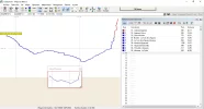
In the last column I indicated some of the AACS distancies obtained by:
- downloading the tracks of the association
- loading them in Ozi-Explorer
- opening the window 'Track Control'
I have only indicated the first ones, so you can play with this very pleasant OZI application.
OZI-Explorer.png

the 20th stage (San Martín de Valdeiglesias – Cebreros) indicates that the distance is 14.27 km in the title of the page, but 17.2 km in the profile diagram,
A few years ago our way always passes by the "Toros de Guisando", an archeological and historical place, but lastly this monument is not free visit, and has opening hours that not always are OK for us, so it is possible to short the way going directly. See the map 20.1 I also join.(Sorry, to heavy, not admited by the forum)
 

Attachments

Last edited:
Join the Camino cleanup. Logroño to Burgos May 2025 & Astorga to OCebreiro in June
I am so enjoying this camino, and am taking refuge in mirror neurons. Seriously...whether we're walking or just thinking about it the same neurons are firing.
From https://www.frontiersin.org/articles/10.3389/fpubh.2016.00094/full
Whether one moves or one is planning to move or thinking about someone else moving, overlapping neural networks are activated.

Of course...sigh..like @C clearly I wish we were all out there physically.

This is the only exception, where the consequences of imagined indulgence are much better than the real thing 😇 ~
For those with a sweet tooth, at least one of the panaderías has a wide selection of pastries.
I'm seriously bread deprived and that photo makes me salivate. But there's no risk of weight gain, no matter how long I gaze at it. 🤣😎
 
I am so enjoying this camino, and am taking refuge in mirror neurons. Seriously...whether we're walking or just thinking about it the same neurons are firing.
From https://www.frontiersin.org/articles/10.3389/fpubh.2016.00094/full
Interesting! That's an article I am going to read on our next rest day ☺

Of course...sigh..like @C clearly I wish we were all out there physically.
I'll join my sigh to yours, @VNwalking , our lockdown in Melbourne has been extended by two weeks...
 
Get a spanish phone number with Airalo. eSim, so no physical SIM card. Easy to use app to add more funds if needed.
See the map 20.1 I also join.(Sorry, to heavy, not admited by the forum)
Here is the map after transformation to jpg. Less quality but readable.
GR239 20 1 San Martin - Cebreros.jpg
The way by Toros de Guisando is the orange line. Shorting possible by N403. Both routes are pavement.
 
Last edited:
For those with a sweet tooth, at least one of the panaderías has a wide selection of pastries.
I'm seriously bread deprived and that photo makes me salivate. But there's no risk of weight gain, no matter how long I gaze at it. 🤣😎
Right, it's time we got moving again, and burned a few calories gained from those lovely pastries! ;)

Day 14: Hoya-Gonzalo to Chinchilla de Montearagón

The walk today, 17.7 km, completes the official 7th stage of the Levante.
This is how @peregrina2000 described this stage in her blog:
I am sure no one would describe Saturday´s walk to Chinchilla as majestic but it was glorious.
My visual image is of field after field of a bright shocking green, halfway between lime and emerald, punctuated every so often by huge blobs of bright red poppies and a number of beehive huts. These huts, which date from the 18th and 19th centuries, were built of stone layered carefully without mortar in successively smaller concentric circles.
Those beehive huts are called cucos in this area. They served generally as shelters for shepherds, and are also found in parts of southern France, where they are called bories, or caselles.

It's an easy flat-ish walk, so we should have enough time to visit Chinchilla after our arrival. This is also a town on @JLWV 's list of towns with castles, and this castle, as well as the rest of the town, looks like it's worth visiting:

Go and check the photos @peregrina2000 has kindly shared earlier. And if we need more time, we can also extend our visit tomorrow morning before leaving. (In real life, Rachel and I would probably take a rest day here)

The Amigos' accommodation list includes a note about a municipal albergue:
A new albergue is forecast for 2020, check on www.vieiragrino.com
It lists otherwise Hostal el Peñón, Hostal el Volante, which are both on the highway coming into town, one of these being possibly where @peregrina2000 stayed in 2013, as well as another 3 private places. The tourism website for Chinchilla has a few more, and includes one that attracted attention earlier in this thread, the Hotel La Posada de Chinchilla. Nice! Very nice! ☺
An interesting lodging is Casa cueva del Alfarero (Cuevas del Agujero). It appears in the video above, the dwellings with the funny white chimneys, which are caves dug out of the rock. It reminds me of the Sacromonte in Granada. I don't think it is available for an overnight, though, but it wouldn't hurt to ask, I guess.

There are a number of options for eating, according to the Chinchilla tourism website. El Rincón Manchego looks nice, what do you think, @VNwalking ? ☺

Now, before I go to bed, I have to ask what @peregrina2000 meant with this:
As we compared my maps with the terrain we saw, it looked like the next day´s walk was going to take us on a long useless meander. So we checked in with the police office, and the officer not only told us exactly how to get out of town more quickly, but she also took us there to make sure we saw it with our own eyes.
Is the useless meander just getting out of town?
 
Is the useless meander just getting out of town?

As someone who goes to the camino for the purpose of doing a lot of “useless meandering,” I am surprised that I used those words. :D But looking at the maps that came with my Levante guide, I figured it out. If you look at the screenshot of the Levante maps, you will see that the route marked heads off (in light lime green) circumventing the town on the left side, then turns at about 10 o’clock after going under the A-1, in and then heads away from the camino before zig zagging to get to the N-430. Even when we walked, the route had been re-marked with arrows, so I am sure it is no trouble now.
 

Attachments

  • D6F3441A-6E81-4393-8BEB-4237C1E3B89E.webp
    D6F3441A-6E81-4393-8BEB-4237C1E3B89E.webp
    1.4 MB · Views: 31
Fail to prepare? reduce your risk by buying this book full of practical info.
2nd ed.
As someone who goes to the camino for the purpose of doing a lot of “useless meandering,” I am surprised that I used those words. :D
😂

Even when we walked, the route had been re-marked with arrows, so I am sure it is no trouble now.
Thank you for the explanation. The tracks that are available on the Amigos' website show the new, more direct, track.
 

❓How to ask a question

How to post a new question on the Camino Forum.

Featured threads

❓How to ask a question

How to post a new question on the Camino Forum.

Featured threads

Forum Rules

Forum Rules

Camino Updates on YouTube

Camino Conversations

Most downloaded Resources

This site is run by Ivar at

in Santiago de Compostela.
This site participates in the Amazon Affiliate program, designed to provide a means for Ivar to earn fees by linking to Amazon
Official Camino Passport (Credential) | 2024 Camino Guides
Back
Back
Top