• ⚠️ Emergency contact in Spain - Dial 112 and AlertCops app. More on this here.
  • Remove ads on the forum by becoming a donating member. More here.

Search 74,075 Camino Questions

Bruma Albergue

Sagalouts

RIP 2015
first of all thanks to John and the Confraternity of st James for the full and concise guide to the Camino Ingles,and because of the guide we have the phone number of Carmen and Benino,but will the Bruma albergue be open the first week in february when Rosie and I walk the camino ingles?
we don't feel our camino would be complete without a stay at a albergue.
also is there such a thing as a free lunch at the Santiago Parador with this camino and do we just turn up at the front door?
We had intended staying there our last night but a mixture of the falling pound against the euro and history student daughter needing money for a college trip to Poland as put paid to that idea :(
sorry to rabbit on but any recomendations for good hostals in central santiago would be much appreciated.
can't believe how much this dour Yorkshireman is looking forward to next week.
"Blue skies nothing but blue skies from now on" :D
http://sagalouts-theroadtonowhere.blogspot.com
 
The focus is on reducing the risk of failure through being well prepared. 2nd ed.
The Airas Nunes Hotel on Rua do Vilar is very nice, it's about 60€ + iva a night with a good cafe next door.
Enjoy your Camino.
 
Hi, Sagalouts,

I walked the Camino Ingles in September, and though we didn't stay in Hospital de Bruma, I did stop in the albergue for a chat with the hospitalero. I didn't specifically ask him whether the albergue was open year round, but his comments to me about winter pilgrims and how there's always a burst around New Years suggest that it is open. I believe that he lives right in town because as I was walking towards the albergue he rode past me on his bicycle with the key, so he must have seen me walk in. If for whatever reason the albergue is closed, though, Meson do Vento is a few short km and there is a pension and a hotel there. Can't wait to hear about your February walk!

Laurie

And p.s. I don't know how much you want to spend on accommodations in Santiago, but the Hotel Costa Vella is an old favorite of many members. I also like the Entrecercas and the Tafona do Peregrino -- these are all small, old stone buildings. For a budget alternative, I've stayed in the Pension Linares, which is close to a favorite restaurant of mine (Bodega San Roque) and about halfway between the cathedral and the bus station, so it's walkable to both. (I'd recommend the http://www.turgalicia.es website to find information on all the many accommodations in Santiago).
 
A selection of Camino Jewellery
just talked with a pilg who is walking the Frances back to home in Holland. He did the ingles to start, and stayed at Bruma right around the New Year. He said there were two other pilgrims there when he stayed, and they all froze to death without any heat. "But otherwise it was fine!" (bring along some food though.)
 
We are planning (the two of us and the daughter who speaks spanish!!) to walk the Ingles from A Coruna leaving on March 2. I have been having a lovely time choosing cheap hostals tonight.
The Pension Palacia in A Coruna sounds wonderful for Monday night.
Then Pension Alba on Tuesday.
Then Albergue Hopital de Bruma, Wednesday
then Hostal Miras Thursday,
then I was thinking of the Albergue Seminario de Menor (sorry, notes are downstairs so I may not have spelt all these right!) in Santiago for Fri and Sat, before flying home on Sunday. (No cancelled flight emails from Ryanair yet!)

Will we need sheet sleeping bags for the Albergues? Or something warmer if it was cold?
Rebekah Scott said:
and they all froze to death without any heat.

We arrive about mid afternoon on Monday at Santiago Airport. The airport website says there is a Ryanair bus which will drop us near the train station, and I see there are plenty of trains to A Coruna. Does that sound right? Or will the Ryanair bus be shockingly expensive when a local one would do just as well?

I can't afford to spend too much more time planning this, as the wedding plans are crawling ahead (golden shrugs to finish, bridesmaid dresses being made by the bride not completed yet, the bride's cloak which I rashly proposed for warmth is not even begun, and then theres all the begging and borrowing of tablecloths, crocks etc, the planning, shopping, ordering and preparing of the food, ....and THEN theres the question of just where these dear babies I mean young adults are going to live because they're terrified of committing themselves to the rent and........)

DEEP BREATHS

You can see why we will need to leave all that behind after the wedding and just walk. Our weekly training walks (with packs full of tinned tomatoes) in the Brecks (central East Anglian district of sandy soils and famously contorted pine trees, used to be full of rabbits, now instead rather a lot of USAF bases - Lakenheath, Mildenhall etc) are our life saver at the moment.
 
Wow.
Do not think about albergue and bus details now. You have too many other things to consider. In March you won´t have many problems with overcrowded buses, I think, and Ryanair buses are usually very reasonably priced. Just bring your standard lightweight sleeping bag (or whatever you usually use) and you will be fine. If it´s cold just put on more clothes, or cuddle up!

Neither the Ryanair bus nor the albergue at Hospital de Bruma can compare to a Golden Shrug.

Relax. It´s going to be fine.
Deep breath.
Those "babies" are going to step right up and be downright Adult when they need to. I´ve seen it myself. (I´ve been it myself!)
God bless you both.
Reb.
 
Train for your next Camino on California's Santa Catalina Island March 16-19
Hi all

Sorry I've just notice this.

Sagalouts - Buen Camino! But make sure you have your raingear packed I see from the five day forecast for A Coruna that rain is predicted - but that has happened to me and I got very little rain. Good luck.

The albergue at Bruma will be open - on the rare occassions they go away they make sure everything is ok. As as has been said there is the option of just walking up the road to Meson do Vento.

It will still be cold in the evenings February/March but I agree that I wouldn't take a sleeping bag for just one night - put all your clothes on if needs be!

Food at Bruma - the local restaurant delivers and the sign is on the notice board in the albergue. Carmen and Benino won't let you down and may drive you to the supermarket if you wish to cook.

Free meals in the Parador in Santiago - the CSJ says:

On arrival, pilgrims present their Pilgrim Passports, duly stamped at each of their halts along the way, at the Cathedral's Pilgrim Office, and apply for the Compostela, the traditional certificate in Latin confirming their completion of the pilgrimage. It also entitles them (provided they are among the first 10 in the queue) to three free meals a day for three days in the staff quarters of the Hostal de los Reyes Católicos, now a parador, but formerly the pilgrim hospital established by Ferdinand and Isabela as a thank offering for the final recovery of Spain from the Moors in 1453: the pilgrims' right to hospitality has survived the change in the status of the hospital.

Brigit and Peter - I think the best option might be just to get the airport bus from Santiago airport to the bus station - where it stops. There you can get the regular bus service to A Coruna - a link to the timetable is in the guide:

HORARIOS
Autobus Santiago de Compostela A Coruña
Por A-9 Autopista Santiago de Compostela - A Coruña
Laborables:
A las 7, 8, 9, 10, 11, 12, 14:30, 15:20, 16, 17, 18, 19, 20, 21 y 22:30 horas

Sábados:
A las 9, 10, 11, 12, 13:00, 15:20, 16, 17, 18, 19, 20, 21 y 22:30 horas

Domingos y festivos
A las 10, 12, 13, 15:30, 17, 18, 19, 20, 21, 22 y 22:30 horas

Por Carretera Santiago de Compostela A Coruña

Laborables:
A las 6:30, 8, 9, 10, 11, 12:30, 14, 15:30, 16:30, 18, 19:30 y 21:15 horas

Sábados:
A las 8:30, 10, 14, 16:30, 18, 19:30 y 21:00 horas

Domingos y festivos
A las 8:30, 12, 14, 18, 19:30 y 21:15 horas

Solo vieres laborales o víspera de puente y domingos o días de fin de puente: 22:00

Santiago: will be quiet at this time. A real option is to arrive, leave your luggage somewhere ( with Ivar? or in the Internet cafe round the corner from the pilgrims office) and then just walk around and find a place that suits you. But there are lots of recommendations in other postings.

Brigit and Peter - I'd value your help in getting details of the location of the church in Sigras and perhaps a photograph. Maybe we can chat nearer the time or on Saturday :)

Good luck all.

John
 
I was there in early October, and yes it was cold in the Kitchen/dining room.

But the dormitory is on two floors, with an electric wall heater on each floor and an open staircase between the two floors. Both heaters were on, and I slept upstairs - so I was, in effect, heated by two heaters. The couple who had slept downstairs said it was cold.

I remember going to bed with shirt and socks on as well as my normal boxer-type underwear thinking it would be cold, but the shirt and socks came off in the night as I was soooooooooo warm. I was in a lightweight sleeping bag (about 500g)

So, you know where to sleep!!

Enjoy yourselves
Mike
 
hi all
thanks for all the info
I don't want to stress you out anymore bridget and peter but according to the home page I was on the albergue seminario de menor is closed till march 31st (hope I'm wrong)
http://www.albergueseminariomenor.com/reservas.php (one of sils 2008)
we are looking at the pension Costa Azul Santiago -double room 25 euros, but will leave all that till we get there (Rosie likes to barter)
plus ryan air have links on their site to hostals in santiago from 15 euros a head (doubles and triples)
I also think john is right about the bus
Now chill 8) stand back they may surprise you.
will try not to muddy the path to much and maybe we will leave some Victory V's at Bruma for you
Ian and Rosie
 
The focus is on reducing the risk of failure through being well prepared. 2nd ed.
JohnnieWalker said:
I'd value your help in getting details of the location of the church in Sigras and perhaps a photograph
is there some doubt?? It's here http://maps.peterrobins.co.uk/e.html?zo ... 655&mark=y
I have some photos if they're any use. One of the front, one of the fine calvary opposite, and one which was supposed to be the curious little box hedges round the graves with a view over the valley in the background, but which didn't come out very well, as the foreground is dark, and the background over-exposed. :-(
 
Peter - you're the one who pointed out that the Guide doesn't mention it! Possibly because either I wasn't looking or the route has altered. Either way I am sure Brigit and Peter will solve the riddle :)
 
Train for your next Camino on California's Santa Catalina Island March 16-19
Hi John,

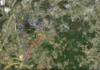
See the attached image from Google Earth. Place Marker 1 is Hostal Alba and Marker 2 is the church at Sigras. The red route indicates the directions in the new guide whereas the blue is the route in the old guide. Basically the difference is walking straight on (red route) at Hostal Alba (the slight diagonal deviation on the red route is due to discrepancy in the photography overlay as it is actually KSO), or a very sharp right (blue route) at Hostal Alba which joins up with another variation of the route a few hundred metres before the church at Sigras. As you can see going via the church adds a couple of kms to the route but it is through country lanes (the first since leaving Coruna) and gives the opportunity to see the church at Sigras and the Shrine of St. Anthony. Both routes converge just before crossing the Autovia and branching off towards Anceis.

This area is really where the suburbs of Coruna end and the countryside begins.

Regards
Mig
 

Attachments

  • Sigras2.webp
    Sigras2.webp
    142.6 KB · Views: 2,594
Hola Miguel

This is most helpful. I followed directions and carried straight on at the Hostal Alba then at the top of the hill veered left at the sign to Anceis. Hence the discrepancy in the guide. Any chance you could look at the new guide at http://www.csj.org.uk/guides-online.htm and give me word directions to the church and then onto the route again? I take it that it isn't waymarked?

Thanks

John
 
The one from Galicia (the round) and the one from Castilla & Leon. Individually numbered and made by the same people that make the ones you see on your walk.
As I've discussed with John, the route via Cambre is not the official route. Pat and Francis decided to recommend going that way because they considered the official route on the Camino Real had been spoiled by the construction of the poligono at Alvedro. The Xacobeo guide http://www.xacobeo.es/index.php?idMenu= ... idIdioma=3 says:

"passing by the seafront promenade of Burgo, the Romanesque church of Santiago and the mills of Acea de Ama. It then proceeds to Alvedro and, after crossing the medieval bridge over the Valiñas river [what Pat called the 'dear little bridge' in her original notes], it enters the municipality of Cambre.
The visitor follows the Royal Way in Xira towards Sigrás, passing by the Romanesque church of Santiago de Sigrás. Take a little time to visit the de church of Santa María de Cambre (12th century) which preserves a “jug from the wedding at Cana”."

In other words, going to Cambre is a detour (quite a lengthy detour if you go from Sigras).
 
Train for your next Camino on California's Santa Catalina Island March 16-19
Peter/Miguel

This is becoming clearer :) Since you have both been there I'd value your advice.

Since it is a detour from the route described in the Guide is it worth treating it as such and describing in detail how pilgrims get there and rejoin the route later- just as with San Miguel de Breamo on the Ferrol arm of the route?

If so then we should incorporate detailed directions. Miguel can you help? Or perhaps Brigit and Peter can be persuaded to take the detour and notes! :)
 
Happy to find the answers to specific questions - does anyone have a reasonably large scale map we could borrow? Maybe you could fill us in at the AGM tomorrow?
 
Re: mapping for Corunna branch

I've set up a provisional map at http://maps.peterrobins.co.uk/e/ingles.html based largely on John's description in the guide. Using a screen capture program is the best way of getting a hard copy if you want one, but it's rather a laborious process. I'm sure there are shops in Corunna where you can buy maps, but I don't have any specific info.

When I get some time, I would like to go back to the Corunna end and explore the various options. Specific questions I would like answers for are:
- is the 1st detour via Eiris correct? Sadly, there's a gap in the online mapping at this point.
- what's the exact line of the route along the 'seafront promenade'? I have guessed at this. I would assume this is more attractive than marching along the main road
- I have marked both the route via Cambre and what I guess is the official route via Almeiras and Xira, but is this latter the waymarked route or does that go somewhere else?
- I expect the marked route at Alvedro/A Silva goes straight to the main road, but I've suggested going over the top via the castro, as that would avoid a bit of road-walking. Does this track on the map actually exist?
- From Xira, I think the route I've marked is correct.
- At As Travesas (just before the jcn with the Ferrol route), I've marked the old route across country, but John reports this is now hopelessly overgrown, so I've also marked the route round by the road (IMO, if the old track is overgrown, the Xunta should get its act together and clear it).
- have I got the jcn with the Ferrol route in the right place?
- just after this, the tracks are not marked on the maps - have I got the route correct?
A bit further along, the route is marked on the maps with the red scallops, and I think this is correct as far as Sigueiro. The only question I have is at San Xulian de Poulo where the map shows the route going round the church. Is this correct? It seems odd for the route to bypass the church.
- at Sigueiro itself, I've marked the old route, but from John's description the waymarked route no longer follows this. It would be good to have an up-to-date line
- from Sigueiro, the red scallops on the map show the old route along the main road, but leaving this at A Sionlla and heading down to San Marcos - I'd be interested to know whether this latter bit is waymarked
- I couldn't follow John's description from where the marked route leaves the main road at A Sionlla de Abaixo and heads up to Monte Formaris, and no track is marked on the map. Where is the line of this?

Answering all these questions is probably more for people like me who like exploring things, and aren't too bothered whether they actually get to Santiago or not. :-) But if you (or anyone else) can resolve anything, that would be good.
 
The one from Galicia (the round) and the one from Castilla & Leon. Individually numbered and made by the same people that make the ones you see on your walk.
Re: CSJ guide

JohnnieWalker said:
Peter/Miguel

This is becoming clearer :) Since you have both been there I'd value your advice.

Since it is a detour from the route described in the Guide is it worth treating it as such and describing in detail how pilgrims get there and rejoin the route later- just as with San Miguel de Breamo on the Ferrol arm of the route?

If so then we should incorporate detailed directions. Miguel can you help? Or perhaps Brigit and Peter can be persuaded to take the detour and notes! :)
IMO, the guide should follow the official marked route. By all means, give recommended alternatives where appropriate, to visit churches, accommodation, whatever, but the marked route should be the main focus. Personally, I cannot see the point in going round via Cambre; it's a couple of km longer with no great advantages, apart from visiting Sta Maria - but is this going to be open? Ok, so the poligono, or 'Parque Empresarial' as the IGN rather grandly calls it, is probably not too attractive, and probably makes a mockery of the 'dear little bridge', but it's only a few hundred metres, and you can look the other way if you don't want to look at it.
 
Hi John,

Here are directions for the diversion through Sigras. Sorry, I can't remember if there was a Panaderia at the junction but the road is virtually opposite the Hostal Alba.

Just before the Hostal Alba, turn sharp right (4 o'clock positon as you walk up the hill). Take the second turning on the left (325m from the junction) and proceed up a hill on a minor road. At the top of the hill you reach a grass mound in the centre of a minor road junction. It has a cruceiro on it and it is also the point where it joins the "official" route from A Xira (judging by Pete Robbins mapping page) and waymarking certainly becomes more plentiful. At the grassy mound, take the left road and continue up the hill passing a shrine (to St. Anthony) on your LHS. A further 125m up the hill and on the RHS is the church of Santiago de Sigras. The church was closed when I passed by.

After the church, continue up the narrow road. There are houses on either side. At a V junction bear left and 40m later turn right. The road continues for 600m until a cross roads with houses on each corner. Continue straight across and follow the road for a further 400m until you eventually pop out on the main road at a junction. A yellow arrow on the road directs you to bear left and cross the junction following the signpost to Anceis. You have now returned to the "direct" route up the hill from the Hostal Alba. Cross over the motorway by a bridge and take the slight left towards Anceis.

I've attached a Google Earth (.kmz) file of the route from A Coruna to Santiago which can be downloaded and opened in the Google Earth application. It is basically the route I walked last May which took in both Cambre and Sigras, however I've added both the route indicated by Pete Robbins through Alvedro and A Xira and also the direct continuation past the Hostal Alba that you indicate in the guide. At As Traviesas I actually continued along the road all the way to Meson Do Vento (I stayed in Hotel Canaima that night so I could watch Liverpool in the Champions League!). I've therefore tried to map the route to the Albergue at Bruma using the directions in the new guide and Pete Robbins map. The rest of the route is as I walked it and, as far as I can make out, as per your directions in the new guide. I hope it is of use to others.

Pete, I haven't got the answers to all your questions but here are a few...

San Xulian de Poulo - The waymarked path does bypass this church
Sigueiro - The waymarked path cuts off the road just after the industrial units and passes through a newly sculptured park.
A Sionlla de Abaixo - the route runs parallel to the main road from here on a small track. It then turns right at the first factory unit at the Poligono de Taimbre running alongside the factory until it reaches a crossroads (your routing also comes to this same crossroads). Waymarking then sends you left here back towards the factory units, your routing turns right towards Garabal.

I hope these make sense (they should do in conjunction with the Google Earth file) but let me know if you want further info.

Regards
Mig
 

Attachments

Miguel

This is perect. Thanks. Perhaps Brigit and Peter could use these directions to check out the detour to the church and get some pics. In the meantime I will add this detour to the guide.

San Xulian de Poulo - the route bypasses this church as you say but you can see it off to your right - I will check this out myself in April and add it to the guide.

Muchas gracias.

John
 
3rd Edition. More content, training & pack guides avoid common mistakes, bed bugs etc
miguel_gp said:
I've attached a Google Earth (.kmz) file of the route from A Coruna to Santiago which can be downloaded and opened in the Google Earth application. It is basically the route I walked last May which took in both Cambre and Sigras, however I've added both the route indicated by Pete Robbins through Alvedro and A Xira and also the direct continuation past the Hostal Alba that you indicate in the guide. At As Traviesas I actually continued along the road all the way to Meson Do Vento (I stayed in Hotel Canaima that night so I could watch Liverpool in the Champions League!). I've therefore tried to map the route to the Albergue at Bruma using the directions in the new guide and Pete Robbins map. The rest of the route is as I walked it and, as far as I can make out, as per your directions in the new guide. I hope it is of use to others.


Wow! I know I could work this out if I studied all the posts and the guide but I should be working (the snow is my reason to stay at home to work today) so help me out, please, Miguel, Johnnie or Peter?
Miguel; is the blue your route, the green Peter's and the red the guide?
Which routes have the most metalled road?
Can someone give me a simpler account of the pros and cons?

I have only got to the Hostel Alba debated area yet, looking forward to studying it all in detail.

Lovely as Google Earth is, I really don't feel properly equipped until I have a map. Can someone tell me which maps we will need (the nearest equivalent to the OS 1:50,000, although I do know we are very fortunate in the quality of our OS maps)and where to get them from?

Ivar, I wondered if this could be something you could expand into - mail order maps for Camino routes -as part of your new business? I have found it hard to understand some of the big mail order map-sellers' web sites, or to find information about which maps would be most helpful for my purpose.
Also, when we bought french IGN maps via the web, the prices plus the postage were almost twice what we paid en route, even in a touristy shop in Vezelay! I would have thought you could provide a competitive service and still make a profit.
 
Ivar, I wondered if this could be something you could expand into - mail order maps for Camino routes -as part of your new business?
Maybe one day, for now I think I will focus on getting my current adventure right... :-)

It is a good tip though...

Ivar
 
Get a spanish phone number with Airalo. eSim, so no physical SIM card. Easy to use app to add more funds if needed.
I struggled to find a sufficiently detailed map(s) so in the end I took the old guide, which I scanned on to A5 pages and laminated and I also saved detailed images from Google Earth which I loaded on to my phone. Once I reached Sigras however (and had got over the novelty of using it!), I really had no need to refer to the phone again as the waymarks and guide were more than sufficient. As John says there is probably no need for a map apart from your own peace of mind.

Yes my (or rather the old guide's) route is that in blue, John's is the red and Pete's is the green, although I'm not sure if this is the official route or Pete's best guess at where it runs. I'm sure Pete will confirm. I didn't walk actually that way having gone via Cambre so can't confirm how well it is waymarked but as I said earlier from where it meets the Sigras diversion it was very well waymarked.

In terms of pros and cons for each route, Cambre road (blue route) is a fairly wide two and sometimes three lane road with a lengthy but not overly steep climb. After passing through Cambre there is a nice downhill section along a quieter tree lined road. You also cross the restored Pilgrim's Bridge just after the Church of Santiago de Burgo. It does add a couple of KMs though so you may want to take this into account, especially if walking through to Bruma on the first day. Based on Google Earth images the route via A Xira looks quieter traffic wise and narrower (once you've crossed under the Autovia) but it is nearer the airport and does pass close to some industrial\factory areas. If going via Cambre, I would recommend the Sigras detour at Hostal Alba as this is much quieter and I suspect prettier than the direct (red) route, although again slightly longer. I believe that all routes are completely on metalled road until at least Anceis.

I'm walking the Ferrol Branch at the end of May so looking forward to trying out John's new guide then.

Unfortunately, despite the snow, I have to return to work now but let me know if you want any further info and I'll try to help.

Regards
Mig
 
JohnnieWalker said:
no need for a map, honestly,

But I LIKE maps.

I look at them before I go and examine the contour lines. I get the shape of the countryside in my head. I consider where might be a pleasant picnic spot if the sun shines. I sit down en route to have a swig of water and a chocolate biscuit and I identify which village is over there, and which church tower I can see. When three cans come rushing up from a by-road I look to see where they might have come from. I like to track whether the stream we cross here is the same as the one we crossed there. When I write up our log in the evening the map reminds me which village it was where the old lady sat beside us on the bench outside the cemetery, or where the hairdresser had a funny name. I use a highlighter pen to mark our route. I can show it to a stranger who thinks we look like we are locals and asks us the way. (That happens to us everywhere. I think its the wire baskets on the front of our bikes).

It won't be very heavy, it won't fur up my arteries, it won't add too much carbon to the atmosphere.

My father did oceanographic surveys in the Indian Ocean, my maternal grandfather did ordnance survey, so it's genetic. One memory from my childhood is travelling with my friend behind her parents in the front seat of their car. He was driving and she was trying to navigate. The tension was mounting as she got her lefts and rights mixed up. Finally he snatched the map from her hands and threw it towards the back seat. 'Let Bridget do it' he said,'she can read a map!'

So indulge me, please, HELP ME GET A MAP.
 
Bridget and Peter said:
When three cans come rushing up from a by-road
cans? are you sure it's just water you're swigging?

If you go to http://www.ign.es/ign/en/IGN/Map_Ima_Co ... _det_1.jsp and click on the appropriate bit, those are the 1:50,000 sheets. Click on the square and it tells you the name of the sheet ('hoja') and the 4 component 1:25,000 sheets (they're produced from the same map base).

You can download the 1:50,000 sheets from the cartoteca, and I'm sure the IGN has a distributor in Corunna somewhere if you want the paper version. The tourist office can no doubt tell you where. The 1:50,000 ones cost about €4 apiece IIRC.
 
Holoholo automatically captures your footpaths, places, photos, and journals.
Thank you Peter.

I feel much better just having the numbers of the maps.

Perhaps its OCD - Obsessive Cartographical Desire.

Bridget

(I'm sure Peter would wish to disassociate himself from the appalling procrastination I've been doing today.)
 
Corunna branch mapping

Miguel

If you'd told me you were going to set up a Google Earth file, you could have used my data http://maps.peterrobins.co.uk/files/ingles.kml as a base - would have saved you some time!

Here's your file overlaid on IGN maps http://maps.peterrobins.co.uk/e/ingles_m.html - compare and contrast.
I'm afraid it takes a while to load, as GE has recorded each of those yellow icons separately, even though they're all the same icon. Makes the file about 3 times larger than it needs to be!

It's a bit out in places, but otherwise looks good. I presume the km markers are as calculated by GE, and not official Galician marker stones?

You mark 'start of consistent marking' at Sigras - is there any marking at all on the road via Cambre?
Just after the station at Cambre, you show the road going straight as opposed to the map. I notice on the aerial photos, it looks like construction work going on. Have they straightened the road here?
If you want to go from Cambre to Sigras, it's a long way round via the Hostal Alba, which was why I suggested taking the direct lane from Sigras de Abaixo (unless you want to stop at the Hostal, of course). John, if you want a description of the route to Sigras from the Hostal, take a look at Pat & Francis' guide :-)

A couple of other points on the pros and cons of going via Cambre. Even if going via Alvedro, it's worth the short detour to Santiago do Burgo, and from there it's only another short detour over the old bridge to look at Sta Maria do Temple - some 300m there and 300m back - tho I'm afraid these are 2 more churches that are rarely open apart from when services are being held. Also, Alvedro airport is not very busy, so there's not many flights to disturb the passing walker. When I walked this, long before there was any marking, I took the road running parallel to the N550 then the left turn to San Xulian de Almeiras, where there is (or was) a little shaded area with benches where you could picnic in good weather. There is a bar/restaurant called Casa German at the x-roads at Xira. I don't know which is now the official route, but the roads through Almeiras and Xira/Sigras are nice quiet little lanes. At least when I walked it, as I recall, the track over the old bridge at Xira was not tarmac, and if there is a track over the hill by the castro at A Costa that is also not tarmac. There are also supposedly good views from the castro. Against that, you have to set the dull bit along the main road by the poligono.

Miguel, to give you some background on the mapping. We've been having some talks in the CSJ about combining these online maps with John's new guides, and we thought the Camino Ingles would make a good pilot project to try things out. I have set up the start of a facilities/points of interest file in a Google Spreadsheet at http://spreadsheets.google.com/pub?key= ... VPk2YCLBBA This is read dynamically by my map program to determine which icons are put where on the map. Storing things in a file like a GE file is ok when only one person maintains it, but it gets complicated if you want several people to be able to edit/change it. At the moment, my route is in Google Earth format (kml), but I'm thinking of moving that to a spreadsheet too, as that's also simpler to maintain. So, if it's ok with you, I will combine our two routelines, and copy the many placemarks you have entered in your file to the spreadsheet. Then we'll have a good lot of data as a demo for what can be done. I'm thinking that anyone can get a copy of part or all of the data, either in GE format, or in GPX for loading into a GPS device.
 
Peter Robins said:
John, if you want a description of the route to Sigras from the Hostal, take a look at Pat & Francis' guide

Yes I was aware of that and with Miguel's excellent directions the "detour" will now be fully described in the Guide.

I also think that the on line mapping is a tremendous development - thanks.

Regards

John
 
Train for your next Camino on California's Santa Catalina Island March 16-19
Ok here it is. Peter and Miguel you've both been here is this correct?

Detour to the Church of Santiago de Sigras

Just before the Hostal Alba, turn sharp right (4 o'clock positon as you walk up the hill). Take the second turning on the left, 325m from the junction, and proceed up a hill on a minor road. At the top of the hill reach a grass mound in the centre of a minor road junction. It has a cruceiro on it and it is also the point where it joins the "official" route from A Xira and waymarking becomes more plentiful. At the grassy mound, take the left road and continue up the hill passing a shrine to St. Anthony on your Left. The shrine is dated 1815 with the legend round the edge, “Si buscas milagro, mira” i.e. “If you are looking for a miracle, look!” KSO for another 125m up the hill and on the Right is the church of Santiago de Sigras which is nearly always closed. To the left of the church is a dilapidated pilgrim hospital. There is a fine 18th century Calvary nearby. The west front of the church has a stone inset saying Re-edifase el año de 1500. From the outside a stained glass roundel depicting Santiago Matamoros can be seen. From the graveyard behind the church there are good views of the surrounding hills. Many of the graves are surrounded by low clipped box hedges.

After the church, continue up the narrow road. There are houses on either side. At a V junction bear left and 40m later turn Right. The road continues for 600m until a cross roads with houses on each corner. Continue straight across and follow the road for a further 400m until you eventually come out on the main road at a junction. A yellow arrow on the road directs you to bear left and cross the junction following the signpost to Anceis. You have now returned to the "direct" route up the hill from the Hostal Alba. Cross over the motorway by a bridge and take the slight left towards Anceis.
 
A selection of Camino Jewellery
Pete,

Yeah if only I'd known! I set most of this route up about this time last year when planning the walk. I then came back in May and corrected the bits which I'd obviously interpreted wrongly from the directions in the guide and added the green\red routes having been inspired again by this thread. You are of course more than welcome to use any of the data contained within the file. KM markers are measured in GE not from official waymarkers.

In terms of waymarks on the Cambre route, I think they were non-existent. The last waymark I definitely remember was just before Culleredo which indicated a left turn down towards the sea front road (AC211). However, waymarking disappeared quite quickly and I ended up cutting through a set of apartment blocks to get on to the AC211. With hindsight, the old guide actually tells you to carry on a little further before taking a left towards Burgo but it eventually met the route I had taken at Villa Lucinda. The next waymark I recall (although that's not to say there weren't any) was at the point I state "start of consistent waymarking". That said the route through Cambre is pretty straightforward without waymarking.

After going through Cambre and passing the RENFE station the road does now go more or less straight up to Alba, I simply followed the directions in the old guide. I recall the road bridge over the river there looking relatively new so maybe there has been some construction here. After crossing the bridge there was a turning to the left which ended abruptly at the river, this looks in GE as though this used to be the bridging point and possibly why your route appears to cross at that point (unless there was an element of wading involved!).

Cheers
Mig
 
Re: Corunna branch mapping

miguel_gp said:
In terms of waymarks on the Cambre route, I think they were non-existent.
yes, that's what I thought. I'm pretty sure the route via Cambre was a Pat Quaife special which has never had any official standing
miguel_gp said:
The last waymark I definitely remember was just before Culleredo which indicated a left turn down towards the sea front road (AC211). However, waymarking disappeared quite quickly and I ended up cutting through a set of apartment blocks to get on to the AC211.
yes, this seems to be the common experience. As the xacobeo guide specifically mentions the 'seafront promenade', I'm willing to bet (well, I'll bet a beer anyway) that the official route (and any waymarking) does not follow the road but crosses the railway and continues along the estuary path.
miguel_gp said:
After going through Cambre and passing the RENFE station the road does now go more or less straight up to Alba, I simply followed the directions in the old guide. I recall the road bridge over the river there looking relatively new so maybe there has been some construction here. After crossing the bridge there was a turning to the left which ended abruptly at the river, this looks in GE as though this used to be the bridging point and possibly why your route appears to cross at that point (unless there was an element of wading involved!).
Google's satellite imagery is obviously more recent than the Spanish aerial survey and clearly shows this new bridge http://maps.peterrobins.co.uk/google.ht ... layers=0BT (the road map still shows the old road, as on this hybrid view). The imagery also clearly shows a new riverside path, so I would suggest anyone coming from Cambre and wanting to go to Sigras should use this path - shorter and more pleasant than going on the road via Hostal Alba. It would be good if someone could check this out.

The new route through Sigueiro is also clear on Google's satellite imagery.

Re Poulo, I see the old guide mentions a cut-through to the church from the marked line. It would be good to hear if anyone has used this in recent years to visit San Xulian (even if the church is rarely open).
 

❓How to ask a question

How to post a new question on the Camino Forum.

Most read last week in this forum

Hey I am just trying to put together a Camino for my family (2 adults & 2 kids <10). I am thinking of doing the Camino Ingles in the Easter holidays next year. Currently researching ferry times V...
@Peterexpatkiwi and a few others have mentioned this place on the Ingles, and a know a few folks are planning an Ingles Camino so I though I would share the tip. Just a place with a real buzz and...

Featured threads

❓How to ask a question

How to post a new question on the Camino Forum.

Featured threads

Forum Rules

Forum Rules

Camino Updates on YouTube

Camino Conversations

Most downloaded Resources

This site is run by Ivar at

in Santiago de Compostela.
This site participates in the Amazon Affiliate program, designed to provide a means for Ivar to earn fees by linking to Amazon
Official Camino Passport (Credential) | 2024 Camino Guides
Back
Back
Top