Search 74,075 Camino Questions

Brierley Guide - Misguided? Caminha to Valenca / Tui

Michael Mattalo

Grateful for My Life
Time of past OR future Camino
See My Signature
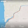
So ... we left Caminha this morning seeking the route along the Minho River. We followed the Brierley guide precisely getting to the way markers. BUT, the markers did not take us to or along the river at all but rather on a wild adventure leading east over the N13 and winding up and down 100m elevation changes until Villa Nova de Cerveira. The strange thing is this path is well marked with lots of official Camino shells and arrows BUT is not even mentioned in the Brierley guide. Has anyone else had the same experience and can anyone offer any suggestions? Did we miss something? For reference, here is the link to my Strava that tracks my movement and you will see the route taken, elevation changes and distance travelled. Sure glad tomorrow is a rest day in Tui. Buen Camino. Michael

https://strava.app.link/RLDFwGJx5Z1568827412477.webp
 
Perfect memento/gift in a presentation box. Engraving available, 25 character max.
From the Casa Gwendolin at Villa nova de Ceveira we were told there was a walk that followed the river but the way-marked route goes slightly inland and apparently is shorter. We took the shorter option, got off piste a couple of times on a busy main road , never saw the river then found our way to Valencia and on to Tui.
The previous day had been unbearably hot , we walked to Caminha and then took a train to Villa Nova de C. Other pilgrims arrived later at the Casa having done your inland route and walked many kms.
 
Last edited:
A route has been marked but Brierley from memory uses a cycle path that runs by the river. The cycle path is not marked as a camino route but is very easy to follow once you get onto it. The cycle path is part of an ecopista route that runs past Valanca to Monção. But the ecopista doesn't reach Caminha but starts somewhere round Seixas. Unfortunately the ecopista/ecovia is not on Google maps but it was on maps.me app.
 
Join the Camino cleanup. Logroño to Burgos May 2025 & Astorga to OCebreiro in June
Okay. Thanks. I just wonder why Brierley would not have included the actual waymarked path on his guide? We would have planned our day much differently had we known the actual route we Would follow. We couldn’t even find reference in the guide to get to the river at all even though the guide features this route. In Villa Nova de Cerveira, we just followed our instincts towards the river as the waymarked way again would have taken us inland.
 
Thanks for all this info. Now I understand why we found that walk a bit strange.
 
I also missed this new flat route and went up and down those hills that went on forever. The Brierley book does mention how to get there. I knew where I needed to go over to the left about 2.9 km after leaving Caminha. Right after the cemetery and across from the BP gas station you turn off left and are along the river. Of course I needed coffee and a bathroom so I went straight, as the village of Seixas was just ahead. I asked how to get back to Camino and they pointed across the street to where the church was and all the yellow arrows. Unfortunately, this was the old, hilly route. Just stay on the far left side near the river and don’t go to right side of road. Brierley guide has it but the wording is confusing. The hilly route is at least 5km longer and more up than down. The gas station is the key. Head off to the left on the other side of the road from it.
 
Join the Camino cleanup. Logroño to Burgos May 2025 & Astorga to OCebreiro in June
There are a couple of spots where the riverside path spits you out onto the road, to get around marsh and/or private property. Usually a few hundred metres later you are past the obstruction and you can go back to the river. It's a lovely and easy walk.
 
It was easy to miss if you hadn’t “read” the Brierley guide stage. We went up and down by the church, were sad the pilgrim cookie stop was closed and got out google earth. We followed the Camino down and then crossed the road and over the railroad tracks to the ecopista. I think the key is not to ask for the Camino, rather the ecopista “river trail”
 
Last edited:
We did that route 3 years ago and bailed on the last mile, walking on the road instead. It was too hot to go up and down AGAIN.
But, it's a beautiful way to go, dont you agree?
 
...and ship it to Santiago for storage. You pick it up once in Santiago. Service offered by Casa Ivar (we use DHL for transportation).
Does anyone here have a tracking of the waymarked not too hilly connection route from Caminha to Valenca? I have found this gps file - does that look right to you? https://www.wikiloc.com/hiking-trails/02-caminha-valenca-caminho-de-santiago-novembro-2019-43448339
That looks like it takes you up the hill in Seixas. Just before Seixas you need to be on the left side of the road and follow the river. If you go to the church and follow the arrows from there it sends you up the hill.. Cross back over to the other side of the street.
 
We noticed the waymarked path after Caminha going up but before we heard in our hotel that following the Ecopista footpath along the river was a better option and so we did .
 
...and ship it to Santiago for storage. You pick it up once in Santiago. Service offered by Casa Ivar (we use DHL for transportation).
We made that mistake and went up by the church. We hardly saw the river!!
 
Nexr time, we'll know what to do!
 

❓How to ask a question

How to post a new question on the Camino Forum.

Featured threads

❓How to ask a question

How to post a new question on the Camino Forum.

Featured threads

Forum Rules

Forum Rules

Camino Updates on YouTube

Camino Conversations

Most downloaded Resources

This site is run by Ivar at

in Santiago de Compostela.
This site participates in the Amazon Affiliate program, designed to provide a means for Ivar to earn fees by linking to Amazon
Official Camino Passport (Credential) | 2024 Camino Guides
Back
Back
Top