• ⚠️ Emergency contact in Spain - Dial 112 and AlertCops app. More on this here.
  • Remove ads on the forum by becoming a donating member. More here.

Search 74,075 Camino Questions

LIVE from the Camino BP starts from Málaga, June-July 2022

Bad Pilgrim

Veteran Member
Time of past OR future Camino
Yes
Hello again,

I will be walking the Mozárabe from Málaga. I took the AVE train from Cuenca to Málaga (via Madrid) yesterday. (I stopped my Camino de la Lana in Cuenca.)

I arrived to Málaga late in the evening yesterday. I had to stay at a youth hostel *gasp*: Hostal Málaga Centro, 27 euros. I had time to do the laundry and see the cathedral - that's it!

I will post a little something at the end of every stage.

I plan to walk to Mérida. (From Baena I know my way, since I already walked the Mozárabe from Almería.)

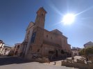
It was too late in the evening to take decent pictures. (My cellphone needs sunlight). A bad photo of the cathedral in Málaga is all I have!

More to come!
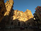
DSC_1275_copy_1600x1200.jpg
 
€2,-/day will present your project to thousands of visitors each day. All interested in the Camino de Santiago.
Buen camino, I did that part up to Baena en January on a T-shirt, it was BEAUTIFUL!!! I want to go back soon, it is peaceful and the Antequera region is fantastic, buen camino!
 
Day 1: Málaga - Almogía, 21 kms

Wow. This is not the Camino de la Lana. To make a long story short: I ran out of water. The walk to Junta de los Caminos was easy, then murderous mountains appeared. Beautiful views and I could see all the way back to the Mediterranean, but I couldn't enjoy it as my water supply dwindled. But I have only myself to blame.

Albergue donativo is five-star. A municipal albergue with AC? that works?? Impressive. You don't need to pass by the Ayuntamiento: walk directly to the albergue and call one of the three numbers on the wall. The hospitalero might not answer due to bad reception. The people at the nearby restaurante-hostal told me to try after 3 pm. But I reached him a bit earlier. There are no rooms at the nearby hostal anymore (I had to ask, didn't I...) and I don't know about other alternatives. Nothing appears on Booking.

Tomorrow: Villanueva de la Concepción.

DSC_1276_copy_1000x750.jpg
 
Perfect memento/gift in a presentation box. Engraving available, 25 character max.
If you are staying in Antequera, there is a restaurant in the bull ring where you can eat under the stars in the ring itself. There are also a number of exhibits inside too, though not to my taste.

Locally-sourced (!) beef is on the menu.
 
Join the Camino cleanup. Logroño to Burgos May 2025 & Astorga to OCebreiro in June
Train for your next Camino on California's Santa Catalina Island March 16-19
Day 2: Almogía - Antequera, 34 kms

Yes, you read that right. When I got to Villanueva de la Concepción I felt I had more to give, so why not continue? I am in the bar next to the church in Antequera now, waiting for the priest to give me the keys to the parrochial albergue (5 euros).

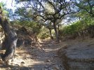
The walk from Almogía was hard at first. It was still dark when I descended the gullies/slopes and the woods. I do not recommend doing this too early: wait until daylight.

The terrain slowly got easier the nearer I got to Villanueva. But the dogs...! I stopped counting them. Unchained and coming towards me from one farm after another. If there was a fence, they would crawl under it. A family of four swarmed around my legs for a quarter of an hour and although they were cute, I almost tripped over them.

Cute also the turtles that I saw from the bridge before Villanueva. Turtles are less aggressive and don't come running at my calves...

Waymarking: We are not amused. But I don't feel like explaining. It will be in my summary at the end of the journey.

From Villanueva there are 7 kms uphill, which feels like 117 kms. Then of course the walk towards the cliff(s) El Torcal and the peculiar landscape shaped by the rocks. The descent from the cliff is brutal, especially on a 30+ stage (with added kms where I went wrong, or lost time because I thought I went wrong).

My feet were bruised and battered when I entered Antequera, otherwise I feel fine.

The doors of the albergue were wide open when I arrived. But God forbid I should leave my backpack in there. They use it as a sort of storage room and they are preparing something for the church this evening. I can't use it until the priest arrives. I asked if I could at least leave my shoes in there and put on my sandals (since my feet were dead). The guy snorted at me: "Do it quickly then". Ah, the hospitality of parrochial albergues. How I have missed it.

Antequera is a monumental, beautiful town. I know most pilgrims will do a shorter stage to be able to explore what is to see there. As for me, I have been walking all day... Oh well, it is what it is and I seldom take rest days. Tomorrow? I haven't even checked the maps yet...

To be continued!

DSC_1297_copy_1000x750_1.jpg
 
Last edited:
Get a spanish phone number with Airalo. eSim, so no physical SIM card. Easy to use app to add more funds if needed.
Day 3: Antequera - Villanueva de Algaidas, 24 kms

Easy walking between Antequera and Cartajoal (11 kms). The rock that looks like a face - El Indio - guides you all the way. First on tarmac, then on a country road between olive groves, and occasionally sunflowers. Many cyclists, many people walking their dogs in the morning.

In Cartajoal I had the best breakfast ever in the bar Casa Caro. Toasts as the size of toilet lids, a trough of butter and jam, a café con leche large enough to drown in. All this for 2.60 euros! Caro = expensive?? They should change the name of that bar...!

From Cartajoal to Villanueva de Algaidas (13 kms) it is first uphill 6 kms but the inclination is barely noticable until the end of that stretch. Then abrubtly downhill, passing 2 milliaria from Roman times. There is a fountain dedicated to the Mozárabe before entering Villanueva, at the gates of one of the fincas! I wish more landowners would build fountains along the way!

Municipal albergue is donativo or ,"you don't pay anything at all" as Mr Policeman told me when he handed me the keys. Keys at: Ayuntamiento, Policía local or the Bar Pedro. Phone number for these places are easy to find online. There was also a list with albergues to come and their phone numbers in the albergue in Almogía, and I snapped a photo of that list.

I haven't been to the albergue yet. I hope standard is ok. Parrochial albergue in Antequera yesterday actually had a fridge. And AC (a portable one, standing on the floor). But I never checked if it worked. I hope there is some luxury here as well... I will be back when I have investigated the albergue.

Update: albergue is fantastic: fully equipped kitchen, fridge, clean. No washing machine though and there is no laundromat in town. Right now there are two Italians living there who volunteer at the school. So not only pilgrims use it. And there is a donativo box: as it should be, because this is too good to be free.

I tried to take pictures of the albergue but they ended up to dark. This one will have to do:

DSC_1301_copy_1000x750.jpg
 
Last edited:
Oh I just didn't carry enough water. I forgot to check the elevation before I started: that should have given me a hint. I still make those mistakes...
This was one of my concerns at the start of the CP this year. I was regularly drinking three litres during the walking day, then perhaps another litre in assorted beverages at the end of the day.
 
Hello again,

I will be walking the Mozárabe from Málaga. I took the AVE train from Cuenca to Málaga (via Madrid) yesterday. (I stopped my Camino de la Lana in Cuenca.)

I arrived to Málaga late in the evening yesterday. I had to stay at a youth hostel *gasp*: Hostal Málaga Centro, 27 euros. I had time to do the laundry and see the cathedral - that's it!

I will post a little something at the end of every stage.

I plan to walk to Mérida. (From Baena I know my way, since I already walked the Mozárabe from Almería.)

It was too late in the evening to take decent pictures. (My cellphone needs sunlight). A bad photo of the cathedral in Málaga is all I have!

More to come!

View attachment 128436
I will be looking forward to your posts. I plan on walking first week of October.
Bien camino,
Donna
 
Ideal pocket guides for during & after your Camino. Each weighs only 1.4 oz (40g)!
Day 4: Villanueva de Algaidas - Lucena, 34 kms

From Villanueva to Cuevas Bajas (10 kms) it is basically up a hill among the olive groves and down again. There is a mozarabic ermita right outside Villanueva, but I didn't see much of it in the darkness...

In Cuevas Bajas a waymark at the church pointed me in the wrong direction. The same thing happened at bar Eros in Encinas Reales. Not the painted arrows, that can be open for interpretation, but the official mosaics on the walls. The arrow is in the wrong direction. I lost time, especially in Cuevas Bajas, running like a headless chicken around the church without knowing how or where to get out of town.

The Camino ascends also after Cuevas Bajas, but on tarmac this time, and reaches Encinas Reales (6 kms). Encinas Reales doesn't look that interesting from the outskirts, but it has a modern and pretty center and the church is beautiful.

You better like olive groves because from Encinas Reales to Lucena there is nothing else for 20 kms. I felt as if it went uphill all the time! And finally: the mother of all industrial suburbs. This one made the entrance to Cuenca feel like Disneyworld in comparison.

My guidebook says there is an albergue at the old train station (at least on that street). There are no other details about it online: no phone number, no instructions about the keys... And when I noticed that the street is far away from the center of Lucena, and that I was walking out in the godforsaken industrial suburbs again, I said: NO! Never!! And in a heartbeat I booked a room at the hotel Al Yussana in the center of Lucena. It cost me 42 euros. I gladly paid the price instead of being trapped out there the rest of the day, or spending the evening running after the keys...

My grumpy mood is due to a painful blister that I have developed since the descent from El Torcal two days ago. I now have to erase every post I have ever written that "I never get blisters"... Today's 34 kms were especially hard because of this. It drained me of all energy. My fault: this wouldn't have happened if I hadn't done Almogía - Antequera in one go. This evening I made an effort to go to the laundromat and to buy food. I just want to lock myself in at the hotel and sleep...

Today's picture: the church in Encinas Reales.

DSC_1305_copy_1000x750.jpg
 
Last edited:
€2,-/day will present your project to thousands of visitors each day. All interested in the Camino de Santiago.
I am enjoying your posts. I am planning to walk it but not sure about the best starting point. Does anyone have any suggestions?
 
The focus is on reducing the risk of failure through being well prepared. 2nd ed.
Day 2: Almogía - Antequera, 34 kms

Yes, you read that right. When I got to Villanueva de la Concepción I felt I had more to give, so why not continue? I am in the bar next to the church in Antequera now, waiting for the priest to give me the keys to the parrochial albergue (5 euros).

The walk from Almogía was hard at first. It was still dark when I descended the gullies/slopes and the woods. I do not recommend doing this too early: wait until daylight.

The terrain slowly got easier the nearer I got to Villanueva. But the dogs...! I stopped counting them. Unchained and coming towards me from one farm after another. If there was a fence, they would crawl under it. A family of four swarmed around my legs for a quarter of an hour and although they were cute, I almost tripped over them.

Cute also the turtles that I saw from the bridge before Villanueva. Turtles are less aggressive and don't come running at my calves...

Waymarking: We are not amused. But I don't feel like explaining. It will be in my summary at the end of the journey.

From Villanueva there are 7 kms uphill, which feels like 117 kms. Then of course the walk towards the cliff(s) El Torcal and the peculiar landscape shaped by the rocks. The descent from the cliff is brutal, especially on a 30+ stage (with added kms where I went wrong, or lost time because I thought I went wrong).

My feet were bruised and battered when I entered Antequera, otherwise I feel fine.

The doors of the albergue were wide open when I arrived. But God forbid I should leave my backpack in there. They use it as a sort of storage room and they are preparing something for the church this evening. I can't use it until the priest arrives. I asked if I could at least leave my shoes in there and put on my sandals (since my feet were dead). The guy snorted at me: "Do it quickly then". Ah, the hospitality of parrochial albergues. How I have missed it.

Antequera is a monumental, beautiful town. I know most pilgrims will do a shorter stage to be able to explore what is to see there. As for me, I have been walking all day... Oh well, it is what it is and I seldom take rest days. Tomorrow? I haven't even checked the maps yet...

To be continued!

View attachment 128518
I would not like to face the amazing descent to Antequera with all the previous climbs between Almogia, then Villanueva de la Concepción, then even higher to Torcal. I loved this part early in a winter morning, but it looked very different to a blazing summer afternoon like you did. Antequera is worth a long stop, indeed! And, yes, there are quite a few dogs. This camino, in the first two stages is surprisingly hilly, at the end of the day, the climbing adds up to quite a lot, really, and the descent to Antequera can be tricky on heavy legs!
 
Day 5: Lucena - Doña Mencía, 26 kms

Lucena is a large town with its own Casco historico - The old town - worth exploring. That is where my hotel Al Yussana is located. And there I was yesterday, restricted to my room, unable to move because of my blister. So whatever charm there is to Lucena, I missed out on it.

The guidebook says the Camino starts from the old railway station in Lucena. So there must be an albergue there after all. But I had no intention of entertaining my blister with the industrial suburbs in the morning. I checked the maps for the shortest way to connect with the Camino from Al Yussana. I made my own way through town, and I soon joined the Vía verde - the disused railway - and the arrows.

The Camino follows the old railway through Cabra (13 kms) all the way to Doña Mencía (13 more kms). The rails have been replaced with an asphalted road, but there is a shoulder with a dirt path/gravel if you would prefer that. Very popular with cyclists, joggers and people walking their dogs in the morning. No cars - what a relief!

The Vía verde doesn't enter Cabra, but I veered off a few hundred meters into town to have breakfast. To join the Camino again I went through the old railway station of Cabra and continued towards Doña Mencía. These 26 kms were extremely flat. I think that was the best thing that could have happened to my blister. This morning I could hardly stand on my feet; after after a few hours on the Vía verde it felt ok. Asphalt is what I do best! Still, I have been stomping on that darned blister for 26 kms today. I think tomorrow will be crucial: if it is getting better, or if I have to call it quits.

In Doña Mencía the staff at the Ayuntamiento informed me that the parrochial albergue is closed since the Covid pandemic. They don't know if or when it will open again. They directed me to a pensión around the corner: La Casa Morejón (15 euros). I was so happy there was a room for me! The nice lady and her son could easily have charged more for a room as decent as this; probably 20-25 euros. But maybe I got a pilgrim discount.

Now a siesta and I hope my blister will heal...

Picture of the day: The Vía verde as it starts from Cabra. Choo-choo go!

DSC_1313_copy_1000x750.jpg
 
Last edited:
I am enjoying your posts. I am planning to walk it but not sure about the best starting point. Does anyone have any suggestions?

That depends. To avoid mountains, start in Antequera. But then you would miss out on the mountain views. With shorter stages it is absolutely fine to start in Málaga. Or do you mean that you are thinking about starting from Almería or Jaén?
 
Ideal pocket guides for during & after your Camino. Each weighs only 1.4 oz (40g)!
I would not like to face the amazing descent to Antequera with all the previous climbs between Almogia, then Villanueva de la Concepción, then even higher to Torcal. I loved this part early in a winter morning, but it looked very different to a blazing summer afternoon like you did. Antequera is worth a long stop, indeed! And, yes, there are quite a few dogs. This camino, in the first two stages is surprisingly hilly, at the end of the day, the climbing adds up to quite a lot, really, and the descent to Antequera can be tricky on heavy legs!
Wise words. I would do it differently if I was to walk it a second time. I now understand why the first suggested stage in my guidebook is to Junta de los Caminos: to shorten the difficult stretch to Almogía.
 
Last edited:
Day 6: Doña Mencía - Castro del Río, 29 kms

To Baena: 1 hard km to climb to get out of Doña Mencía, with dogs barking from the darkness around me. Then mostly downwards to Baena (8 kms) among the olive trees.

In Baena I would join the Mozárabe coming from Almería so I was excited to get there. I remembered the nice square Plaza España where the routes merge, and how I had to walk up and down a slope between the municipal albergue and the rest of town, which I found annoying...

Everything looked the same as four years ago. Even the bar next to the square, El Primero del Día, still wasn't open at 8 in the morning in spite of its name (First One of the Day). Last One of the Day would be more appropriate, as virtually every bar in town was open except them. I gave the evil eye to the laziest bar in Baena and proceeded to the bar Casa Juani, right on the Camino, to have breakfast.

From Baena to Castro del Río (20 kms) there is a dirt road among the olive groves at first, but the rest is all on tarmac. In Castro del Río I passed by the albergue, next to the church, but it has bad reviews on Gronze and I have never stayed there. Now that I am on the Camino coming from Almería there is information of each stage on Gronze. (There is no information on Gronze about the Camino between Málaga and Baena, except for rudimentary maps.)

I stay at hostal A Ka La Sole (25 euros) for a second time. It is in the outskirts of town, but a quick walk takes you back to the town's centre. The Camino passes right next to the hostal: you can see the arrow on the lamp post in front of the bar of the hostal.

Tomorrow I have to choose between going to Córdoba directly (39 kms) or in two leisurely stages (20-something kms each). I have already walked through Espejo and Santa Cruz so I would like to reach Córdoba in one day. My blister is... stable. I think I will give it a try.

Picture of the day: a typical street in Castro del Río.

DSC_1318_copy_750x1000.jpg
 
Last edited:
Day 1: Málaga - Almogía, 21 kms

Wow. This is not the Camino de la Lana. To make a long story short: I ran out of water. The walk to Junta de los Caminos was easy, then murderous mountains appeared. Beautiful views and I could see all the way back to the Mediterranean, but I couldn't enjoy it as my water supply dwindled. But I have only myself to blame.

Albergue donativo is five-star. A municipal albergue with AC? that works?? Impressive. You don't need to pass by the Ayuntamiento: walk directly to the albergue and call one of the three numbers on the wall. The hospitalero might not answer due to bad reception. The people at the nearby restaurante-hostal told me to try after 3 pm. But I reached him a bit earlier. There are no rooms at the nearby hostal anymore (I had to ask, didn't I...) and I don't know about other alternatives. Nothing appears on Booking.

Tomorrow: Villanueva de la Concepción.

View attachment 128439
Buen Camino. Good luck and Godspeed. I miss that part of the world.

Samarkand.
 
Ideal sleeping bag liner whether we want to add a thermal plus to our bag, or if we want to use it alone to sleep in shelters or hostels. Thanks to its mummy shape, it adapts perfectly to our body.

€46,-
Day 7: Castro del Río - Córdoba, 39 kms

I woke at 4 am and started to walk at 4.30 in an attempt to avoid the sun as much as possible. From A Ka La Sole you turn right and pass in front of the Guardia Civil. Then you choose: to go left towards Espejo (and Espejo is a very nice town!) or straight ahead towards Córdoba. I walked straight ahead - and into a compact darkness. The dogs went crazy as they heard my steps, and one or two porch lights turned on along the way. If my flashlight had failed me I would have had to sit down on the spot and wait for dawn. I couldn't see a thing around me. No moon either, so I could at least watch the stars and the Milky Way above me.

I joined the carretera for a while, then turned left onto a smaller road. There was a lot of ups and downs the first 10 kms, and this would go on all the way to Córdoba. Although the slopes would eventually get more stretched out and therefore easier to conquer. After about 20 kms I joined the route coming from Espejo and Santa Cruz, and I recognized the scenery from four years ago: endless fields, often with sunflowers, slope after slope after slope... Not a drop of water. No shadow. I sat down once under an olive tree to drink.

I chose the longer alternative only to challenge myself. Of course it is easier to walk through Espejo, stay the night in Santa Cruz, and then have a shorter second day to reach Córdoba. Gronze has all the information you need about these towns and where to stay.

There were conflicting waymarks at two places. I believe it means you can go in whatever direction: they merge later on, I think. The second one was tricky though. It is no use explaining as I didn't take a picture of the spot... If you have printed maps, and Google Maps, you can still find your way. I checked the maps to figure out where to go, and found the arrows later on. I do not recommend walking a stage of 39 kms in isolation without a guidebook or maps: the waymarking is not that good all the way.

On my way into Córdoba I stopped in pilgrim-friendly bar Francis: the first one in almost 40 kms... What a relief. I was amazed that I had survived this arid stage. I was also sure I would never do it again 🥵!!

I stay in hostal La Fuente, 30 euros. I booked it yesterday, on Booking, to be sure I had a place when I arrived. As far as I know there is no albergue de peregrinos in Córdoba. But when I went through the newspapers in bar Francis there were three pages about the Mozárabe, its significance and that the politicians want to focus on it to attract more people to the region. They named a building that they want to convert to an albergue, but I don't remember the name. I don't remember the name of the newspaper either so I can't link the article. I may edit this later.

I have been to the Mezquita and to other places in Córdoba before. I will see if I have time to visit something later this evening. First of all, I have to pray at the sanctuary of Nuestra Señora de la Lavandería Automática: the spiritual center of every Spanish city.

Tomorrow? Tag along and you will find out!

Picture of the day: arrival to Córdoba.

DSC_1324_copy_1000x750.jpg
 
Last edited:
Wow.
You're chugging along, heat and all.
So do you get extra Napolitanos for managing that? I hope so.
Happily tagging along, looking forward to tomorrow.
 
Wow @Bad Pilgrim : what an achievement!

Hope La Fuente is quiet this evening?Wonderful patio but the accoustics of the place are quite something.

If you still have energy tonight , a quiet walk to the plaza de Capuchinos with the statue of Christo de los Faroles maybe? Lovely atmosphere.
 
...and ship it to Santiago for storage. You pick it up once in Santiago. Service offered by Casa Ivar (we use DHL for transportation).
Hope La Fuente is quiet this evening?Wonderful patio but the accoustics of the place are quite something.

Yes someone has been hammering on something inside the building every ten minutes now... No idea what that is about... And I suspect the LTRA (Loud Teenagers Rampage Association) to have their annual gathering nearby, maybe in this hostal... They follow me wherever I go...

If you still have energy tonight , a quiet walk to the plaza de Capuchinos with the statue of Christo de los Faroles maybe? Lovely atmosphere.

That sounds perfect. I will do that!
 
Wow @Bad Pilgrim : what an achievement!

Hope La Fuente is quiet this evening?Wonderful patio but the accoustics of the place are quite something.

If you still have energy tonight , a quiet walk to the plaza de Capuchinos with the statue of Christo de los Faroles maybe? Lovely atmosphere.

Edit: I went to the wrong place... Only I am capable of misreading a map like this.

I went to the Plaza de CapuchinAS, not CapuchinOS. But it was nice! I even entered the church, behind the statue, where a bunch of nuns were sitting in silence, along with a couple of other people. Praying? Meditating? Waiting for the priest to arrive? It was dead quiet in there, and I didn't know if I was intruding or not. Beautiful inside! But didn't think it was appropriate to take picture while they were doing nuns' stuff in there. I sneaked out in the patio. Very bad picture below. But it was cool and silent. Plants, candles and saints. Posters about organized pilgrimages to Santiago, to Jerusalem. I tip-toed back behind the quiet congregation and left the church.

Oh, Córdoba has a lot to offer but I need to sleep... 💤

DSC_1328_copy_750x1000.jpg
 
Last edited:
€2,-/day will present your project to thousands of visitors each day. All interested in the Camino de Santiago.
We just missed you in Cordoba, by a day, we’ve been doing a tourist thing post Lana. It was scorching hot, real mad dogs and Englishmen grade heat and they have an issue with their drains but we loved it. The teenager thing is happening all over Spain - seems to be high school graduation. The tourist office took one look at our backpacks and handed us brochures about the part of the Mozarabe that passes through Cordoba province, but only Cordoba province. Why do they do that? Don’t they get on? Anyway, Buen Camino and good luck with the next part.
D9E049DE-C726-460E-93DF-0B3CA77FF694.jpeg
 
Face it, BP, you are a magnet for raucous teenagers. Or maybe they read the forum and figure out how to get there just in time to torment you.

I can’t imagine being in Córdoba and not going into the Mezquita — how did you resist?

It was hard to resist the Mezquita. It was one of the reasons I wanted to return to Córdoba. But after 40 kms I had no time nor energy. I would have to do a lot of walking in there as well, and it felt impossible yesterday!

Next time I will walk from Santa Cruz instead of Castro del Río, to have more time in the afternoon in Córdoba. Now that I have tried both alternatives I know what suits me...
 
The 2024 Camino guides will be coming out little by little. Here is a collection of the ones that are out so far.
We just missed you in Cordoba, by a day, we’ve been doing a tourist thing post Lana. It was scorching hot, real mad dogs and Englishmen grade heat and they have an issue with their drains but we loved it. The teenager thing is happening all over Spain - seems to be high school graduation. The tourist office took one look at our backpacks and handed us brochures about the part of the Mozarabe that passes through Cordoba province, but only Cordoba province. Why do they do that? Don’t they get on? Anyway, Buen Camino and good luck with the next part.
View attachment 128808

Wow,

How nice to have time to explore Córdoba as a tourist...! If I took rest days I could do this as well. It is just something I am not used to. Beautiful picture - I am now convinced I have to come here again to visit the mosque!! I heard about the Medina Azahara (?) a bit outside the city that is being excavated. I would love to see that as well!

Starting from Jaén would give me a good reason to come back... 🤔!
 
Ideal sleeping bag liner whether we want to add a thermal plus to our bag, or if we want to use it alone to sleep in shelters or hostels. Thanks to its mummy shape, it adapts perfectly to our body.

€46,-
Day 8: Córdoba - Cerro Muriano, 18 kms

There are quite a few kms to get out of Córdoba. But there are no industrial suburbs. The Camino goes uphill on a rocky path - very rocky - amongst boulders and trees all the way to Cerro Muriano (18 kms). There are sections of a broad dirt road as well, but always more or less upwards... It is a pleasant walk though, as the Camino makes its best to keep you off-road. The only problem is the cyclists coming in full speed down the hill, sometimes just around the corner. I don't understand how you can ride a bike on this surface!

There is a restaurant as soon as you enter Cerro Muriano. I paused there for a while and thought about whether it would be possible to continue to Villaharta (21 more kms). But I restrained myself. I need a rest after the long stage yesterday, and had already phoned bar-hostal X (Equis) in Cerro Muriano to let them know I was coming. The hostal is closed on Fridays but the owner would come by and open it for me.

I stayed here four years ago so I am familiar with the mythical room nr 7 in hostal X. I ceremoniously accepted the keys with my trembling hands... A room decorated with Mozárabe maps, stamped credentials and photos from the Camino all over the walls. Spotlessly clean, bathroom looks like it is a hotel. 25 euros. There is an AC on the wall but I didn't get much of an air flow when I tried it? And a heater, for winter pilgrims.Wifi printed on the keys.

Cerro Muriano is a functional town along the national road but with enough facilities to keep a pilgrim happy. Tomorrow I go to Villaharta, where I will stay at the municipal albergue since the bar Mirasierra apparently doesn't have rooms anymore. There are more alternatives in Villaharta, but I thought it would be interesting to check out the albergue that has pretty good reviews on Gronze!

To be continued!

Picture of the day: part of the enchanted woods before Cerro Muriano.

DSC_1332_copy_1000x750.jpg
 
Last edited:
Day 9: Cerro Muriano - Villaharta, 21 kms

I slept in since it would be another short stage. I left Cerro Muriano, passed the military base El Obejo and at least hundred military vehicles of different sorts... The Camino follows the N-432 almost all the way to Villaharta. But it is off-road, on a dirt trail and sometimes on tarmac.

After 12 kms there is the small pueblo El Vacar, clutched to the motorway and therefore sprinkled with bars and restaurants. I think I never saw so many bars, restaurants and panaderías concentrated to one street. Last time I was here it was early Sunday or Monday morning and only one of them was open. This Saturday I was luckier. I had breakfast in one of them, a café con leche and a magdalena in another...

In the bar Acuario, the owner told me she has five rooms in the hostal. She also said that El Vacar was talking about having their own albergue de peregrinos: only the pandemic had thwarted their plans. Now the future of the albergue is uncertain. Unfortunately I don't think pilgrims will benefit from accomodation in El Vacar anyway. Villaharta is only 9 kms away, and you have to reach Villaharta in order to make the following stage to Alcaracejos (35 kms with nothing in between).

I had to phone the albergue in Villaharta yesterday, since it was friday, so that the guy would come by and hand me the keys when I arrived (orders from Gronze). The albergue is... Wow. It has everything. 10 euros is a steal any day of the week. No AC, but fans in the ceiling and that is all I need. You can't use the stove, that is the only thing not working. Fridge, micro-oven, washing machine and detergent, 3 dormitorios with 2 or 4 beds each. Two bathrooms. It used to be an apartment, so... you get the picture. The albergue opened earlier this year as the previous owners of the apartment retired and went back to Madrid. The beds in the dormitories look brand new. (- Edit: there is no wifi. But in the Biblioteca Municipal (library) there is wifi, and outside the Biblioteca. I found the password on an infoboard in the restaurante Mirasierra across the street.)

Tomorrow is a hard stage: 35 kms with no village until I reach Alcaracejos. It will be an early rise...

Picture of the day: Calle Posito in Villaharta where the albergue is located. The albergue is behind me, and I am facing the Ayuntamiento.

DSC_1335_copy_1000x750_1.jpg
 
Last edited:
The one from Galicia (the round) and the one from Castilla & Leon. Individually numbered and made by the same people that make the ones you see on your walk.
we'll be walking from Almería starting on 22 September.
Great news AJ !
Lucky you and your beloved. Buen camino. This thread will be very helpful. What will you both do on the long stretch that bad Pilgrim will be walking tomorrow. ? (Knowing you are the star researcher for shorter etapas)
 
Train for your next Camino on California's Santa Catalina Island March 16-19
Great news AJ !
Lucky you and your beloved. Buen camino. This thread will be very helpful. What will you both do on the long stretch that bad Pilgrim will be walking tomorrow. ? (Knowing you are the star researcher for shorter etapas)
As you know, we're not purists 😄
So our plan is to walk half way up to a place called Puerto Calatraveño. We'll call a taxi (Taxi Juan 600 05 94 94, listed in the Mozárabe guide) to take us to Alcaracejos. Then the next morning, he'll take us back to Puerto Calatraveño, and we'll walk the second half. And I know my darling will like this, because on the 2nd half, she won't have to carry a backpack ☺️

I have heard of people asking a taxi in Villaharta to take their backpacks to Alcaracejos, and they walked the whole stage with a light day pack. But 35km is really too much for my darling.

There is information about all the alternatives in the albergue, so no pilgrim needs to despair! There is the number of a taxi, yes, and also timetables for the buses in the area: back to Cerro Muriano/Córdoba, or forward to Alcaracejos for those who prefer to skip the stage. The hospitalero in Villaharta will explain this to you when you meet him! They are aware of the difficulties of the stretch and they are keen on keeping the pilgrims informed.

Already on the stage before, in Cerro Muriano, I am sure that the owner of bar X will tell you about it. He knows the owners of the restaurante Mirasierra in Villaharta, who previously provided the taxi service to Alcaracejos. (Don't know if they still are the ones who do it.)

According to the hospitalero in Villaharta a pilgrim needed to go to the hospital after a failed attempt to complete the stage, due to the heat, not long ago. So one has to be careful.
 
Last edited:
Day 9: Cerro Muriano - Villaharta, 21 kms

I slept in since it would be another short stage. I left Cerro Muriano, passed the military base El Obejo and at least hundred military vehicles of different sorts... The Camino follows the N-432 almost all the way to Villaharta. But it is off-road, on a dirt trail and sometimes on tarmac.

After 12 kms there is the small pueblo El Vacar, clutched to the motorway and therefore sprinkled with bars and restaurants. I think I never saw so many bars, restaurants and panaderías concentrated to one street. Last time I was here it was early Sunday or Monday morning and only one of them was open. This Saturday I was luckier. I had breakfast in one of them, a café con leche and a magdalena in another...

In the bar Acuario, the owner told me she has five rooms in the hostal. She also said that El Vacar was talking about having their own albergue de peregrinos: only the pandemic had thwarted their plans. Now the future of the albergue is uncertain. Unfortunately I don't think pilgrims will benefit from accomodation in El Vacar anyway. Villaharta is only 9 kms away, and you have to reach Villaharta in order to make the following stage to Alcaracejos (35 kms with nothing in between).

I had to phone the albergue in Villaharta yesterday, since it was friday, so that the guy would come by and hand me the keys when I arrived (orders from Gronze). The albergue is... Wow. It has everything. 10 euros is a steal any day of the week. No AC, but fans in the ceiling and that is all I need. You can't use the stove, that is the only thing not working. Fridge, micro-oven, washing machine and detergent, 3 dormitorios with 2 or 4 beds each. Two bathrooms. It used to be an apartment, so... you get the picture. The albergue opened earlier this year as the previous owners of the apartment retired and went back to Madrid. The beds in the dormitories look brand new. (- Edit: there is no wifi. But in the Biblioteca Municipal (library) there is wifi, and outside the Biblioteca. I found the password on an infoboard in the restaurante Mirasierra across the street.)

Tomorrow is a hard stage: 35 kms with no village until I reach Alcaracejos. It will be an early rise...

Picture of the day: Calle Posito in Villaharta where the albergue is located. The albergue is behind me, and I am facing the Ayuntamiento.

View attachment 128831

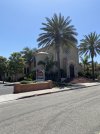
Spain looks just like Southern California.

Hermosa Beach, California.

About twenty minutes south of Los Angeles.
 

Attachments

  • 359EAFB1-8004-4D35-B49C-0B9431389EEE.jpeg
    359EAFB1-8004-4D35-B49C-0B9431389EEE.jpeg
    2.9 MB · Views: 76
€2,-/day will present your project to thousands of visitors each day. All interested in the Camino de Santiago.
Day 10: Villaharta - Alcaracejos, 35 kms

I woke at 4:30, but it was hard to leave my comfy bed and my humming fan... That was a five-star albergue. I tried to leave the apartment as tidy as possible for future pilgrims.

The 34-36 kms to Alcaracejos are hard but entertaining. Narrow trails meandering through the woods, or broad dirt roads. Only two stretches of asphalt: at the beginning when you leave Villaharta, and towards the end a few kms before Alcaracejos. Waymarks all the way, possibly even more frequent than four years ago.

Wild animals lurk behind every bush. I saw a group of deer - four big and a little one - a wild boar, vultures... but they were all gone before I could catch them on camera.

There are slopes to conquer almost all the way to Alcaracejos. The middle part is the worst, with monotonous ups and downs... Luckily the scenery is varied and said animals can appear at any moment to brighten up the day.

It was cloudy and cool until I reached the water fountain. Then it got unbelievably hot. Walking in other seasons should be much easier. But then there are river crossings that could get flooded.

The water fountain at Villa San Juan works perfectly. It appears on your left a little more than half-way to Alcaracejos. There is a shelter that looks like a bus stop next to it, and I sat down on a bench there for a while. If it is raining, it will be a nice refuge. But in sunny weather there is not much of a shadow in the shelter. It was getting hot and I carried on.

I stay in hostal Las 3 Jotas (18 euros) in Alcaracejos. It is not known to me what the three J:s (Jotas) stand for. Jabalí? Jamón? Jengibre? Who cares: they have AC! I will take a nap and rest my feet for a while. Then solve the food problem: it is Sunday and every shop I walked by on my way here was closed. Sunday on the Camino is hard. Sure, the restaurants will probably be open. But I would like to have something to nibble on in the morning.

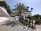
No picture of the day from the Camino. I didn't use my phone as I was concentrated on walking and only wanted to enjoy the scenery. I will see if there is something interesting in Alcaracejos later. - Edit: Photo of central Alcaracejos. Sorry, not so many interesting buildings here.

DSC_1338_copy_1000x750.jpg

Coming up next: Hinojosa del Duque!
 
Last edited:
The tourist office took one look at our backpacks and handed us brochures about the part of the Mozarabe that passes through Cordoba province, but only Cordoba province. Why do they do that? Don’t they get on?
The Portuguese do exactly the same thing. Seems to be a mixture of local loyalties plus the non-sensical way the tourism department's euros are split between the different regions.

Still, I don't know about your home town or whatever, but here in British Columbia, the same thing happens between towns/regions.

(Sorry for the diversion from topic, but definitely relevant to all the caminos/caminhos!)
 
The 2024 Camino guides will be coming out little by little. Here is a collection of the ones that are out so far.
Sounds like excellent but challenging walking, BP. I hope your days continue to entertaining, because when they are for you, they are for us too. Sans sweat and sore feet.

I tried to leave the apartment as tidy as possible for future pilgrims.
Thank you, thank you.

Maybe they already transfered to another city to wreak havoc
The sad thing about LTRAs is that in a few short years they turn into your doctor and your dentist.
 
Day 11: Alcaracejos - Hinojosa del Duque, 22 kms

Flat flat flat all the way to Hinojosa del Duque. I passed the cute towns of Villanueva del Duque and Fuente La Lancha which seem to be proud to be part of the Mozárabe, considering the statues, ornaments and decorations referring to the Camino. You stay on a dirt road close to the A-422 all the time. There is really no way to get lost. Only before entering Hinojosa del Duque there is half a km or so on the shoulder of the motorway.

Unfortunately Hinojosa del Duque has its fair share of industrial suburbs. Nothing like a large city, but it takes a toll on your feet when all you want is to get there. All of a sudden there is a nice park, with trees, fountains and a couple of cafés: perfect to sit down and celebrate my arrival. Random costumers wished me a Buen Camino. They informed me already about the much longer and difficult stage I will face tomorrow.

I stay at the albergue, around the corner from the Policía Local. Keys at the Policía Local in the same building as the Ayuntamiento. That's at the main square, next to the beautiful church San Juan Bautista. I hope the church is open later in the afternoon. I couldn't get inside last time I was here. The church is huge and looks like a cathedral: I would like to know more about it.

Mr Policeman told me the albergue is free. But there is a donativo box here. There is no fridge, in spite of Gronze saying so. There is excellent wifi, a clean bathroom, 8 beds, clean bedsheets, micro-oven and forks and knives, but no real kitchen. There is an AC that looks like a mix between a radio station and a nuclear power plant and that sounds like a combine harvester. There is very little water in the shower, just enough so you can clean up. No washing machine but there is a laundromat in town. The albergue is ok, I think. I can also recommend Pensión Ruda, 18 euros if you prefer to stay at a private accomodation.

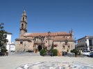
I need a siesta before breaking into the church! Picture of the day: the church in all its glory, a stone's throw from the albergue.

DSC_1348_copy_1000x750.jpg

Next episode: Monterrubio de la Serena.
 
Last edited:
Flat flat flat all the way to Hinojosa del Duque. I passed the cute towns of Villanueva del Duque
Thank you @Bad Pilgrim !
We're slow walkers, or distance challenged :), and I was thinking that if the 22 km was a tad too much for my darling (we'll see on the day), we might take a taxi from Alcaracejos to Villanueva del Duque. Would we be missing anything beautiful?
 
Holoholo automatically captures your footpaths, places, photos, and journals.
Thank you @Bad Pilgrim !
We're slow walkers, or distance challenged :), and I was thinking that if the 21 km was a tad too much for my darling (we'll see on the day), we might take a taxi from Alcaracejos to Villanueva del Duque. Would we be missing anything beautiful?

No, you would only miss 3 kms of countryside between Alcaracejos and Villanueva del Duque. But there is an albergue in Villanueva del Duque, so you can also stay there if you would like to!

Since you seem to be interested in the taxi alternative to split up the long stage between Villaharta and Alcaracejos, you could choose not to stay in Alcaracejos but walk on to Villanueva del Duque (+ 3 kms from Alcaracejos). I hope this makes sense... It would make your stages shorter. That is:

1) Villaharta
2 ) Taxi somewhere between Villaharta and Alcaracejos
3) Villanueva del Duque
4) Hinojosa del Duque
An excellent suggestion! ¡Gracias @Bad Pilgrim !
 
2 ) Taxi somewhere between Villaharta and Alcaracejos
If anyone is going to take a taxi on this stage, I would highly recommend walking the first part and getting picked up for the kms into Alcaracejos. Unless BP’s more recent experience tellsl me I’m remembering wrong, I remember the first part as being quite beautiful, and the last kms into Alcaracejos as being along the side of a road in the sun.

Alcaracejos does have several taxis, and I remember there was an obvious pick-up point at some road/highway crossing, but my memory is very fuzzy. BP, hoping you can help!
 
Train for your next Camino on California's Santa Catalina Island March 16-19
If anyone is going to take a taxi on this stage, I would highly recommend walking the first part and getting picked up for the kms into Alcaracejos. Unless BP’s more recent experience tellsl me I’m remembering wrong, I remember the first part as being quite beautiful, and the last kms into Alcaracejos as being along the side of a road in the sun.

I agree: the first part is the most beautiful. I also remember walking on the side of a road (asphalt) four years ago: the last 4 kms to Alcaracejos. But my memory is fuzzy too. This time, there was only tarmac for 1 km or so. The remaining 3 kms to Alcaracejos was on a country road! I don't know if the Camino has been re-routed since four years ago, or if I don't remember it correctly. Either way there is not much tarmac to talk about.

Alcaracejos does have several taxis, and I remember there was an obvious pick-up point at some road/highway crossing,

There are two. At 17 kms or 25 kms from Villaharta. I thought about the second one for @AJGuillaume and his beloved. They would be able to have a hearty breakfast or lunch in Alcaracejos and then continue 3 more kms to the albergue in Villanueva del Duque, to shorten the next stage to Hinojosa del Duque at least a little bit.
 
Here you go:

Thanks,

The church was closed unfortunately... I just saw the opening hours in your link. The facade and the walls are interesting enough from the outside, though! Like the windows made to fool your eyes (trompe-l'œil)... Don't know how to explain in English... But no more photos: time to sleep! 💤
 
...and ship it to Santiago for storage. You pick it up once in Santiago. Service offered by Casa Ivar (we use DHL for transportation).
Day 12: - Hinojosa del Duque - Monterrubio de la Serena, 32 kms

I returned the keys to Mr Policeman in the morning. There is someone at the desk in the Policía Local 24/7 so no problem. No bars open this early. I had to face the 32 kms to Monterrubio de la Serena without café con leche, which is a violation of fundamental human rights. But there was nothing I could do about it.

Dogs are unchained on this stage. There is one farm about half-way where I had problems with a dog four years ago. Now there were at least three of them running towards me, and the gates were wide open. This time the owner hollered to them as soon as they started barking so they aborted the mission before reaching me. Actually an owner was around every time I went through a farm so I was lucky today. Those dogs are probably protecting sheep: I have never seen so many hordes of sheep on a stage before.

It is a pretty walk among holly oaks. There is even a little lake a few kms before the Ermita. Many gates that need to be opened and closed carefully along the way. A few slopes up and down but nothing difficult. I like the abandoned train station that suddenly appears out of nowhere (picture below).

The bucolic beauty ends abrubtly at the Ermita Virgen de la Alcantarilla. The last 8 kms is on the road A-3280, later called EX-211 when you cross the border to Extremadura. It is a real slog in the heat at the end of a long stage.

I went to the Ayuntamiento and the staff told me to go to the albergue on Calle nueva where someone would help me. A german lady, living in Monterrubio with her family, is in charge of the albergue while her collegue is on vacation. She and her son was in a hurry though: they needed to go to the Día supermarket before it closed. Would I like to join them? Of course! So we went there by car - what a luxury - and then they dropped me off at the albergue again.

Another five-star albergue. Once again an apartment (that is what it looks like at least) with everything; for example a fully equipped kitchen. Since 2017. I can only see two beds though. The thing missing is an AC or a fan. But I will go through the rooms and the cupboards later: maybe I find something in there. 8 euros.

Still, I somehow miss the Hostal Vaticano in front of the Ayuntamiento. Good standard, reasonable price, kind owners... I walked by their door on my way to the Ayuntamiento and my mouth started watering. But I slapped myself in the face and shaped up: I had decided to try the albergue this time and I was sticking to it. I will go to their bar-restaurant later for a café con leche or something to eat. The plaza at the Ayuntamiento is very nice and relaxing in the evening.

Picture of the day: the abandoned railway station in the middle of nowhere, between Hinojosa and Monterrubio.

DSC_1349_copy_1000x750.jpg

Next episode coming soon!
 
Last edited:
The bucolic beauty ends abrubtly at the Ermita Virgen de la Alcantarilla. The last 8 kms is on the road A-3280, later called EX-211 when you cross the border to Extremadura. It is a real slog in the heat at the end of a long stage.
There's another opportunity for the non purists slow walkers distance challenged that we are to call a taxi in Monterrubio, asking them to pick us up at the Ermita. ☺️
The remaining 24 kms are still going to be a challenge for my darling.
 
There's another opportunity for the non purists slow walkers distance challenged that we are to call a taxi in Monterrubio, asking them to pick us up at the Ermita. ☺️
The remaining 24 kms are still going to be a challenge for my darling.

Yes, I don't know what to do with the 24 kms before the Ermita if you want to split the stage. Those roads are not easily accessible for a taxi. Except for a road CO-9011 that you cross 14 kms after Hinojosa. If you could get a taxi to drop/pick you up there, you would have two stages of: 14 and the remaining 18 kms.
 
Train for your next Camino on California's Santa Catalina Island March 16-19
I think that is the stage where we encountered a support van that was waiting for some walkers to ease that stage. The van had driven into a dirt side road to turn around and then park nearby, and some dogs guarding sheep nearby were quite upset. As we approached, my companion and I were quite relieved to see that the dogs and sheep were behind a fence. However, one came running, barking ferociously, jumped over the fence to chase the bus into retreat. Well that's what the dog thought, because he then stopped barking, ran back and jumped over the fence again into the enclosure with the sheep, and let us pass without fanfare.
 
Day 13: Monterrubio de la Serena - Castuera, 18 kms

A short stage. Maybe I could have pushed on to Campanario but that would be 40 kms in total. And I was curious about the albergue in Castuera. I have also stayed at hostal Los Naranjos in Castuera, which is fine if you would prefer private accomodation. But Los Naranjos is at least 20 euros as I remember it, not 15 as Gronze says.

The walk between Monterrubio and Castuera is a bit monotonous, among the olive groves, and it is mostly on asphalt. The last few kms are pleasant, with holly oaks, farms, summer houses and open views of the landscape. Half-way there is a town with a castle seen at the side of a mountain. Alas, it is not Castuera. But it was beautiful in the morning light. The castle looked like something from a fairy tale, at least from a distance.

Castuera is one of the largest towns in the region so it is a great place to spend the day. There is a museo del turrón (yum yum) but it seems you have to call the Ayuntamiento in advance to get access... Too complicated *yawn*. I will look out for cultural exploits that are more accessible in the evening. Mr Friendly Policeman and Deputy García handed me a tourist map of Castuera when I got the keys at the police station. I have so much time to spend in Castuera so I better use it.

Keys at the Policía Local next to the Ayuntamiento, as usual. Albergue is fine. 8 euros. Two dormitories with four beds each. Two bathrooms. Large building, clean, equipped with virtually everything except a washing machine. There is no wifi. There is a small AC, combined heater, that has some kind of cool air flow when you plug it in. Important: the front gates are hard to open. (I couldn't get them open, and previous pilgrims who have left commentaries on the Gronze website have experienced the same.) Continue around the building until you see a pair of gates that look identical to the front gates (they are both painted red). You can enter there with the keys.

As for cultural exploits, Plaza San Juan looked interesting, and it is only a stone's throw from the albergue. I went there to see the building that was used as a hospital during the civil war, the statue of the guy who explored Chile... The casco histórico - old town - of Castuera is small, but it is beautiful and well preserved.

Tomorrow I will stay in Magacela (32 kms). I phoned Casa Cercón where I spent a peaceful day four years ago. The small pueblo of Magacela is more interesting than the larger Campanario, where accomodation is tricky, in my opinion. El Cercón is now 20 euros, not 15 as some guidebooks state. But breakfast is included!

Picture of the day: view from one of the small, hidden streets in the casco histórico, close to the albergue.

DSC_1366_copy_1000x750.jpg
 
Last edited:
A selection of Camino Jewellery
Day 14: Castuera - Magacela, 33 kms

I left the albergue early and dropped the keys in the mailbox at the police station. The main street through Castuera was dark, but I saw a light glimmering: one bar that opened early... I had a café con leche. I was gonna need it, since there is no village until Campanario 21 kms away.

There is not much to say about the walk to Campanario. Countryside, holly oaks, sheep, more abandoned railway stations. There is not an inch of asphalt, except when you enter Campanario of course. My stop for the day, Magacela, is visible already before you reach Campanario, some 15-20 kms before getting there.

I took a break in Campanario and its busy square. On my way out of Campanario I passed the sports hall where the albergue is located, at least 2 kms from the center. I never wanted to stay there: I don't know what I would do all day so far from town. There is also a hostal Malay, with bad reviews on Gronze and from members on this forum, so I tend to avoid that as well.

Between Campanario and Magacela there is no shadow whatsoever. The lonely hill with Magacela by its side is right in front of you all the time. There is not much more to look at. I wanted to take pictures of an ice-blue lake that I saw four years ago which really stands out in the burnt landscape: el Embalse de Paredón. But when I got there, it had shrunk to a fraction of what I saw last time and the water looked brown and dirty. What happened? The other point of interest, the archeological prehistorical site La Mata, was still there. The gates protecting the area were open so I could have walked right in to take a closer look. But by now I was approaching 30 kms in the midday heat and my feet were burning. I needed to reach Magacela as soon as possible.

It is worth walking 12 kms from Campanario to Magacela to stay at El Cercón. El Cercón consists of an apartment and a casa rural, a few hundred meters from each other, run by a family with Nice Lady in charge. It is in the outskirts of Magacela so there is no need to climb the hill where the rest of the town is located. I thought I was going to stay at the casa rural like I did four years ago. It turned out it is occupied by a family on vacation so Nice Lady and her son put me in the apartment instead.

El Cercón - both the apartment and the casa rural - is otherworldly. No need to save up for the parador in Santiago de Compostela when you can stay in the Eden of Magacela. This family deserves an award for their housekeeping abilities, and for their hospitality. 20 euros for a luxury like this is unmatched on any Camino. Breakfast included. I wondered if my daily photo would be that of Magacela from a distance or of El Cercón. It turned out I could have both in the same picture: I can see the top of Magacela from the picturesque patio in El Cercón.

Food can be a problem on weekends. On a Sunday all shops are closed. That's my experience at least. In Summer there is always the bar at the piscina though. I will have to investigate if there are nearby shops open now that it is Thursday. Keep in mind that Magacela is a small place. But the town is worth a visit. There are winding streets up the hill and fantastic views of the surroundings once you are there!

Picture of the day: the top of Magacela seen from El Cercón.

DSC_1385_copy_1000x750.jpg
 
Last edited:
Day 15: Magacela - Santa Amalia, 34 kms

Sorry for the long post. But you might be interested in the Yelbes vs Santa Amalia alternatives: comparison below.

I said farewell to El Cercón and started the day by cheating. I walked on the major road around the hill, instead of climbing to the center of Magacela... The road goes uphill anyway so I don't know if I saved much energy.

After watching the sunrise from the road I walked 7 easy kms to La Haba. The café-bar La Parilla opens early. Nice Man filled up my water bottles with cold water from the bar. I enjoyed my café con leche while I watched the San Fermines that started at 8 o'clock. Since I always walk the Camino in July, there is no way to avoid it. They play and replay those scenes in every bar with television, all day long... Then I walked 7 more kms to Don Benito, luckily still in the cool morning because there is zero shade out there.

Don Benito is the largest town between Córdoba and Mérida. There is an endless walk in the suburbs on your way out. You litteraly put your life at risk on the motorway and at the railway bridge: Gronze's words, not mine. There is hardly any shoulder to walk on over the railway bridge. The cars don't see you until they are at the top, from where they come hurling down towards you. It is kind of scary. But as soon as the bridge ends the arrows take you off the road to a safe dirt road. Gronze goes as far as to suggest that pilgrims take a bus between Don Benito and Medellín to avoid the walk out of Don Benito.

Medellín is interesting. Most pilgrims will stay there to explore its history. There is a huge castle overlooking the town, and a newly excavated Roman theater beneath it. In central Medellín there were lots of of publicity in the streets about famous actors and the plays they will perform in the Roman theater in Medellín, just like they do in the Roman theater in Mérida.

I crossed the Roman bridge and took pictures of the river. There is so much more water on this stage! After a couple of kms it was time to choose: go through Yelbes or Santa Amalia (the alternatives merge later). I chose Santa Amalia, and started walking next to a large irrigation canal. I wish I could have dived right in: the clear, flowing water was so tempting. Waymarks were ok until I reached the tomato factory La Guadiana where there was an array of new and faded arrows... I turned left and discovered an artficial lake/large pond; a beautiful rest area with jetties and huts across the water. One or two lazy waymarks appeared after the pond but without giving me any direction. I am not sure in what way I am supposed to enter Santa Amalia.

Finally I reached hostal Fuente de la Magdalena, 23 euros, in the center. Santa Amalia is larger than Yelbes. On or next to the Plaza España there are cafés, stores, a hostal, ATM:s, a church... As for Yelbes, I remember it as a one-horse town when I visited four years ago. But my memory is fuzzy. I also walked through Yelbes early in the morning: maybe I didn't see the town in a favorable light.

So what can be said about Yelbes vs Santa Amalia? First of all I thought waymarking was lacking on the Yelbes stretch, but maybe that's just me. I was running back and forth in the fields and hardly gained any time. (Yelbes is supposed to be 3.5 kms shorter than Santa Amalia.)

Gronze says Yelbes is the way to go and that there is hardly any reason to visit Santa Amalia. On the other hand, the Asociaciones guidebook says Santa Amalia is the real deal and lists Yelbes only as an alternative. Gronze says that the only reason to go through Santa Amalia is to continue directly to Alcuéscar: a shortcut to the Vía de la Plata that ignores Mérida. I beg to differ. Santa Amalia is a good starting point if you want to reach Mérida the next day (36 kms). Otherwise it would be 44 kms to Mérida from Medellín. I will try to reach Mérida tomorrow - and it will be the end of my Mozárabe adventure.

Anyway, my final thoughts are that Santa Amalia is a great place to end a stage and to spend the day. Larger, more food, pilgrim's information at the Plaza España. But if you are going further and want to save a couple of kms, I understand that you would go through Yelbes.

Picture of the day: water! From the Roman bridge in Medellín.

DSC_1392_copy_1000x750.jpg
 
Last edited:
Ideal pocket guides for during & after your Camino. Each weighs only 1.4 oz (40g)!
Anyway, my final thoughts are that Santa Amalia is a great place to end a stage and to spend the day.
What I worry about is the fact that the Santa Amalia option looks like it gives you even MORE kms on the N-430 than if you had walked through Yelbes (and not tried the river crossing). I am hoping that since tomorrow is Saturday, there will be less traffic than M-F, but that stretch was one of the most terrifying of all my caminos. Be very careful, BP, we want to hear that you have arrived safely in Mérida.
 
Train for your next Camino on California's Santa Catalina Island March 16-19
Day 15: Magacela - Santa Amalia, 34 kms
I will try to reach Mérida tomorrow - and it will be the end of my Mozárabe adventure.
It’s been so much fun following your posts bad pilgrim. Shame it has to end —- or will you be switching to another route from Mérida ?

Buen camino.
 
Day 16: Santa Amalia - Mérida, 36 kms

The Camino from Santa Amalia joins the Camino from Yelbes at the bridge over the river Burdalo. This is where the Camino enters the infamous motorway N-430. (There is no additional stretch on the dangerous road if you come from Santa Amalia.) There is no other option than to walk next to the cars and trucks on the motorway, so you better be careful.

I moved as fast as I could to get it over with. Still it was 30-45 minutes of near-death experience. There was a lot of traffic even on a Saturday morning. True, most of the cars were heading for Mérida in the same direction as me so I had little oncoming traffic. But the cars would frequently pass one another in the left lane so they would come up from behind and startle me. Sometimes oncoming traffic wanted to pass a car as well: I would have not one but two cars hurling towards me in a narrow space. The arrow pointing left onto a calmer road to Torrefresneda (11 kms from Santa Amalia) couldn't come soon enough. This is the second stretch where Gronze says that pilgrims put their lives at risk (the first one is the way out of Don Benito), no joke.

The churchtower in Torrefresneda, identical to the one in Yelbes, must be the ugliest in Western Europe. You see it miles away so there is no way to miss Torrefresneda. There is an albergue for those who prefer to shorten the stage to Mérida, and two or three bars close to the albergue: that's rad. I can see myself staying there next time around! I had breakfast in one of the bars and had to live through yet another San Fermines on TV.

I pushed on to San Pedro de Mérida (9 kms). There is a truck stop/hostal Kavanna down by the road, open 24/7, where I stayed four years ago. I had a coffee break. I watched in horror as the news anchors announced that temperatures could reach 41C in Extremadura today.

There is no albergue in San Pedro de Mérida. (There is a sign that says Albergue in front of the Guardia Civil, but Gronze says it is closed since a few years.) Staying in Kavanna means that there are only 16 kms to Mérida the next day. It would be a short stage and it gives you time to explore the city in the afternoon.

7 more kms to Trujillanos, on a service road next to the motorway and some bridges. There are a couple of bars and shops. Then 9 kms of countryside, no shade whatsoever, to Mérida. Although part of that distance goes through Mérida itself, which is a huge city (the capital of Extremadura).

There are one million things to see in Mérida. Many pilgrims enjoy a rest day here, starting with a tour of the archeological site that includes the impressive Roman theater. The theater is well worth a visit: even I, a cultural savage, have been there.

I stay at the municipal albergue Molino de pan caliente, on the Vía de la Plata, down by the river. It is easy to find and it is pretty close to the bus station. We are at least seven pilgrims here. It is "donativo" but actually 10 euros.

Tonight I will sneak out in the darkness, cross the bridge Lusitania and take the bus to Ponferrada. I arrive in the morning and have a whole leisurely day there. Then I will start walking the Camino de Invierno on July 11. My Mozárabe adventure is over! I will soon be back with a final judgement about the Málaga-Mérida branch of the Mozárabe. Stay tuned!

Picture of the day: the last mojón on the Camino Mozárabe, and the Roman bridge of Mérida in the background. The Mozárabe and the Vía de la Plata merge here.

DSC_1398_copy_1000x750.jpg
 
Last edited:
...and ship it to Santiago for storage. You pick it up once in Santiago. Service offered by Casa Ivar (we use DHL for transportation).
What I worry about is the fact that the Santa Amalia option looks like it gives you even MORE kms on the N-430 than if you had walked through Yelbes (and not tried the river crossing).

I thought so at first, but the Camino doesn't leave Santa Amalia on the carretera. Instead it follows the river Burdalos for the first kms, until it reaches the N-430 and the bridge over the river! It is the same stretch of N-430, from Yelbes as well as from Santa Amalia.
 
will you be switching to another route from Mérida ?

Buen camino
Thanks for the daily posts on the Mozarabe!

I am really looking forward to your comments on that route!

Yes I will be back on the Invierno... But I don't think I will post about it here. I blabbed enough about it as recently as last year! I will bore people to death if I write about it again!! o_O
 
...and ship it to Santiago for storage. You pick it up once in Santiago. Service offered by Casa Ivar (we use DHL for transportation).
The churchtower in Torrefresneda, identical to the one in Yelbes, must be the ugliest in Western Europe.
I take from that comment that you haven’t walked the San Olav from Covarrubias. :p
Maybe you should put it on your list, because it also has one of the most beautiful churches in Spain, in Quintanillas de las Viñas.

That stretch on the national highway is just awful, I am sure someone someday is going to be killed or badly injured. But I was relieved to hear that you didn’t have even more kilometers on it than “usual.”

Enjoy the Invierno — are you telling us you‘re not going to regale us with stories about wild teenagers out of control in Quiroga or excellent pastries in Bandeira (or is it Sillleda)?
 
Yes I will be back on the Invierno... But I don't think I will post about it here. I blabbed enough about it as recently as last year! I will bore people to death if I write about it again!! o_O
Ohhh I can think of a certain few who you will never bore to death :D Maybe just a snippet of news or a photo once in awhile to give us a bit of joy? I really enjoy your writing BP!!
 
The 2024 Camino guides will be coming out little by little. Here is a collection of the ones that are out so far.
Thank you @Bad Pilgrim for your daily posts. It has helped us immensely,and we look forward to walking the Mozárabe later this year.

¡Muchísimas gracias y Buen Camino!
 
Join the Camino cleanup. Logroño to Burgos May 2025 & Astorga to OCebreiro in June
Yes I will be back on the Invierno... But I don't think I will post about it here. I blabbed enough about it as recently as last year! I will bore people to death if I write about it again!! o_O
Please continue to post. I lost connection with your posts for a while, but I can agree wholeheartedly that your posts are delightful.
 
I had to phone the albergue in Villaharta yesterday, since it was friday, so that the guy would come by and hand me the keys when I arrived (orders from Gronze). The albergue is... Wow.
I am late in catching up to your posts on this thread (stage 9). This albergue sure sounds like it was "heaven on earth". Favorites such as this one are always a morale booster along the way!
 
Day 16: Santa Amalia - Mérida, 36 kms

The Camino from Santa Amalia joins the Camino from Yelbes at the bridge over the river Burdalo. This is where the Camino enters the infamous motorway N-430. (There is no additional stretch on the dangerous road if you come from Santa Amalia.) There is no other option than to walk next to the cars and trucks on the motorway, so you better be careful.
The route through Yelbes was recently waymarked and it leads pilgrims to a point where they can ford the river. By doing this pilgrims can avoid the dangerous traffic To verify that the river is not in flood, you are advised to ask the Guardia Civil or Tourism office in Medellin.

That stretch on the national highway is just awful, I am sure someone someday is going to be killed or badly injured. But I was relieved to hear that you didn’t have even more kilometers on it than “usual.”
You are correct. This stretch of highway is an accident waiting to happen. Please advise all pilgrims to follow the route through Yelbes unless advised that the dams are open and the river is flooded.
 
Perfect memento/gift in a presentation box. Engraving available, 25 character max.
I am late in catching up to your posts on this thread (stage 9). This albergue sure sounds like it was "heaven on earth". Favorites such as this one are always a morale booster along the way!

Yes. In general, all the albergues where I stayed were nice. There is no need to stay in hostals when standard is this good! I wasn't disappointed once.

The only time I was disappointed with an albergue this summer was on another Camino: The Lana, in Cardenete. The Lana should learn its housekeeping skills from the Mozárabe...!
 
Last edited:
Ideal sleeping bag liner whether we want to add a thermal plus to our bag, or if we want to use it alone to sleep in shelters or hostels. Thanks to its mummy shape, it adapts perfectly to our body.

€46,-
Thank you @Bad Pilgrim for your daily posts. It has helped us immensely,and we look forward to walking the Mozárabe later this year.

¡Muchísimas gracias y Buen Camino!

I did some crazy long stages in the end: you, who prefer shorter stages, don't have to! For example: After Campanario (my day 14 above) you never have to walk more than 15-20 kms between accomodation!
 
Thanks to everyone for encouraging me to write about the Invierno. But I really have to take a break! 🥵 Sorry!!

I will let you know if there has been changes, new accomodation, obstacles and so on, on the Invierno. And I will do a summary when I am done.

I will do a summary here about the Mozárabe: I just have to get my notes together...
 
A selection of Camino Jewellery
Hello again,

I will be walking the Mozárabe from Málaga. I took the AVE train from Cuenca to Málaga (via Madrid) yesterday. (I stopped my Camino de la Lana in Cuenca.)

I arrived to Málaga late in the evening yesterday. I had to stay at a youth hostel *gasp*: Hostal Málaga Centro, 27 euros. I had time to do the laundry and see the cathedral - that's it!

I will post a little something at the end of every stage.

I plan to walk to Mérida. (From Baena I know my way, since I already walked the Mozárabe from Almería.)

It was too late in the evening to take decent pictures. (My cellphone needs sunlight). A bad photo of the cathedral in Málaga is all I have!

More to come!

View attachment 128436
I'm curious that you left the Lana. I did too in Cuenca back in early June. Just couldn't handle the heat, lack of decent infrastructure, little shade, and no other pilgrims.
 
I'm curious that you left the Lana. I did too in Cuenca back in early June. Just couldn't handle the heat, lack of decent infrastructure, little shade, and no other pilgrims.

I have already walked from Cuenca, so I chose to jump to the Mozárabe!
Most of the things you mention is what I like about the Lana though :D!

With more pilgrims, the infrastructure would surely follow. More albergues are needed. I would pay 30 euros for a hostal one day, the next day sleep for free in the polideportivo... There should be something in between!
UMMMMM, you are not taking a break from the forum as you threatened in your post yesterday. :cool:
 
Holoholo automatically captures your footpaths, places, photos, and journals.
Camino Mozárabe (from Málaga): Final verdict

The Camino jury has deliberated and has reached a verdict!

Long stages:
The longest one is without a doubt Castro del Río - Córdoba, 39 kms. No villages, no water. But it can be avoided by walking an alternative route of two stages with roughly 25 kms each. The second longest stage, that you cannot avoid if you don't use taxi, is Villaharta - Alcaracejos, 36 kms with no villages. But there is water half-way on this stage. (You better ask in Villaharta if the fountain is working so you don't get an unpleasant surprise.) The third longest stage is Hinojosa del Duque - Monterrubio de la Serena, 32 kms with no villages or water. Apart from these stages, I don't think you ever need to walk longer than 30 kms between accomodation.

Waymarking
: there is room for improvement. Especially in the rugged terrain Málaga - Antequera (El Torcal). I may have made mistakes because I was exhausted; well rested pilgrims will not have any difficulties? One or two times an arrow simply pointed in the wrong direction, as was the case in Cuevas Bajas. I frequently used the guidebook (digital) from the combined Asociaciones of the Mozárabe and Google Maps to find my way.

Albergues: very good standard. That said, I avoided those with bad reviews on Gronze so I don't know about every albergue along the way. Don't miss albergues in Cerro Muriano (mythical), Villaharta (spectacular), Monterrubio de la Serena (impressive), Magacela (casa rural; otherworldly).

Isolation: I met 1 other pilgrim between Málaga and Mérida (16 days); a guy on a bicycle that I spoke to 30 seconds near Castuera. That's how lonely the Mozárabe can be in summer. Of course, there are more pilgrims out and about in spring, autumn.

Difficulty: I suffered quite a lot between Málaga and Baena (first week). The terrain is hard at the beginning with much elevation after Málaga. It is possible to make shorter stages than I did and alleviate the pain... I walked Málaga - Antequera in two days, but it would be better to walk in four days (Sara Dhooma did this when she vlogged from the Mozárabe): 1) Junta de los Caminos, 2) Almogía, 3) Villanueva de la Concepción, 4) Antequera. From Antequera the Camino is flatter and I don't remember any obstacles, apart from the very long stages mentioned above. From Baena, Gronze has detailed information about each stage so it is easy to prepare.

Málaga vs Almería: I prefer the Camino coming from Almería (both merge in Baena, before Córdoba). It is longer, it has more towns of interest: Almería, Guadix, Granada... There are some hills to conquer from Almería as well, but not as murderous as the first days from Málaga. And I just thought the scenery was nicer in general... The Almería branch also has very good albergues!

That's it!

Take care!/Bad Pilgrim
 
I agree: the first part is the most beautiful. I also remember walking on the side of a road (asphalt) four years ago: the last 4 kms to Alcaracejos. But my memory is fuzzy too. This time, there was only tarmac for 1 km or so. The remaining 3 kms to Alcaracejos was on a country road! I don't know if the Camino has been re-routed since four years ago, or if I don't remember it correctly. Either way there is not much tarmac to talk about.


There are two. At 17 kms or 25 kms from Villaharta. I thought about the second one for @AJGuillaume and his beloved. They would be able to have a hearty breakfast or lunch in Alcaracejos and then continue 3 more kms to the albergue in Villanueva del Duque, to shorten the next stage to Hinojosa del Duque at least a little bit.
About the 2 pickup points between Villaharta and Alcaracejos , I know the 17km point is Puerto Calatraveno and has a fountain , bench and shelter. Does the 25km point have a name or any features to refer to if we wanted taxi to pick us up there ?
 
Get a spanish phone number with Airalo. eSim, so no physical SIM card. Easy to use app to add more funds if needed.
About the 2 pickup points between Villaharta and Alcaracejos , I know the 17km point is Puerto Calatraveno and has a fountain , bench and shelter. Does the 25km point have a name or any features to refer to if we wanted taxi to pick us up there ?
The 25km point crosses the A-435.
There's no particular feature, according to Google Street view. The map coordinates are 38.318961, -4.951849.
Google maps gives a name to the paths that you're following, so hopefully a local would know them: Camino del Coto before arriving to the A-435, and Camino al Arroyo de Anovero on the other side.
¡Buen Camino!
 

❓How to ask a question

How to post a new question on the Camino Forum.

Featured threads

❓How to ask a question

How to post a new question on the Camino Forum.

Featured threads

Forum Rules

Forum Rules

Camino Updates on YouTube

Camino Conversations

Most downloaded Resources

This site is run by Ivar at

in Santiago de Compostela.
This site participates in the Amazon Affiliate program, designed to provide a means for Ivar to earn fees by linking to Amazon
Official Camino Passport (Credential) | 2024 Camino Guides
Back
Back
Top