Search 74,075 Camino Questions

Between Irache and Luquin

Bert45

Veteran Member
Time of past OR future Camino
2003, 2014, 2016, 2016, 2018, 2019
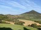
The attached photo shows a view from the alternative route from Irache to Los Arcos via Luquin. You can see the castle of San Esteban de Deyo on top of the hill above Villamayor de Monjardin. Can you tell me what looks like a monolith is on the left of the photo? Any details - when was it erected? why? height?1-DSCN0259.JPG
 
€2,-/day will present your project to thousands of visitors each day. All interested in the Camino de Santiago.
What a great puzzle this is! Is the built up area in the centerr of your view Urbiola? Have you tried "walking" the alternate with your fingers to see all possible views?
 
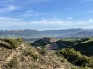
Here are our two pictures of the same monolith taken this year in May, 2022.
497CA365-95F0-4881-B4B1-62D190779FC2.jpeg
The second looking back at it. About 30 minutes apart.
E3FD3E93-CDF2-432A-B468-8F26B50886E0.jpeg
We really enjoyed walking the alternate route to Los Arcos via Luquin. A small number of pilgrims went the same way. The views were wonderful.
But we can’t help to identify the monolith, sorry.
 
The 2024 Camino guides will be coming out little by little. Here is a collection of the ones that are out so far.
Dang, not aliens after all. Here is a summary of what it is, pasted from another travel site:

I found someone who knows. One of the residents of Villamayor de Monjardín was three years old when it was built in 1948. It was a gravity water tower that has since been replaced by pumps.
There is a spring on Montejurra, a mountain some distance away. They actually ran pipes down into the valley and up this hill to a tank that is no longer in or on the tower. The base of the tower is the same altitude as Villamayor de Monjardín, so the residents no longer had to carry water in or truck it. The resident I spoke to owns a vineyard close to Azqueta, so he occasionally had to go up to the tower, which provided his irrigation as well as the running water to Igúzquiza, Azqueta, and Villamayor de Monjardín.
He was not sure what year the Mancomunidad de Montejurra built the current water system that taps into many other springs and rivers to serve a much bigger region. But that's when the tower stopped being used, and the access roads were reclaimed by local agriculture (which is why it is no longer easy to get to). The villages of Azqueta and Villamayor de Monjardín are now supplied by a pump somewhere near autovía A-10.

And here is the original post, with some up close and interior photos of the structure:
 
here is the original post, with some up close and interior photos of the structure
As I can see on that website, it was our very own forum member @WGroleau who posted this information about the water tower and the close-up photos.

So it was actually @WGroleau who found a local person who knew, and who also walked to the tower to have a look at it.

As far as I remember from earlier posts, he was a long-term hospitalero at the pilgrim albergue in Villamayor de Monjardin which is only a few kilometres away from the tower.
 
Last edited:
A selection of Camino Jewellery
What a great puzzle this is! Is the built up area in the centerr of your view Urbiola? Have you tried "walking" the alternate with your fingers to see all possible views?
No, the buit-up area is Villamayor de Monjardín. Streetview didn't follow the alternate route, and, even if it had done, it would only show views similar to mine, since the alternative camino does not go near the 'monolith'. However, the main question has been answered, together with one of the minor ones (date? - 1948).
 
No, the buit-up area is Villamayor de Monjardín. Streetview didn't follow the alternate route, and, even if it had done, it would only show views similar to mine, since the alternative camino does not go near the 'monolith'. However, the main question has been answered, together with one of the minor ones (date? - 1948).
Our friend said 1948, but since he was three years old that year, he might be a few years off.
 
My son walked up to the castle in 2015 after the communal dinner at the Dutch run albergue in Monjardin. It had an intact fortified wall and a locked gate. When he returned to the albergue a hospi told him they have the key for it.
I wonder if other forum members who stayed at the albergue have hiked up to the castle and possibly took pictures inside.
 
The focus is on reducing the risk of failure through being well prepared. 2nd ed.
My son walked up to the castle in 2015 after the communal dinner at the Dutch run albergue in Monjardin. It had an intact fortified wall and a locked gate. When he returned to the albergue a hospi told him they have the key for it.
I wonder if other forum members who stayed at the albergue have hiked up to the castle and possibly took pictures inside.
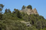
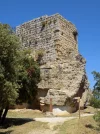
I walked up to the castle this year (June). I was told that it is no longer kept locked, which proved to be true. I didn't take many photos inside the castle – I can only think that there wasn't much left to take photos of, but here they are:
DSCN0111.webpDSCN0112.webpDSCN0116.webpDSCN0120.webp
 
The first edition came out in 2003 and has become the go-to-guide for many pilgrims over the years. It is shipping with a Pilgrim Passport (Credential) from the cathedral in Santiago de Compostela.

❓How to ask a question

How to post a new question on the Camino Forum.

Most read last week in this forum

I have done 7 walks including three CF, and I had been fortunate that I had not been affected by bedbugs. Now I have my next CF walk scheduled in next April and have heard two of my friends got...
Asking for friends planning to walk the Frances from SJPP tp SdeC in 2025. What were folks who have walked during summer/fall 2024 been spending per day? They are a couple preferring a private...
Hello everyone, I hope you are well! I did the Camino Ingles last year and it was an amazing spiritual experience. This year, with many personal changes coming up, i feel the need to walk for a...
I'm currently staying near Oviedo, in the north of Spain. I know there are various Camino trails near here but I can't find any using Google maps and Google searching. Is it possible to find...
Hello, has anyone been to the Sahagun street market. Do you know if they close promptly at 2:00pm (I'll be walking there on a Saturday). What kind of stands/boothes are there (food, cheese...
Reading https://www.caminodesantiago.me/community/threads/ruins-of-a-tower-between-hontanas-and-castrojeriz.89457/ reminded me of a tower near Azqueta. I don't think I was on this forum back...

Featured threads

❓How to ask a question

How to post a new question on the Camino Forum.

Featured threads

Forum Rules

Forum Rules

Camino Updates on YouTube

Camino Conversations

Most downloaded Resources

This site is run by Ivar at

in Santiago de Compostela.
This site participates in the Amazon Affiliate program, designed to provide a means for Ivar to earn fees by linking to Amazon
Official Camino Passport (Credential) | 2024 Camino Guides
Back
Top