• ⚠️ Emergency contact in Spain - Dial 112 and AlertCops app. More on this here.
  • Remove ads on the forum by becoming a donating member. More here.

Search 74,075 Camino Questions

And we're off - the Lycian way ....

Undermanager

Veteran Member
Day 1 Birmingham to Fethiya
Birmingham was pouring when the plane took off. It was nice and warm when I landed. I fretted before going about getting from the airport to Fethiya after 9.00pm but I shouldn’t have. You just walk out the terminal, past the semi circle of tour desks outside and look left. There are big Havas buses waiting for customers. I saw busses to Marmaris and Fetiya. It was 15L and took just under an hour. The walk from the bus stop to the hotel was about 20 minutes.

Day 2 Fethiya to Faralya
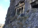
Fethiya is a sprawling town with all the facilities you could need. After a great breakfast at the friendly Eroglu City hotel, I queued up for half an hour to change cash in a bank, after the first one’s system was down. The rate was 4.71L to the pound. Then I spent another half an hour getting a SIM called from Turkcall. 67 Lira bought me 3Gb of data and 35 Lira of calls, valid for a month. Make sure you take note of the SIM pin number on the card the sim was extracted from! If you reboot your phone, you will need it and you only get 3 attempts before your sim card locks followed by hassle trying to work out how to get it unlocked. Then I had a quick look around the old cliff tombs.

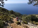
I set off about 11.00am, catching a minibus to Ölüdeniz right outside my hotel, a large town completely given over to tourism and would be a fine place for a night. It was already very hot and I was carrying 2 litres of water, which was just enough, along with some snacks. I had written down the Lycian Way in Turkish to show the minibus driver, and was dropped off at the right turnoff. There’s a short walk on a road, then along a dirt road and finally, you come to a big Start of Lycian Way sign. Photos were taken and then I set off. More dirt track and then it becomes mountain path, with lots of potential for slipping on stones; walking sticks are essential.

Today was signedposted with red and white stripes very well all day. The first two and a half hours are a real killer! Very uphill and steep, hot and exposed. After that, there are a few flat parts, quite a few steep downhill paths and a few uphills again. Cafes start appearing after about three hours so you can get fed and watered and rest up quite frequently all the way to Faralya. The yogurt shakes were really thirst quenching and the figs on the path in Kirma, a small village with a couple of cafes. were so sweet.

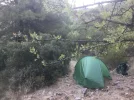
Faralya is a spread out village with lots of cafes, pensions and hotels, and places to camp. One of the first cafe-pensions you’ll see as you enter the village is Gul Pension. You can camp opposite, use their shower and toilet and eat in their cafe with great views. If you are visiting Butterfly Valley, you can leave your bag there, too. It’s a nice spot but I decided to walk past Faralya and into the woods just off the Lycian Way and camp in a nice flat spot. With hindsight, if you walk 30 minutes outside of Faralya from the road to the top of the hill, there are some lovely spots for camping, which have clearly been used before. It is a steep 30 minutes, though, which may not be what you want at the end of a long day.

On wild camping, it seems okay to camp anywhere away from civilisation as long as you use common sense. There are plenty of flat spots, and plenty of places where it’s too steep. You just have to nose around when ready to stop. I had dinner and got more water in Kirma so was ready to put the tent up at about 7.00pm whilst it was still light, read and wrote a bit then slept to the sound of owls and barking dogs. The tent was very hot inside until about 9.00pm but then it cooled and was fine and I needed to have the sleeping bag over me. I wouldn’t light fires anywhere as the whole place seems very dry. I’m not carrying a cooker, as am planning to eat along the way and just have a few snacks. I slept well and woke up fully refreshed at 7.00am
 
Train for your next Camino on California's Santa Catalina Island March 16-19
Great start Dave. I'd be interested to know the cost of accommodation when you use it. What weight are you carrying?
 
Perfect memento/gift in a presentation box. Engraving available, 25 character max.
Looking forward to following your way along the Way. Take it easy in that mid-day heat.
Bon voyage/Iyi yolculuklar!
 
Have a great adventure, look forward to reading your updates.
 
€2,-/day will present your project to thousands of visitors each day. All interested in the Camino de Santiago.
Day 3 Faralya to 2kms past Alinca

All day today, the route was well marked but a few times, I needed to refer to my GPS track. From the road in Faralya to the top of the hill is a 30 minute uphill slog. Then it levels out for 30 minutes and if they are set up, you’ll be able to stop at the mobile cafe and have a juice. Less than an hour later and you are in Kabak. It is downhill and steep once you turn off the dirt road so have your poles at the ready!

As you come towards the village of Kabak, there is a sign. Turn right into Kabak for one minute and you’ll see Mama’s, a small shop, hostel and restaurant with WiFi. A full breakfast with great views was 20L. Kabak looks like it has quite a few hostels spread around, especially down near the beach, which looks busy. It might be worth investigating a stay overnight or camp on the beach if you have plenty of time.

After eating like a king at Mama’s and stocking up on water, I set off. You can either go down down down to the beach and then pick up a path there or go back to the junction and follow the sign to Alinca. I didn’t fancy a mega climb from the beach so backtracked to the sign and started walking. Apart from one luxury hotel on this route, there are no facilities and no water. Take at least 2.5 Litres of water. You will need it!

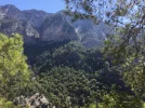
This route is quite spectacular! There is a lot of climbing steep paths and quite a bit of descending. At times you are walking just a few feet away from a drop of many hundreds of feet, and some paths are more suited to goats than humans so take care! There is one confusing junction, where the path splits and both are signed with the red and white stripes, about 10 minutes after the well-groomed grave of someone buried on the mountain. The right hand path downhill goes to Kabak beach. The left hand one uphill is the Alinca path.

Alinca has about a dozen buildings and a couple of places to stay. The first place in the village does bungalows, dinner and breakfast for 85L. There is another place 500m along the main road but I don’t know the cost. After resting, drinking and stocking up on 2.5 litres of water again, I set off.

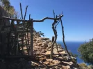
You can follow the road to Gey. Or you can take the Lycian Way. A warning. This part of the Lycian Way route is tough! The path is very steep, slippy rocks are everywhere, there’s a bit of scrambling in places, it’s narrow and close to the edge of big cliffs at times. You need strong knees, walking poles, plenty of water and perfect weather. It is great though. Really spectacular. I had enough water and food for the evening so after about an hour and a half, I stopped to camp, near an old hut. I was knackered but the views from the campsite are really great. I hope I don’t sleepwalk!

Day 4 2kms past Alinca to Bel.
After the very difficult 2kms from Alinca yesterday, the way to Gey is easy; about 3 kms along gently rolling dirt track followed by 3kms along a road. I stopped at the first shop / cafe, which did a great breakfast. This was my first proper meal since yesterday’s breakfast, so that might explain it. The heat is intense here, the dirt tracks a lot harder, there is more rocky dirt track to negotiate, the ups and downs are more and my pack is heavier. My normal camino rucksack is about 8kgs. Add 2kgs for a laser lightweight tent, sleeping mat and sleeping bag liner for the mountains. Then add 2 or sometimes 3 kgs for water and some snacks, the pack can weigh nearly 13kgs! I’m drinking about a third more than on any camino and am drinking at every opportunity. The pomegranate juice is fabulous, and the ayran, or yoghurt shake is too. This walk and the heat really needs less than 10kg on your bag at any time, or it does at my age!

From Gey to Bel is just 6kms but it took well over four exhausting hours. It’s mostly very exposed and got very hot so slap on the sun protection, dunk the hat in water and take plenty of water to drink, at least 2.5 litres. The path starts off on a dirt road then becomes a rocky path with some steep ascents and descents so care is needed. I also had to dance around a small snake hiding in rocks on one descent so that kept me alert. I missed the red and white stripe marker twice from Gey and had to backtrack for twenty minutes uphill on one occasion so keep your eyes open and check your gps regularly! About half way is what looks like a goat camp, with a few buildings, enclosures and some big shady trees. I stopped here for lunch and to rest before the next 3kms. The way up to Bel is hard. I was knackered when I finally arrived.

Bel is a small village high up in the hills. I saw hardly anyone. There was a small cafe as you entered, which looked closed. Walk further to the centre of the village and there are seats around a shady tree and a tap with cool drinking water. All you need to do is negotiate the hundreds of wasps around the tap! As I’d camped the previous two nights, I decided to take a room in a pension, wash clothes, have a shower, get the battery pack charged and get out of the heat. Fatma’s is the orange house you can see 100m from the water tap. It’s great and is 60L for a room including dinner and breakfast. There’s no WiFi and I couldn’t get a phone signal. Dinner was great, on the terrace, listening to the cow mooing as it was being milked, the dogs barking and the chickens running around. The mosque’s call to prayer echoed down the valley and tonight was the first night I really needed my warm puffer jacket. It’s very rural at Fatma’s and really is worth an overnight stay. She is a super, attentive host and to be honest, everyone I’ve met since arriving has been super friendly and helpful.

On a general note comparing this walk with Spain’s caminos so far; I’ve walked the first week of the Lycian Way 10 years ago but I don’t remember it being this tough! The first 3 days are much harder than any 3 days I can remember on Caminos in Spain! You cannot beat the mountains and sea views but there are a lot of narrow tracks and steep climbs and descents which are a lot of fun but you have take these very carefully and they are hard on your knees. I thought September would be a good time to go but the heat and open tracks are proving a real challenge - well into October might be a better time to start. Taking a tent gives you flexibility but the price you pay in extra weight is not to be underestimated. And you can’t beat a shower, cleaning out clothes, a proper meal and a cold beer after a long, sweaty, hard walk. I’ve noticed a lot of pensions let you camp in their garden and have facilities you can use, so that’s another option to try. Water is a big concern. Many springs and cisterns are dry. You would need to purify the water from some that are working. Some with running water are delicious. But never run out, not in this heat. It can be dangerous! So far, the facilities have been just fine, with just enough places to get fed and watered. I’ve only seen one other group of three walkers. The rest of the time, you are on your own. The route is well-marked so far but there are permutations and side trips so it’s useful to know where you are heading in advance (I don’t have a detailed plan and it can be a bit confusing working out the route to take). Spanish caminos are far better marked. It’s cheap enough to stay in pensions so might do more of that - it certainly beats camping. I definitely need a holiday already!
 
Thanks for the update. Sounds marvellous. With a slight family connection with Turkey to give it extra appeal I will put the Lycian Way on my very long "perhaps" list :-)
 
Wow, 60 Liras for a bed, dinner and breakfast, that's a bit less than 15€!!!
Additional reward after a tough day ;)
 
3rd Edition. More content, training & pack guides avoid common mistakes, bed bugs etc
Day 5 Bel to Pydnae
Today, I’m on holiday - more on that later!

I feel totally 200% refreshed after staying at Fatma’s. Breakfast was great and I left full of beans, sort of literally. It was another hot and sunny day but not quite as intense as yesterday. Y’know I said I’d only seen three other hikers in the last few days? Today, I saw nearly 200!! There was some kind of Lycian Way Ultra Marathon going on. It started in Fethiya a few days ago and I think the idea is that they complete a route on the Lycian Way. The good news for me was that there were three or four water stages set up, and ambulance back-up if I needed it! So, I was rarely alone for more than 5 minutes!

As you leave Bel, you go up a road, which turns quickly into a dirt road and then after 20 minutes, you have to take a dirt track going uphill on the right, away from the main track. After another 20 minutes, and you are on another mountain side and on a very steep goat track full of loose rocks and going down down down for half an hour. I did go flying once but no damage done. Slowly slowly catchy monkey when you have dodgy knees.

After the descent, the track for a few hours is very pleasant, some up, some down but never too taxing. The waymarking today is okay but I got off the track numerous times. Concentration is needed! It’s too easy to get in a good mood and whistle away and forget to look for what might be fading or hidden waymarks. Eventually you come to a road. The Lycian Way I think follows a track but I hunted down two paths and followed my gps track but couldn’t see any red or white stripes. There wasn’t any on the road either but I could see on Maps.me that it went to Pydnae so set off. By good fortune, there was a water source at a cemetery about a km down the road, and another a further kilometer along so managed to get a good cold drink and dunk my hat.

After 2kms up and 2kms down, you come to a Lycian Way sign pointing at Letoon. This path takes you through the very overgrown ruins of Pydnai, which I couldn’t get very excited about. I lost the waymarks again and had to resort to the gps and clambering over a fallen down wall at the back. You then have to walk about 600m towards the sea along a hard, rocky and thorny half hidden path and hunt very hard for a ramshackle bridge that looks like it will collapse any second. Cross that and it’s decision time. Do you press the tired body on to Letoon in the burning heat of the day at 2.30pm 8kms away, or do you say, ‘fu** it’, book into a beachside bungalow for 50L with breakfast at the lovely Patara Green Park campsite and restaurant right next to the ramshackle bridge and chill for the rest of day, having a swim in the warm sea and relaxing writing these notes over a cool beer …..?
 
Tough decision! Seems like quite an adventure - pity about the heat.
 
Yes indeed. It does cool down here after around 6.00pm, and the temperature is forecast to drop over the next few days around Letoon to a far more reasonable 24 degs! And there is a nice breeze by the sea.
 
The one from Galicia (the round) and the one from Castilla & Leon. Individually numbered and made by the same people that make the ones you see on your walk.
Day 6 Pydnia to Patara
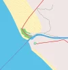
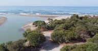
On camping on the beach near the Patara Green Park. This is a small resort of maybe a dozen bungalows right next to the dangerous looking bridge you have to use to cross the lagoon from the Pydnai ruins. It has outdoor seating areas to lounge in set in a garden and there is a camping area for 25L if you have your own tent. It also has a restaurant, a shower and toilet block. There is wifi and the bungalow I’m in had three electrical points. This is the only development on the beach from what I could see. From here, the next 10kms looked deserted, with scrubland trees behind the beach. There would be nothing stopping you having dinner at the resort, buying a few drinks and heading off to wild camp a few hundred meters down the beach. If you look on the map, you could walk down the beach a few kilometres, where a road takes you straight from the beach to Letoon. Just a thought. Another thought is that the sea looks really warm and inviting. In fact, it was bloody freezing!

I wanted to try and put in some big kilometres today and the next few days so will be setting the alarm clock earlier. There isn’t a daily schedule or any resemblance of a detailed plan except to follow the spaghetti gps route I have from Wikilocs. I’m pretty sure I need to up my game and do more than the 12 kms a day I have been doing though if I’m going to have any chance of getting to Sofia on the 20th October! I may also miss a few sections out that I’ve walked before.

Today’s waymarking is bordering on non-existent. You’ll need a gps and map to have any chance of getting to where you want to be. I saw two red and white stripe waymarks all morning, and then just gave up and made my own Lycian Way to Patara. You also need to decide how many ruins you want to take in - you can get excited by piles of rocks only so often. The other thing about today is that it is nearly all flat walking. No hills and no steep descents.

First I set off for an 8km hike to Letoon (missing the Lycian Way until a local pointed me back on track). On the way, I bought a litre of ice cold pomegranate juice from a stall as I approached Letoon. An extravagance but so very tasty. You’ll go past your first set of ruins as you walk through Letoon. I’ve been before so carried on walking out of the village and stopped at a junction with a few shops and cafes. After a drink, I used my map and followed the road round first to Kumluova then to a river, and then left alongside the river to the bridge at Kinik. Before Kumluova to the actual village itself, you’ll find a long line of shops, an ATM, cafes, supermarkets and so on. On the way to Kinik, someone stopped on the scooter and offered me a lift for a few kilometres so in the interests of international relations, I hopped on, and got off just before the police checkpoint at the bridge!

Kinik has another set of ruins, Xanthos, which is better than Letoon if you want to pick. Kinik is a small town with a bustling centre. I saw a couple of banks if you need to change cash and there’s a bus station. I had lunch in a cafe then walked up to Xanthos in 10 minutes from the centre of Kinik, took a few snaps then walked down again. Ruins are just not my thing when it’s boiling hot. As I came down from Xanthos into Kinik again, a minibus was pulling out towards Patara. Now I’ve walked along the Roman bridge and aqueduct before near Cavdir towards Uzumlu and it is impressive but decided to miss this section out and do the Patara loop instead (for another beach, more ruins). The minibus takes you down to the road junction, in less than 10 minutes, where you get off and walk 3kms to Patara (or wait for another minibus into Patara). I guess I’d be disqualified from the Lycian Way Ultra Marathon if they found out so shush, please. Patara itself is essentially a seaside resort, with lots of pensions, cafes etc. There were rooms going for 50L but mine cost 70L with breakfast cos I’m a big spender who likes en suite and a swimming pool if possible. It was 1.00pm and another boiling hot day. I’d been walking since about 7.30am so decided to check in and relax for the rest of the day, maybe catch another ruin or two. The owner of Flower Pension is adamant that the sea is warmer here than in Padnia so I may just have to go and see.

Leaving by 7.30am was a good move as it was nice and cool but we’ll try and leave by 7.00am tomorrow, when it is light. I’ll probably walk around the coast to Kalkan tomorrow and beyond but have saved a few days by skipping a section so that helps the schedule a lot. I might even try to read a bit about the next few days, to help with the planning.
 
Last edited:
A selection of Camino Jewellery
Day 7 Patara to Bezirgan

Patara is a seaside resort, except the sea is about 1.5 kms from where all the cafes and pensions are. The ruins are scattered over a wide distance and I thought it was expensive. It’s okay for a night but not much more.

I left at 7.30am. The Lycian Way is signed right outside the Flower Pension, on a steep road up. You keep walking up, following the waymarks until you see a sign - one is 10kms to Kalkan via Delikkemer and the other is to Kalkan via the coast route. I decided to go use the more direct but hillier route and top up my ‘ruins visited’ numbers. It takes about 40 minutes from Flower Pension to get to the top of a hill, where there are great views and plenty of flat places to wild camp. After that, the next couple of hours to Delikkemer are fairly easy, a mixture of flat dirt track through forest and occasional dirt paths up and down. The waymarking was mostly okay but poor in places - I needed to use my map and gps route a few times. There was one spring with running water, one place where I had to throw stones and wave my walking stick to get rid of a pack of dogs and a place where the bees took exception to me taking a photo of their hive and I got stung twice!

The ruins at Delikkemer are impressive. What you see is a big aqueduct crossing a valley. It is made up of many large stones shaped to fit snuggly together. You can walk alongside the aqueduct as well as on it. Pity the poor slaves who had to put that one together! Today was really hot again. It was very hard work being in the sun after about 10.00am and I decided to do what many before have done. I walked down to the road below the aqueduct, and then walked down to the main D400 road to wait for a minibus. After about 20 minutes, a lady pulled up and kindly offered to take me to Kalkan. The minibusses don’t go along this part of the D400 apparently. I should have walked left from this main road back towards Petara and then walked into the village you can see on the right if I wanted to catch a minibus!

Kalkan is another large resort but this time by the sea with many shops, banks, restaurants, pensions and such like. I had a look around, drank a load of water, had dinner in a cafe next to the bus station then was happy to sit in the bus station for an hour out of the heat, waiting for a minibus to where the Lycian Way crosses the main road to Berzigan about 3kms away. It was too hot to walk and I really wanted to save my energy wherever possible, especially because the route to Berzigan looks all uphill.

My first mistake was to take a minibus that went along the main D400 from Kalkan to Kas. I should have taken one going above it, along the 07-53 road. As it was, I got dropped just before Ulogol at the Lycian Way sign. From there on the D400 to the 07-53 road above it is about 1.5 kms but took nearly two hours. It’s steep and although the path starts off well marked, I kept losing it and spent a lot of time looking for fading waymarks. Don’t attempt this route without a gps or map. It’s easy to lose your bearings.

I finally emerged onto the 07-53 and right near a bus stop, totally knackered and looking unhappily at the sign over the road that says ‘Bezirgan 6km’. I wasn’t sure I could walk anymore when a school bus stopped and dropped off some kids, and one of them said he lived in Bezirgan and was waiting for the next bus! Decision made. One bus and 15 minutes later, I was outside Bezirgan’s two shops and mosque! I didn’t realise there was a paved road to the place let alone regular minibusses going there from Kalkan!

I was expecting a small village in the mountains. It’s actually a huge prosperous village spread out over an enormous fertile flat valley. It’s worth a visit. There is a pension costing £35 about two kilometers from the shops not far from the ‘famous’ grain huts on the Lycian Way run by a British lady. If you do walk from Kalkan, you’ll see the sign for the pension next to the tap by the grain huts, saying 500m away. Yes, there is a tap with fresh water by the grain huts. In the end, I decided to set up camp behind the nearest hut to the water. I also found out that a bus leaves Bezirgan every hour, to Kalkan I think. I’m starting to like the idea of short hops on minibusses to take away some of the strain, when it’s too hot or to up a steep road, for example. While I was relaxing by my tent, a tour bus turned up to look at the huts. It has been really exhausting and long today but it’s also been a lot of fun with lots of different adventures and I’ve finished camping in a great place. Tomorrow is supposed to be as hot as today. Bring it on!
 
Last edited:
Day 8 Bezirgan to Gokceoren
I had a great night’s sleep camping behind one of the grain stores last night but be warned; Allah calls the faithful to prayers very loudly across the valley, and especially into tents.

I was up, packed and on my way by 7.30am. I stopped at the shop for breakfast, a fresh, warm loaf, cheese, an onion and ayran, and some for later. I wasn’t rushing as I had a plan! I knew today was going to be hot and I really didn’t fancy two megaslogs across bolder country looking for red and white stripes again so decided to make use of the newly built roads and have a road hiking day. So, about 8.30am, I set off to Saribelen by road. There’s only one that zigzags upwards roughly towards the sea and it’s the one I came in on yesterday by bus. From the mosque in Bezirgan, the Lycian Way was signposted 6km but the road way I took was about 4kms. 40 minutes from Berzirgan at the top of the hill next to the road, there’s a praying room, taps with running water, a toilet and viewing area. Another 40 minutes and you are at the bottom at a junction on a sharp bend with more taps. I followed the sign there saying Saribelen, past a school to a junction that had Gokceoren signposted 7kms away. I took that road all the way to Gokceoren, about a 2 hour hike. It is quite uphill for the first hour, and you will pass the Lycian Way sign that says Gokceoren 13kms. Take that path or stick to the road and walk half the distance - up to you!

There’s very little traffic on the road although there were a fair number of trucks carrying rocks for more road building projects. The scenery had some trees but was mostly scrubland with lots of large boulders, although I did get to look inside an industrial sized tomato greenhouse and was given a perfectly formed specimen for eating later.

Gokceoren is another village spread out over a large valley. There were no shops I could find. As it was 2pm and hot and I was tired, I decided to stop at a pension tonight. The only one I saw was the house just before the mosque as you climb the hill - it has a sign on it. I negotiated 70L for dinner, breakfast and a nice room (I offered 60L, he asked for 80L so 70L it was!)

It seems perfectly good for one night with nice views. My host, Huseyin, wants me to take a taxi tomorrow to Hacioglan Deresi, but I don’t think I will. A countryside hike in the hills is on the agenda tomorrow. There is a road being built above the guesthouse that looks impressive. Every 10 minutes this afternoon a lorry full of rock or tarmac went past. The area around the guesthouse has a lot of fruit and veg growing and many traditional grain storage huts. I’ll need some supplies for tomorrow as there isn’t any available along the 20kms walk tomorrow apparently, which I’m sure Huseyin will be only to happy to provide. There is a running water source opposite the guesthouse, to have a good slurp from before setting off, and for topping up bottles.
 
Ideal sleeping bag liner whether we want to add a thermal plus to our bag, or if we want to use it alone to sleep in shelters or hostels. Thanks to its mummy shape, it adapts perfectly to our body.

€46,-
Day 9 Gokceoren to Kas
What a mega fantastic day! You do need something to eat for lunch, have plenty of water and a gps track on a map - there are plenty of places I needed to refer to the gps today and could have easily got lost or wasted hours without one.

Huseyin had a great breakfast ready for me at 7.00am, and I secretly snaffled all the bread, some cheese and the egg for lunch. His tea was great and had to have three glasses before leaving. He is an excellent host and his place is certainly recommended. So with 2.5 litres of water from the spring opposite, off I went.

The LW went past Huseyin’s guesthouse but after half a kilometer, there were red X’s at a junction in all directions. A quick look at the map on maps.me showed that I needed to follow the road down to the end of the valley so I turned left, got on the road down in the valley and frog marched to the first junction, Hacioglan Deresi, about 8kms away, which took about an hour and three quarters. There was a working spring 6kms from Huseyin’s guesthouse, and it’s nearly all new road or wide dirt track to the 8km mark. The valley is very pretty, through pine forests. It looks like a new road and I saw very few waymarks.

After that, the next 3 or 4 kilometers are all uphill. It can be very hard at times but eventually you get to a plateau, where there are fabulous views, a cool wind and many places to camp.

On to Phellos. Sometimes, you will feel like you are fighting in the jungle, pushing thorny bush and tree aside every few seconds, hunting for the next waymark. Keep your eyes open for the small piles of stones to guide you. Look hard for footprints of those who have gone before. Many waymarks are missing or fading. It’s really tough at times but if you have a gps, you’ll make it to Phellos!

Phellos is quite small, on a mountain top, very overgrown and interesting for 15 minutes. You can photograph the ruins of a temple, the ruins of some burial sites, the ruins of etc etc. You get the idea! I’m not big into ruins! It was pretty though, and the clouds were rolling up one side of the mountain and down the other. Wonderful to watch, and so high up.

It took about 7.5 hours from the guesthouse to Phellos. It then took another 2 hours to get down to the first mosque in Cukurbag so it was about 5.00pm by now. I cleaned up and drank loads at the mosque. I was knackered so was going to camp at Cafe Dede’s, except it has closed now and is just a house! Bugger. And the owner was outside eating, just to tease me!

I kept on walking along the LW but stopped in a bus shelter where the road carries on and the LW splits off left downhill. Then a magical thing happened - a bus to Kas arrived! The choice was camping tonight a few kilometers along, a 2 or 3 hour slog into Kas or a 2.5L 10 minute bus ride into town and find a nice pension. Guess what I did?

So, here I sit on the balcony of my 50L pension as the sun goes down, with really wonderful views over the sea. I have two cold cans of beer on the table. I have wandered around the town and harbour and it is very, very pretty. I could quite happily come here on holiday for a week or two. I have to decide whether to press on or stay another day and have a day off. Pressing on means working out a route. The notes from a few different websites shows different routes forward but I’ll probably just follow the line on my gps!

It’s been a long but really brilliant day, everything I love about long distance walking. I should be totally exhausted but I’m ready for a few hours on the town. What a great day!
 
Good to see the rehydration system is working well, although you did throw me off a bit in your early posts as I misread and thought you were talking about yoghurt snakes...
 
Day 10 Kas to Uzum Iskeles
Another brilliant day, although hair-raising at times! It has been a welcome few degrees cooler today and there has been a cooling wind at times. I really enjoyed my night in Kas. It’s a small town totally given over to tourism. There are hundreds of over-priced bars and cafes and it looks like a fun place for a traditional one week break but there are cheap pensions about and cheap places to eat and drink if you move away from the tourist centre. You could get a really nice hotel for just over 100L at the moment, or a basic pension with shower and balcony for 50L. Try in front of the harbour and the road behind the one in front of the harbour. It is the start of the off season and everyone is saying that numbers are down because of political situation in Turkey so finding a bargain isn’t too difficult.

The walk out of Kas was easy. You leave uphill, go around a bend with a small beach in and then come to a sign that says Limanagazi 3km. I couldn’t find the upper path but it must be there somewhere! The lower one is downright dangerous! Don’t go this way if it has been raining, you don’t like a bit of rock-climbing, you don’t have a head for heights and are okay balancing on a two foot ledge whilst holding onto a rope to keep you falling, and your knees are strong! The reward if you are okay with all the above is an energetic descent to the sea, climbing down over rocks and steep drops, great views and passing by some lycian rock tombs. Seriously, know your limitations before attempting this route. After 2 hours, I finally got to the resort in the bay but didn’t get more water. You need as much as you can carry if it is hot, at least 2.5 litres.

From Limanagazi, you have about 2 to 3 hours of up and down walking, passing by some pretty bays until you get to Fakdere Mevki. Luckily for me, someone was there to sell cold water and cook me a chicken and chips meal with salad and bread that I could stuff myself with as the main meal for today. I stayed for about an hour, after thinking about camping but decided to press on. The place seems to be camping only now with a restaurant. There are no rooms for rent. It’s a really pretty place for a day.

At 2.00pm, I left. Two hours of ups and downs and more clambering over rocks later, I was at Uzum Iskeles beach, putting my tent up and having a swim in warm, clear waters. There are no facilities of any kind here. There is a road to the beach so a few cars were here as well, a few groups camping, some people fishing and it was all very nice.

I booked my ticket from Sofia to Birmingham this morning as I think I should finish the walk on the 11th or 12th October. I’ll have 6 days to meander to Sofia from Antalya. You can take as long as you want if you fancy shorter walks and stopping off in more places but it seems quite possible to do the Lycian Way in about 24 days, and that is without skipping any sections (I skipped a two day bit I’d walked before) and only the very occasional minibus for short hops.

It’s been another fabulous day. Looking forward to a good sleep tonight listening to the sea lapping about twenty feet from my tent, and more of the same tomorrow.
 
€2,-/day will present your project to thousands of visitors each day. All interested in the Camino de Santiago.
Day 11 Uzum Iskeles to Kekova
We are in the groove! Another fabulous day, although it started slowly. Last night didn’t work out quite as expected, and I should have worked it out in advance. The beach was great; there were no facilities but it did have a road going to it. And it was Saturday night. As soon as I went to bed, a car full of loud drunk blokes turned up, lit a fire on the beach about 20 feet from my tent and got even more drunk and ever louder for the next hour. Fortunately, they never spotted my tent and left eventually. Then, just as I nodded off, I heard another car arrive, and then 10 minutes later, a few lights were shining into my tent! All I could see as I unzipped the tent were lights in my eyes, jackboots, guns and someone saying, ‘passport’. What is going on in Turkey? What police force feels the need to do a security sweep on a campsite at 10.00pm on a Saturday night? After they left all very good humouredly, I dropped off until 7.00am. Note to self: do not camp in ‘remote’ spots if there is a road going to it.

The trouble with not having a full breakfast, just a handful of dried apricots and nuts, is that trying to do a lot of hard work on that is well, hard work! The 5kms from the beach to the road that leads 1km to Bogazcik is all uphill. It was cooler than previous days but far more humid and I nearly ran out of water. When I got to Bogazcik after two and a half hours, the campsite with restaurant, one of the first buildings on the right was closed! The first two taps I tried in the road were also dry. This proved to be a blessing in disguise, however. I walked into the village and just 200m from the LW was Ali’s House, a pension and restaurant. And 6 Turks who were camping on the beach last night were also there; the breakfast, the host and his wife and the company were just awesome. You should have seen the breakfast, and everything for 15L. Everything was instantly revived over the next hour. From then on, all was well. I would recommend staying there if you get a chance, or at least have breakfast.

So, after that it was on to Aperlae, a really interesting valley inlet leading onto the sea, strewn with ruins, an inland lake, a bay on the sea and two perfectly reasonable options for camping and eating, in the Purple House and the Boathouse. I topped up the drink and had a salad at the Boathouse two hours after leaving Bogazcik, contemplated staying the night but then decided to move on. If you have the time, this is another area I would make time for. It’s exceptionally pretty and even I was impressed with the ruins across the valley!

The walk from here to Kekova took about three hours. It goes uphill for a while, then there’s a great plateau, then down to the sea followed by an hour scrambling over and round boulders as the sea laps up the rocks on your right. It is very pretty and there are plenty of places for wild camping half an hour after leaving the Boathouse but after last night, I really fancied a pension and a bed.

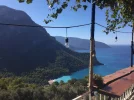
Kekova is very pretty, a small village with a couple of shops, a dozen restaurants, half a dozen pensions and a million boats. It’s a centre for boat trips in the area, apparently. I booked into Kekova pension for 80L with breakfast because it is right on the water’s edge and the views from my balcony are fantastic. I also saw a pension that had rooms for 60L. I saw the Turks I had breakfast with in the village and they are camping in a local campsite.

Today started slowly but the impact of a damn good breakfast was incredible so will stock up better in future. Am off to Myra / Demre tomorrow, about 20kms away, and then the first big challenge, 3 days in the mountains but having to carry all supplies. I need to think this one through carefully tomorrow, especially the water situation. I may take a minibus up the mountain part of the way to the first village but we’ll have to see.

The LW is a definite step up in difficulty from any Camino I’ve done in Spain but if you like a challenge, are reasonably fit, are okay camping and are not phased by being self-reliant then this would be a great walk to try and much cheaper than doing a Spanish camino. It would make a top superb holiday if the hiking were combined with taking minibuses when you felt like it across the whole route, rather than trying to walk every meter from start to finish. You could avoid the bits where you really need to camp and just stay in pensions, and from what I've seen, everything is really quiet from the last week of September, although the start of October would be a better time to begin. The first three days of this walk were a killer, but it has become much more manageable and fun since then. Perhaps my fitness levels needed a jolt. I like hiking rather than visiting ruins and sight seeing, but you could do this walk in a far more leisurely pace and have a great time.
 
Last edited:
Day 12 Kekova to Myra
Another long but exciting walk. Kekova is the place to plan a stop for a day, if you fancy going on a boat trip. The whole area is full of small bays and ships sailing around them. There are trips to suit all tastes and budgets! I left my great little pension at 7.30am as usual after eating the sandwich they prepared the night before and walked out, past the castle about 30 minutes away. There were a couple of pensions near the castle if you fancy staying there but they must have been the other side of the hill because I didn’t actually see them. About an hour later, you come to the Smugglers Inn, a sort of campsite, restaurant, bar and a few rooms, I think, set in a small secluded bay. I don’t think business was actually booming, but I stayed for a few Cokes and then had a long swim in the bay. It would be a great place to relax for a few days, but the owner running it seemed to have limited get up and go!

After that, another few hours walking brought me to another gorgeous beach in a small secluded bay called Cakil Plaji so on with the trunks again and had another good soak and swim followed by lunch. Another hour or two and I was at Cayagzi or something like that. It seems like another harbour where tour boats come and go from. Perhaps you could jump on a boat in Kekova and sail to here instead of walking, just for variety. Apart from the harbour, there are a few restaurants, at least one campsite and a long and uninteresting 4km walk by the side of the road into Demre.

Demre is a pleasant enough small town with wide roads, banks, shops and loads of restaurants. There is nothing touristy about this place and I found it quite interesting to wander for half an hour. After changing some money in a bank, the security guard there with excellent English helped me find a cheap pension! You just walk through the town following the Lycian Way waymarks towards the ruins of Myra. Kent Pension is on your left about 2kms out of town, below the ruins on what looks like a cliff. You really can't miss it. It is set in a big leafy guarded with a very helpful lady running it. Bed and breakfast was 70L, although I had dinner there too so that’ll be a bit extra. Just down the road on the right and a bit further on the left are four or five small supermarkets where you can stock up for the next few days.

I’m not sure at all about the next three days at all because I know from experience you can’t rely on the wells for water in Turkey in the mountains. They could all be dry so I have to carry what I need, which means taking about 5 litres/kgs of water plus another kg in food, and even that might not be enough - I drank 3 litres of water today just doing a relatively easy 21 kms in the heat and high humidity so tomorrow’s walk could easily use up the water quickly. The whole trip involves around 18 - 20 hours of actual walking in the mountains, 1800m up and 1800m down over 34kms. The plan is to take a minibus to the first village and save 3 hours uphill walking, then keep walking to the ruins of a church for two more hours. After that, it’s either camp there and return the next day, or keep going forward, but we’ll have to play it by ear. The gps routes are ready and loaded into the phone as well as the gps unit for back-up.

The whole stretch today could easily warrant a few extra days, for a boat trip and to relax by some nice beaches. There are also some brilliant places for wild camping, right by the sea. So much to see and do!

And it's a good job I decided not to book my return flight with Monarch .....
 
Last edited:
Day 13 Myra to a few kilometers past Finike

The day started poorly! First, I seemed to have developed a snivel. Then I never realised just how loud the 6.00am mosque call can be when your pension is 10m away. Next, the bag was packed and was heavy with over 5 litres of water and food, but doable. My electronic devices stopped charging in the night so weren’t fully juiced up - the sockets in the room were so loose that it was hard to get a secure connection. Breakfast was late, and the expectation exceeded reality, and it was hot, humid and there were no minibuses to Beloren. That just about covers it.

So, I set off ready to climb up to Beloren at 8.30am. The path is poorly and at times confusingly waymarked so you should not even consider setting off without a gps, a track loaded and are confident in using it, and have a back-up device. I walked out of Myra, turned left after crossing a bridge and followed the road for a few kilometers. Eventually, you turn right and have a cliff in front of you. Until you climb it and find the paths, you wonder how on earth you will get to the top. When you look down, you realise that along with distant vistas, you'll be staring for quite a while at a huge cement and gravel works along the entire valley. Not very inspiring.

It took about an hour to get up to the Beloran road just 1km away using the very steep and rocky Lycian Way, and as I feared, I’d already drunk a litre of my own water plus some from a well. I decided to carry on along the road rather than take the steep path, even though it was nearly twice the distance but still drank a lot of water. I think the noticeable humidity was the problem and the snivel, perhaps. This was not going to work! I had drunk nearly a third of my water and hadn’t even got to the first village. So, safety first, I sat down in the shade, threw away some of the water to cut the weight down and was just about to start walking down the road when a lorry came by. Out went the thumb, he stopped, and 20 minutes later I was at the bus station in Demre getting a minibus to Finike, and fell fast asleep on the bus. On the way down, I did get to see a sample of the many Ruins of Myra' that draw big tourist daytrippet buses to Demre.

So, in Finike, I awoke, got off the bus and went and had a snack and some tea whilst figuring out the next move. Finike is a not unpleasant large non-tourist town on the coast with all the usual facilities. It was only 1.00pm so decided to walk along the coast following the LW for an hour or two. This involves walking besides the busy dual carriageway D400 but you also have the sea and a steady stream of little parks, juice sellers and restaurants so it’s not uninteresting. I could see on maps.me that there were quite a few hotels and pensions about three kilometers away, and when Pension Baykal appeared on the other side of the road at about 2.00pm, I decided to investigate.

You get a clean room with shower, tv, fridge and balcony for 40L, 50L if you want breakfast. It’s next to the busy road but also by the sea. There are a few shops and restaurants within 5 minutes walk so meets all needs. It just makes you think how cheap prices are when in a completely untouristy area! Tomorrow, I’ll probably walk round the coast to Karaoz, or maybe take a minibus there and start walking from there, to camp at the lighthouse. I quite like the luxury of pensions!

So. I’m slightly disappointed that I didn’t get up into the mountains but know it was the correct, safest decision. On a plus note, there was a road sign near the hotel that said ‘Antalya 117kms’ so not far to go now. The sooner I get there, the more time I can have crossing Turkey and into Bulgaria!
 
Last edited:
The 2024 Camino guides will be coming out little by little. Here is a collection of the ones that are out so far.
I'm enjoying your pragmatic approach and the fortuitous appearance of helpful lifts at crucial times. Hope sniffle passes and next breakfast completely satisfying.
 
Day 14 A few kilometers past Finike to Karaoz.

I really liked Pension Baykal but I can see why someone might be put off at first glance. There’s a lot of road building going on around the hotel, and it’s opposite an empty dirt field. But don’t be put off. It’s cheap, clean and a friendly old chap runs it, and I slept well. Breakfast was the standard Turkish affair and I was off at 8.00am.

I decided to walk to Karaoz, about 25kms. It was another hot day but the humidity was not as bad as yesterday. I saw no waymarks at all today but with maps.me and a trail, there’s only one or two places you might miss a turning. It’s entirely flat, except for the last 5kms, where there are some gentle uphill bits, and it’s all pavement or road walking. You don’t need more than a litre of water as you are never far from a shop or water source the whole day.

Some of the advice is to take minibuses for this section but I liked it. The sea and a cooling wind is on your right side for much of the day but you do need to slap on the sunblock. During the first half of the day, you’ll pass fishermen, swimmers along a beach that stretches for nearly 15km, beach resorts, finished and unfinished condo blocks and the odd shop. After leaving Pension Baykal, you’ll also see half a dozen more pensions and hotels over the next two kilometers. The busy D400 is off-putting and I had three cars pull over suggesting I take a lift with them! I wondered if they were being nice or if I looked like a specialist sexy jay-walker in shorts, backpack and walking poles? Walk against the traffic if this bothers you. I did after the third time!

Eventually, you arrive in Karaoz, a large village of perhaps three or four hundred houses, at least half a dozen pensions and one shop that I saw. It is set in a small squashed bay by the sea and on the way to the place, you’ll pass other smaller bays with beaches, picnic benches, toilets and no camping signs. The first pension I tried, Oz Lycian Pension wanted 100L for B&B and kept holding up their big sign that they had made showing a 9.1 rating from Tripadvisor! It was by the sea but still overpriced IMO. A quick walk to Blue Lycian Pension and I had an evening meal, bed and breakfast for 80L. The place is fine but if you have a headache, you might want to avoid it - the small hyperactive son is very very loud!

Apart from that, there’s not a lot else to say. I took out a trial subscription to Kindle Unlimited before I left. You have access to all the Lonely Planet guides which is good, but to be honest, I’ve found it hopeless trying to find what I need. Give me a book to flick through anytime. The other thing I tried for the first as part of the Kindle Unlimited trial was listening to an audiobook as I walked - The Hunger Games. That worked rather well. The feet are holding up well, with just one blister underfoot. I’m using tights under socks and foot cream every day. The shoes have not fared so well at all on the sharp rocks on many trails over the last two weeks and have many cuts and bits falling off them. They will be binned before flying home. The Osprey rucksack has performed brilliantly. It’s very comfy, even with heavier weights, and my back doesn’t sweat on the back. The stretch pockets are working well, too. Highly recommended. There’s less than 100kms to go now and plenty of time. I suspect I’ll finish now by the 10th so I may stop somewhere soon for an extra day’s rest but am loving the hiking at the moment. Tomorrow to Adrasan could be a hard day so that might be a good place to stop. So far, not a drop of rain. Long may this continue.
 
Last edited:
The one from Galicia (the round) and the one from Castilla & Leon. Individually numbered and made by the same people that make the ones you see on your walk.
Day 15 Karaoz - rest day.
I woke up and had a great breakfast whilst watching and listening to the sea a few hundred yards away just before 7.00am. The one blister I’d developed recently was where the toe joined the foot and was quite painful every time I took a step, and I had managed to get a bit of sunburn on my lips yesterday, despite using high factor lip sun block every few hours, something I know to do from experience. With lots of time on my hands, I decided to have a rest day so asked to stay an extra night at my pension and chill. So, today was spent doing lots of nothing, a lot of sleeping, a short swim on the nice beach and reading / listening to the first book in The Hunger Games series. A German trekker turned up later at the pension and is following the same route as me so tomorrow, we will set off together. He did show me an interesting water filter called ‘Life Straw’, which was very light and would be ideal for use drinking water in Turkey from the wells in the mountains, which may not always be clean. This evening, I’m feeling really refreshed and looking forward to tomorrow’s long trek.
 
Day 16 Karaoz to Adrasan
Today was fantastic. Not too hot, a cool wind, plenty of shade most of the time and nice and long without being extreme. The walk took me about 8.5 hours to do the 23kms with a few breaks and a 30 minute lunch stop. I left the excellent Blue Lycian pension about 8.00am after another nice dinner the previous evening and an excellent breakfast. The walk up to the lighthouse is about 8km gently uphill except for the last 30 minutes, which is a much harder slog.

There are great views for much of the rest of the walk. There are some hard uphills and hard downhills and a long section which is gently following a flattish path around bays. It’s all very nice. There are a number of comments in blogs about not doing this section on your own, how isolated it is etc but I thought this section was positively easy compared to some of the others. Do this section with no fear! You can camp at the lighthouse but I didn’t think it was anything special and judging by the number of people coming towards Karaoz with rucksacks this morning, I’m guessing there were a lot of campers all looking for solitude at the lighthouse last night!

I took 3 litres of water and drunk about 2.5 litres of it. The last water was about 4kms from Karaoz and after that, there’s nothing until Adrasan.

Adrasan is a slightly grubby tourist spot in a bay. Try to avoid it if you can. There is a 1km beach with clean public showers and toilets, loads of hotels but not too many pensions. I saw one campground, half a dozen shops, and loads of boats for daytrips. It is very, very quiet and a lot of places have shut. I asked around but couldn’t get a nice room for less than 120L. Then I found a pension and I took the room for 50L. On the plus side, it’s central, private, has a shower and toilet, is better than camping and the owner is jolly. On the downside, it’s a shithole. A 100% grubby shithole. Fortunately, I’m only there for less than 12 hours but next time, no more dingy dumps. I tend to do this sort of thing when I’m on my own after a long day, when I’m tired and I can’t be bothered trawling endless hotels. If I wasn’t so tight, I’d have a nice place by now! Silly boy!

The plan is to make a fast exit tomorrow out of Adrasan but there is a hard clamber up a mountainside. I have breakfast in my bag so will take a break after an hour or two. The only downside is rain is forecast tomorrow but I’m not staying here whatever happens! I won’t go up the mountain if it’s raining so may have to take a minibus, but we’ll see. Overall, a fabulous section
 
Day 17 Adrasan to Cirali
Today’s walk took 9 hours and was bloody hard work! The temperature had dropped 4 or 5 degrees compared to yesterday but at times, the humidity was very high and exhausting. More on Adrasan, though. Where I emerged from the LW yesterday was towards the right hand side of the beach as you look at the sea. There are mostly hotels here, and the hovel I ended up in. Behind the hotels is essentially a large swamp, which explains why there were a lot of insects in the evening. If you walk all the way down the beach road for about 1km (walk left as you look at the sea) and turn the corner, there are probably a couple of dozen pensions over the next half kilometer, with many advertising rooms for 50L as well as restaurants and shops. There’s still some kind of small river inlet on the right side of the road so my guess is it will still be a little swampy but this is the area to head for in Adrasan. It looks a lot nicer than the run down beach front area.

The walk to Cirali was really hard and I struggled, not helped by a couple of downpours, which made the rocks slippy. After leaving Adrasan, you climb about 700m, which took me about 4 hours. At the top, the views should be good but were obscured by the rain. A few hundred meters from the top is a shack selling drinks and a place to sit, which I came on just as the hardest of the rain started falling. I was here for half an hour, until it stopped.

From the cafe, there appears to be a dirt road all the way to Olympus, so that might be a good shortcut out if you’ve had enough. The next four hours were really tough, however, if you take the LW. I had to scramble over and under many fallen trees, fight through soaking wet very narrow paths, descend very, very steep tracks with slippy rocks and generally, take it slowly and carefully. Someone has also been ‘rearranging’ the yellow signs to Olympus, so the closer you get, the further the signs say you have to go!

Eventually though, you will arrive in Olympus. I still haven’t worked it out but you seem to arrive in the very extensive ruins so you don’t need to pay. There also seems to be some kind of village next to the ruins, with lots of ‘treehouses’ but I didn’t explore this. I spent half an hour looking around the pretty impressive ruins, which are still ruins so need a lot of imagination, and then walked the extra few kilometers to Cirali.

Cirali is very spread out, perhaps over a few kilometers along the beach and maybe a few hundred meters from the beach. This seems like a tourist hub, presumably because of the Olympus ruins, and there are pockets of tourist areas with bars and restaurants in many different places. I used maps.me to zoom in to different areas to look for a cheapy pension and you can see loads. I found the brilliant ecosite called Aylakyasam Camp (next to Keyif Pension). They have little wooden bungalows as well as tents set up, with jazz playing in the communal seating areas. Dinner, breakfast and bungalow was 100L, although I didn’t haggle as I liked the lady showing me round! I’ve booked in for one night but may stay another - the weather is a bit iffy again tomorrow and the under-skin blister under my left foot is really killing me! We shall see. A great day but really hard.
 
The one from Galicia (the round) and the one from Castilla & Leon. Individually numbered and made by the same people that make the ones you see on your walk.
Day 18 Cirali - rest day
Another rest day so soon after the last one? The heavens opened up last night big time and didn’t stop until this afternoon. Being on slippy tracks is no fun here on the LW so decided to stop again for a day, and the weather from tomorrow onwards turns great again. I also really like the Aylak Yasam Camp where I’m staying, so having a nice place to hang out makes a difference. I bumped into the German Tolgar I met a few days ago and the French hiking couple he was with and pointed them to the Camp. They got a good deal here, staying in a pre-erected tent with breakfast for 40L. They are missing out on the evening meal though, which last night was excellent.

I didn’t do much today; a few beers, a walk about, bought supplies for tomorrow, sat around reading and planning the next few days. I decided to walk the coastal route from here rather than the mountain route because of my foot problem so will probably have two more stages to the finish to go unless I change my mind. Then probably a day or two in Antalya followed by a bus to Konya, a train to Istanbul and an overnight train to Plovdiv in Bulgaria, then Sofia. All is good.
 
Day 19 Cirali - and another rest day
I like Cirali. It’s a fairly large (2km or so) beach, mainly pebble but with some sandy parts, with a whole range of hotels, pensions, campsites and shops. The sea is warm and it’s not expensive. There is enough to do if you want to visit things and transport to Antalya and beyond looks straightforward. I could easily see myself coming here for a week or two beach holiday in the future at the end of September or beginning of October. There aren’t many people around at all at the moment (second week in October) so bargains can be had.

Not being particularly rushed for time and it being a nice day today, I thought a beach day was in order so that’s what was had. After a late breakfast bordering on early lunch, I spent the afternoon swimming and sunbathing. Apart from that, there’s not a lot to report! Will definitely be off for the last few stages early tomorrow before meandering over to Bulgaria.
 
Day 20 Cirali to Tekirova
After a lazy few days, it was good to set off again. It took about 6.5 hours of walking, and I stopped in an isolated bay for about an hour for a swim and sunbath in crystal clear warm waters. There are a lot of long ups and a lot of long downs today as you go around perhaps a dozen or more bays and gorges.

Two hours after leaving the wonderful Cirali and the very relaxing Alak Yasam Kamp, you come to a small bay with a beach of about 10m. Half an hour later is another equally isolated bay but this one has a 200m grey sand and stoney beach. If you picked up supplies in Cirali, both would make ideal and doable camping spots for a day or two, especially the second bay. I didn’t see any road tracks to them so you are isolated. The next large bay, the one with a mine shown on maps.me at the far end had trials bikes zooming around it, quad bikes and a couple of dirt roads may mean wild camping privacy may be compromised.

In this third bay, walk along the bay to the mining building and then walk past the right side of it to pick up a dirt road. Follow that uphill for what seemed like forever! There are still many ups and downs when you get to the top, but you will see quite a number of nice bays that could be used for camping, and I saw two working clean water sources.

The route is very pretty. Eventually, you will come to Tekirova, a medium sized resort aimed squarely at Russians. As you leave the dirt road and hit the neat tarmac road, you still have a few kilometers to go into town. If you want to go straight to Antalya, I saw minibuses every 15 minutes along this road going there. I decided to stay so booked into the first pension I saw, Turkuaz Pension. They wanted 90L but we settled on a really nice room with all mod cons for 60L without breakfast. Arranging breakfast in pensions for an early start anywhere along the LW is always a pain so decided just to get breakfast at my convenience tomorrow for a change!

My GPS trail has ended here and so I think has the official LW. The other way towards Antalya, 4 to 6 days of mountain walking looks awesome from the coast, although the top seemed always in cloud except for first thing in the morning. You'd need to be pretty fit to tackle that route. From Takilova, there appears to be a cable car to the top of one peak! No more following the red line on my phone! Not sure what the plan is yet, except to visit the ruins of Phaselis, 2kms further around the coastline first thing tomorrow. After that, I haven’t made my mind up. The choices are to carry on walking around the coast using tracks on maps.me, catch a bus and stay in Antalya, or head for Konya tomorrow, and get a fast train the following day to Istanbul. This is a really nice time of the year to be in Turkey so not keen to rush off!
 
Last edited:
The focus is on reducing the risk of failure through being well prepared. 2nd ed.
Day 21 Tekirova to Kemer via Phaselis
Tekirova is pretty awful as resorts go. Although small, it was full of shops selling tat and dreadful clothes that seem to belong in the 80s and 90s, and miserable ill-looking Russians with a bad dress sense were browsing and buying the tat. There were few restaurants and no personality to the place so was glad to depart.

I slept late this morning, had water, figs and walnuts for breakfast and set off on a glorious blue sky day. The temperature was around 22 deg C and there was a cooling wind. Using maps.me, I followed first a road then a trail that led from Tekirova to Phaselis round the coast and past a campground. The walking took just over an hour. It was fairly clear and there were a few waymarks to help as well. The route passes a nice sandy beach so stopped for an extra hour for a swim and sunbathe, but then half a dozen tour boats turned up with music blasting out so left.

I spent about 10 minutes looking around the ruins at Phaselis. It’s a pretty setting on a peninsular but piles of rocks are piles of rocks so moved on along another path, along the coast and round to the D400 road, which took less than an hour, and flagged down a minibus to Kemer.

Kemer is on the coast and is a large bustling bright resort with a really nice feel to it. Definitely recommended for a few days. It has a large modern shopping centre, a 2km promenade full of all-inclusive hotels, bars and restaurants, a large marina and the first McDonalds I’ve seen in Turkey. I only saw a long pebble beach which seem to be divided up for hotel use only although there are beaches nearby.

It was about 1.00pm so had lunch and liked it enough to stay rather than get a bus for the last 40kms to Antalya. Half an hour later I was booked into the lovely and friendly Kemer Pension near the centre and the main bus stop in town for 50L including breakfast. A bargain. Another pension I saw that looked just as promising was called Opalin Pension, a bit closer to the sea. They were both on Maps.me. Dinner and beer were had in a restaurant near the bus station, which were excellent and then I went back to the pension.

I investigated going to Antakya by boat tomorrow from the marina. There are three small ferry boats a day but the first leaves at 10.30am, a bit late for me so the bus it is, and probably onwards from there. A great day today, feeling good and still a week to go.
 
Notes to help you if you are thinking of doing the Lycian Way:
  1. The Turkcell sim card worked brilliantly about 98% of the time, with excellent 4g speed giving fast Internet access almost anywhere on demand. It was 67L from any Turkcell shop for 3 gig of data and 35L of calls, which has easily lasted the whole trip, but I think you can top it up if necessary but may be wrong. I think the SIM is valid only for one month but could also be wrong. Each short call to the UK cost 4 - 5L a time and worked without a hitch. Don’t forget to keep the card the SIM card comes out of. It has the SIM pin number, which you will need if you ever power down the phone then switch it on again.

  2. Wifi is generally good but not brilliant everywhere.

  3. Accommodation everywhere is negotiable, especially if you are here out of season (from about the middle of September onwards). Never accept the first price, say you are on a budget, ask for a cheaper room, a Lycian Way discount, a room without meals erc etc. I guess I paid around the 50L-60L mark most of the time, sometimes more, sometimes less, and often including an excellent evening meal and breakfast. You can get a cheaper price and a bit more flexibility by excluding meals. Always negotiate! Check the location of mosques relative to pensions if you are a light sleeper! On the plus side, although there are hostels with shared dorms about, there isn’t any real reason to use them like on a Camino as private rooms are cheap. Some homes in villages and isolated houses offer rooms but they may not have any sign up so have the Turkish written down for ‘Do you have a room?’, ‘How much?’ etc etc. I never booked anything in advance, except for day one in Fethiye after arriving from Birmingham airport at around 11.00pm.

  4. Generally, I’d say it’s about a third cheaper to be in Turkey walking the Lycian Way than being in Spain doing a Camino, taking into account accommodation, food, drinks, beer, snacks, entrance fees, travel and general shopping.

  5. You need to make sure you are happy and clear when you want breakfast in the morning before agreeing to take a room. Many places weren’t keen on breakfast until 8.00am or later, which means you are missing a cooler part of the day for walking. The place in Cerali I stayed at typically had breakfast between 10.00am and 11.00am!

  6. Aim for a rucksack weighing 10kgs with a tent but without water. It’s hot, sometimes humid and you are going to be doing a lot more ups and downs in a day than on most Caminos, many days will be on tracks with lots and lots of loose, sharp rocks, and some will be very steep, on narrow tracks. I met people with rucksacks approaching 20kg, which is a lot in this heat. Don’t bother with cooking gear. Apart from the weight, you usually need water for cooking, which you have to carry! People I met who had them generally regretted the decision. A water filter called Life Straw or the bottle equivalent is an excellent bit of kit for staying safe drinking well and mountain water.

  7. The Lycian Way is harder generally than the Caminos I’ve done. Obviously this is just my opinion, but the tracks are harder, the distances I covered generally in a day were much less, the heat and humidity more oppressive and energy sapping at times and I was really tired at the end of many days. But it is a seriously impressive hike with fantastic scenery and very doable for absolutely everyone if you plan it carefully. You can do shorter sections, and use minibuses to help the journey if you aren’t sure you can do all the sections. This would also be a great way for a group of people with differing abilities to have a fabulous holiday together, meeting up in different places. Transport using minibuses is brilliant, cheap, frequent and go to the smallest of outposts but taxis are also really cheap if you need them. You can avoid camping simply by skipping those sections that need a tent, or finding your own route as a substitute, but wild camping gives you great flexibility if you plan it properly and is a lot of fun, but the extra weight can be an issue. The biggest problem when camping however is always going to be water for the current and next day. Don’t camp anywhere where there is road or track access or you will be subject to anyone driving to your isolated camp at night. Note that there are quite a few signed alternative routes along the Lycian Way so that can be both confusing and helpful.

  8. Maps.me as always is a must but I would also invest £5 in a year's subscription of the Wikiloc app. Explore and use any apps you intend using on the trail before you go so you really know how to use them! Wikilocs has some fun features, like live reporting of your progress on Facebook and being able to use maps with contour lines.

  9. Water is always going to be a major daily concern, more so than on a Camino, I think. You can’t rely on springs and wells working, even when they are marked on a map or on maps.me, especially in September or October, after the hot dry Summer. Running out can be dangerous, and losing Sodium through dehydration can equally be a problem. Bring a few dried electrolyte packets or buy and carry sports drinks, available in supermarkets. Invest in a Life Straw or similar in bottle format. Know how to spot the start of dehydration problems.

  10. Do not do this walk without a gps route on your phone and also on a backup gps device with a route on. The waymarking is generally good but is often poor, confusing or non-existent on parts of a stage or indeed whole stages.

  11. On mountain routes, you must take all reasonable steps not to get lost and to plan for emergencies. Make sure you have a whistle, know the international distress call using a whistle, have a flashlight, know the Turkish rescue and police numbers, have enough supplies for a few days in case you do get lost, make sure you have checked the weather forecast (although mountain weather can change in minutes) have ideally told someone where you are going (even if it’s just your pension before you set off), have appropriate equipment and clothes and have a backup power battery to recharge your phone or a solar charger, and know how to use your gps route and be able to give your current gps coordinates! Use a dry bag for electrical equipment and use them for other stuff, too. Don’t be a prize plonker and rely only on your phone!! Think twice about doing mountain routes if it is raining as paths are very slippy. Mountains are potentially dangerous, especially if you are walking on your own so plan accordingly.

  12. I started walking around 22nd September. The week before I started, temperatures were hitting an impossible 35 deg C! It was around 30 deg C for most of the first two weeks I was walking and that was exhausting. By the 10th October, temperatures were a far more manageable 24 deg C. I guess the message is that the beginning of October is a great time to start. In the three weeks I’ve been here, it has rained twice. The other days have been brilliant blue-sky days.

  13. I found Turkish very difficult to speak, but start early and learn a few phrases and people will appreciate your efforts. Everywhere, everyone has been brilliant, helpful, friendly, honest and it’s great to be in Turkey. I never felt concerned or worried at all about safety, except perhaps for the time when the police decided to visit my tent when I was fast asleep, with guns at the ready for a passport check at 10.00pm one night whilst camping!

  14. My feet held up well, with just one problem blister. I used Gewohl foot cream before and during the walk, wore short tights (pop socks) under my normal socks and used broken-in light waterproof hiking shoes not leather boots, which make my feet sweat and swell up. I also changed the insoles for some Dr Scholl Pro II insoles to prevent straining the muscles under my feet. I carried flip flops for evening use. The shoes (Karrimor Weathertite Bodmin Low IV) however, got cut up very badly and will be binned after this trip, but they were cheap at about £30 so no complaining.

  15. The lightweight Osprey 48 litre rucksack I bought just before this trip was brilliant; really comfy and the perfect size for a trip like this.

  16. Walking poles are essential in my opinion. You need them for the many steep paths there are on this walk, both going up but definitely to help you down steep paths, to help with balance and to reduce knee pressure. You can also use them to tap ahead of a path you are walking to check for snakes and to use them to scare the many vicious sounding dogs that come up to you regularly. Buy the best you can afford but ideally light ones that can be quickly adjusted with levers rather than by twisting, which need more messing about, and get ones that fit inside your rucksack for air transport if possible. Get used to them before starting the trip.

  17. I carried more or less what I take on a Camino. It can get cool in the evenings so my puffer jacket, which weighs little and squashes to nothing, was perfect. I had three cycling vests, two trousers that zip off to shorts, a lightweight camping towel, swimming trunks, a lightweight rain jacket, a few pairs of socks and undies, a medical bag, sunblock especially sunblock for lips, ipad, phone and battery pack, dry bags and lightweight camping stuff. It weighed about 10kg, which went up when water and food was added. For food, I generally carried in a clip box walnuts, dried figs, dried apricots and chocolate - lots of energy and filling for the weight.
 
Last edited:
Day 22 Kemer to Konya
I will finish this thread in a few days, as I leave Turkey, in case any of the info is useful to anyone.

I left Kemer about quarter past eight. Breakfast didn’t materialise as the woman doing it arrived just as I was leaving. Oh well, no great loss. I walked round to the bus stop and hopped on a minibus going to ‘Antalya Otogar’ and was there just over an hour later after driving along the coast. There are certainly more places to explore along here one day.

Antalya is massive, a huge sprawling city that took about half an hour to get to the bus station once we got to the outskirts. I got there at 9.30am and got a bus ticket for the 10.00am bus to Konya with a company called Ozkaymak. That gave enough time to grab breakfast before leaving. There seemed to be half a dozen coaches leaving to different places at 10.00am, all pulling out together.

The 220km bus trip was fine. It was comfy, there were regularly coffees, a couple of stops and some great scenery over mountains. It took about 4.5 hours. As you come over a high hill, you see all of Konya down below, sprawling over a flat plain. I got out at the train station in Konya rather than going out to the bus station. That meant I could buy a train ticket to Istanbul for the 6.50am train on Saturday. I had already decided to stay for an extra day so I could have a full day of sightseeing tomorrow rather than rush around today. After getting the train ticket, I then found a shop that sold ‘ElKarts’. These cost 1L and you then load it with cash. As you board a tram or bus, you scan your card. I loaded my card with 10L and it seems to be about 2L per trip.

I decided to head for Hotel Yasin, mentioned in the Lonely Planet as a clean cheapy. This was right near the main tourist attraction, the museum, in amongst many shops, and many buses should go there. I had maps.me open on the bus so knew when to get off as the hotel was shown on there and it was easy to find. It all worked out very well. By about 4.00pm, I was settled in a great room with all mod cons for 40L a night without breakfast. The chaps working in the hotel spoke good English so it was all easy. I then went to the tourist info office. Head to the right side of the museum from the hotel, and you’ll see it just past the entrance to the museum. They provided maps and suggested what to see. Sadly, the cultural performances were on Saturday, when I will be leaving.

I spent the rest of the day having a general wander around the shops and alleys, having a good meal in a restaurant and drinking tea in a couple of different tea houses - there are some great tea houses about. You just find a seat and order a glass. At typically 1L a glass, it’s a very cheap way of passing an hour or two people watching and catching up on emails! Konya seems a very interesting place for a day or two and so completely different to the Turkey I’ve seen in the last three weeks - more on this tomorrow. And it’s really cold at night! Looking forward to a full day tomorrow and no long trips.
 
A selection of Camino Jewellery
Oh Undermanager, are you really nearly at the end? Wouldn’t you like to keep walking and posting? I’ve appreciated every post and enjoyed every stage. Will never do it myself as not brave enough to do it alone anymore but travelled through Turkey 40 years ago on one of those overland bus trips from London to Kathmandu on the way home to Sydney. Your posts have brought back many happy memories. Yours has been a wonderful adventure. I so wish! Buen camino.
 
Notes to help you if you are thinking of doing the Lycian Way:
  1. The Turkcell sim card worked brilliantly about 98% of the time, with excellent 4g speed giving fast Internet access almost anywhere on demand. It was 67L from any Turkcell shop for 3 gig of data and 35L of calls, which has easily lasted the whole trip, but I think you can top it up if necessary but may be wrong. I think the SIM is valid only for one month but could also be wrong. Each short call to the UK cost 4 - 5L a time and worked without a hitch. Don’t forget to keep the card the SIM card comes out of. It has the SIM pin number, which you will need if you ever power down the phone then switch it on again.

  2. Wifi is generally good but not brilliant everywhere.

  3. Accommodation everywhere is negotiable, especially if you are here out of season (from about the middle of September onwards). Never accept the first price, say you are on a budget, ask for a cheaper room, a Lycian Way discount, a room without meals erc etc. I guess I paid around the 50L-60L mark most of the time, sometimes more, sometimes less, and often including an excellent evening meal and breakfast. You can get a cheaper price and a bit more flexibility by excluding meals. Always negotiate! Check the location of mosques relative to pensions if you are a light sleeper! On the plus side, although there are hostels with shared dorms about, there isn’t any real reason to use them like on a Camino as private rooms are cheap. Some homes in villages and isolated houses offer rooms but they may not have any sign up so have the Turkish written down for ‘Do you have a room?’, ‘How much?’ etc etc. I never booked anything in advance, except for day one in Fethiye after arriving from Birmingham airport at around 11.00pm.

  4. Generally, I’d say it’s about a third cheaper to be in Turkey walking the Lycian Way than being in Spain doing a Camino, taking into account accommodation, food, drinks, beer, snacks, entrance fees, travel and general shopping.

  5. You need to make sure you are happy and clear when you want breakfast in the morning before agreeing to take a room. Many places weren’t keen on breakfast until 8.00am or later, which means you are missing a cooler part of the day for walking. The place in Cerali I stayed at typically had breakfast between 10.00am and 11.00am!

  6. Aim for a rucksack weighing 10kgs with a tent but without water. It’s hot, sometimes humid and you are going to be doing a lot more ups and downs in a day than on most Caminos, many days will be on tracks with lots and lots of loose, sharp rocks, and some will be very steep, on narrow tracks. I met people with rucksacks approaching 20kg, which is a lot in this heat. Don’t bother with cooking gear. Apart from the weight, you usually need water for cooking, which you have to carry! People I met who had them generally regretted the decision. A water filter called Life Straw or the bottle equivalent is an excellent bit of kit for staying safe drinking well and mountain water.

  7. The Lycian Way is harder generally than the Caminos I’ve done. Obviously this is just my opinion, but the tracks are harder, the distances I covered generally in a day were much less, the heat and humidity more oppressive and energy sapping at times and I was really tired at the end of many days. But it is a seriously impressive hike with fantastic scenery and very doable for absolutely everyone if you plan it carefully. You can do shorter sections, and use minibuses to help the journey if you aren’t sure you can do all the sections. This would also be a great way for a group of people with differing abilities to have a fabulous holiday together, meeting up in different places. Transport using minibuses is brilliant, cheap, frequent and go to the smallest of outposts but taxis are also really cheap if you need them. You can avoid camping simply by skipping those sections that need a tent, or finding your own route as a substitute, but wild camping gives you great flexibility if you plan it properly and is a lot of fun, but the extra weight can be an issue. The biggest problem when camping however is always going to be water for the current and next day. Don’t camp anywhere where there is road or track access or you will be subject to anyone driving to your isolated camp at night. Note that there are quite a few signed alternative routes along the Lycian Way so that can be both confusing and helpful.

  8. Maps.me as always is a must but I would also invest £5 in a year's subscription of the Wikiloc app. Explore and use any apps you intend using on the trail before you go so you really know how to use them! Wikilocs has some fun features, like live reporting of your progress on Facebook and being able to use maps with contour lines.

  9. Water is always going to be a major daily concern, more so than on a Camino, I think. You can’t rely on springs and wells working, even when they are marked on a map or on maps.me, especially in September or October, after the hot dry Summer. Running out can be dangerous, and losing Sodium through dehydration can equally be a problem. Bring a few dried electrolyte packets or buy and carry sports drinks, available in supermarkets. Invest in a Life Straw or similar in bottle format. Know how to spot the start of dehydration problems.

  10. Do not do this walk without a gps route on your phone and also on a backup gps device with a route on. The waymarking is generally good but is often poor, confusing or non-existent on parts of a stage or indeed whole stages.

  11. On mountain routes, you must take all reasonable steps not to get lost and to plan for emergencies. Make sure you have a whistle, know the international distress call using a whistle, have a flashlight, know the Turkish rescue and police numbers, have enough supplies for a few days in case you do get lost, make sure you have checked the weather forecast (although mountain weather can change in minutes) have ideally told someone where you are going (even if it’s just your pension before you set off), have appropriate equipment and clothes and have a backup power battery to recharge your phone or a solar charger, and know how to use your gps route and be able to give your current gps coordinates! Use a dry bag for electrical equipment and use them for other stuff, too. Don’t be a prize plonker and rely only on your phone!! Think twice about doing mountain routes if it is raining as paths are very slippy. Mountains are potentially dangerous, especially if you are walking on your own so plan accordingly.

  12. I started walking around 22nd September. The week before I started, temperatures were hitting an impossible 35 deg C! It was around 30 deg C for most of the first two weeks I was walking and that was exhausting. By the 10th October, temperatures were a far more manageable 24 deg C. I guess the message is that the beginning of October is a great time to start. In the three weeks I’ve been here, it has rained twice. The other days have been brilliant blue-sky days.

  13. I found Turkish very difficult to speak, but start early and learn a few phrases and people will appreciate your efforts. Everywhere, everyone has been brilliant, helpful, friendly, honest and it’s great to be in Turkey. I never felt concerned or worried at all about safety, except perhaps for the time when the police decided to visit my tent when I was fast asleep, with guns at the ready for a passport check at 10.00pm one night whilst camping!

  14. My feet held up well, with just one problem blister. I used Gewohl foot cream before and during the walk, wore short tights (pop socks) under my normal socks and used broken-in light waterproof hiking shoes not leather boots, which make my feet sweat and swell up. I also changed the insoles for some Dr Scholl Pro II insoles to prevent straining the muscles under my feet. I carried flip flops for evening use. The shoes (Karrimor Weathertite Bodmin Low IV) however, got cut up very badly and will be binned after this trip, but they were cheap at about £30 so no complaining.

  15. The lightweight Osprey 48 litre rucksack I bought just before this trip was brilliant; really comfy and the perfect size for a trip like this.

  16. Walking poles are essential in my opinion. You need them for the many steep paths there are on this walk, both going up but definitely to help you down steep paths, to help with balance and to reduce knee pressure. You can also use them to tap ahead of a path you are walking to check for snakes and to use them to scare the many vicious sounding dogs that come up to you regularly. Buy the best you can afford but ideally light ones that can be quickly adjusted with levers rather than by twisting, which need more messing about, and get ones that fit inside your rucksack for air transport if possible. Get used to them before starting the trip.

  17. I carried more or less what I take on a Camino. It can get cool in the evenings so my puffer jacket, which weighs little and squashes to nothing, was perfect. I had three cycling vests, two trousers that zip off to shorts, a lightweight camping towel, swimming trunks, a lightweight rain jacket, a few pairs of socks and undies, a medical bag, sunblock especially sunblock for lips, ipad, phone and battery pack, dry bags and lightweight camping stuff. It weighed about 10kg, which went up when water and food was added. For food, I generally carried in a clip box walnuts, dried figs, dried apricots and chocolate - lots of energy and filling for the weight.
 
Undermanager,
Would you recommend the Lycian Way in Turkey for a woman walking alone?
Also, do you meet people like in the Camino who walk with you for a while, or mainly you walk alone?
 
Holoholo automatically captures your footpaths, places, photos, and journals.
I didn't meet so many people, which is fine as I like my own company! Think Camino de Madrid rather than Camino de Frances. I saw a couple of single women passing by walking the LW so I guess like all these walks, a woman on her own is more vulnerable, but the chances of anything happening are slim. I guess camping increases very slightly the potential for problems but again, you'd be unlucky to have a problem. Turkey seems pretty safe to me, far more so than in Coventry, UK where I live!
 
Day 23 Konya - rest day
I was up and out at 9.00am.It was quite nippy this morning and jacket weather but very bright. First stop was a cafe for a pastry and coffee. Then it was off to the Mevlana museum. Entrance was free. It’s quite small, with a dozen small rooms with a few things in each and a description in English, a few rooms with waxworks in action poses and a mausoleum with lots of notables’ graves on display, which was quite moving. It takes no more than an hour to see everything, if you go as slowly as possible.

From there, I hopped on a tram and went to Aladdin Park, situated on a small hill in a big roundabout and had a wander, stopping off at quite a few different tea houses to watch the world go by and sometimes to listen to Turkish music blast out. I have a real addiction for Turkish tea now and need regular cups through the day and night to prevent the shakes so will need to perfect the art when I get back to the UK next week. The tea houses in Aladdin park are really nice, with big cushions on big chairs, where you can sit in the sun or sit in the shade and watch the world go by down below on the roads or watch the trees grow on the hill. It’s all very relaxing.

I wandered around the shopping areas trying to decide where and what to eat at lunchtime and came across a packed canteen-like place so ate there. They had only one thing on the menu - a kind of kebab in bread with a glass of ayran. That was it and it cost 4L. People were queuing to get in and sit down with their food and it was tasty. After that, it was drinking more tea and sampling a few cakes and seeing what I came across. I decided against anymore cultural visits and just took in whatever was there.

Before going back to the hotel for a shower and rest, I sorted out where to get a minibus to the train station 3kms away in the morning for the high speed train, which happens to be right near the hotel. I’ll set off at 6.00am tomorrow, to allow for screw ups and having to find a taxi in a panic and also to get breakfast. Tomorrow, I should be in Istanbul by 1.00pm but will then have to cross 25km from the Asian side over to the European side. I gather this can take a few hours. The choices then are to stay in Istanbul for the evening and get a bus to Plovdiv, Bulgaria in the morning or to see if I can get a ticket for the overnight train at 10.40pm but haven’t decided yet. The overnight train means getting up at 2.00am for a border crossing before going back to bed.

Konya is a great place to visit but just for a full day. There isn’t a great deal to see here but what there is is interesting enough, and wandering around for an afternoon and evening, trying out tea shops and sampling snacks is fun.
 
Day 24 Konya to Erdine
What a long, interesting day! I left the hotel at 6.00am, waited 20 minutes for a minibus that never came then grabbed a taxi. You need to arrive at the railway station in good time to get through a security check so I had enough time for that and to grab a few snacks and a drink for the train.

The train is great. It was a high speed train that got up to 255km/h although for many stretches, it did much less than that. Because I’d booked two days in advance, I had a window seat with a table facing forward so very nice. Most seats didn't have a table. The scenery was not unexciting but not thrilling either. The trip took 4 hours 20 minutes to roll into Istanbul Pendik station, about 25kms out on the Asian side. My mission was to get to the International Bus Terminal at Esenler way out on the European side. It’s a huge bus station with buses going to many places, including Bulgaria. And it was surprisingly easy and quick!

As you come out of the station, I hopped on a few buses and asked the driver for ‘metro’. When I found one going past the metro, I jumped on and got dropped off 3 minutes later on a busy bridge going over a massive road and wondering where I was! However, the metro was there down below when I looked hard enough and all I had to spot was the lift, that took me down to Pendik Metro station. Result. The machines there didn’t have an English option so someone helped me use one to buy an Istanbul Card for 6L and load it with 10L for fares. The rest was easy after examining the underground map, just like any underground. I needed to make two changes and I was in the International Bus Station. The whole thing from Pendik took less than an hour and a half!

It was about 1.00pm when I got to the station and there was no way I was getting to Bulgaria today so decided to go to the border city of Erdine. There seems like hundreds of bus ticket offices and you just have to start visiting them in turn. Someone in one of them will soon point you to a company going where you want to go and the Metro Turizm bus company were going to Erdine in an hour so bought a ticket for 40L, grabbed lunch and then went to find the platform and bus.

The 220km journey took just over 3 hours, including one stop and one security check. The bus was very comfy with drinks served regularly.

Erdine is totally recommended for a day. In fact, I’d say it is a really nice, open small city with some remarkable 16th century mosques, old souks, interesting statues,a big shopping area that was nice to wander around and some cheap pensions. I got a basic room with shower for 45L in a place called Star Pension, a few hundred meters past the slightly posh looking Sultan Hotel. There are a fair number of cheapies in this slightly rundown part of town but I found it all fine. I had a shower and headed out.

The first stop was the Metro Turizm office in the centre of town, to ask about tickets to Plovdiv. There was a bus tomorrow at midday but I have to find my way out to Arslanli Hotel, about 7kms away. Fortunately, it is 7kms along the main road outside my hotel so should be easy to catch a minibus at least some of the way. I’ll have to set off around 10.30am or so, just to be sure so will have a few hours for breakfast and a wander tomorrow. After getting the ticket, I spent the evening doing some sightseeing at night, going around mosques, visiting souks and snapping some of the statues. I then grabbed dinner in a cheap kebab place, drank lots of ayran then found a tea shop.

All in all, a fun day, lots of kilometers covered and an unexpected city at the end of it. Tomorrow, I should be in Plovdiv by the early evening and will stay there for two nights before heading off to Sofia to get the plane on Tuesday.
 
Ideal sleeping bag liner whether we want to add a thermal plus to our bag, or if we want to use it alone to sleep in shelters or hostels. Thanks to its mummy shape, it adapts perfectly to our body.

€46,-
HedaP - thanks for your kind words. I dreamt of a London to Kathmandu overland trip years ago. I bet it was great fun. If you use Facebook, send me a name or email address by private message and I can 'friend' you. You can see the LW photos if interested.
 
HedaP - thanks for your kind words. I dreamt of a London to Kathmandu overland trip years ago. I bet it was great fun. If you use Facebook, send me a name or email address by private message and I can 'friend' you. You can see the LW photos if interested.
You should have done it. All those years ago we travelled through countries that have long been closed. Strong memories travelling along the Turkish coast of beautiful scenery, kind locals, cheeky kids, good food, and swimming off beaches made of pebbles. For me Turkey is a tiny glass of bitter tea with a lump of toffee to suck on and a story teller telling wonderful stories in an unknown language. I’ve sent you my facebook stuff. Thank you.
 
Day 25 Erdine to the border - the last post
After a fairly late night of heavy tea drinking, I slept in until 8.30am and left the hotel at 9.30am. It was a nice day again so had a shower, bagged the bag and went off to find some breakfast and have a wander for an hour. (I resisted the temptation to have a breakfast in the McDonalds here!) My efforts to get a coffee and pizza slice resulted in a glass of warm milk and a bread ring. Very nice, though.

The woman at the Metro Turizm bus office was really unhelpful about how to get to this Arslanli Hotel place 7km out of town on the way to Bulgaria, except to repeat ‘taxi’. Is this really the first time she has sold a ticket to Bulgaria from Erdine to a cheapskate? As it turned out, it was very easy when you know how. You get yourself to the nearby tourist office, cross the big main road to the other side and walk downhill about 30m and stand in front of a green bank - that’s the unofficial bus stop for buses leaving town down this main road. You are looking for a tatty bus with ‘Arslanli’ written on it, or possibly ‘Kapikule’ (the name of the border with Bulgaria), but check with the driver. I got one at 10.30am and it took about 10 minutes. The ticket was 2.5L. I did see a few buses heading in my direction whilst having breakfast so it looks like there isn’t a huge problem getting one. There are always plenty of taxis if you really make a mess of things and can’t get a bus for some reason.

You quickly leave Erdine and walk past a few old historical ruins. Then it’s just a long road in the countryside, until you get to the Arslanli hotel. It would be perfectly possible to walk this in under two hours if your were in the mood; it isn’t unpleasant.

The Aslanli hotel belongs in a murder / horror film. It’s a huge hotel with a mixture of styles stuck together with dilapidated buildings, and there’s an impressive statue of an eagle on the roof at one end, which looks half dead. There were some horrific looking restaurants in the building complex, with workers there who look like they gave up caring years ago. Covers cover the tables and chairs in a large, empty dining room. It’s spooky! Outside was a petrol station and then along the road was a line of trucks as far as you could see, queuing to get over the Bulgarian border. I ordered a tea and sat outside, soaking up the ambiance and knowing that I had about an hour of this joy. Still, it gave me a bit of time to send off a few texts and use the last of my 3 gig of data, reflecting on what a great nearly 4 weeks I’ve had in Turkey and that I really must do a full exploration of other parts of the country, like the black sea and the Eastern side of the country. The weather has been just about perfect, there’s a lot to see, transport and pensions are fantastic and it is all very easy on the budget.

The bus arrived at bang on midday and we drove past all the lorries to the border. Getting out of Turkey and into Bulgaria took over an hour of getting on and off the bus, getting passports handed over, checked, stamped and returned. It’s a good job I caught the bus to Plovdiv rather than make my own way; you can get to the border alright, but there is absolutely nothing there but the border and I didn’t see any single people walking across. Everyone was in a car, lorry or bus so not sure if walking across is even allowed.

After clearing the border on the Bulgarian side, we drove past about 5kms of lorries parked up and waiting to get into Turkey and then drove an easy but unexciting drive for about 2.5 hours to Plovdiv. My hotel was a 10 minute walk from the bus station, past some sex shops and the odd scantily clad lady. I’m here in Plovdiv for two nights so a full day of sightseeing tomorrow, then a 3 hour train ride into Sofia Tuesday morning, a wander around for a few hours and the evening flight home.

Already thinking about the next adventure! Will be going off to Cambodia for a month or so at the end of next week, and will be planning next year’s camino soon, or maybe the 88 temples walk in April in Japan, or the Israeli national trail, or ….

Thanks for reading and bye for now.
 
The 2024 Camino guides will be coming out little by little. Here is a collection of the ones that are out so far.
Thanks Dave. I will tuck this away for future reference. Safe journey home, albeit for a brief stay.
 
Safe travels! I've thoroughly enjoyed following your journey through Turkey. Your means and methods are a bit out of my comfort zone, lol! :). But maybe that's why reading your posts was so enjoyable.

I spent a few days in Cambodia earlier this year. An amazing, beautiful country. If you haven't been before (and already know this!), I have a feeling you will love it. Enjoy!
 
€2,-/day will present your project to thousands of visitors each day. All interested in the Camino de Santiago.
Thanks for sharing your memories! Best wishes for your next travels and, of course, ultreia.
 
Wow! Great travel blog! I am heading out on the Lycian Way April 15. I was wondering if you could confirm with me how and where you got the GPS co-ordinates. I have the Kate Chow book which is supposed to send me the GPS points but so far, I have not had any response from them (made my request about 2 wks ago).
 
Welcome to the forum @Just Me - and I do hope you have a great time. This walk looks spectacular to me. So many walks, so little time!
 
€2,-/day will present your project to thousands of visitors each day. All interested in the Camino de Santiago.
Time to start posting again soon!

I just picked this message up after a hard morning at school in Cambodia! Three weeks to go, then back to the UK for a few weeks then a new Camino starting April 13th, starting in Almeria, Cordoba, Salamanca, left to Portugal and north to SdC. Very difficult to train in this heat and humidity.

I used Wikilocs for the Lycian Way. Just search with a filter for only walking and hiking routes over a few hundred kms and you'll find what you need. It is very spectacular but also very hard - lots of ups and downs but often the sea is there in isolated bays for a quick skinny dip. You could go crazy and pay a few Euros for their app for a year - it has some fun features to play with and makes using their trails easy, although I prefer using maps.me nearly all the time. Are you taking a tent?

I hope you post a daily blog here.
 
"Just Me" here! Thanks Undermanager for your prompt response. I also just received the GPS co-ordiinates from the Kate Chow/Cultural Turkey people as well. Also got the Lycian Way app and the Trail Smart app so with your additions I should be set. I will definitely be doing some sort of blog and I will try to also post that here on the forum as well. I think with your posts, another guy from this forum and a couple who did the Lycian Way about 5 years ago there is nothing else about the Lycian Way as far as a day to day what to expect kind of thing. I absolutely loved your posts on the Lycian Way. Hope you continue to post more off the beaten track adventures. You and I are of the same minds - I am also eyeing the 88 temples and the Israeli National Trail. Will probably hit the Primivito in the fall as I am missing Spain.

Enjoy your remaining time in Cambodia and don't forget to indulge in the "Happy Pizza" and fish exfoliation process ;-)
 
Hi Elizabeth -- I've done the Lycian Way multiple times. If there's anything you can't get answered via your other sources, please feel free to ask me. Will help if I can. FYI, I am also the publisher of the TrailSmart app you mentioned.

Have a great walk!
 
The one from Galicia (the round) and the one from Castilla & Leon. Individually numbered and made by the same people that make the ones you see on your walk.
Hey Stratophile! You're the one who first got me interested in this from your posts on here a few years back! Wow! Talk about synchronicity! I love your app. I've been using it every night since I downloaded it a few months ago planning routes and getting a sense about accommodations and terrain. Very user friendly and lots of great info. Looking forward to the walk and using your app in the field.
 
LOL! I really like the Lycian Way. Beautiful trail and the people in the region (especially in the mountain villages) are incredibly friendly. If I've helped you discover the trail, then that makes me very happy. :-)

You mentioned above that you will be blogging your trip -- please post a link.
 
Hola caminantes, Joe here. Forum posting newbie...:cool: First off: Dave, thanks a ton for your travelogue. I really enjoyed following your journey and it was reassuring to know that LW can be done on a relative shoestring. After walking the Frances last spring and the Norte/Primitivo last autumn, I've been umming and aahing about giving the LW a try - and stumbling across the incredibly helpful TrailSmart app (Thanks two tons, stratophile!! :D) has helped make up my mind...

So, question: I was about to book a cheap flight from London to Dalaman to start in mid-May (before it becomes waaaaaaay too hot) when I realized my planned month of walking will coincide with the entire month of Ramadan. Stratophile or others, how much trickier do you think this will make my underplanned plan? I have been to Turkey once before (about 15 years ago) and found the people incredibly welcoming and generous in their hospitality, so I doubt that aspect has changed. However, if it's going to be very difficult to get food served along the way (between sunrise and sunset), that may take a lot of the fun out of the adventure. While I understand non-Muslims are not expected to observe fasting themselves, I always want to be culturally sensitive while traveling. And more specifically, I wondered if many restaurants/cafes will simply be closed, at least until sundown (8pm-ish).

Any knowledgeable thoughts on this would be very welcome. Thanks in advance!
 
Perfect memento/gift in a presentation box. Engraving available, 25 character max.
That is a good question! I have a Turkish colleague who frequently leads tours on the Lycian Way (and has an excellent book on it, too, if you read Turkish). I have just emailed him to get his thoughts -- I'll post here when I hear back from him.

Regarding avoiding the heat, too late! Temperatures have started sharply rising early this year -- I'm in contact with a lot of people walking on the trail now and I'm hearing lots of comments about the heat. Also worth noting is that the cisterns / wells seem to be very dry this year. Do a bit extra 'water planning' this year -- don't rely on remote water sources.
 
Hey joe! I’m on Lycian Way right now. It is hot. Very hot. Water sources are not reliable. People are wonderful and helpful but if you come mid may or later be prepared for the heat. Heat walking the Lycian Way is not like heat walking a Camino.
 
Thanks for the replies. Stratophile, I look forward to hearing what your tour guide friend thinks re Ramadan. Justme, I hope you are enjoying your trek despite the heat. My current line of thought is, give it a try and if it's too darned hot to walk, I'll go lie on the beach instead... ;)
 
Holoholo automatically captures your footpaths, places, photos, and journals.
I heard back from my Turkish friend (he's leading a tour on the Lycian Way now, actually). Here's what he had to say:

- Most (almost all) restaurants will be open, including in small villages.
- They are used to tourists in this region, so Ramadan is not a problem. Nobody will say anything.
- To be kind and polite, though, avoid eating out in public places (such as parks) during daylight hours. Again, nobody will say anything but it is a courtesy.
- If a restaurant is open (and most will be), eat whenever you want. There are no issues at all.
- That said, if you are sitting down close to sundown (say, within 5 - 10 min of it), it would be courteous and friendly to wait with them the final few minutes to break the fast with them.

So there you have it!

By the way, if anyone wants a guide or someone to arrange logistics for you, let me know and I'll put you in contact with my friend. If there is anyone who knows the Lycian Way inside-and-out, it is him (with perhaps the exception of Kate Clow, who designed and still oversees the route! LOL).
Thank you (and your friend) so much, stratophile! That has given me due reassurance...:) Flight now booked, e-visa procured, Kate Clow book ordered. Wish I could afford a real-life guide but will have to make do with the paperback version (and your app, of course!)... :)
 
Great! FYI, there is a big update coming to the Lycian Way content later this month (probably next week). Be sure to download the update before you depart (which can be done inside the app -- no need to re-download TrailSmart). Feedback on the content is always appreciated, especially updates about trail conditions, water sources, accommodation, etc.

Have a great hike! Be suitably wary of the heat...
 
The focus is on reducing the risk of failure through being well prepared. 2nd ed.
Hello fellows.
If this topic still alive, would someone answer few questions about my future hike on Lycia?
 
Thank you.

I would like to explore some side trails as well, for example there is a path on a seashore from Battery valley to Kabak, what do you think is it worth to add few km?Screenshot_20210830-194112__01.webp
 
Perfect memento/gift in a presentation box. Engraving available, 25 character max.
Hi @mikeme - welcome to the forums!

That's the coastal option between Faralya and Kabak Beach, going via Uzunyurt. It has lots of very nice views. At the northern end you are walking along the cliffs above Butterfly Valley, so the views are spectacular (with lots of different angles). Once you curve away from the valley, you have nice coastline views almost the entire way south.

By contrast, the main route between Faralya and the upper village of Kabak is over a pine-forested hill and through some olive groves at the southern end. It's an attractive walk, but the views are not as compelling (though still decent).

Neither variant is overly difficult, though on the coastal variant there is a short stretch up a very steep, rocky incline with a rope available for assistance and another stretch ascending through a narrow crevice. The main option is steeper overall (going over a hill) but nothing too serious. Both variants have a lot of rocky, uneven ground but again, nothing too serious (especially compared to many places elsewhere on the Lycian Way).

The main variant is about 6.4 km long (Faralya to upper Kabak to Kabak Beach) whereas the coastal variant (Faralya to Kabak Beach, bypassing upper Kabak) is about 9.8 km.

The coastal option is waymarked, so finding your way isn't a problem (though keep in mind that the Lycian Way is definitely not the Camino and waymarks are sometimes inconsistent).

If you follow the main variant, there are no amenities available until you reach Kabak. On the coastal variant, there's a restaurant and toilets available at Aktaş Beach (which is a nice lunch / rest spot even if you don't stop at the restaurant). You'll also pass a few pansiyons scattered along the coastal variant where you can often get a meal or basic supplies even if not staying there.

In recent years, the coastal variant has been becoming quite popular. Based on feedback I receive, I'd estimate that most people still follow the official path but it isn't at all unusual for people to take the coastal option these days.

On my last few walks of the Lycian Way I've found myself opting for the coastal variant. For me, the extra distance is worth it. That said, neither option is "can't miss"; as nice as the views are along the coastal variant you'll have similar (and better) views elsewhere – you are never overly short of fantastic views along the Lycian Way!

One thing to consider, though, is where your stage breaks will be. For example, if you overnight in Faralya and then plan on overnighting in Alınca, that means you'll have the challenging ascent from Kabak Beach to Alınca in the same stage as the coastal variant from Faralya – the extra distance of the coastal variant might be meaningful in that context.

Hope that helps. Let us know how your hike goes!
 
I don't know about any specific routes other than the one I walked. On a general note though, if you've got the time, just go for it. Turkey is fabulous everywhere. It's a massive country with a big heart, lots of diversity, with top food, friendly, helpful natives, tonnes of history, a great infrastructure and loads of places to stay. When I was there, it was about 4.5 Lira to the pound. It's now heading towards 12 thanks to a Government with interesting economic ideas so its the bargain of the century at the moment. One of the pleasures of getting a bit off the beaten track in Turkey was coming across and staying in out of the way places. There were always people offering to put you up for the night in their homes for a reasonable fee. The non-tourist hotels were equally hospitable and sometimes real gems. If you have a tent, you'll love the endless choices of fantastic places to pitch up. Just use common sense i.e. leave no trace, no fires, have enough water and food, camp well away from tracks to avoid late night party goers arriving in cars (as happened to me).

I'd walk the Lycian way again in a shot.
 
Hi @mikeme - welcome to the forums!

That's the coastal option between Faralya and Kabak Beach, going via Uzunyurt. It has lots of very nice views. At the northern end you are walking along the cliffs above Butterfly Valley, so the views are spectacular (with lots of different angles). Once you curve away from the valley, you have nice coastline views almost the entire way south.

By contrast, the main route between Faralya and the upper village of Kabak is over a pine-forested hill and through some olive groves at the southern end. It's an attractive walk, but the views are not as compelling (though still decent).

Neither variant is overly difficult, though on the coastal variant there is a short stretch up a very steep, rocky incline with a rope available for assistance and another stretch ascending through a narrow crevice. The main option is steeper overall (going over a hill) but nothing too serious. Both variants have a lot of rocky, uneven ground but again, nothing too serious (especially compared to many places elsewhere on the Lycian Way).

The main variant is about 6.4 km long (Faralya to upper Kabak to Kabak Beach) whereas the coastal variant (Faralya to Kabak Beach, bypassing upper Kabak) is about 9.8 km.

The coastal option is waymarked, so finding your way isn't a problem (though keep in mind that the Lycian Way is definitely not the Camino and waymarks are sometimes inconsistent).

If you follow the main variant, there are no amenities available until you reach Kabak. On the coastal variant, there's a restaurant and toilets available at Aktaş Beach (which is a nice lunch / rest spot even if you don't stop at the restaurant). You'll also pass a few pansiyons scattered along the coastal variant where you can often get a meal or basic supplies even if not staying there.

In recent years, the coastal variant has been becoming quite popular. Based on feedback I receive, I'd estimate that most people still follow the official path but it isn't at all unusual for people to take the coastal option these days.

On my last few walks of the Lycian Way I've found myself opting for the coastal variant. For me, the extra distance is worth it. That said, neither option is "can't miss"; as nice as the views are along the coastal variant you'll have similar (and better) views elsewhere – you are never overly short of fantastic views along the Lycian Way!

One thing to consider, though, is where your stage breaks will be. For example, if you overnight in Faralya and then plan on overnighting in Alınca, that means you'll have the challenging ascent from Kabak Beach to Alınca in the same stage as the coastal variant from Faralya – the extra distance of the coastal variant might be meaningful in that context.

Hope that helps. Let us know how your hike goes!
WOW! Your most detailed response just left me speechless! Thank you very much for so many useful information! If you don't mind I will ask you some more questions about some stages.
 
Train for your next Camino on California's Santa Catalina Island March 16-19
I don't know about any specific routes other than the one I walked. On a general note though, if you've got the time, just go for it. Turkey is fabulous everywhere. It's a massive country with a big heart, lots of diversity, with top food, friendly, helpful natives, tonnes of history, a great infrastructure and loads of places to stay. When I was there, it was about 4.5 Lira to the pound. It's now heading towards 12 thanks to a Government with interesting economic ideas so its the bargain of the century at the moment. One of the pleasures of getting a bit off the beaten track in Turkey was coming across and staying in out of the way places. There were always people offering to put you up for the night in their homes for a reasonable fee. The non-tourist hotels were equally hospitable and sometimes real gems. If you have a tent, you'll love the endless choices of fantastic places to pitch up. Just use common sense i.e. leave no trace, no fires, have enough water and food, camp well away from tracks to avoid late night party goers arriving in cars (as happened to me).

I'd walk the Lycian way again in a shot.
Thank you very much!
Yes, that's what I'm looking for and hopefully plans will come through in late October!
 
Hello guys. Hopefully you would be able to help me with my next question.
How hard is this trail? I managed to find few photos it seems rocky but not very steep and rich with sea views. Did you ever been on this trail? On a map it seems like better way from Kabak to Alinca...

Screenshot_20210927-153820__01.webp
 
Get a spanish phone number with Airalo. eSim, so no physical SIM card. Easy to use app to add more funds if needed.
Hi @mikeme,

Here's a better map showing the notable alternatives to the S of Kabak:

1632758199270.webp

The paths on this map are colour-coded to reflect the different types of options. The blue path is the main official option that ascends steeply to the ENE from Kabak Beach before curving to the S (still ascending) and going through Alınca. The purple path is an increasingly popular coastal variant that goes via Cennet Koyu before eventually cutting inland at Sancaklik Koyu / Kalabantia. The path you are considering is one of two 'secondary' variants that connect from the coastal variant to the main path, both rejoining the main path to the S of Alınca.

The path you are considering is very challenging. To put it in context, most people consider the main path to be quite challenging, with over 900 m of ascent over 6 km (Kabak to Alınca), with non-trivial portions of the way at 30%+ slope. However, the path itself is generally of good quality. Other than being steep, it isn't an overly difficult trail.

By comparison, the purple coastal variant is generally considered more difficult (and that is certainly my own experience). It's about 7 km long and involves about 925 m of ascent. The trail, though, is much more rugged and difficult than the main path particularly at the southern end. On the upside, the purple variant is quite attractive and it is shorter than the equivalent main path.

Your proposed path makes both of those options seem downright easy. From Kabak Beach to where it merges with the main path is about 3.8 km with total ascent of about 815 m. This might seem like it would be a quicker and easier option than the main path. But for most people it won't be.

The purple portion of your proposed path isn't the problem; it is the secondary light blue portion. First, it is *much* steeper than the main path with a *typical* slope in excess of 35% with non-trivial stretches exceeding 50% (there is 580 m of ascent over just 2.3 km for the light blue path). That is compounded by the path quality being poor and sometimes downright bad. It's often narrow, usually rocky (and sharp rocks, at that), and footing can be problematic in places. Watch out for loose rocks – there's a lot of them.

That said, if you are experienced at this sort of terrain, it's a nice challenge. Fantastic views. The junction where you turn off the purple path has a signpost there so you can't really miss it. There's another signpost where it merges with the main path. There's a cistern partway up the slope but the water is usually quite dirty (and often the cistern is completely dry, so don't rely upon it). It certainly isn't all *that* difficult by mountain hiking standards, but it is definitely much more difficult than the typical Lycian Way path. Give yourself plenty of time unless you have really, really good mountain legs. And don't forget to carry plenty of water.

For whatever it is worth, an experienced mountain hiker wrote me last month after finishing that path, with a pointed comment: "Yikes! That was steep and hard!" :-)

FYI, the other secondary variant (the lower of the two light blue lines) is one I haven't walked myself yet. I've been told by multiple people, though, that it is also difficult with slopes exceeding 40% most of the way and 50% in portions.

Good luck with it!
 
Hi @mikeme,

Here's a better map showing the notable alternatives to the S of Kabak:

View attachment 109939

The paths on this map are colour-coded to reflect the different types of options. The blue path is the main official option that ascends steeply to the ENE from Kabak Beach before curving to the S (still ascending) and going through Alınca. The purple path is an increasingly popular coastal variant that goes via Cennet Koyu before eventually cutting inland at Sancaklik Koyu / Kalabantia. The path you are considering is one of two 'secondary' variants that connect from the coastal variant to the main path, both rejoining the main path to the S of Alınca.

The path you are considering is very challenging. To put it in context, most people consider the main path to be quite challenging, with over 900 m of ascent over 6 km (Kabak to Alınca), with non-trivial portions of the way at 30%+ slope. However, the path itself is generally of good quality. Other than being steep, it isn't an overly difficult trail.

By comparison, the purple coastal variant is generally considered more difficult (and that is certainly my own experience). It's about 7 km long and involves about 925 m of ascent. The trail, though, is much more rugged and difficult than the main path particularly at the southern end. On the upside, the purple variant is quite attractive and it is shorter than the equivalent main path.

Your proposed path makes both of those options seem downright easy. From Kabak Beach to where it merges with the main path is about 3.8 km with total ascent of about 815 m. This might seem like it would be a quicker and easier option than the main path. But for most people it won't be.

The purple portion of your proposed path isn't the problem; it is the secondary light blue portion. First, it is *much* steeper than the main path with a *typical* slope in excess of 35% with non-trivial stretches exceeding 50% (there is 580 m of ascent over just 2.3 km for the light blue path). That is compounded by the path quality being poor and sometimes downright bad. It's often narrow, usually rocky (and sharp rocks, at that), and footing can be problematic in places. Watch out for loose rocks – there's a lot of them.

That said, if you are experienced at this sort of terrain, it's a nice challenge. Fantastic views. The junction where you turn off the purple path has a signpost there so you can't really miss it. There's another signpost where it merges with the main path. There's a cistern partway up the slope but the water is usually quite dirty (and often the cistern is completely dry, so don't rely upon it). It certainly isn't all *that* difficult by mountain hiking standards, but it is definitely much more difficult than the typical Lycian Way path. Give yourself plenty of time unless you have really, really good mountain legs. And don't forget to carry plenty of water.

For whatever it is worth, an experienced mountain hiker wrote me last month after finishing that path, with a pointed comment: "Yikes! That was steep and hard!" :)

FYI, the other secondary variant (the lower of the two light blue lines) is one I haven't walked myself yet. I've been told by multiple people, though, that it is also difficult with slopes exceeding 40% most of the way and 50% in portions.

Good luck with it!
Thank you a lot for such a useful and detailed review of options. My self have some experience with ascents like 1200 m in 5 km but we are planning fun journey with friends who is hiking not much, so I guess we will take classic trail for first time.
Thank you very much one more time ⚡
 
Hello. It's me again :)
I found one shortcut to get to Patara by seashore, it's seems like main trail goes through the villages and roads which we would like to avoid. To do so we have to cross the river. I found video of this crossing, it's seems dry or shallow depends of the season, so in theory it's should be easy access to Patara sites. Is anyone have done this before?

Screenshot_20210928-204143__01.webpScreenshot_20210928-204201__01.webpScreenshot_20210928-203620__01.webp
 
Get a spanish phone number with Airalo. eSim, so no physical SIM card. Easy to use app to add more funds if needed.
I haven't yet walked the entire length of the beach from Karadere (the beach / area at the top-left of your first screenshot) to Gelemiş (aka Patara Village). However, I've had photos and feedback sent to me by various people who have done it. So, it is definitely do-able. However, comments have ranged from the river being ankle-deep to it being knee-high to it being uncrossable without getting soaked. So, I assume the season makes a big difference, along with recent rainfall in the region.

The risk for you is that if you can't cross it there is no convenient alternative – you'll have a lot of backtracking to do.

I'd recommend taking a taxi from Karadere Beach to Gelemiş and continuing your hike from there, if you don't want to walk the loop around the delta. You'd miss out on the ruins at Letoon and Xanthos, but those at Patara are the best in the region (in my opinion) anyway. Also, much of the walk around the delta that isn't on roads is along paths that are frequently over-grown with prickly bushes, so you'd be missing that, too. :-)
 
I haven't yet walked the entire length of the beach from Karadere (the beach / area at the top-left of your first screenshot) to Gelemiş (aka Patara Village). However, I've had photos and feedback sent to me by various people who have done it. So, it is definitely do-able. However, comments have ranged from the river being ankle-deep to it being knee-high to it being uncrossable without getting soaked. So, I assume the season makes a big difference, along with recent rainfall in the region.

The risk for you is that if you can't cross it there is no convenient alternative – you'll have a lot of backtracking to do.

I'd recommend taking a taxi from Karadere Beach to Gelemiş and continuing your hike from there, if you don't want to walk the loop around the delta. You'd miss out on the ruins at Letoon and Xanthos, but those at Patara are the best in the region (in my opinion) anyway. Also, much of the walk around the delta that isn't on roads is along paths that are frequently over-grown with prickly bushes, so you'd be missing that, too. :)
Thank you again @stratophile ☺️
We are going by end of October, so we will decide depends on forecast, hopefully it will be dry period.
 
3rd Edition. More content, training & pack guides avoid common mistakes, bed bugs etc

❓How to ask a question

How to post a new question on the Camino Forum.

Most read last week in this forum

An adventure of a lifetime!!! In June 2024, 36 pilgrims took part in the Tall Ships Camino Ingles – including:- Walking a short pilgrim route in the UK finishing at Fowey, Cornwall Sailing...

Featured threads

❓How to ask a question

How to post a new question on the Camino Forum.

Featured threads

Forum Rules

Forum Rules

Camino Updates on YouTube

Camino Conversations

Most downloaded Resources

This site is run by Ivar at

in Santiago de Compostela.
This site participates in the Amazon Affiliate program, designed to provide a means for Ivar to earn fees by linking to Amazon
Official Camino Passport (Credential) | 2024 Camino Guides
Back
Back
Top