• ⚠️ Emergency contact in Spain - Dial 112 and AlertCops app. More on this here.
  • Remove ads on the forum by becoming a donating member. More here.

Search 74,075 Camino Questions

After Medellín -- through Yelbes or Santa Amalia?

peregrina2000

Moderator
Staff member
That was the question for me a couple of weeks ago. https://www.caminodesantiago.me/community/threads/help-with-medellin-to-merida.55082/ If you look at the association guide, you will see the choice.
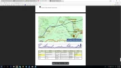
Screenshot 2018-05-18 09.21.14.webp

I learned that nearly everyone goes through Yelbes now, as I did. I had GPS tracks as I was walking alone, and my tracks followed the southern route through Yelbes. Leaving Yelbes, I was very glad to have the tracks because it is not well marked.

What I soon learned, though, was that whether you take the southern loop or the northern loop, you will wind up crossing the river on the bridge right at the point where the two alternatives merge. And then you will have a horrendous few kms on the side of an extremely busy national highway. I can't decide which was worse, the 3 kms from Cáceres to Casar de Cáceres or this stretch, but I am pretty sure this walk on the shoulder of the N-430 wins. Soon after Torrefresnada, the route goes off road, but those few kms are awful.

I know that Erik and a few forum members forged their own way straight west from Yelbes to the river. This wikiloc track did just that:
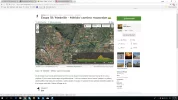
Screenshot 2018-05-18 09.27.08.webp

You can find the track at https://www.wikiloc.com/hiking-trails/etapa-18-medellin-merida-camino-mozarabe-9878755

The guy who posted this track says he was lucky to find a tractor to take him across the river, but that the river crossing could be very dicey. And if you can't cross the river, it's another 12 km back to take the bridge over.

This is what Erik said about it: There is a track, complete with occasional old markers, from Yelbes to San Pedro de Mérida which crosses the vast agricultural lands of the area and which parallels much of the engineering work that provides millions of litres of irrigation water to the rice, maize and tomatoes which dominate the fields. Crossing depends on river levels because fording the Búrdalo can only be achieved when they are low (which they were). Finding the ford was easy, crossing was not, as I elected in such shallow, calf-deep water to go barefoot.

So I guess the point of this post, other than that it serves as a diversion for a jet-lagged post-camino peregrina is that it seems that it would be a real risk to walk straight west to the river and then find it was impassable. Erik was lucky, but I guess I would recommend staying with the bridge crossing, whether you choose to go through Santa Amalia or Yelbes. But I would love to hear other opinions.

Buen camino, Laurie

p.s. To any of the other members of the Mozárabe mob, if you are not still walking, tell me what you did!
 
Train for your next Camino on California's Santa Catalina Island March 16-19
Hi, I got completely lost after I followed a Camino sign which indicated a hard left just before the entrance to Santa Amalia. This track went past some agricultural buildings and then out among the fields. I seemed to be stuck in a wedge of land between Yelbes and the N-430. The arrows disappeared out there, although on some of the wells (?) you could see old arrows that had been painted over.

Somehow I ended up bypassing Santa Amalia entirely and had to use maps.me to get myself onto the N-430. So I ended up walking about 5km along the road into Torresfresnada which was quite busy even on a Sunday!

The peregrina who left before me that morning told me later that day that she ignored that sign and walked straight into Santa Amalia and picked up the arrows from the other side of the village.

So, if you decide to go to San Pedro de Mérida via Santa Amalia, maybe ignore any Camino sign pointing left BEFORE entering Santa Amalia. : )
 
Wow, I did the stage through Yelbes today. The things I could tell you...!

Just wait until I get there in my Moz report!!

BP
 
Train for your next Camino on California's Santa Catalina Island March 16-19
Oh, the suspense, the suspense. And you are only in Córdoba in your reporting. :(

And at some point you will also have to let us know whether you are going to the Invierno or not. Too many mysteries, BP!

I begin the Invierno tomorrow, actually! :0D

I am about to call the Hostal Torres in Puente Domingo for my first stop!

I have decided to do it 9 stages : I know it is possible, as I managed to do so I in 2015. I will arrive in Santiago the 27, a strange date... A few days after the big Fiesta! So I will miss the big party...

I bring the Forum guide and will do my best to give updates, if necessary!

BP
 
... I will arrive in Santiago the 27, a strange date... A few days after the big Fiesta!...
There is a fiesta going on from THE DATE for a week. I remember closing of Fiesta in 2015 was a huge almost half an hour fireworks. Staircase in front of the entrance to Seminario Menor was a good place to watch it. I think you can catch some of the Fiesta feeling even after 27th.

Buen Camino Invierno!
 
...and ship it to Santiago for storage. You pick it up once in Santiago. Service offered by Casa Ivar (we use DHL for transportation).
Wow, I did the stage through Yelbes today. The things I could tell you...!

Just wait until I get there in my Moz report!!

BP
A short version for a peregrina coming there in 3 days? So I know if I should do Santa Amalia or Yelbes.
 
We did the Santa Amalia option and stayed there at a new hostel just alongside the plaza. Don’t remember the name, as I’m on camino now without my notes regaring Mozarabe
 
BP, where are you when we need you?

You can still go through Yelbes without doing the river crossing. The arrows will take you to a point where you meet up with the Santa Amalia option as you cross the river on the bridge. Either way you then walk what can only be described as kms from hell. Very busy, very dangerous.

I am surprised to hear that @Oppis went through Santa Amalia, since the woman in the tourist office in Medellín told me “everyone” now goes through Yelbes. The decision about the river crossing comes in Yelbes. Good luck Beatrice.
 
Get a spanish phone number with Airalo. eSim, so no physical SIM card. Easy to use app to add more funds if needed.
BP, where are you when we need you?

You can still go through Yelbes without doing the river crossing. The arrows will take you to a point where you meet up with the Santa Amalia option as you cross the river on the bridge. Either way you then walk what can only be described as kms from hell. Very busy, very dangerous.

I am surprised to hear that @Oppis went through Santa Amalia, since the woman in the tourist office in Medellín told me “everyone” now goes through Yelbes. The decision about the river crossing comes in Yelbes. Good luck Beatrice.
I have the GPS track for SA not Yelbes :-)
 
As I did a 54 km stage today I might option for Santa Amalia as my place to sleep tomorrow. Or my feet are way to tired and want to stop in Medellín.
 
As I did a 54 km stage today I might option for Santa Amalia as my place to sleep tomorrow. Or my feet are way to tired and want to stop in Medellín.

I have the GPS track for SA not Yelbes :)

Hi, Beatrice,
On the Yelbes thread, I posted some alternative tracks that would take you through Yelbes and at least cut down on the highway walking. You also have an alternative to stop in San Pedro de Mérida after Medellín, if you don’t go through Santa Amalia, though it was not my favorite pueblo on this camino. I didn’t go through Santa Amalia, so I don’t know what it’s like, but others have said it is ok. Good luck and buen camino, Laurie
 
A selection of Camino Jewellery
On another thread, @Raggy gave some great news about an effort to keep people off the highway with an option over the river. I’m just pasting it in here so that other Mozárabe peregrinos will be more likely to see it. I would love to hear from people who have navigated this section without the highway stretch. This was one of the 3 “most terrifying highway walks” I have had on my caminos, with the other two being the walk on the Lebañiego into Potes (also apparently re-routed now) and the Vdlp out of Cáceres into Casar de Cáceres (try to do this on a weekend or after rush hour!).


peregrina2000 said:
And even more terrifying, on the Mozárabe from the bridge on the N-430 after Santa Amalia and into Torrefresnada.
I'm delighted to report that Badajoz Jacobea (the Camino association for this region) has signposted an alternative route from Medellin to San Pedro de Merida which avoids this section of road entirely.

www.europapress.es

Mejoran la señalización para los peregrinos del camino Mozárabe de Santiago en Vegas Altas
La Asociación de Amigos del Camino Mozárabe de Santiago de Badajoz, en colaboración con...
www.europapress.es
www.europapress.es
If I understand the article correctly, The route goes through Yelbes and allows pilgrims to cross the Rio Burdalo at a point where there is a natural bump which allows pilgrims to ford the river safely most of the time. The signage provides warnings about when it is safe / unsafe to cross. My advice would be to check with the locals in Medellin and Yelbes to confirm the river conditions before you do this.

I look forward to hearing from people on the way about the new route.
 
allows pilgrims to cross the Rio Burdalo at a point where there is a natural bump which allows pilgrims to ford the river safely most of the time.
If anyone finds a KML file to locate this crossing point, it would be helpful. All the routes I've seen cross the river on the N-430 highway bridge.
 
If anyone finds a KML file to locate this crossing point, it would be helpful. All the routes I've seen cross the river on the N-430 highway bridge.

Can't resist those requests, CC. I think I may have found it on the web page of the association mentioned in the article as the group responsible for the re-routing. Take a look here. Looks like track number four crosses the river and avoids the highway. I downloaded it to basecamp, and am attaching a screen shot. Looks like the river crossing takes place at a narrow point, just as the article says. What do you think?

p.s. if that link doesn't work (it's to google drive), go to the association website, http://badajozjacobea.org/, and click on camino, and there is a whole section for gps tracks.
 

Attachments

  • Screenshot 2020-02-19 13.44.49.webp
    Screenshot 2020-02-19 13.44.49.webp
    161.9 KB · Views: 39
Ideal pocket guides for during & after your Camino. Each weighs only 1.4 oz (40g)!
I now have a KML file that seems to cross the river at a place where clearly there have been tracks/trails, and it avoids the highway - as shown on your screenshot. It was track 4 as you said.

Thanks @peregrina2000 . Now, when will I get to use it???
 
I will add here that the associations involved in this initiative looked into planning applications for a footbridge but it was rejected.
It will be very helpful if pilgrims who use this alternative route could share their experiences and opinions here or in emails directly to the Badajoz association - whether to thank them for their work or to ask them to keep trying for a better option.
 
Ideal pocket guides for during & after your Camino. Each weighs only 1.4 oz (40g)!
Just saw a comment by @Carel5 about his experience on the Burdalo River crossing. I’m pasting it in:

In September 2016 I followed a French couple out of Yelbes. A few kilometers outside the town the yellow signs disappeared. It turned out that we were on the old Burdalo route that was no more maintained. The local people in the fields however insisted that we were on the Camino and pointed us the right way. The Burdalo crossing turned out to be very easy, much easier than all the others on the Mozarabe. The water was well below the knees. It would be good to revive the old route. It is much shorter and not along busy highways. A must however is correct information about the river conditions.

Carel5 makes a good point about getting good information about the condition of the river. It would be a very long walk (and very frustrating) to get to an impassable river and then have to backtrack to the bridge and the highway. @Raggy, do you have any suggestions?
 
In another forum (about safety along highways) I found this Spanish news report about improved signalisation between Medellin and San Pedro de Merida on the Camino Mozarabe. I understand that the Camino Associations have restored the old route that involves a crossing of the River Búrdalo, and avoids a long walk along a busy highway. When I walked the Mozarabe in April 2016, the river crossing was very easy but sometimes the crossing is impossible.

 
A selection of Camino Jewellery
It would be a very long walk (and very frustrating) to get to an impassable river and then have to backtrack to the bridge and the highway. @Raggy, do you have any suggestions?
If anyone should reach the river and find it fuller than they expected, I would strongly advise them to err on the side of caution - Don't take risks with the river.
In the event that you decide not to cross, I believe (from looking at Google maps / satellite) that you can turn north and take paths along the side of the river until you reach the road bridge. If you were to do this, I don't think you would walk very much further than if you had taken the Santa Amalia route (28km from Medellin to San Pedro de Merida).You can take a look at this post on the Badajoz Jacobea Facebook page to see a diagram of the three routes:

In an ideal scenario, you would find out whether the river is crossable before you get there. Apparently, the Badajoz association has put up some signage to advise people about this - but I'm not sure where it is or what it says (I have a feeling that the images in the Facebook post above are of the signage but I can't read them). It would be great if someone on the way could post a picture here.

You could send a tweet or a message to the Badajoz association when you're approaching this stage to check in with them. Their details are as follows:
Facebook - https://www.facebook.com/BadajozJacobea
Twitter - https://twitter.com/BadajozJacobea
Email - badajozjacobea@gmail.com
Web - http://badajozjacobea.org

Another option would be to check in at the Policia Local or the Ayuntamento in Medellin and ask them for the latest information on river conditions. The Policia Local have the keys to the sports hall (where pilgrims can stay) so they must be used to helping pilgrims.

And finally, of course, as you pass through the town of Yelbes, you should ask for an update from the farmers there. One person told me that he got a ride across the river on a tractor. So that might be an option if the water is high ...
 
Last edited by a moderator:
Here is another Spanish item on the new route with illustrations that I can not read good.


Crossing the river is at a "badén natural". My Google Translate calls it a "natural speed bump". No idea what they mean. The report say that there is information for the pilgrims at two information panels in Medellin and Yelbes.

By the way. About 300 meter before the river crossing, there is a dirt road going SW-NE. I think you must follow this dirt road NE, if the water is too high, to reach the highway bridge. A very frustrating detour indeed.
 
Crossing the river is at a "badén natural". My Google Translate calls it a "natural speed bump". No idea what they mean.
I expect it refers to a bar in the river:

By the way. About 300 meter before the river crossing, there is a dirt road going SW-NE. I think you must follow this dirt road NE, if the water is too high, to reach the highway bridge. A very frustrating detour indeed.
Sure. But better than drowning, and not as frustrating as it would be if you had to backtrack all the way to Yelbes.
 
Ideal pocket guides for during & after your Camino. Each weighs only 1.4 oz (40g)!
I expect it refers to a bar in the river:


Sure. But better than drowning, and not as frustrating as it would be if you had to backtrack all the way to Yelbes.

Can you estimate the extent of the detour? It looks to me like walking from Yelbes to the river, and then back to the bridge before Torrefresnada would add more than 15 km. It is almost 6 km from Yelbes to the bridge. From Yelbes to the crossing looks like 8 or so (?) and then back to the bridge another equal amount. I may be way off, but I am estimating with the amigos map. The distance from the crossing back to where the purple and green lines intersect is longer than Yelbes to the bridge, so it would be a very long detour.

When I walked, I heard bits and pieces about this river crossing, but just wasn't willing to risk that long backtracking. So I am afraid that unless there is good up to date information, many people will continue to take that safe route. There was talk of a bridge, but I guess that has gone nowhere.
 
Can you estimate the extent of the detour? It looks to me like walking from Yelbes to the river, and then back to the bridge before Torrefresnada would add more than 15 km.
My estimates:
Yelbes to the N430 bridge direct route = 6km
Yelbes to the crossing point and then to the N430 bridge = 15km
So - If you're unlucky and you can't cross at the river, you've got an extra 9km to walk. Not great. That's why I hope that the locals will get into the habit of informing pilgrims about this crossing.
 

Attachments

  • Screen Shot 2020-02-24 at 23.25.29.webp
    Screen Shot 2020-02-24 at 23.25.29.webp
    59.6 KB · Views: 30
Provided that the locals are well informed. Also in 2016 an old man in a remote house (the same man that featured in later reports about the harassment of female pilgrims) warned me for the second river crossing in the mountain stage from Villaharta. As I had already successfully crossed the first river, I did not listen to him. The second crossing turned out to be very easy.
 
Perfect memento/gift in a presentation box. Engraving available, 25 character max.
Provided that the locals are well informed. Also in 2016 an old man in a remote house (the same man that featured in later reports about the harassment of female pilgrims) warned me for the second river crossing in the mountain stage from Villaharta. As I had already successfully crossed the first river, I did not listen to him. The second crossing turned out to be very easy.
Ha! I had that same experience. He is a sad elderly man who lives alone and engages in all sorts of inappropriate behavior. The Spanish safety net has not taken care of this guy.
 
My estimates:
Yelbes to the N430 bridge direct route = 6km
Yelbes to the crossing point and then to the N430 bridge = 15km
So - If you're unlucky and you can't cross at the river, you've got an extra 9km to walk. Not great. That's why I hope that the locals will get into the habit of informing pilgrims about this crossing.
Thanks! And once again showing my inability to do basic arithmetic, I had forgotten to subtract the 6 km from the total from Yelbes to the river to the highway, but we would have to walk that anyway. So it is about a 9 km add-on.

I really hope this gets worked out. It would be such a great alternative, it would totally bypass Torrefresnada. And it would also greatly shorten the distance into San Pedro de Mérida, to make Medellín to Mérida much more do-able!
 
And it would also greatly shorten the distance into San Pedro de Mérida, to make Medellín to Mérida much more do-able!
With the river crossing, the stage from Medellin to San Pedro de Merida is reduced to 21km. That's a game changer. I think it means that:
- Few people will walk via Santa Amalia and Torrefresneda.
- The albergue in Torresfreneda (which I heard is poorly maintained) will become redundant
- Pilgrims who can handle 40km will walk from Medellin to Merida in one day.
- Pilgrims who can handle 30km will stay at the newly renovated Albergue Turistico at Trujillanos. They might explore Cornvalo natural park before walking the short stage to Merida.
- Another section of the Mozarabe becomes accessible to people who prefer stages around 20km.
 
Perfect memento/gift in a presentation box. Engraving available, 25 character max.
Does anyone have more recent information on the options from Yelbes to San Pedro de Mérida?

Also what are the water levels on the Río Búrdalo likely to be in October?

(I'm asking for a friend- unfortunately it's not me traveling :confused: )
 
Does anyone have more recent information on the options from Yelbes to San Pedro de Mérida?

Also what are the water levels on the Río Búrdalo likely to be in October?

(I'm asking for a friend- unfortunately it's not me traveling :confused: )
You don't seem to have had an answer to your query, @C clearly . 🤔

We could (it depends on our son's movements in September and October) walk the Mozárabe from Almería to Mérida starting end of September 2022.
So I have been reading all the posts about this bit of the Camino Mozárabe, but haven't found the answer.

As slow walkers, we would walk from Medellín to Torrefresnada (approximately 16 km?) via Yelbes, but would have to walk along the dreaded N-430.
The albergue in Torresfreneda (which I heard is poorly maintained)
As the albergue in Torrefresnada is the only lodging option there, if the river can't be crossed other than on the bridge on the N-430, I was thinking of walking a very short day from Medellín to Santa Amalia staying in the hostal, and then walk to San Pedro de Mérida.
 
I have a recent report from the Mozárabe, crossing the Rio Búrdalo:

The Ayuntamiento, the tourism office and the local police in Medellin can all advise whether it's crossable or not.
 
The one from Galicia (the round) and the one from Castilla & Leon. Individually numbered and made by the same people that make the ones you see on your walk.
I have a recent report from the Mozárabe, crossing the Rio Búrdalo:

The Ayuntamiento, the tourism office and the local police in Medellin can all advise whether it's crossable or not.

Great sleuthing, AJ! I think these peregrinos walked this stage about a month ago (based on my calculations of their 56 day camino from Almería). I am not sure where that puts things in terms of the “rainy season,“ but it is encouraging to see people cross it in springtime. I’m guessing that as summer comes, the level drops quite a bit. But what do I know.

Your suggestions about where to find out about the condition before starting out are great ones, because it would be a very unpleasant surprise (requiring a LOT more kms of walking) to get to the river and not be able to cross.

Walking from Almería is a real treat, hoping you can get there this year!
 
I have a recent report from the Mozárabe, crossing the Rio Búrdalo:

The Ayuntamiento, the tourism office and the local police in Medellin can all advise whether it's crossable or not.
The water level in Rio Búrdalo was about the same in April 2016. It was by far the easiest of the three that I did. The first one after Villaharta was the most difficult, with water above the knees. The second was longer but not deep. I skipped the crossing of Rio Zuhar for road walking as it was raining that day. Apparently there are now yellow markings towards Rio Búrdalo.
 
Meanwhile I watched the whole series of videos from the French couple that walked from Almeria to Santiago. It was great footage for reliving my own walk of 2016. The continuation along Via de la Plata and Sanabres was nice as well. The couple just has reached Santiago despite a heavy fall of the woman Monique, which made her last days very painful.
 
A selection of Camino Jewellery

❓How to ask a question

How to post a new question on the Camino Forum.

Featured threads

❓How to ask a question

How to post a new question on the Camino Forum.

Featured threads

Forum Rules

Forum Rules

Camino Updates on YouTube

Camino Conversations

Most downloaded Resources

This site is run by Ivar at

in Santiago de Compostela.
This site participates in the Amazon Affiliate program, designed to provide a means for Ivar to earn fees by linking to Amazon
Official Camino Passport (Credential) | 2024 Camino Guides
Back
Back
Top