Search 74,075 Camino Questions

A Side-Pilgrimage to Covadonga

Dave

Veteran Member
Time of past OR future Camino
First: Camino Francés 2002; most recent: Norte/Primitivo 2019
One of the side-trips that I've long wanted to make from the Norte is the connecting pilgrimage to Covadonga. It could be said that Covadonga is where the reconquista began, as a group of Iberian Christians, led by Pelayo (not the hermit, the soldier!), won their first victory over the conquering Umayyad forces. From there, the kingdom of Asturias was formed and the resistance grew. Covadonga was a sight well chosen to make a defensive stand, situated in the foothills with many caves. A statue of the Virgin Mary, ultimately known as Our Lady of Covadonga (the patron of Asturias), was hidden in one of those caves and ultimately credited for the victory.

Given that, it's no surprise that Covadonga is the major Asturian pilgrimage site, alongside of Oviedo of course. A route to Oviedo is waymarked from Gijon and frequently overlaps with the Norte between Gijon and Amandi (near Villaviciosa), before splitting off on its own. I stayed in Amandi at the La Ferreria (which is great), and the location was ideal, as it's actually right on the route to Covadonga. I woke up the next morning and was off and running.

The best resource that I found for this walk online was the series of hand-drawn maps found on the Xurde Moran site (you've got to scroll down quite a ways to get to them). There are a couple of gps tracks online as well. By and large, though, I was just relying on the waymarks, which were quite dependable. In addition to the Covadonga symbol that appears quite often (see it here, pointing back from the Norte/Primitivo split), there are Camin a Cuadonga signs, and also blue and orange (or maybe pink?) arrows spray-painted on the road. From Amandi to Covadonga, I felt quite confident of the route throughout.

From Amandi to Covadonga, the walk spans 52km. It's around 70% on minor paved roads and 30% on trails/dirt roads. The first half of the walk is comparable to the Villaviciosa-Gijon walk (understandably enough), proceeding along minor hills on a valley's edge. As you get closer to Covadonga, the mountains grow around you, but there are rarely significant ascents/descents on this walk (the steps to Covadonga at the end might be the most strenuous climb). Most of the villages that you pass through are small. Facilities are sporadic and the bars early on don't open for breakfast, so you've got to plan accordingly. There are, however, some albergue turisticos along the way, including La Casona de la Figar in Miyares (20.5km from Amandi), Albergue El Puntual de Romillo (in Romillo/Rumillo, 33.5km from Amandi), and Albergue Cangas de Onis (aka Albergue La Riera), which is located not in Cangas but in La Riera, just 4km before Covadonga. There is also an albergue in Llames de Parres, La Pesa de Arriba, but it was reported to be closed this year.

Cangas de Onis is the lone town of any significant size along the way, some 40km from Amandi. It's a really nice spot, set right on the Rio Sella, with cafes set along the river and a few interesting sights. With regards to the route, a chunk of the walk lines up with what's known as the Camin de la Reina, which is said to be the route followed by Isabel II en route to Covadonga in the 19th century, and was originally a Roman road.

Covadonga is definitely accustomed to absorbing big crowds, but there is no special attention given to walking pilgrims. (Perhaps this is different in holy years.) When I arrived, despite it being an overcast and occasionally rainy day, there were lots of people visiting--both by car and tour bus. The two main components of the visit are: 1) the basilica, which is perched magnificently on a hill overlooking the valley below (despite the clouds, it was still stunning to see this appear far above me), and 2) the Holy Cave, where "Our Lady" is revered. Beyond that, there is a luxury hotel, a couple of cafes, and a souvenir shop. The small museum has a stamp available and I'm sure there's one in the basilica's sacristy as well--if you can get access.

Buses depart from Covadonga periodically for Cangas de Onis and there are some direct buses for Oviedo. To get back to Villaviciosa, to continue along the Norte, you'll want to bus to either Oviedo or Ribadesella, and then find a connection to Villaviciosa. There is a GR that connects Llanes/Poo and Covadonga (the GR-105.2--thanks to Valeria for this tip!), so one could theoretically through-hike from Llanes to Amandi via Covadonga, but I didn't have time to scout the Llanes-Covadonga option. I looked for any info in Llanes/Poo on this. The turismo in Llanes helpfully offers a few pages of info (a zoomed out map and some route descriptions), but there was nothing immediately evident in Poo where the route should have broken off from the Norte. Something for another time...

Anyway, I enjoyed the walk. While the weather wasn't totally accommodating, Covadonga is a striking spot and essential to the history of both Spain and the Camino. It's well worth a two-day detour.
 
Get a spanish phone number with Airalo. eSim, so no physical SIM card. Easy to use app to add more funds if needed.
One of the side-trips that I've long wanted to make from the Norte is the connecting pilgrimage to Covadonga. It could be said that Covadonga is where the reconquista began, as a group of Iberian Christians, led by Pelayo (not the hermit, the soldier!), won their first victory over the conquering Umayyad forces. From there, the kingdom of Asturias was formed and the resistance grew. Covadonga was a sight well chosen to make a defensive stand, situated in the foothills with many caves. A statue of the Virgin Mary, ultimately known as Our Lady of Covadonga (the patron of Asturias), was hidden in one of those caves and ultimately credited for the victory.

Given that, it's no surprise that Covadonga is the major Asturian pilgrimage site, alongside of Oviedo of course. A route to Oviedo is waymarked from Gijon and frequently overlaps with the Norte between Gijon and Amandi (near Villaviciosa), before splitting off on its own. I stayed in Amandi at the La Ferreria (which is great), and the location was ideal, as it's actually right on the route to Covadonga. I woke up the next morning and was off and running.

The best resource that I found for this walk online was the series of hand-drawn maps found on the Xurde Moran site (you've got to scroll down quite a ways to get to them). There are a couple of gps tracks online as well. By and large, though, I was just relying on the waymarks, which were quite dependable. In addition to the Covadonga symbol that appears quite often (see it here, pointing back from the Norte/Primitivo split), there are Camin a Cuadonga signs, and also blue and orange (or maybe pink?) arrows spray-painted on the road. From Amandi to Covadonga, I felt quite confident of the route throughout.

From Amandi to Covadonga, the walk spans 52km. It's around 70% on minor paved roads and 30% on trails/dirt roads. The first half of the walk is comparable to the Villaviciosa-Gijon walk (understandably enough), proceeding along minor hills on a valley's edge. As you get closer to Covadonga, the mountains grow around you, but there are rarely significant ascents/descents on this walk (the steps to Covadonga at the end might be the most strenuous climb). Most of the villages that you pass through are small. Facilities are sporadic and the bars early on don't open for breakfast, so you've got to plan accordingly. There are, however, some albergue turisticos along the way, including La Casona de la Figar in Miyares (20.5km from Amandi), Albergue El Puntual de Romillo (in Romillo/Rumillo, 33.5km from Amandi), and Albergue Cangas de Onis (aka Albergue La Riera), which is located not in Cangas but in La Riera, just 4km before Covadonga. There is also an albergue in Llames de Parres, La Pesa de Arriba, but it was reported to be closed this year.

Cangas de Onis is the lone town of any significant size along the way, some 40km from Amandi. It's a really nice spot, set right on the Rio Sella, with cafes set along the river and a few interesting sights. With regards to the route, a chunk of the walk lines up with what's known as the Camin de la Reina, which is said to be the route followed by Isabel II en route to Covadonga in the 19th century, and was originally a Roman road.

Covadonga is definitely accustomed to absorbing big crowds, but there is no special attention given to walking pilgrims. (Perhaps this is different in holy years.) When I arrived, despite it being an overcast and occasionally rainy day, there were lots of people visiting--both by car and tour bus. The two main components of the visit are: 1) the basilica, which is perched magnificently on a hill overlooking the valley below (despite the clouds, it was still stunning to see this appear far above me), and 2) the Holy Cave, where "Our Lady" is revered. Beyond that, there is a luxury hotel, a couple of cafes, and a souvenir shop. The small museum has a stamp available and I'm sure there's one in the basilica's sacristy as well--if you can get access.

Buses depart from Covadonga periodically for Cangas de Onis and there are some direct buses for Oviedo. To get back to Villaviciosa, to continue along the Norte, you'll want to bus to either Oviedo or Ribadesella, and then find a connection to Villaviciosa. There is a GR that connects Llanes/Poo and Covadonga (the GR-105.2--thanks to Valeria for this tip!), so one could theoretically through-hike from Llanes to Amandi via Covadonga, but I didn't have time to scout the Llanes-Covadonga option. I looked for any info in Llanes/Poo on this. The turismo in Llanes helpfully offers a few pages of info (a zoomed out map and some route descriptions), but there was nothing immediately evident in Poo where the route should have broken off from the Norte. Something for another time...

Anyway, I enjoyed the walk. While the weather wasn't totally accommodating, Covadonga is a striking spot and essential to the history of both Spain and the Camino. It's well worth a two-day detour.
Hi Dave, thank you for sharing this.
I keep it mind for next year.
Wish you well, Peter.
 
Thanks i was thinking of doing that trip as a German guide online had in in their description as an option but then I decided to stick with normal Norte. Check GPS-tracks.com
 
The focus is on reducing the risk of failure through being well prepared. 2nd ed.
I visited Cavadonga in 2011, and found it to be a magical place. you can get a trip in a car to the lakes above the cave and the chapel.
 
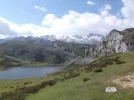
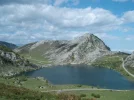
We had missed out on the lakes when we walked to Covadonga in 2013 due to bad weather. We took the car up to the lakes which are about 11kms from the turning, earlier this year. Lovely but some scary drops at the side of the road . In summer you have to take the shuttle bus and at any time you are supposed to go up with a car before 10.00am as the road is so narrow in places. That didn't seem to be enforced when we were there as we met folk still coming up as we went down.

Glad to see that @Dave got there - and we too felt that there was little interest in walking pilgrims in Covadonga itself. A pity, but our hosts at Casa Asprón were interested and would even have taken us to the lakes if it had been good weather.

Our stamp came from the museum. We asked after the mid-day Mass in the Basilica. The priest pointed us to the sacristan/verger and he just was not interested and sent us to the museum. not very encouraging but the museum stamp was good and the museum itself worth visiting.
 

Attachments

  • lake1.webp
    lake1.webp
    109.6 KB · Views: 18
  • lake 2.webp
    lake 2.webp
    118.5 KB · Views: 18
Get a spanish phone number with Airalo. eSim, so no physical SIM card. Easy to use app to add more funds if needed.
Hi, I took a detour on my pilgrimage to Santiago to visit Covadonga in May. I walked on the roads from Llanes staying overnight in a little village called Mestas. The second day the road took me up into the hills with breath taking views and no traffic. I stayed with the nuns at Covadonga ( by prior arrangement ) which was lovely and was able to join them for prayers. I also got the stamp from the museum and was told that this was the only one available at the shrine. I then walked on via Cangas de Onis and onto Villaviciosa, I saw the signs for the camin a cuadonga on my way to Villaviciosa, but was not sure where they lead. Covadonga was a amazing place to visit and the pictures on the internet do not capture the wonder of the place. I noticed the devotion to our lady of Covadonga in so many of the churches that I visited on my pilgrimage and I was so glad that I included it on my journey.
 
One of the side-trips that I've long wanted to make from the Norte is the connecting pilgrimage to Covadonga. It could be said that Covadonga is where the reconquista began, as a group of Iberian Christians, led by Pelayo (not the hermit, the soldier!), won their first victory over the conquering Umayyad forces. From there, the kingdom of Asturias was formed and the resistance grew. Covadonga was a sight well chosen to make a defensive stand, situated in the foothills with many caves. A statue of the Virgin Mary, ultimately known as Our Lady of Covadonga (the patron of Asturias), was hidden in one of those caves and ultimately credited for the victory.

Given that, it's no surprise that Covadonga is the major Asturian pilgrimage site, alongside of Oviedo of course. A route to Oviedo is waymarked from Gijon and frequently overlaps with the Norte between Gijon and Amandi (near Villaviciosa), before splitting off on its own. I stayed in Amandi at the La Ferreria (which is great), and the location was ideal, as it's actually right on the route to Covadonga. I woke up the next morning and was off and running.

The best resource that I found for this walk online was the series of hand-drawn maps found on the Xurde Moran site (you've got to scroll down quite a ways to get to them). There are a couple of gps tracks online as well. By and large, though, I was just relying on the waymarks, which were quite dependable. In addition to the Covadonga symbol that appears quite often (see it here, pointing back from the Norte/Primitivo split), there are Camin a Cuadonga signs, and also blue and orange (or maybe pink?) arrows spray-painted on the road. From Amandi to Covadonga, I felt quite confident of the route throughout.

From Amandi to Covadonga, the walk spans 52km. It's around 70% on minor paved roads and 30% on trails/dirt roads. The first half of the walk is comparable to the Villaviciosa-Gijon walk (understandably enough), proceeding along minor hills on a valley's edge. As you get closer to Covadonga, the mountains grow around you, but there are rarely significant ascents/descents on this walk (the steps to Covadonga at the end might be the most strenuous climb). Most of the villages that you pass through are small. Facilities are sporadic and the bars early on don't open for breakfast, so you've got to plan accordingly. There are, however, some albergue turisticos along the way, including La Casona de la Figar in Miyares (20.5km from Amandi), Albergue El Puntual de Romillo (in Romillo/Rumillo, 33.5km from Amandi), and Albergue Cangas de Onis (aka Albergue La Riera), which is located not in Cangas but in La Riera, just 4km before Covadonga. There is also an albergue in Llames de Parres, La Pesa de Arriba, but it was reported to be closed this year.

Cangas de Onis is the lone town of any significant size along the way, some 40km from Amandi. It's a really nice spot, set right on the Rio Sella, with cafes set along the river and a few interesting sights. With regards to the route, a chunk of the walk lines up with what's known as the Camin de la Reina, which is said to be the route followed by Isabel II en route to Covadonga in the 19th century, and was originally a Roman road.

Covadonga is definitely accustomed to absorbing big crowds, but there is no special attention given to walking pilgrims. (Perhaps this is different in holy years.) When I arrived, despite it being an overcast and occasionally rainy day, there were lots of people visiting--both by car and tour bus. The two main components of the visit are: 1) the basilica, which is perched magnificently on a hill overlooking the valley below (despite the clouds, it was still stunning to see this appear far above me), and 2) the Holy Cave, where "Our Lady" is revered. Beyond that, there is a luxury hotel, a couple of cafes, and a souvenir shop. The small museum has a stamp available and I'm sure there's one in the basilica's sacristy as well--if you can get access.

Buses depart from Covadonga periodically for Cangas de Onis and there are some direct buses for Oviedo. To get back to Villaviciosa, to continue along the Norte, you'll want to bus to either Oviedo or Ribadesella, and then find a connection to Villaviciosa. There is a GR that connects Llanes/Poo and Covadonga (the GR-105.2--thanks to Valeria for this tip!), so one could theoretically through-hike from Llanes to Amandi via Covadonga, but I didn't have time to scout the Llanes-Covadonga option. I looked for any info in Llanes/Poo on this. The turismo in Llanes helpfully offers a few pages of info (a zoomed out map and some route descriptions), but there was nothing immediately evident in Poo where the route should have broken off from the Norte. Something for another time...

Anyway, I enjoyed the walk. While the weather wasn't totally accommodating, Covadonga is a striking spot and essential to the history of both Spain and the Camino. It's well worth a two-day detour.

So every time I start veering away from my plan to walk the Norte in 2017 (and to hop over to France for the Arles route), I come across one of Dave's posts extolling the virtues of this or that detour on the Norte. Now I'm thinking that combining the pilgrim-filled Norte with a few of these special "extras" might be just what the doctor ordered. But then again, all that asphalt.......

Thanks for this intriguing suggestion, Dave! Buen camino, Laurie
 
One of the side-trips that I've long wanted to make from the Norte is the connecting pilgrimage to Covadonga. It could be said that Covadonga is where the reconquista began, as a group of Iberian Christians, led by Pelayo (not the hermit, the soldier!), won their first victory over the conquering Umayyad forces. From there, the kingdom of Asturias was formed and the resistance grew. Covadonga was a sight well chosen to make a defensive stand, situated in the foothills with many caves. A statue of the Virgin Mary, ultimately known as Our Lady of Covadonga (the patron of Asturias), was hidden in one of those caves and ultimately credited for the victory.

Given that, it's no surprise that Covadonga is the major Asturian pilgrimage site, alongside of Oviedo of course. A route to Oviedo is waymarked from Gijon and frequently overlaps with the Norte between Gijon and Amandi (near Villaviciosa), before splitting off on its own. I stayed in Amandi at the La Ferreria (which is great), and the location was ideal, as it's actually right on the route to Covadonga. I woke up the next morning and was off and running.

The best resource that I found for this walk online was the series of hand-drawn maps found on the Xurde Moran site (you've got to scroll down quite a ways to get to them). There are a couple of gps tracks online as well. By and large, though, I was just relying on the waymarks, which were quite dependable. In addition to the Covadonga symbol that appears quite often (see it here, pointing back from the Norte/Primitivo split), there are Camin a Cuadonga signs, and also blue and orange (or maybe pink?) arrows spray-painted on the road. From Amandi to Covadonga, I felt quite confident of the route throughout.

From Amandi to Covadonga, the walk spans 52km. It's around 70% on minor paved roads and 30% on trails/dirt roads. The first half of the walk is comparable to the Villaviciosa-Gijon walk (understandably enough), proceeding along minor hills on a valley's edge. As you get closer to Covadonga, the mountains grow around you, but there are rarely significant ascents/descents on this walk (the steps to Covadonga at the end might be the most strenuous climb). Most of the villages that you pass through are small. Facilities are sporadic and the bars early on don't open for breakfast, so you've got to plan accordingly. There are, however, some albergue turisticos along the way, including La Casona de la Figar in Miyares (20.5km from Amandi), Albergue El Puntual de Romillo (in Romillo/Rumillo, 33.5km from Amandi), and Albergue Cangas de Onis (aka Albergue La Riera), which is located not in Cangas but in La Riera, just 4km before Covadonga. There is also an albergue in Llames de Parres, La Pesa de Arriba, but it was reported to be closed this year.

Cangas de Onis is the lone town of any significant size along the way, some 40km from Amandi. It's a really nice spot, set right on the Rio Sella, with cafes set along the river and a few interesting sights. With regards to the route, a chunk of the walk lines up with what's known as the Camin de la Reina, which is said to be the route followed by Isabel II en route to Covadonga in the 19th century, and was originally a Roman road.

Covadonga is definitely accustomed to absorbing big crowds, but there is no special attention given to walking pilgrims. (Perhaps this is different in holy years.) When I arrived, despite it being an overcast and occasionally rainy day, there were lots of people visiting--both by car and tour bus. The two main components of the visit are: 1) the basilica, which is perched magnificently on a hill overlooking the valley below (despite the clouds, it was still stunning to see this appear far above me), and 2) the Holy Cave, where "Our Lady" is revered. Beyond that, there is a luxury hotel, a couple of cafes, and a souvenir shop. The small museum has a stamp available and I'm sure there's one in the basilica's sacristy as well--if you can get access.

Buses depart from Covadonga periodically for Cangas de Onis and there are some direct buses for Oviedo. To get back to Villaviciosa, to continue along the Norte, you'll want to bus to either Oviedo or Ribadesella, and then find a connection to Villaviciosa. There is a GR that connects Llanes/Poo and Covadonga (the GR-105.2--thanks to Valeria for this tip!), so one could theoretically through-hike from Llanes to Amandi via Covadonga, but I didn't have time to scout the Llanes-Covadonga option. I looked for any info in Llanes/Poo on this. The turismo in Llanes helpfully offers a few pages of info (a zoomed out map and some route descriptions), but there was nothing immediately evident in Poo where the route should have broken off from the Norte. Something for another time...

Anyway, I enjoyed the walk. While the weather wasn't totally accommodating, Covadonga is a striking spot and essential to the history of both Spain and the Camino. It's well worth a two-day detour.

Dave, after a little more exploration, I have a question. Is there a reason you chose to walk east from Amandi rather than take the detour starting in someplace like Llanes (which I believe is what Tia Valeria did)?
 
Get a spanish phone number with Airalo. eSim, so no physical SIM card. Easy to use app to add more funds if needed.
Good to see that someone has walked our originally planned route. We planned the walk that @Pilgrim 122 did from Llanes with the same hotel stop. Bad weather sent us round to walk in from Arriondas instead. A decision approved by the Mountain Rescue team we spoke to in Cangas de Onis (Lovely sello from them at the police station) The route we followed was well marked and has markings to/from Oviedo too.
 
Dave, after a little more exploration, I have a question. Is there a reason you chose to walk east from Amandi rather than take the detour starting in someplace like Llanes (which I believe is what Tia Valeria did)?

Yikes--sorry, Laurie, missed this originally. How has it been 2.5 years? My plan originally was to walk from Llanes. Then I got to Llanes and asked the turismo folks for info, since I couldn't find much online. They had nothing more to offer. Undeterred, I figured I'd try making my way with a sketchy photocopy of a map that they provided. As I passed through Playa de Poo, though, continuing through the outskirts, I continued to find no waymarks of any kind (it was supposed to be a GR). I knew, though, that there were excellent waymarks linking Gijón/Amandi and Covadonga, so I abandoned the Llanes option and shifted to Amandi.

Would love to go back and connect Llanes-Covadonga, but I figured at the time that the well-waymarked approach would be more accessible to pilgrims and the best use of the limited time I had for scouting. It's the eternal challenge, trying to cram in as many new route options around re-walking the essentials, without rushing so quickly that I do a poor job with all of it.
 
Holoholo automatically captures your footpaths, places, photos, and journals.
One of the side-trips that I've long wanted to make from the Norte is the connecting pilgrimage to Covadonga. It could be said that Covadonga is where the reconquista began, as a group of Iberian Christians, led by Pelayo (not the hermit, the soldier!), won their first victory over the conquering Umayyad forces. From there, the kingdom of Asturias was formed and the resistance grew. Covadonga was a sight well chosen to make a defensive stand, situated in the foothills with many caves. A statue of the Virgin Mary, ultimately known as Our Lady of Covadonga (the patron of Asturias), was hidden in one of those caves and ultimately credited for the victory.

Given that, it's no surprise that Covadonga is the major Asturian pilgrimage site, alongside of Oviedo of course. A route to Oviedo is waymarked from Gijon and frequently overlaps with the Norte between Gijon and Amandi (near Villaviciosa), before splitting off on its own. I stayed in Amandi at the La Ferreria (which is great), and the location was ideal, as it's actually right on the route to Covadonga. I woke up the next morning and was off and running.

The best resource that I found for this walk online was the series of hand-drawn maps found on the Xurde Moran site (you've got to scroll down quite a ways to get to them). There are a couple of gps tracks online as well. By and large, though, I was just relying on the waymarks, which were quite dependable. In addition to the Covadonga symbol that appears quite often (see it here, pointing back from the Norte/Primitivo split), there are Camin a Cuadonga signs, and also blue and orange (or maybe pink?) arrows spray-painted on the road. From Amandi to Covadonga, I felt quite confident of the route throughout.

From Amandi to Covadonga, the walk spans 52km. It's around 70% on minor paved roads and 30% on trails/dirt roads. The first half of the walk is comparable to the Villaviciosa-Gijon walk (understandably enough), proceeding along minor hills on a valley's edge. As you get closer to Covadonga, the mountains grow around you, but there are rarely significant ascents/descents on this walk (the steps to Covadonga at the end might be the most strenuous climb). Most of the villages that you pass through are small. Facilities are sporadic and the bars early on don't open for breakfast, so you've got to plan accordingly. There are, however, some albergue turisticos along the way, including La Casona de la Figar in Miyares (20.5km from Amandi), Albergue El Puntual de Romillo (in Romillo/Rumillo, 33.5km from Amandi), and Albergue Cangas de Onis (aka Albergue La Riera), which is located not in Cangas but in La Riera, just 4km before Covadonga. There is also an albergue in Llames de Parres, La Pesa de Arriba, but it was reported to be closed this year.

Cangas de Onis is the lone town of any significant size along the way, some 40km from Amandi. It's a really nice spot, set right on the Rio Sella, with cafes set along the river and a few interesting sights. With regards to the route, a chunk of the walk lines up with what's known as the Camin de la Reina, which is said to be the route followed by Isabel II en route to Covadonga in the 19th century, and was originally a Roman road.

Covadonga is definitely accustomed to absorbing big crowds, but there is no special attention given to walking pilgrims. (Perhaps this is different in holy years.) When I arrived, despite it being an overcast and occasionally rainy day, there were lots of people visiting--both by car and tour bus. The two main components of the visit are: 1) the basilica, which is perched magnificently on a hill overlooking the valley below (despite the clouds, it was still stunning to see this appear far above me), and 2) the Holy Cave, where "Our Lady" is revered. Beyond that, there is a luxury hotel, a couple of cafes, and a souvenir shop. The small museum has a stamp available and I'm sure there's one in the basilica's sacristy as well--if you can get access.

Buses depart from Covadonga periodically for Cangas de Onis and there are some direct buses for Oviedo. To get back to Villaviciosa, to continue along the Norte, you'll want to bus to either Oviedo or Ribadesella, and then find a connection to Villaviciosa. There is a GR that connects Llanes/Poo and Covadonga (the GR-105.2--thanks to Valeria for this tip!), so one could theoretically through-hike from Llanes to Amandi via Covadonga, but I didn't have time to scout the Llanes-Covadonga option. I looked for any info in Llanes/Poo on this. The turismo in Llanes helpfully offers a few pages of info (a zoomed out map and some route descriptions), but there was nothing immediately evident in Poo where the route should have broken off from the Norte. Something for another time...

Anyway, I enjoyed the walk. While the weather wasn't totally accommodating, Covadonga is a striking spot and essential to the history of both Spain and the Camino. It's well worth a two-day detour.
Lovely to read your post! I know that area very well and I have mentioned in a Picos de Europa threat
 
The 2024 Camino guides will be coming out little by little. Here is a collection of the ones that are out so far.
Lovely to read your post! I know that area very well and I have mentioned in a Picos de Europa threat
Sorry writing on my phone....
Meant to say that I have mentioned in a Picos de Europa thread that local councils and groups in the area are working together to have recognised "La Ruta de la Reconquista" as part of the Camino del Norte.
This is the old route used by pilgrims from Liebana across Picos de Europa to Covadonga to pray before they continued to Oviedo.
It is possible another link to the all route will follow from Poo de Llanes to El Alto de Hortiguero (gateway to Cabrales/ Picos de Europa) and on the route to Covadonga.
Lots of Asturians and Spanish people do the pilgrimage to Covadonga on 8th September as La Virgen de Covadonga is the patron saint of Asturias and el Dia de Asturias.
Recognition of La Ruta de la Reconquista will bring better services & information on routes available to pilgrims.
Services at present cater for a very large number of tourists as this is the most visited area in Asturias.
I walked from Cangas de Onis to Covadonga along the river Gueña and up to Lagos de Covadonga through mountain trails known to locals and then back again & it felt like hiking Los Pirineos!
There is a great video posted by Ivar on the thread Picos de Europa called something like "90 miles hiking solo in Picos de Europa" showing the magestic beauty of the area!
To anyone with a bit of time on the Camino del Norte my recomendation always is to visit Covadonga and Picos de Europa!
Saludos amigos del camino!
 
We walked from Arriondas to Covadonga through Cangas de Onis. Well way-marked in 2013. We had intended to walk from Poo, on the GR105a, having walked to Llanes but bad weather changed our plans.
Waiting to see what this year brings......but not planning on distance walking this time.
 
I just found this interesting text from the Casa de Cultura in Cangas de Onís about an historic alternative to the Norte, going inland to Cangas de Onís. It is a bit difficult to figure it out exactly. It lacks a map. ;-)

El Camino de Santiago de la Costa tenía una variación a la altura de Posada de Llanes hacia el interior por Rales y Telledo de Ardisana, llegando al municipio de Cangas de Onís por el Puerto de Piedrahita. El camino desciende por Cuerres y Llenín para seguir, en torno a la Cuesta de Igüedo por Villaverde, Pedrugada, Pandesiertos y La Estrada, subiendo desde aquí a Corao-Castillo para continuar por Corao, Soto de Cangas, Celorio, Cardes y llegar a Cangas de Onís.

En Llenín recibía este camino otro procedente de Liébana que pasaba por Sotres, Tielve, Camarmeña, Ortiguero, Onís, pasando a Cangas de Onís por Grazanes y Beceña.

Por estas vías, durante siglos, pasaron los peregrinos jacobeos hacia el llamado Puente Romano, único existente hasta el siglo XIX, desde Cangas de Onís hasta su desembocadura. Otra razón del paso de los peregrinos por esta zona sería, sin duda, visitar Covadonga, sobre todo a partir del siglo XIV en el que este lugar va adquiriendo importancia como santuario religioso de primer orden.

El camino en el Concejo de Cangas de Onís está jalonado de interesantes iglesias románicas: Grazanes, Con, Villaverde, o Abamia. Los peregrinos llegaban a Cangas de Onís buscando refugio en las capillas de San Roque o Santa Ana, si no encontraban alojamiento en el hospital de peregrinos.

La capilla de San Roque se encontraba al lado de un camino que conducía desde el Mercáu a la antigua iglesia parroquial en Cangas de Arriba, ocupando el lado oeste de la superficie donde se celebra hoy el mercado de los domingos.

Santa Ana tenía su capilla en las proximidades de la antigua iglesia parroquial. En esta capilla recibían sepultura los niños, los pobres y los peregrinos. La imagen de Santa Ana se conserva en la actualidad en la capilla de San Antonio. El hospital de peregrinos estuvo situado en la Calle San Pelayo junto a la actual farmacia de Reyes Comas.

(Del libro Cangas de Onís. Señas de identidad. El legado de Celso Diego Somoano. "El camino de los peregrinos a Oviedo y Santiago por Cangas de Onís".)
 
Ideal sleeping bag liner whether we want to add a thermal plus to our bag, or if we want to use it alone to sleep in shelters or hostels. Thanks to its mummy shape, it adapts perfectly to our body.

€46,-
Thank you for this post you all! Now I’m hoping I can add San Toribio and Covadonga to my Camino this year God willing.
 

❓How to ask a question

How to post a new question on the Camino Forum.

Most read last week in this forum

Planning on walking Norte-Primitivo starting about June 10, 2025. Are the albergues very busy at that time and also what will the weather be? I did this the end of August and September of 2017 and...

Featured threads

❓How to ask a question

How to post a new question on the Camino Forum.

Featured threads

Forum Rules

Forum Rules

Camino Updates on YouTube

Camino Conversations

Most downloaded Resources

This site is run by Ivar at

in Santiago de Compostela.
This site participates in the Amazon Affiliate program, designed to provide a means for Ivar to earn fees by linking to Amazon
Official Camino Passport (Credential) | 2024 Camino Guides
Back
Back
Top