• ⚠️ Emergency contact in Spain - Dial 112 and AlertCops app. More on this here.
  • Remove ads on the forum by becoming a donating member. More here.

Search 74,075 Camino Questions

LIVE from the Camino Caminka on a route from le Puy-en-Velay to Carcassonne

caminka

Veteran Member
Time of past OR future Camino
see signature
Day 19: le Puy-en-Velay - Landos 27,5km

This is a continuation of my 2024 camino in France. For the first part, see my reports on Via Gebenennsis)

Through the night and in the morning storms and strong showers were sailing to and fro above le Puy. Still, everyone was up and about by 6am and at breakfast by 6h30. It was so nice to see excited faces of those who were starting, or more expectant faces of those who already came here walking. Amongst them was a german guy who started in Berlin, bivouaced a lot, and walked south to le Puy to have more company.

Because of the rain, I started only after 7am when there was a lull. Still, I kept a close eye on the clouds and on the possible roofs, so I managed to duck into a handy garage when the next barrage of rain came. And then into a bus shelter.

The Regordane follows the suburbs of le Puy for a bit more than 2km then starts climbing. The grass was of course all wet. I had a reprieve from the rain for just enough that I could photograph le Puy's silhuette entwined in the mist, then the next storm came down.

When I reached the plateau the rain calmed a bit and the going was good, on gravel and asphalt roads almost due south.
After Tarreyres the route descends a stony lane to the former railway viaduct, crosses it then climbs up even steeper and more stony lane. I briefly considered staying on the gravel voie verte (bicycle lane) but dismissed the idea - my legs get a lot more and more quickly tired on flat surfaces.

After this big valley the Regordane traverses a high plateau covered in still green fields, meadows and pastures with far-reaching views, and sprinkled with small villages. Very beautiful. Reminiscent a bit of Spain in May.

Every village had a big fountain but none were drinkable. That is 27km without a water source that I have seen! The route is exposed so plan accordingly. But I got to use my water filter!

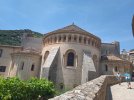
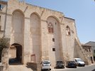
I started to feel the 'strolling' flatish gravel roads after about 20km and by the time I reached Landos everything hurt. I detoured to the lovely romanesque church first because I doubted I would budge much once I was in the room.

I am sleeping in gite d'etape la Bascule in the centre of the village on the main road. There is another hiker here, a woman, but we each have our own rooms. Which are up steep flight of stairs, or two, if you are on the second floor. Bed €22, dinner €17-20, breakfast €8, washing machine €4, towel €4. I think I payed extra €3 for being vegetarian (an omelette instead of chicken and more salad instead of sausage), I've seen this a few times posted on internet sites of gites d'etapes on the Stevenson.

I am getting hungry, perhaps I should head downstairs and see if I can get an early dinner.

... Dinner was still excellent.

IMG_20240712_081525_1.jpg IMG_20240712_085343.jpg IMG_20240712_091449_1.jpg IMG_20240712_101953.jpg IMG_20240712_104346.jpg IMG_20240712_132748.jpg IMG_20240712_140640.jpg IMG_20240712_145144_1.jpg IMG_20240712_151752.jpg IMG_20240712_161414.jpg
 
Last edited:
Ideal sleeping bag liner whether we want to add a thermal plus to our bag, or if we want to use it alone to sleep in shelters or hostels. Thanks to its mummy shape, it adapts perfectly to our body.

€46,-
A selection of Camino Jewellery
I did wonder if anyone else carries a water filter, interesting that you didn’t bother using it on the VG with so many streams/ river etc available.
What do you have, Katyden or Sawyer Squeeze?
There were enough water points on VG, I always topped-up, and it worked fine.
I have Sawyer Mini. It's the first time I'm using it (I only got it for new years).
 
Last edited:
Train for your next Camino on California's Santa Catalina Island March 16-19
Already on day 19! Now that I've stopped walking I'll go back and read all about your Chemin. Hope you ate well.
Yes, I can't believe it's been almost three weeks already! Dinner was locally sourced and included chanterelles with chestnuts and the good sour milk with honey.
 
Day 20: Landos - Langogne c.21km

The morning was cold! I started in my sleeveless fleece, sleeves and gloves. I was hoping the promised sun will rise soon and warmed me up. It did rise soon but also soon hid behind those high up white clouds. It peeked out sometimes and then it was hot, and I took off the fleece, and it hid and the wind picked up, and I put the fleece back on and the sun came out again.

The route started behind the lovely church down an overgrown and wet track in the middle of the village. I was wet to my knees first thing in the morning. It didn't help with the no-sun thing for sure.

In the morning the route still ran along the dark violet-brown gravel roads of volcanic origin, bordered by colourful flowers. Sometimes I had a feeling I was walking in spring.

It is weird though that there are no more scallops anywhere. Yesterday I didn't really notice this yet, but today I kinda missed them. There are no stamps in the churches either, although I got one in Pradelles' chapelle Notre-Dame today. :)

Both little villages on the plateau had big fountains with no warning plaques, so I assumed the water was drinkable.

I made more small stops today because I still felt the legs from yesterday, especially in the hips.

Reaching a stone cross on a big pedestal and an asphalt road, the route on mapy.cz does not follow the waymarks.

A bit more then halfway I arrived into Pradelles, one of les plus beaux villages de France. It's a lovely medieval town built on a slope, with lots of medieval-cum-later stone houses, portals and window frames. I popped into the tourist office and got a stamp of the Stevenson route.

The gravel road from Pradelles onwards was of the normal whitish colour, so we definitely left the volcanic land behind. Flowers were the same, though.

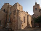
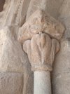
My end stage is Langogne, another lovely old town with tall medieval buildings, some still having pulleys installed under roofs, to haul things up to the top floors. Also a well preserved romanesque church with some interesting capitals and reliefs.

Landos and Langogne were not originally my plan, but I schuffled the days around a bit because tommorrow is national holiday and supermarkets and shops will be closed. I wanted to reach Langogne on a Saturday to resupply for two days.

I am staying in gite d'etape le Mas du l'Oncle Joseph on the outskirts of the town near two supermarkets. There is a kitchen and I could indulge in some proper vegetables. Bed €22, optional breakfast €8, wifi, duvets.

Another randonneur (hiker) is here, walking the Stevenson route. He started to wash his laundry in the kitchen sink, but I told him to please move to the bathroom. I was not going to make my dinner next to smelly socks.

IMG_20240713_063752_1.jpg IMG_20240713_073543.jpg IMG_20240713_105140_1.jpg IMG_20240713_114622_1.jpg IMG_20240713_135245_1.jpg IMG_20240713_134321.jpg IMG_20240713_134533.jpg IMG_20240713_135400_1.jpg IMG_20240713_133119.jpg IMG_20240713_125933_1.jpg
 
Last edited:
The focus is on reducing the risk of failure through being well prepared. 2nd ed.
Day 19: le Puy-en-Velay - Landos 27,5km

This is a continuation of my 2024 camino in France. For the first part, see my reports on Via Gebenennsis)

Through the night and in the morning storms and strong showers were sailing to and fro above le Puy. Still, everyone was up and about by 6am and at breakfast by 6h30. It was so nice to see excited faces of those who were starting, or more expectant faces of those who already came here walking. Amongst them was a german guy who started in Berlin, bivouaced a lot, and walked south to le Puy to have more company.

Because of the rain, I started only after 7am when there was a lull. Still, I kept a close eye on the clouds and on the possible roofs, so I managed to duck into a handy garage when the next barrage of rain came. And then into a bus shelter.

The Regordane follows the suburbs of le Puy for a bit more than 2km then starts climbing. The grass was of course all wet. I had a reprieve from the rain for just enough that I could photograph le Puy's silhuette entwined in the mist, then the next storm came down.

When I reached the plateau the rain calmed a bit and the going was good, on gravel and asphalt roads almost due south.
After Tarreyres the route descends a stony lane to the former railway viaduct, crosses it then climbs up even steeper and more stony lane. I briefly considered staying on the gravel voie verte (bicycle lane) but dismissed the idea - my legs get a lot more and more quickly tired on flat surfaces.

After this big valley the Regordane traverses a high plateau covered in still green fields, meadows and pastures with far-reaching views, and sprinkled with small villages. Very beautiful. Reminiscent a bit of Spain in May.

Every village had a big fountain but none were drinkable. That is 27km without a water source that I have seen! The route is exposed so plan accordingly. But I got to use my water filter!

I started to feel the 'strolling' flatish gravel roads after about 20km and by the time I reached Landos everything hurt. I detoured to the lovely romanesque church first because I doubted I would budge much once I was in the room.

I am sleeping in gite d'etape la Bascule in the centre of the village on the main road. There is another hiker here, a woman, but we each have our own rooms. Bed €22, dinner €17-20, breakfast €8, washing machine €4, towel €4.

I am getting hungry, perhaps I should head downstairs and see if I can get an early dinner.

... Dinner was excellent.

View attachment 174464 View attachment 174465 View attachment 174466 View attachment 174467 View attachment 174468 View attachment 174469 View attachment 174470 View attachment 174471 View attachment 174472 View attachment 174473
Thank you for your review, it is very helpful. Your photos are beautiful and tell a story on their own 🙂
 
Ideal sleeping bag liner whether we want to add a thermal plus to our bag, or if we want to use it alone to sleep in shelters or hostels. Thanks to its mummy shape, it adapts perfectly to our body.

€46,-
And you didn’t even have to design an off-route scamper to see them! What do you think the guy who is being burned by the dragon did to deserve that treatment? I’ve seen lots of punishments in romanesque capitals, but I think this is my first dragon.
I know, right. On the interpretations in the church it said he is a male version of luxuria, the lust. Idk, maybe he is gay?
True, dragons are usually the poor fellows being pierced by various pointy objects.
 
Day 21: Langogne - Laveyrune 19,5km

This morning I dared to look at the temperature, it was 6 degrees celsius! No wonder I was freezing my fingers off in the mornings. The skies were clear, though, so I expected at least some warm-up during the day.

From the gite, there is a direct connection to GR, so no backtracking needed. The start is along a quiet asphalt road which in about half an hour becomes soft gravel road past meadows then up into woods.

The going is steadily up, with one steep stony section in the woods after the first stream, then a lovely track amidst meadows and pastures with views to the east over the valley below.

The hamlet of Esfagoux appeared suddenly and at start looked quite abandoned, with big stone ruined houses. I though it would be a cool place for a gite d'etape, peaceful and quiet. No fountain or bench, just a hiker's weather marker.

Surprisingly lots of meadows for a route I though will mostly be in the woods. At one point, there was heavy breathing on the right somewhere and my heart started to beat a little faster until I saw there were just cows. Just cows. Later, and this was in the forest again, jays started to scream over a valley to the left, clearly trying to warn off whatever spooked them. Just in case the creature ventured too close to the road, I started singing, obviously warning it that there is a human here and that we do not approach humans.

When I arrived to an asphalt road (heading left on it saves 1,5km), I was starting to really look forward to the rest area by a small lake a bit further on. GR heads right on the road then goes sharp left down by signs for lac de l'Auradoux. This turn-off was not GR waymarked, unless the mark was hidden behind a rubbish bin.

On the way to the lake I met a woman coming from Cheylard l'Eveque on the Stevenson. She said she heard lots of wildly barking dogs in the woods on the way here. I didn't hear anything, luckily.

Finally the lovely little lake was here and the benches under spruces. I plopped down on one. The spot was serene and beautiful, but not without visitors. About 20 hikers went past in an hour I was there and a few families who came with cars and dogs.

Too soon it was time to leave. The descent to Luc is along a medieval route, probably the original Regordane, now a lovely path. It reaches Luc at its ruined castle above the village. I made a short tour of the ruins then hastened to the village's toilets. It was a squatter which was just as fine. No toilet paper so I used my tiny portable bidet.

I languished on the bench at the 'village green' for a long while because my gite was just 3km further on and it opened only at 15h30. I ambled there slowly, passing by the small Luc's church with a romanesque abside.

So here I am, in gite d'etape Colonie d'Espoir, a long building with many windows, used by children groups for vacations. But the gite portion is well separated. The shower was rather cool, but I have my own room and dinner is at 19h. Half-pension €46, picnic €9, duvet, blankets, linen €8, washing machine, wifi.

IMG_20240714_074615.jpg IMG_20240714_075703.jpg IMG_20240714_080202_1.jpg IMG_20240714_095009_1.jpg IMG_20240714_104347.jpg IMG_20240714_113043.jpg IMG_20240714_113907_1.jpg IMG_20240714_134343_1.jpg IMG_20240714_135817.jpg
 
Last edited:
FYI, I learned today that la Malle Postale also runs baggage and person service along the Stevenson.

Yesterday I came upon another navette/shuttle on the Stevenson, see photos.
IMG_20240713_160033.jpg IMG_20240713_160037.jpg
 
Perfect memento/gift in a presentation box. Engraving available, 25 character max.
I know, right. On the interpretations in the church it said he is a male version of luxuria, the lust. Idk, maybe he is gay?
True, dragons are usually the poor fellows being pierced by various pointy objects.
Dragons are most often seen with St. Michael (or St George).
 
Day 22: Laveyrune - Chasserades 23,2km + 4km to the village and back

I had a late start today because breakfast wasn't prepared before 7h and I couldn't negotiate a change to picnic. So I packed two marmelade sandwiches and a yoghurt, and was off.

A lovely track with views north lead back to GR which then climbed to a saddle then descended to a road. Down across a stream and up to another small road in fine beech woods. While I was taking photos I missed a turn and had to backtrack up, adding a km.

The climb up to Espervelouze (1225m), the highest point for a while, was pretty cool, partly in shady woods. From the top the view encompassed the route further on, although everything looked to be covered in woods.

The descent was steep and very stony, but luckily a small path has been made alongside and it was a lot better.

In la Bastide-Puylaurent I first stopped by the farmacy. I have something in my right ear I feared might have been a tick because it is getting bigger. The farmacist looked and said it is not a tick just an unusual pimple. I was greatly releived, but seriously? Pimple in my ear!?

Then I called camping municipal in Chasserades to see if they have beds as well. I was maybe kinda thinking of using my tent but the forecast was for storms in the afternoon and if they had beds, I would prefer those. They did, in a small wooden chalet. €12, full kitchen, washing and drying machine €5+€4, duvet, linen €, wifi. There is a tinny depannage (shop) with a few items for the microwave. The reception opens at 17h but you can install yourself when you arrive.

After la Bastide-Puylaurent I followed the Regordane up to the main road, down to the old main road (strawberries!), up to the main road, and into le Thort. I had a rest here in an open former public bread oven, out of the wind. At one point, a cat confidently walked in, went 'uh oh', and quickly scampered out. A little later loud chatter revealed a group of female hikers passing by.

Just south of the village is Lou Palet de Gargantua, a capstone of a dolmen.

At that point, I left the Regordane for a series of yellow local paths towards Chasserades. I was practically walking in the cloud, and it drizzled. So I put my poncho over the backpack and my rain visor over my glasses. For being a last minute 'invention', I think the visor performs pretty well.

Camping is a ways from the village and in the afternoon I made a trek to the romanesque church, covered twins of lavoir (washing place) and fontaine-abreuvoir (long fountain for cattle and horses), and the shop for something to warm up in the microwave.

IMG_20240715_072208.jpg IMG_20240715_075411.jpg IMG_20240715_080423.jpg IMG_20240715_085256_1.jpg IMG_20240715_111342.jpg IMG_20240715_121809_1.jpg IMG_20240715_122915.jpg IMG_20240715_134823.jpg IMG_20240715_163019_1.jpg IMG_20240715_163303.jpg
 
Last edited:
The one from Galicia (the round) and the one from Castilla & Leon. Individually numbered and made by the same people that make the ones you see on your walk.
I just spent the past hour catching up on your two threads 😊. Hats off to you Caminka for taking the time to describe your day's walk in such detail. My heart lies in Spain but the French routes are so tempting!

I know the prices of accommodations are much higher than in Spain but I'm a bit shocked at some of the prices you quoted. You mention a demi-pension of €46 and then have to pay €8 extra for a duvet and linens 😳. And incredible that a vegetarian meal would be more expensive - it's actually cheaper considering what they give you!

I personally find the demi-pension option not ideal if you leave early in the morning and are vegetarian (or in my case vegan). Some gîtes will accommodate you but I've also had the experience that it was take it or leave it, the price remained the same.
 
Hello @caminka! I'm much enjoying your descriptions. We walked the Stevenson last year, though sometimes taking the Regordane, when it was more convenient. Just curious why you chose the Regordane, as most people seem to opt for the RLS? It sounds equally wonderful, though. Any comparisons you can make? It seems you've now detoured off to the Stevenson, in Chasserades. Are you going to stay on the RLS now? There's some magnificent walking coming up across the Cevennes National Park on the RLS. We also discovered a very pleasant short-cut, if you're looking to abbreviate the long stage to Florac. (I can forward a mapy.cz track, if you're interested).

Anyway, have a great rest of your walk, and I'll look forward to your continuing descriptions.

(And for those also following this thread, the Regordane and Robert Lewis Stevenson trails both start in Le Puy en Velay and continue to Ales in France, generally following separate routes but passing through many of the same towns, especially in the first half. Both are covered in the same Miam Miam Dodo guide).
 
I just spent the past hour catching up on your two threads 😊. Hats off to you Caminka for taking the time to describe your day's walk in such detail. My heart lies in Spain but the French routes are so tempting!

I know the prices of accommodations are much higher than in Spain but I'm a bit shocked at some of the prices you quoted. You mention a demi-pension of €46 and then have to pay €8 extra for a duvet and linens 😳. And incredible that a vegetarian meal would be more expensive - it's actually cheaper considering what they give you!

I personally find the demi-pension option not ideal if you leave early in the morning and are vegetarian (or in my case vegan). Some gîtes will accommodate you but I've also had the experience that it was take it or leave it, the price remained the same.
For some reason I had no reception yesterday and the wifi was blah.

I discovered I actually like writing more detailed descriptions and sometimes even go back to add something if I remember and think it might be of use. Don't know why, I am usually more a lecture kinda girl. ☺️

I know what you mean, I love Spain too, just France is faster to go to by train (I'm still not convinced on airplanes but will have to seriously consider the option because getting to Spain from Slovenia by train takes 3 days and getting back from SdC 5, and that is seriously too many days I could spend walking).
I do love french routes as well. They are usually more green which I like a lot.

Yes, prices have gone very up since covid. I carry a sleeping liner and a sleeping bag so I'm not paying anything extra. I'm putting the prices up for reference.

I was (and still am) put off by the fact that I have to pay extra for a cheaper meal just because I am a vegetarian. Seems very unfair.

I always try to wiggle out of breakfast if possible or at least try to negotiate a picnic instead. I am also choosing gites that don't have a set half-pension but separate bed, dinner, breakfast and picnic.
 
Last edited:
3rd Edition. More content, training & pack guides avoid common mistakes, bed bugs etc
Hello @caminka! I'm much enjoying your descriptions. We walked the Stevenson last year, though sometimes taking the Regordane, when it was more convenient. Just curious why you chose the Regordane, as most people seem to opt for the RLS? It sounds equally wonderful, though. Any comparisons you can make? It seems you've now detoured off to the Stevenson, in Chasserades. Are you going to stay on the RLS now? There's some magnificent walking coming up across the Cevennes National Park on the RLS. We also discovered a very pleasant short-cut, if you're looking to abbreviate the long stage to Florac. (I can forward a mapy.cz track, if you're interested).

Anyway, have a great rest of your walk, and I'll look forward to your continuing descriptions.

(And for those also following this thread, the Regordane and Robert Lewis Stevenson trails both start in Le Puy en Velay and continue to Ales in France, generally following separate routes but passing through many of the same towns, especially in the first half. Both are covered in the same Miam Miam Dodo guide).
I chose the Regordane because it was more direct, no other reason. The Stevenson is pretty popular and I didn't want to compete for beds (but yesterday it happened that both gites d'etapes were full).

I'm off the Stevenson now as well and will only cross it in Florac for the last time.

Thank you and I can't believe it's been more than three weeks already!
 
(And for those also following this thread, the Regordane and Robert Lewis Stevenson trails both start in Le Puy en Velay and continue to Ales in France, generally following separate routes but passing through many of the same towns, especially in the first half. Both are covered in the same Miam Miam Dodo guide).

And the St. Giles Way is almost the same as the Regordane -- it apparently follows a historical route. But that means it also parallels the busy roads that have been laid over it. We started on the St. Giles way and then mostly followed the Regordane (GR 700).

Re: walking in France vs Spain. For me, coffee and breakfast are generally better in Spain, but, in French villages that still have boulangeries ----- getting to start the day with a chocolate croissant is the best!

I'm really enjoying reading your notes Caminka!
 
Day 23: Chasserades - le Bleymard 20km + 1,6km to village and back (yesterday)

There was intermittent rain during the night and I was glad I was in the little chalet. It cleared up by morning. I actually slept till 7h and left half an hour later. This turned out to be the time of the earlier starters.

Right out of the village of Chasserades I almost felt I was on a camino, starting from one of the mid-stage points. Six other hikers, all on the Stevenson, were behind me. More were coming and I counted eleven people. One man was even walking with a two-wheel buggy. It almost felt crowded.

In l'Estampe I detoured to top-up my water bottle at the fountain a bit off route the last for almost 13km) and let everybody pass me by. They were fast walking hikers and I was soon by myself. Later the second group caught up with me and I let them ahead also. I am not a fast uphill walker and even less so with the extra weight.

In the first hamlet of Mirandol we walked above then crossed under a railway viaduct. The little 'tunnels' on both sides are not real tunnels, they are protectors against the snow.

It was the day of a lot of climbing. The first was a long one up to the ridge at Guy Cubizolle, all in nice woods with strawberries. Due to some racing event in near future it has been rerouted to some vertical paths - the ones you walk nearly parallel to the ground.

After the following long descent, a long climb and a shorter descent, all in woods, I detoured to have a picnic at the source of the river Lot. The same Lot that much later crosses Via Podiensis at Saint-Come, Espalion, Estaing, Figeac, Cajarc and Cahors. I didn't see a clear source because it was buried under lush somewhat marshy vegetation in a little valley.

A small signposted path descends from the trail to the source and the rest area. When I was packing, a woman arrived along the trail, looking at her phone. She stopped a little up, turned around, went down, turned around, up again, down again, always only looking at her phone and zooming in. She was obviously looking fir something. I packed and went up to trail, and asked her what is she looking for. The source of le Lot, she said. I pointed down the path to the clearly visible marshy area. ... This digital era...

The route follows the valley of the fledgling river for a while on lovely paths across pastures, then climbs out to les Alpiers and deacends again to the river in le Bleymard.

Both gites d'etapes in le Bleymard were full (I kept checking for three days) so I went to camping municipal by the river Lot. It had three small tents for rent - together with a mattress and a blanket - and I took one of those. Being by the river, I suspected that there will be a lot of dew in the morning. There was. Tent for rent €10.60, own tent €7, small kitchen with microwave, fridge, kettle and utensils, washing and drying machine €2.50+2, no toilet paper! Free use of municipal pool in the afternoons.

By evening, some 12 tents popped up in the small corner reserved for randonneurs. Some were arriving as late as 19h. Francoise and Henri, an elderly couple, Orelie, a young lady, and me comandeered the corner with a picnic table. We chatted a bit and I learned that there has been a bedbug outbreak three days ago in abbaye Notre-Dame de la Neige and in la Bastide-Puylaurent. Good then, that I planned different stages.

IMG_20240716_080907.jpg IMG_20240716_082252.jpg IMG_20240716_094151.jpg IMG_20240716_115224_1.jpg IMG_20240716_115556.jpg IMG_20240716_120951_1.jpg IMG_20240716_124953.jpg IMG_20240716_163158_1.jpg IMG_20240716_164057_1.jpg IMG_20240716_183606.jpg
 
Last edited:
The one from Galicia (the round) and the one from Castilla & Leon. Individually numbered and made by the same people that make the ones you see on your walk.
Day 24: le Bleymard - la Fage 24,5km

Today was absolutely beautiful, possibly my favourite day so far on this camino. More than half of it was on beautiful old lanes that once linked one village to another, and that I love walking on so much.

I was right, the tent was wet outside and inside in the morning. I was glad I didn't put up my tent because I would have to carry the extra weight at least until the sun was strong enough to dry it up.
I still slept surprisingly well once I figured out the lumps and bumps of the packed earth beneath. I was also really glad to have the extra blanket and I cocooned myself in it. Just when I went to pee in the middle of the night, there was some ungodly barking just across the little river. I was really glad I was in a camping and there were other people around.

Right out of the town a steep climb on an old grassy lane bordered by flowers, trees and stone walls delivered me to a ridge from which another old lane, this time more shady, descended to Mas-d'Orcieres. There are two fountains here and a pretty green corner by the brook for relaxing.

The next climb on a road lead to menhir Cheyroux and a view ahead across a deep wooded valley to a village I suspected I will be visiting later on.

A gravel road with strawberries lead to almost abandoned Lozerette then a beautiful old lane, often almost submerged in broom, descended into the valley. Sometimes I thought I was in el Bierzo, heading out of Valle del Silencio. The GR waymarking was a bit scarce here but there were also more regular yellow flashes. The stream on bottom was crossed on stones, then I had to navigate one of those U passages through a fence. These tend to be too narrow for my horizontally strapped mattress and some precision coordinating was needed.

Another beautiful old lane, wider and grassier but still in the woods, ascended to Outlet, exactly the village I was looking on from the other side of the valley. It had two fountains and a clocher de tourmente, a type of bell tower typical for the villages around Mont Lozere built to assist travellers in storms and mists. This one is extra special because it's built on top of a communal bread oven.

A somewhat less pretty lane climbed to menhir de la Fergere which surveyed the saddle with menhir Cheyroux. More beautiful old lanes in woods and across pastures lead to Auriac, a pretty village of stone houses with its own clocher de tourmente and a fountain.

The big climb followed, of course on another beautiful old lane in the woods which transformed into a steep climb along a gurgling stream then a lane-path so little used I had to navigate between trees.

I reached the plateau and crossed it on a beautiful track nestled between aromatic pines, ripe bluberries, colourful flowers and occasional views. Absolutely delightful.

From the top at 1439m I was suddenly on a wide open forest track with shady spruce woods on both sides, but in the sun. This descent was long, became an ever steeper and stonier path in pine woods, and ended with a short eroded section.

On bottom, an amazing view opened on the plateau full of fields, menhirs (in the distance), and two unusual conical hills. (I learned at dinner that they are older and sturdier than the surrounding eroded limestone plateau.)

A tribe of goats was trying to get my attention. I saw that one of them had her head stuck in a fence. But as I was climbing over another fence to get to her, she found enough incentive to twist and pull and get her head safely out.

Here at croix des Faux I detoured right to my gite d'etape la Fage in the village of la Fage. Bed €20, dinner €23, breakfast €10, picnic €10, linen €4, blankets, towel €3, full kitchen, washing machine €7-10, wifi.

IMG_20240717_072039_1.jpg IMG_20240717_090903_1.jpg IMG_20240717_091302.jpg IMG_20240717_092836_1.jpg IMG_20240717_102044_1.jpg IMG_20240717_104929_1.jpg IMG_20240717_114702.jpg IMG_20240717_121805.jpg IMG_20240717_141339.jpg IMG_20240717_143619_1.jpg
 
Last edited:
And the St. Giles Way is almost the same as the Regordane -- it apparently follows a historical route. But that means it also parallels the busy roads that have been laid over it. We started on the St. Giles way and then mostly followed the Regordane (GR 700).

Re: walking in France vs Spain. For me, coffee and breakfast are generally better in Spain, but, in French villages that still have boulangeries ----- getting to start the day with a chocolate croissant is the best!

I'm really enjoying reading your notes Caminka!
Yes, it is mentioned in a chanson de geste from the 12C, I think.

Pain aux raisins, it's the pain aux raisins which is the best. 😋

Thank you!
 
Day 19: le Puy-en-Velay - Landos 27,5km

This is a continuation of my 2024 camino in France. For the first part, see my reports on Via Gebenennsis)

Through the night and in the morning storms and strong showers were sailing to and fro above le Puy. Still, everyone was up and about by 6am and at breakfast by 6h30. It was so nice to see excited faces of those who were starting, or more expectant faces of those who already came here walking. Amongst them was a german guy who started in Berlin, bivouaced a lot, and walked south to le Puy to have more company.

Because of the rain, I started only after 7am when there was a lull. Still, I kept a close eye on the clouds and on the possible roofs, so I managed to duck into a handy garage when the next barrage of rain came. And then into a bus shelter.

The Regordane follows the suburbs of le Puy for a bit more than 2km then starts climbing. The grass was of course all wet. I had a reprieve from the rain for just enough that I could photograph le Puy's silhuette entwined in the mist, then the next storm came down.

When I reached the plateau the rain calmed a bit and the going was good, on gravel and asphalt roads almost due south.
After Tarreyres the route descends a stony lane to the former railway viaduct, crosses it then climbs up even steeper and more stony lane. I briefly considered staying on the gravel voie verte (bicycle lane) but dismissed the idea - my legs get a lot more and more quickly tired on flat surfaces.

After this big valley the Regordane traverses a high plateau covered in still green fields, meadows and pastures with far-reaching views, and sprinkled with small villages. Very beautiful. Reminiscent a bit of Spain in May.

Every village had a big fountain but none were drinkable. That is 27km without a water source that I have seen! The route is exposed so plan accordingly. But I got to use my water filter!

I started to feel the 'strolling' flatish gravel roads after about 20km and by the time I reached Landos everything hurt. I detoured to the lovely romanesque church first because I doubted I would budge much once I was in the room.

I am sleeping in gite d'etape la Bascule in the centre of the village on the main road. There is another hiker here, a woman, but we each have our own rooms. Which are up steep flight of stairs, or two, if you are on the second floor. Bed €22, dinner €17-20, breakfast €8, washing machine €4, towel €4. I think I payed extra €3 for being vegetarian (an omelette instead of chicken and more salad instead of sausage), I've seen this a few times posted on internet sites of gites d'etapes on the Stevenson.

I am getting hungry, perhaps I should head downstairs and see if I can get an early dinner.

... Dinner was still excellent.

View attachment 174464 View attachment 174465 View attachment 174466 View attachment 174467 View attachment 174468 View attachment 174469 View attachment 174470 View attachment 174471 View attachment 174472 View attachment 174473
Hi Camilla,
Thank you for information on lack of drinking water. Will be starting from Le Puy on the 6th August. Will bring a big water bottle.
Jo
New Zealand
 
The one from Galicia (the round) and the one from Castilla & Leon. Individually numbered and made by the same people that make the ones you see on your walk.
I was (and still am) put off by the fact that I have to pay extra for a cheaper meal just because I am a vegetarian. Seems very unfair.
Agree 1000%, not that it makes any difference on your end.

Ooooooo. Big distractions.
It sounds like a delightful day.
 
Day 25: la Fage - Florac Trois Rivieres c.17km

I couldn't fall back asleep after waking up at 3am and only dozed on and off till 6am, so I was a bit slow in going. But Ibhad a shorter day planned, so it was no biggie.

The sky was clear and a little wind was blowing. I backtracked to continue on the GR down an overgrown track then an unexpected scramble down some boulders, nothing alpinistic, though.

A short ascent later I was at the site of apparently the second largest megalithic site in France. But it is so large and spread out that you need a car to really appreciate it. Where I was at menhirs de la Fage, is easy to get to and I counted at least 14 menhirs (!) along the route, plus remains of a dolmen. Because of that the site is popular and three camper vans were parked around. It was difficult to get a photo without one lurking in the background 😤.
It was still awesome to get close to and touch so many menhirs in such a small area.

The rest of the route was basically a gravel/stony descent which took forever. I went slowly but not too slow, with short steps but not too small, to avoid tentenitis and crampa. It's a delicate balance between the two and I did pretty well.

Florac is a small town with an old centre nestled under rocky towers of thr Causse Mejean.

I am staying in gite d'etape l'Etape, fairly big, at the southern end. Bed €20, dinner €18, breakfast and dinner €21, duvets, linen €4, washing machine €4, strange wifi. It's the first gite where I wasn't given fresh bottom sheet (or a disposable sheet) and it is, frankly, quite dirty. So I'll be sleeping on a duvet.

Dinner was okay, I had company of five hikers on the Stevenson.

IMG_20240718_075052.jpg IMG_20240718_080721_1.jpg IMG_20240718_080731.jpg IMG_20240718_081912.jpg IMG_20240718_082032_1.jpg IMG_20240718_083149.jpg IMG_20240718_104137.jpg IMG_20240718_183417_1.jpg
 
Last edited:
Join the Camino cleanup. Logroño to Burgos May 2025 & Astorga to OCebreiro in June
A short ascent later I was at the site of apparently the second largest megalithic site in France
Oh. Myyyyyy. When I think French megaliths, I think Brittany. I had no idea there were so many in the SE.😯
Then I did a quick search. TIL of a possible maritime connection. https://www.smithsonianmag.com/arti...ts-france-sea-routes-mediterranean-180971467/
And I have 3 more tabs open waiting to be read. So much for getting much done today.

It was still awesome to get close to and touch so many menhirs in such a small area.
🥳
It was difficult to get a photo without one lurking in the background
But you managed. Wonderful images, @caminka !
 
Last edited:
Brava! That's an interesting route you seem to have blazed between Le Bleymard and Florac, and would definitely be of interest to those walking the Stevenson, as it's quite a savings in time and energy. Mapy.cz shows that your route is 37.4 k with 955 meters of climbing, while the standard route on the Stevenson -- through Le Pont de Montvert and Bedoues -- is 46.2 k with 1263 meters of climbing.

Sounds gorgeous, too (although the Stevenson was also quite wonderful).

Keep on trucking. At this point, the Regordane is quite a bit east of you, so I'm very curious how you plan to get to Carcassone. Looking forward to finding out.
I was most definitely glad I chose GR 68 here, but for the purists, it's not the Stevenson and it misses Mont Lozere.

Stay tuned!
 
Join the Camino cleanup. Logroño to Burgos May 2025 & Astorga to OCebreiro in June
Day 26: Florac Trois Rivieres - les Cabanes c.23km (yesterday)

(Yesterday I had zero reception in the valley between ridges.)

Let me first thank whomever mixed today's weather so that it was overcast with occasional shower till noon, otherwise I would have been absolutely gaging in 32 degrees C with little shade and only one water meagre point on the plateau.

I started early, I even managed to cancel breakfast so that I could start early.

The 2,5h climb of 6km was quite tough, an old lane, now a small path, pretty steep in places and at the start a few times almost in impassable, as the stone support has fallen down. It teoretically climbed through the forest but was fairly exposed.

I am pleased to report that there is water source just before the first village of la Rouviere. The route through this cute village literally winds across someones gardens. The owner was already watering his plants when I was passing and he remarked that one doesn't often see hikers so early.

Before the second village the route crosses a what seemed a reliable stream then reaches a meadow. Instead of crossing it, it detours left up a stone wall through trees and brambles. When I was smashing my way up there, I saw a waymark down below the wall, on a perfectly fine path. What? So I managed to climb down in a place clearly used by several hikers to do the same.

Further on the route makes a big effort to bypass the second village of Tardonneche (which may have a fountain?). The next three valleys with possible springs/streams all feed water by a pipe to the second village. Someone there clearly doesn't like hikers passing through.

But the third spring is not completely privatised, it is allowed to flow! This is the last water for about 15km. Afterwards, the lane steeply zigzags up a stony gully to the plateau.

Here it's all exposed and probably very hot on a sunny day. There are meadows and pastures, a big old inn on col du Roy which is being renovated, rest area, ticks, and walking on a fairly busy road to l'Hospitalet which used to be gite d'etape.

Finally off asphalt on a fairly unpleasant stony/gravely road, GR runs above cliffs (called corniche) in view of similar cliffs of Causse du Mejean across the valley.

Then it's up and down pastures and meadows, past occasional far-reaching views, up to a source (just barely running) and steeply down to col du Marquaires. It rained when I was going down so I was very happy to be able to find a rain-free spot under trees for a break.

Because the next climb is vertical. But there were bigger black butterflies with a white stripe that fluttered a meet and greet dance every time they encountered another same butterfly. After it there was col de Salides where I detoured right down the road to my accommodation.

This accommodation is an alternative to the (currently) closed gite d'etape Aire de Cote. It's a big tent with three nests, I got a mattress and a blanket, there are shower and toilet with no paper, and a fridge. Also a big meadow for camping. €10 and I arranged with the lady for dinner (€9) and picnic (€10.50). No phone reception.

IMG_20240719_062748.jpg IMG_20240719_063504_1.jpg IMG_20240719_065713_1.jpg IMG_20240719_084350.jpg IMG_20240719_091023.jpg IMG_20240719_110553.jpg IMG_20240719_115836.jpg IMG_20240719_133917_1.jpg IMG_20240719_204911_1.jpg
 
Last edited:
Must be an amazing picnic if it costs more than dinner!
With all the mention of streams and springs, are you using your water filter more often?
Picnic was comprised from locally produced food, that's why it was more expensive than dinner (two sheep cheeses and quarter of a kilo of dry apple slices). Dinner was a big bowl of quinoa with vegetables and a small loaf of rye bread with seeds.

Actually, no. I didn't know of those sources and if the streams will be running. I lugged plenty of bottles. That's for potential future pilgrims.

Correction, I did know of the source before col de Marquaires but when I inquired of the lady in les Cabanes if it flows, she said not to count on it too much.
 
Last edited:
€2,-/day will present your project to thousands of visitors each day. All interested in the Camino de Santiago.
Day 27: les Cabanes - l'Esperou c.21km

Thr area around Mont Aigoual is a designated star-watching park and the Milky Way was visible during the night despite the moon being almost full.

There was an option of taking a road (asphalt/gravel) directly to Aire de Cote from where I was staying, so I did that and profited about 3km plus some climbing.

Aire de Cote has water tap and a toilet, and a designated bivouac area, now that the gite d'etape is closed. It also has a panorama of the valley of Borgne with a big trumpet for listening in on the sounds of the valley.

After an initial level stroll to a viewpoint into another valley the climb started. At first on forest tracks then up a properly steep mountain path with plenty of loose stone. I huffed and puffed and took little breaks so that my heart could catch up. This path is not a GR on either IGN or mapy.cz which both show a longer and less steep route on forest tracks.

On top a panoramic path (not for the height-challenged) rounded a summit and a short clumb furter I was on top of Mont Aigoual at 1565m. There was a panorama of forested ridges all around, and to the south a village I was aiming for. Also a toilet (with paper!) and water.

I rewarded myself with an apple pie with chocolate chips. Not cheap but I earned it.

After a long break the path quickly left pine-covered summit and plunged into spruce and beech woods. Down to a ski resort, then to a tourist office. Here I learned that the village I wanted to stay in celebrates a local festival tonight. Of course every bed was taken (or too expensive).

Luckily, there is aire naturelle, a basic campsite with a sanitary block (no toilet paper but proper showers!) and I pitched my tent for the first time. It went smoothly, the system with a bottle cap for putting the pegs in worked well, and I watched a video on how to make proper knots for guylines. I like how spacious it is, all my staff goes inside. That is good because storms are forecast for during the night and in the morning. I am hoping those in the morning will somehow transform into sunshine. Pitch €9.30.

I had pizza for dinner. When I arrived to the village's main crossroad, I asked in the restaurant if they do dinners (they don't), then I spotted a tiny pizzeria across the street and enquired there. The lady said that I can choose the toppings and she will have the pizza ready at 19h. I returned at 19h and went away with a hot take-away pizza.

IMG_20240720_082540.jpg IMG_20240720_083212.jpg IMG_20240720_090506_1.jpg IMG_20240720_095722_1.jpg IMG_20240720_102900_1.jpg IMG_20240720_103306_1.jpg IMG_20240720_104252_1.jpg IMG_20240720_110100_1.jpgIMG_20240720_120354.jpg IMG_20240720_151409.jpg
 
Last edited:
Wow. Gorgeous.
A fantastic day's walk from the sound of it - up Mont Aigoual, then down to a cozy (and I hope dry) campsite, and pizza.

For me this is utterly terra incognita, so I'm very grateful, @caminka, that you have taken the time to post. Merci!
 
€2,-/day will present your project to thousands of visitors each day. All interested in the Camino de Santiago.
Wow. Gorgeous.
A fantastic day's walk from the sound of it - up Mont Aigoual, then down to a cozy (and I hope dry) campsite, and pizza.

For me this is utterly terra incognita, so I'm very grateful, @caminka, that you have taken the time to post. Merci!

Hope you have a cosy sleep
In your tent!

Well... got maybe two hours of sleep. Don't know why I woke up before midnight but I couldn't go back to sleep at all. I went to pee four times and tracked progress from a full moon to cloudy to windy to calm before the storm to big storm right above us to windy to rainy and windy right now. I am not budging from the tent until it stops raining. I've got some splash back at the sides but otherwise everything seems dry. No pool below me, either.
I didn't freeze at least (I am at 1255m!). But I got everything on: merinos, thermos and puffy, liner, sleeping bag, anorak around the footbox, poncho on top.
The mattress is kinda hard on my hips and surrounding bones, though. 🙁
Oh my, that sounds cold! I hope that tonight you'll be able to get a better night's rest.

That image is hard to imagine when I think of me in bed a couple of weeks ago in the muni in Orense with the bare minimum of clothing on to remain decent and still sweating. Of course Orense is known for its microclimate and it's located I would guess at sea level.
 
Last edited:
Good you're getting some use from the tent and sleeping mat. Hopefully by the time you get this the rain has passed.

I think most of us underestimate how much insulation a building actually gives us. We tend to think that because we're sleeping with the windows wide open that the temperature is roughly the same outside as in but it's far from it.

I purchased a new tent for the next part of my home to Santiago journey, because the staging was becoming seriously annoying - 17 km one day, 35 the next. And it saves me mucking around so much trying to find accommodation once I hit France.

I set it up in the garden and slept in it a few nights ago.
It was good practice because whilst at home I seldom use more than a sheet at present, I needed my sleeping bag in the tent. It made me realize that I'm going to have to upgrade to my warmer bag for France ( annoying, because it's bigger and heavier - it may force me into a larger pack too: with current s.bag, tent, sleep mat and cook Gear my 32 litre is already Borderline)

It also reminded me of the fact that it always takes me a few nights to adjust to camping, practically every little noise woke me. I think I managed just three of hours of broken sleep.

Hopefully the soreness in your hips is just superficial and eases off quickly once you are up and about. Whilst a sleeping mat is significantly better than nothing, they don't even come close to a good mattress!
 
The 2024 Camino guides will be coming out little by little. Here is a collection of the ones that are out so far.
Good you're getting some use from the tent and sleeping mat. Hopefully by the time you get this the rain has passed.

I think most of us underestimate how much insulation a building actually gives us. We tend to think that because we're sleeping with the windows wide open that the temperature is roughly the same outside as in but it's far from it.

I purchased a new tent for the next part of my home to Santiago journey, because the staging was becoming seriously annoying - 17 km one day, 35 the next. And it saves me mucking around so much trying to find accommodation once I hit France.

I set it up in the garden and slept in it a few nights ago.
It was good practice because whilst at home I seldom use more than a sheet at present, I needed my sleeping bag in the tent. It made me realize that I'm going to have to upgrade to my warmer bag for France ( annoying, because it's bigger and heavier - it may force me into a larger pack too: with current s.bag, tent, sleep mat and cook Gear my 32 litre is already Borderline)

It also reminded me of the fact that it always takes me a few nights to adjust to camping, practically every little noise woke me. I think I managed just three of hours of broken sleep.

Hopefully the soreness in your hips is just superficial and eases off quickly once you are up and about. Whilst a sleeping mat is significantly better than nothing, they don't even come close to a good mattress!
Yeah, no. It's noon and maybe hopefully the storms have had it for the day!

Edit: that was meant to be posted just as the storms stopped and we were off!
 
Day 29: l'Esperou - le Vigan c.20,2km (yesterday)

(I was so tired yesterday I wasn't capable of even thinking, never mind coherent writing)

The night was mostly sleepless, and after about 3am super windy and stormy. But I was ok. The tent performed well in the rains (I had a small pool between the tent and the mat because I pitched it in a little shallow), it it super spacey and I quite liked the privacy.

In the morning it still rained heavily and I couldn't really bring myself to get up early. At about 8am there was a short pause, so I packed my backpack and ran to the sanitary block which had a cozy round space in the middle, heated! Julia and Pierre, a French couple walking Chemin de st Guilhem, were already waiting there, packed and keen to leave. It was not to be. At the next pause I dismantled my tent and brought it to the cozy room to shake off and pack.

Then we waited. Every once in a while we checked the sattelite image, hoping the storms will pass. An elderly couple who cycled came in to have breakfast and they shared with us toast and jam. We waited. We still waited three hours later. At noon, it seemed the storms have finally passed and we were off!

I suggested we take the road at the start till col du Montals, to avoid the forest paths along streams. So we did and joined GR from there, me a bit in front.

It wasn't raining anymore but the wind rained from the trees and it constantly drizzled from a cloud we were apparently in.

The start was on a gravel road which was fine. There were lots of strawberries but I didn't stop a lot (only once or twice) because of the very late start and the plan to reach Montarchier 28km away. I mean, theoretically...

The plan started to seem a bit far fetched down the first descent. It was on an old lane, steep and it took forever. As I was already miffed because of lack of sleep and the late start, I was not a gracious hiker and kept a very colourful commentary about the loose stones, the slippery roots, the uneven rocks, the wet grass, the absolutely wet overhanging bushes and tree branches, the thorns, the drizzle, the wind... you get the idea.

By the time I reached Maison des Cevennes, the sun started shining and I spread out the tent and its mat while I was having a snack.

Julia and Pierre arrived. Julia got tendenitis around a left knee and it was painful. The descent was still long. So Pierre called Residence Viganaise in le Vigan and got us all beds.

The next descent on a lovely old lane was actually really nice. Well planned long swings with occasional views, and I didn't complain even when I had to fight my way through a jungle of ferns. But the last bit down to Aulas was on a very uncomfortable eroded path with overhanging bushes that was a bit dangerous.

In Aulas I detoured through the centre of this tiny medieval town. There was even a cafe open.

The route from Aulas to le Vigan would be really well made if it was better maintained. It ran on crumbling and stony old lanes, and there was a fine view of le Vigan.

I arrived at Residence Viganaise at 19h15. The first impression was not very favourable because of the smell of cat poo and not very clean patio. But the rooms were really nice, clean, with ready-made beds and towels. Because we were so late, the owners agreed to make us dinner which was excellent. Apparently they don't do half-pension anymore, usually. A bed when we reserved as three people was €25, when I called for myself the day before it was €55 for one person. Dinner €15. The owner said he is planning to also open two dorms for those on small budgets. That would be really nice.

By the end of the dinner I was so tired I was asleep practically when my head hit the pillow.

IMG_20240721_140149.jpg IMG_20240721_161943_1.jpg IMG_20240721_163337.jpg IMG_20240721_165549.jpg IMG_20240721_172739.jpg IMG_20240721_180541_1.jpg IMG_20240721_181404_1.jpg IMG_20240721_184434.jpg IMG_20240721_200204_1.jpg
 
Last edited:
€2,-/day will present your project to thousands of visitors each day. All interested in the Camino de Santiago.
Day 30: le Vigan - Navacelles 23,6km

I slept all through the night till 5.41, a solid eight hours, which is a rarity for me (unfortunately). It took me a while to wake up, but I was out the door by seven. I swung by a bakery then made a little detour to see the medieval bridge.

GR leaves le Vigan along the river and it is a good warm-up for a very steep and long climb up to a limestone plateau. Mostly in the woods. On top, a small road passed two stone quarries before reaching Montarchier with a water tap. (And a shop a bit off route.)

A very pretty path (apparently a bettered GR) crosses the carstic plateau with the typical thorny mediterranean vegetation, orange soil, and cicadas. Everywhere defeaning singing of cicadas. I never before realized that not all sing the same.

After a restored dolmen and a small menhir, I deviated from GR to visit a truly big stone circle (called cromlech here), 120m in diameter, made of more than 50 still standing stones, with a bigger menhir in the middle. Fortunately it was well visible from the road because the access through a small stilt gate has been barb-wired and a big board 'propriete privee' put up. I was so disappointed I couldn't visit them properly.

After the village Blandas (toilets and water and restaurant) I made a longer break at an information centre (also toilets and water and cafe). Here I learned that a cave has been discovered in the vicinity in which neolithic inhabitants collected water in a pretty unique way. They made huge clay pots and positioned them under stalactites so that no drop would get lost.

This is a very touristy spot and a unesco site. From the three observation points you can appreciate cirque de Navacelles, an old river bend with a small ridge in the middle, carved out by the river Vis, and part of the Vis' gorge. The flat ground in the cirque is the only arable land for miles.

The descent was on an old road in big swings, but stony. I avoided the top sporty part of the descent (very steep and climby) by taking the modern road.

In the cirque itself lies a small village of Navacelles where I am staying in Auberge de la Cascade. This is my most expensive stay ever, €80.65 for half-pension in a single room. (The small gite d'etape was full and this is actually the second least expensive option, not that there are many.) It is very friendly, I got my breakfast to-go (because it's only at 8am), dinner was good, and the guy knows the route and various practical information.

Below the inn is a pretty but difficult to see waterfall (cascade). Now, in the evening, the place is deserted, but during the day it was teeming with tourists, sun-buskers and river-splashers.

IMG_20240722_071339_1.jpg IMG_20240722_071629_1.jpg IMG_20240722_083142_1.jpg IMG_20240722_085456.jpg IMG_20240722_105131.jpg IMG_20240722_110630_1.jpg IMG_20240722_115450_1.jpg IMG_20240722_120356.jpg IMG_20240722_135149.jpg IMG_20240722_135717_1.jpg
 
Last edited:
Wow! This is some wild and crazy adventure. A French friend we walked the Stevenson with describes the Cevennes area as La France Profonde. But this is truly even profonder. Can't wait to see how you're going to make it to Carcassone.
 
Day 30: Navacelles - la Vacquaire-st-Martin-de-Castries 27,7km

Surprisingly, I didn't sleep very well, despite a good mattress and the sound of the waterfall.

I didn't start particularly early, but luckily the Vis' gorge is deep and the sun took a while to penetrate it.

After a climb to the ridge the path basically follows a ledge more or less level high above the river. Not very shady, so I was happy to be early. On the third ridge, GR descends to follow a wide lane along a water channel. This is grassy and comfortable. At a few points, the water seeps from the channel, producing tiny streams and mud. After a while, this road becomes stony and descends.

At a big abandoned house on bottom I was barked at by a border collie guarding a tent. Someone made bivouac here. It is a good spot, above the river. (O, look, they just came to the camping.)

The climb is mostly on a well graded old lane, ascending in long swings, except the last part which is a path straight up a ridge. It is not very shady and by that time the sun was already well heated.

On the plateau again, I made a pause in the village of st Maurice-de-Navacelles with a water tap. 5m before reaching a street, I almost stepped on a snake.

Shortly after, I left GR for a PR up and down a grassy track. Then I joined Route des Menhirs, because I wanted to see some pretty amazing megaliths.

First was almond-shaped menhir du Coulet 1 (reerected and cemented together) which could be accessed via a small gate. Then tall menhir de Levade on the right in the pasture and almond-shaped menhir de la Cisternette on the left above the road.

After a long slog on the road, very cool grand dolmen du Ferrousac with its mound is on the right between pines. It looks like a double-decker because it has preserved corridor, chamber and the top dolmen. A little further was its smaller cousin.

More boring road walking and super strong winds, and I finally reached la Vacquaires.

I am in camping municipal (small gite d'etape is full) which has a sanitary block (with toilet paper) and not much else. Julia and Pierre are also here, I am glad I know someone, although it's mostly empty. Pitch €6.

A small but well stocked shop opens 17h-19h monday to saturday in the summer. As there doesn't seem to be anywhere to eat, this was really cool.

My shoulders hurt pretty bad today.

IMG_20240723_070415.jpg IMG_20240723_073957_1.jpg IMG_20240723_091113_1.jpg IMG_20240723_094350.jpg IMG_20240723_114421_1.jpg IMG_20240723_120937.jpg IMG_20240723_123119.jpg IMG_20240723_133504_1.jpg IMG_20240723_134113.jpg IMG_20240723_144207.jpg
 
Last edited:
Ideal pocket guides for during & after your Camino. Each weighs only 1.4 oz (40g)!
I am not a dolmen expert by any means, but this “double decker” one is really amazing! I know the dating process is usually unspecific, at least that’s my impression, but neolithic means as old as 10,000 BC, doesn’t it? That pretty much is beyond my capacity to really understand.

Were this one and its smaller cousin just sitting there waiting for you to visit? Nothing walled off?
Yes, it can be. It really depends on the location, though, and in Europe that means a 'bit' younger, say around 6,000 bc.
Yes, they were right beside the road and the pasture fense went around behind them. There was even a small info at the big dolmen. And a tiny parking space.
 
...and ship it to Santiago for storage. You pick it up once in Santiago. Service offered by Casa Ivar (we use DHL for transportation).
Love the photos as always, that “double decker” dolmen (as @peregrina2000 calls it) is really neat, never seen anything like it.
Hope you get a decent nights sleep tonight, & that your shoulder improves dramatically.
It is, isn't it. 🙃 That's why I endured 12 hot km of road walking.
Thank you! I hope the sleeping mat will do better tonight!
 
Day 31: la Vacquaire-st-Martin-de-Castries - st Guilhem-le-Desert c.23km

The ground in the camping was unforgiving but I still slept most of the night. I need to come up with something to improve my sleeping mat.

Today was very stony. Stony with sand, stony with pine needles and cones, stony with rocks, stony with dirt, stony on climbs, stony on descents.

Also zero villages, zero water points and zero facilities.

A path up from la Vacquaire was in shady woods with spider webs and spiders at an inconvenient face height. No monsters like yesterday, fortunately.

A long and meandering track between pines then across open grass, then a harsh climb up to Mont st-Baudille with panoramas all around, including the Mediterranean Sea!

It was so windy on top that I descended below the first saddle to have my first pause. Views were still glorious.

After a slog on a hot road, a path/stream bed descended into the valley (you might want to stay on the gravel road if it rains) and on bottom became a lovely shady path through pine woods, a relief on the legs. I lost one of my pole tips here. :-(

A climb to a wonderful panorama of cirque de l'Infernet, then a steep descent on a medieval road built by the monks of abbaye de Gallone from st Guilhem-le-Desert, for herding their sheep to upper pastures. Beautiful walk under high rocky walls, and joining Voie d'Arles lead to st Guilhem-le-Desert, the village. I remember looking at those zigzags from afar when I was walking Voie d'Arles and thinking 'wouldn't it be cool going there?' So I did, 15 years later.

It was supremely windy today. At one point, the wind blew so fiercly from behind, it practically made me run and I almost twisted my ankle.

I parked in front of gite d'etape de la Tour. I made an online reservation and sent a text message yesterday, and left a voice message today, with no reply. As it should open at 15h, I said to try my luck. Julia and Pierre arrived, Pierre called and they replied him promptly. Huh? He arranged for my stay.
It is possibly a medieval tower-house with fine wooden beams, uneven floors, a pulley, and typically haphazard floor plan. Dorm has four bunks, duvets and blankets, there is a full kitchen, and wifi. Bunk bed €23, optional breakfast €10, linen €4. There are also several rooms.
A girl arrived, walking Voie d'Arles, with painful blisters, a guy on a tour of France, and another guy, not walking.

St Guilhem is a very pretty town (touristy, of course) and consequently expensive. I opted for a memu in Logis des Penitents, a galette of cheese, tomatoes, champignons and eggs with a small salad, a chocolate pancake, and a bottle of water. €22,50 and it was a good deal, considering.

Then I just wandered around a bit, enjoying myself. I had photographed all back then, after all.

Later, I accompanied Julia and Pierre to dinner (galettes and crepes) and we spent good time discussing various things. They are finishing here and are returning home after a couple of vacation days in Montpellier.

IMG_20240724_094140.jpg IMG_20240724_101046.jpg IMG_20240724_101357.jpg IMG_20240724_102844.jpg IMG_20240724_122600_1.jpg IMG_20240724_124733_1.jpg IMG_20240724_125126.jpg IMG_20240724_130737.jpg IMG_20240724_135331.jpg IMG_20240724_180206_1.jpg
 
Last edited:
Day 32: st Guilhem-le-Desert - le Pouget c.27km

I slept okay and was out by 6.25.
Another girl arrived late in thr afternoon. She out her backpack on the top bunk and was not very careful with her chargers in the middle of the night, dropping them around. Ah well.

The route above gorge de l'Herault starts with a path then you transfer to the road. In the (shady) morning it was still okay, but later this road gets very busy.

At Pont du Diable (it has a 10m 'cave' beneath) I ran into a girl pilgrim with a dog who was asking me about the route and cheap accommodation options. I dully informed her about the three in st Guilhem. She said that gite d'etape in Aniane cost €49 for one person!

In st Jean-de-Fos I left all GRs and embarked on a route cobbled together from various petites randonees (PRs) and connecting tracks and small roads in the direction of Beziers.

I passed Gignac with its medieval surveillance tower, vineyards with views back to Montagne de ste Baudille, Popian with its linden tree planted in the french revolution, and lively tiny circular bastide le Pouget with its romanesque church st Jacques.

A local joined me for a quick chat under the linded in Popian. In the midst, a loud big brown plane flied over us, to me it looked like something from the second world war. 'Ah', said the local, 'that's a water carrier. It's never a good sign when it flies. It's going to pick up water from lac du Salagou. There's a fire somewhere.' I didn't see thr plane again.

In le Pouget I did my long rest, eating a pre-made salad from a shop (open daily 8-20), then headed out for the last hour in the scorching heat.

The last climb of the day was to dolmen du Pas de Gallardet, partly restored but amazing.

I am sleeping in camping municipal de l'Affenage in le Pouget. Very helpful lady, she tried to organize my tommorrow's accommodation buy had as little luck as I did. It will be plan B, a long day to Pezenas. Pitch €16.29, special price for hikers and cyclists. Washing machine €5, plus detergent €1. In the summer a snack van arrives around 19h.

IMG_20240725_064651_1.jpg IMG_20240725_071404_1.jpg IMG_20240725_103701.jpg IMG_20240725_104837_1.jpg IMG_20240725_110054.jpg IMG_20240725_111809_1.jpg IMG_20240725_112614_1.jpg IMG_20240725_124830_1.jpg IMG_20240725_125323.jpg IMG_20240725_130432.jpg
 
Last edited:
The one from Galicia (the round) and the one from Castilla & Leon. Individually numbered and made by the same people that make the ones you see on your walk.
Day 33: le Pouget - Pezenas c.27km

By a lucky coincidence I pitched my tent just so that a large pine blocked one light and bushes mostly blocked another one. It was a well lit camping. I slept reasonably well.

It was a day of petites randonnees and small roads, cutting in as straight line as possible to Montagnac. Up and down small hills covered in vineyards and an occasional grove, with a meadow of dry grass here and there. Occasional views and a few small villages.

No drinking points. I filtered water from ornamental fountains and once asked in a bar.

It was hot, so I kept to eastern sides of routes to profit from any shade available.

Once, after Montagnac, I took a wrong turn, but quickly realised that it sat unwell, checked and turned around.

Pezenas is a lovely touristy medieval town with lots of little souvenir shops. It's famous for Moliere's theatre.

My camping municipal was about 20min south of the old town and I planned to rest then go back and explore some more. But they assigned me almost completely sunny place and I couldn't rest in the tent. I found a hard bench which didn't do the job and was too tired to go back to town.

I did go to nearby Intersport to get new pole tips and to Carrefour for dinner and snacks for tommorrow.

There is nowhere to properly sit down in the camping, so I had my dinner in the washing area where I discovered (the only?) charging point. Pitch €18.86 (no special price), washing and drying machine €5 + €5, mosquitos.

They have very old google translate boards for 'bac a vaiselle' 'tub has dishes' and 'bac a linge' 'tub has linen'.

IMG_20240726_082536.jpg IMG_20240726_063928.jpg IMG_20240726_092113_1.jpg IMG_20240726_100905_1.jpg IMG_20240726_103252_1.jpg IMG_20240726_124251_1.jpg
 
Last edited:
3rd Edition. More content, training & pack guides avoid common mistakes, bed bugs etc
Sorry @caminka, I meant that as a joke, obviously a bad one - after your list of costings for your pitch, I was meaning that after you'd paid for all that, they'd better not have charged you for the mosquitoes, too.

I've been delighting in all your dolmens and menhirs. What a walk!
 
They have very old google translate boards for 'bac a vaiselle' 'tub has dishes' and 'bac a linge' 'tub has linen'.
One could write a book about the most awkward and funny translations. The Spanish are also pretty good at that. I've had a few good chuckles during my walks. It does make you wonder what, if any, source they use.

I don't react to every post so I'll just say here, they are just great!

I'm curious about your pack (sorry if mentioned somewhere). Since you carry a tent etc for camping you need extra space and carry more weight. Do you know how heavy it is? I would love to have the freedom a tent would allow but I am a real minimalist with regards to weight.

Wishing you another fine walking day😊
 
Sorry @caminka, I meant that as a joke, obviously a bad one - after your list of costings for your pitch, I was meaning that after you'd paid for all that, they'd better not have charged you for the mosquitoes, too.

I've been delighting in all your dolmens and menhirs. What a walk!
No, no, I get it, really. I just couldn't bring myself to 'like' the post, my legs were itchy! All good! :)
 
Ideal sleeping bag liner whether we want to add a thermal plus to our bag, or if we want to use it alone to sleep in shelters or hostels. Thanks to its mummy shape, it adapts perfectly to our body.

€46,-
One could write a book about the most awkward and funny translations. The Spanish are also pretty good at that. I've had a few good chuckles during my walks. It does make you wonder what, if any, source they use.

I don't react to every post so I'll just say here, they are just great!

I'm curious about your pack (sorry if mentioned somewhere). Since you carry a tent etc for camping you need extra space and carry more weight. Do you know how heavy it is? I would love to have the freedom a tent would allow but I am a real minimalist with regards to weight.

Wishing you another fine walking day😊
True. I have quite a few photos of them, especially from my early caminos.

Thank you!

When I weighted my pack at home it was 9,5kg with 0,75l of water and 0,35gr of snacks. I guess I am usually carrying between 10kg and 11kg, depending on water and food.
I am not super happy with the backpack itself but I quite like tenting. I just wish my sleeping mat wouldn't disagree with my hips so much.
 
So without your water and snacks you basically had a base weight of just eight and a half kilos, not bad considering your carrying your tent, sleeping bag, and mat!
My tent and sleeping mat combo weighs 1.4 kilos, presumably yours is similar. (I could drop 180 grams of that - my ground sheet- but I hate getting punctures in my tent floor).
The item I struggle most with is my sleeping bag. I have a cheap summer one, but I doubt that would cover the temperatures you've encountered. And my four season is old, hence very large and heavy ( it takes up over half my pack!). As I plan to walk earlier than you next year this could be an issue for me.

May I ask specifically what sleeping bag you're carrying?

And am I correct in assuming you have no cooking gear with you?
I've been wondering the same but I didn't want to derail the thread.

Given all you're carrying the weight is understandable but double that of mine. Of course it would be possible but then my propensity to jog downhill would be impossible 🙃
 
Get a spanish phone number with Airalo. eSim, so no physical SIM card. Easy to use app to add more funds if needed.
Yes, my summer camino base weight is 3.4 kilos,; sleeping bag, larger pack etc are the killers. (I only need a sleep sheet if I'm in Albergues).
That's just with normal gear no ultra light stuff.

Hence why I'm interested in @caminka's gear.
 
So without your water and snacks you basically had a base weight of just eight and a half kilos, not bad considering your carrying your tent, sleeping bag, and mat!
My tent and sleeping mat combo weighs 1.4 kilos, presumably yours is similar. (I could drop 180 grams of that - my ground sheet- but I hate getting punctures in my tent floor).
The item I struggle most with is my sleeping bag. I have a cheap summer one, but I doubt that would cover the temperatures you've encountered. And my four season is old, hence very large and heavy ( it takes up over half my pack!). As I plan to walk earlier than you next year this could be an issue for me.

May I ask specifically what sleeping bag you're carrying?

And am I correct in assuming you have no cooking gear with you?
That is what I got at home. It's possible I later added one or two (small) things so my base weight is actually a little higher.

Your tent and mat must be very light! Mine certainly aren't as light. I have Naturehike Star river 2P which weights about 2,25kg incl. mat. I like that I don't need pegs if it's not windy. In the campings ground is sometimes very hard.
My sleeping mat is Decathlon closed-cell foam insulated zig-zag thing which I shortened for 20cm and weights 380gr, if I remember correctly.
My sleeping bag is Camp ED 150 650 cuin 90/10 dawn, 10C, and in theory weights 520gr but in reality, with compression bag, weights about 600gr. I also stuff inside my silk liner which weights about 150gr. I've had the sleeping bag for 12 years now and it served me well. It's not for really cold nights, but in that case I have liner inside and cover myself with the poncho, and wear everything incl. puffy.

I carry no cooking gear.
 
I've been wondering the same but I didn't want to derail the thread.

Given all you're carrying the weight is understandable but double that of mine. Of course it would be possible but then my propensity to jog downhill would be impossible 🙃
Omigosh, you manage to jog?! I confess I sometimes have thought along these lines buy am very quickly reminded of the hopping backpack.
 
Ideal sleeping bag liner whether we want to add a thermal plus to our bag, or if we want to use it alone to sleep in shelters or hostels. Thanks to its mummy shape, it adapts perfectly to our body.

€46,-
Omigosh, you manage to jog?! I confess I sometimes have thought along these lines buy am very quickly reminded of the hopping backpack.
I'll confess that I downsized from an Osprey 35L with an external frame to an Osprey 30L with foam that hugs my back just for the downhills. The first backpack would flop up and down but the one I've used since 2019 fits nice and snug.

It may sound crazy but my leg muscles really appreciate the change of pace when I speed up on downhills. Of course the gradient needs to be just right without too many large stones. The 10% gradient downhill on asphalt coming into Ponte Ulla on the Sanabrés was perfect for this. It still is possible on gravel paths with loose stones but I need to be more vigilant. I also zigzag down and really bend my knees. This protect my knees from injury.
 
Your tent and mat must be very light!
Lanshan 1 pro, with the modifications I've made it's 943g all in. (Trekking pole tent)
I would have preferred the Lanshan 2 pro, but couldn't justify the additional 500g+ weight. Sleep mat is a Klymit static V2 , 471g. Tent, mat, new pegs and ground sheet altogether cost me €300 - whilst not cheap, they're all considered budget items, and pegs aside I got them all on sale.

As you pointed out your tent has a definite advantage in that you don't need pegs. That, and the additional space that a two-person tent gives you. I can easily sit up in mine, but I wouldn't want to be stuck in it for an entire day.

Sorry, not wanting to derail your thread I just got carried away!


Whilst you haven't used your tent all that often, it must have been great to have had it on the handful of occasions you've really needed it.
 
Whilst you haven't used your tent all that often, it must have been great to have had it on the handful of occasions you've really needed it.
I wasn't planning on using it till after le Puy. Now I am very glad I have a back-up option. Today is my third night in a tent in a row. Tommorrow looks like another one. In all, I have used it five times so far. There was one night with only camping available (le Pouget, and I knew this in advance) and tommorrow is another full gite d'etape. There are other options but prices are €60 and climbing quickly.
 
The one from Galicia (the round) and the one from Castilla & Leon. Individually numbered and made by the same people that make the ones you see on your walk.
Day 34: Pezenas - Villeneuve-les-Beziers c.28km

I slept surprisingly well once the tent cooled down enough I could put (more) clothes on.

All morning was cloudy but stuffy. I had to navigate some closed-off road works but was soon on the way. It was a lot on road walking today.

My first stop was Nezignan-l'Eveque with a toilet and a water tap at the cemetery, and fine medieval Hopital des Antonines in town.

The second stop was Montblanc where the church had a beautiful (and beautifully lit) romanesque nave and where there is a huge medieval bread oven. Here I saw boards for a feria with bulls. Another water tap at the cemetery leaving the town.

Then I hoped to join Voie du Piemont. I did see blue stickers with yellow scallops for a while, then I chose the road in an unmarked intersection at a lake. It's probable the waymarked route passes by camping Clairet. I again saw stickers in the recreational area of Bourbaki. They deviated somewhere to the right. I might have followed them if I hadn't already planned a long enough day. They possibly lead directly to Beziers because I haven't seen them in Villeneuve.

After a longer rest in Bourbaki, observing kids navigating an adrenaline park, I crossed a motorway and turned right to a dirt track. This was per a wikiloc track I found. Yeah. I obviously wasn't the only one attempting to cross the following concrete streambed (thankfully empty) and battle the thorns on either side. After crossing a vineyard, I found the track leading forward (further on closed with a ramp) and proceeded on the planned route. Obviously not the perfect choice. I wonder where Voie du Piemont goes.

I joined Canal du Midi to camping municipal in Villeneuve-les-Beziers. They have several fairly shady pitches reserved for cyclists and hikers, a swimming pool (I took advantage of it in my t-shirt because I've forgotten or lost my top), washing and drying machines €5+€2, phone charging €1, a small restaurant, and a tiny shop. Pitch €18.86.
There is bigger Spar in the village but its shelves were fairly empty and nectarines and peaches definitely not selling material.

Villeneuve's church has the first statue of st Jacques I've seen since le Puy, I think.

IMG_20240727_072508_BURST1.jpg IMG_20240727_084302_1.jpg IMG_20240727_084459.jpg IMG_20240727_084825_2.jpg IMG_20240727_090740_1.jpg IMG_20240727_095621_1.jpg IMG_20240727_115621_1.jpg IMG_20240727_125419_1.jpgIMG_20240727_164258.jpg IMG_20240727_162425_1.jpg
 
Last edited:
Day 35: Villeneuve-les-Beziers - Capestang c.26km

Today was mostly along the Canal du Midi. The first stretch till Beziers or ecluses de Foserans was flat, asphalt, shadeless and, frankly, boring. There was a railway bridge (disused?) that was lifted to allow the boats to go under, and that was it.

I crossed the pont-canal de l'Orb which carries Canal du Midi across the river Orb, a quite amazing feature. From it there is a view of Beziers' cathedral and the church of st Jacques. Very near is pilgrim gite.

At the ecluses de Foserans I crossed over to top-up my water in the park, then had to climb over two fences to get back to the correct side of the Canal to continue. I didn't know that the little bridge was for service staff only. Oops.

Ecluses de Foserans is another amazing feature of Canal du Midi, nine consecutive locks to bridge about 15m in height difference. Toilets there are open when the tourist office is open (after 10h).

The bikelane from Foserans to Tunnel du Malpas is mostly gravel and runs high above the canal on the bank. There is also a small path that runs just above the water. This was a lovely grassy track before the beautiful (plane?) trees had to be cut down; these have been now mostly replaced with (not plane) saplings. The path becomes really overgrown after some three kilometers. After a while I gave up battling with the plants and climbed the steep slope to the bikelane above.

Without the trees, this must be hell in the sun. Luckily, most of the morning was cloudy, if stuffy.

I didn't see any camino markings today. Weird.

I took a rest in Colombiers by a water tap in town, then continued for short two kilometres along the Canal.

From there I took a PR along etang du Montady, an amazing feature by the monks from Montady who in the 13C drained a marshy lake to make fields. The original main drainage canal is still operational, but I couldn't get to it due to fencing and overgrowing.

I short-cutted to Capestang along a busy main road (not particularly pleasant) to reach the supermarket before it closed for the Sunday afternoon (at 12h30). I stocked on fruits and dinner.

Tiredly, I traipsed through Capestang to its castle, only to discover that it was closed due to vacation! Whaat?? I wanted to see the beautiful 15C painted ceiling!

So I dragged myself to camping municipal, hoping it was open (no one answered my calls or called back when I left a voice message). It was, so I did the usual business. Then I spent the whole afternoon reading a book I took from a shelf in the camping yesterday (it was marginally better than the usual soaps), which had the desired effect of helping me stay put and resting my legs from all the fast walking I did today. Pitch €7.79 (special pilgrim price), no toilet paper but doggy bags. What's with campings without toilet paper in France??

Doves have been courting all day in the pines above. I hear it's good luck if they poop on you. But not on my tent, please.

IMG_20240728_055849.jpg IMG_20240728_064333.jpg IMG_20240728_070331.jpg IMG_20240728_071750_1.jpg IMG_20240728_072130_1.jpg IMG_20240728_074117.jpg IMG_20240728_081210.jpg IMG_20240728_105101.jpg IMG_20240728_124439_1.jpg
 
Last edited:
Lanshan 1 pro, with the modifications I've made it's 943g all in. (Trekking pole tent)
I was eying the Lanshan, but am very glad I decided for a free-standing tent despite the weight of the pole support. Mat is almost obligatory under mediterranean pines, their needles are big and pointy.
 
Last edited:
€2,-/day will present your project to thousands of visitors each day. All interested in the Camino de Santiago.
Day 36: Capestang - Pouzols-Minervois c.28km (day before yesterday)

(Almost nonexistant internet or log-in wifis, so..)

The little s***s s*** on my tent! Oh, I was not pleased. I did manage to wipe most of it off.

About three in the night I was woken by a weird sounding owl. It went something like oooohoo oooohoo and was sitting in a pine almost above me.

In Capestang starts the proper waymarking of Voie du Piemont (or Chemin du Piemont Pyreneen, as it's written on signposts). Waymarks are the red-white of GR and yellow-blue of the pilgrim chemins. These are usually more direct and I mostly followed them. Plus sticker scallops and real scallops.

Waymarking is in progress. It starts well then becomes inadequate and sometimes confusing. I discovered that sticker scallops don't point the route, they are just there, when I had to backtrack. Several times I had to check my position on google. At least for the leg to Quarante, I recommend an extra means of navigation.

The route leaves Canal du Midi and runs up and down fields, vineyards and hills with little shade.

There are a few romanesque churches en route. Chapelle st Barthelemy-de-Salies is almost in the middle of woods and has an interesting carving on the portal. Either a man with very thin limbs and a huge head, or a skeleton which may have indicated a burial site.

Abbadie ste Marie in Quarante shelters many old tombs and a carved 10C altar. There is a water tap at the corner of the square here.

Ste Eulalie in Cruzy is fortified, and there is a house with a stone canon ball imbedded in the inside first floor window. No water points here.

A shadeless climb in the scorching sun then a quick descent lead to Montouliers with a roman fountain on the outskirts and a water tap by the post office.

A long climb, mostly shadeless even if it is in pine woods, then a stony path down past a citadelle, a stone shepherd cottage, and there is camping in Bize-Minervois. I planned to stay here. Somehow I decided to continue on Voie du Piemont and not detour via Mirande. I think I wanted to get to the sea as soon as possible. Um.

Bize-Minervois is a pretty town where the route passes right through a medieval tower. It has a water tap.

Some three kms after Bize, blue-yellow waymarks take a more direct route to Pouzols, partly on the original pilgrim route (called chemin romieu). The split is clearly marked.

Very friendly camping les Auberges in Pouzols-Minervois has a pilgrim cabin and half-pension is €35. A bed! Oo, I was so happy. Washing and drying machines €5+5, wifi on log-in €, swimming pool. They provided me with a small picnic instead of breakfast and updated info and phone numbers for tommorrow.

IMG_20240729_063644.jpg IMG_20240729_071601_1.jpg IMG_20240729_075645_1.jpg IMG_20240729_084948_1.jpg IMG_20240729_085536.jpg IMG_20240729_092847_1.jpg IMG_20240729_093405_1.jpg IMG_20240729_102531.jpg IMG_20240729_113850.jpg IMG_20240729_132448.jpg
 
Last edited:
Hi @caminka, just a quick note to say how much I enjoy your delightful and informative posts and that it was not only your remark about the little s******g s***s that made me grin today but also your remark about a weird sounding owl that went something like oooohoo oooohoo.

In German Uhu is a common name for a type of owl, and in Dutch it is Oehoe but pronounced the same way. It is called Eurasian eagle-owl (Bubo bubo) in other languages. I am not claiming that your owl in the pine tree above your tent was one of them but it did seem to speak their language. ;)
☺️

One would expect an owl to go uhuu uhuu, which would make it Uhu, not oooohoo. There were quite a few uhuu's on my journey. 😄
 
Perfect memento/gift in a presentation box. Engraving available, 25 character max.
Day 37: Pouzols-Minervois - Laure-Minervois c.34km (yesterday)

Yeah. It was a looong day. In the sun. In 40 degrees. Absolutely not planned. But yeah.

I started in the dark, to get a bit of a start on the heat, on the blue-yellow waymarks. I passed the romanesque st Sernin of Pouzols (water tap in the cemetery, all three water taps in the village weren't funcioning).

I climbed the gravel road up Mont Segonne with modern wind mills. Still shady because it was early but otherwise hot despite pine woods. I startled a fox! The descent on steep rocky paths has been modified a bit but it's well marked. Almost down in the next village is a fine view of Montagne Noire that borders the Carcassonne plain to the north.

I topped-up at Oupia's cemetery. Then it was across fields and vineyards, and a longish road into Olonzac. It's narrow streets were lined with market stalls selling local produce. There is a water tap in the square with the market hall.

Still blue-yellow waymarks to lac de Jouarres with a bar, toilets with paper and water, and a shower. Would be a nice place to bivouac. In fact, someone did.

The start of the path along the lake is poorly marked. You need to go right, climb a rock and there is a good path on the other side. Reaching an olive grove, follow a track to the left of it, and when the pines on the right end, turn left. With a vineyard on the right, climb a small path till a dirt road. Sharp left on it and follow it to GR waymarks.

I took a longer rest by the water tap pointed out by locals (at monument aux morts) in Azille. Leaving the village, I swang by its church.

Then I cut the former railway line on what I thought would be blue-yellow route but it wasn't. It was still pleasant, especially the last part past a dovecote.

When I joined GR on the rail line, it was started to really heat up. There were shady pines for a while, then an occasional tree. The last part into Rieux-Minervois along a stream lined with greenery was actually quite a relief on the eyes.

Rieux-Minervois is known for its eight-sided church, which was closed. As was the tourist office next door. I parked in a nearby restaurant where they let me charge my phone (which for some reason didn't charge overnight) and tried to reach somewhere to sleep. La Vieille Forge has closed down and l'Obrador wasn't answering. It was past one o'clock now.

So I filled my bottles, gathered my stuff and my guts, and forged on. The farmacy sign luckily didn't display the temperature or I might have parked right there. It was hot and hot and hot for the eight kms to Laure-Minervois on the blue-yellow route (GR bypasses the village).

I reached it pretty tired, with aching legs and beginnings of blisters. Ouch. But the mairie was open and I went inside asking for help with the lodging. They gave me a list of addresses. It was either full, not responding, on vacation, or way too expensive. The ladies also tried calling around. After about two hours of getting nowhere, I asked if I could pitch my tent somewhere.

So that is what happened. They arranged for the keys to the stadium area and the changing rooms. The grass looked nicely fluffy, and I had five showers, two squatters, one washing sink, and a charging port. Not bad at all.

I pitched my tent a little away from a tree with lots of branches underneath. The grass was the type that left legs all black. At about eight, it started to blow so fiercly, I thought my tent will blow away. I checked the weather and Carcassonne was under heavy storms. Two polite youths came by then climbed the fence out. The wind was crazy. Just as it was getting dark I panicked, took down the tent and set myself up in the changing room. Of course, my flip flops took precisely that moment to fall apart and I almost face-planted a few times. Just as I was done, it started to rain, but it was nothing wild and even the wind died down. Still, I couldn't bring myself to repitch.

What a day.

IMG_20240730_055905.jpg IMG_20240730_074256.jpg IMG_20240730_084340_1.jpg IMG_20240730_110755.jpg IMG_20240730_111709.jpg IMG_20240730_120701.jpg IMG_20240730_125313.jpg IMG_20240730_125546_1.jpg IMG_20240730_193728.jpg IMG_20240731_200211_1.jpg
 
Last edited:
Day 38: Laure-Minervois - Carcassonne c.25km

I slept reasonably well. I found two banners to put underneath, tent fly on top, poncho on top, extra clothes on top, sleeping bag on top, liner on top. It was about the same as sleeping on packed eart, without the bumps.

I left the key in the letter box and was on my way with the blue-yellow waymarks. They lead me along nice tracks avoiding the road, then joined GR waymarks up through Gibalaux en Bas and en Haut.

Up on the plateau, at the horses, I glimpsed Carcassonne's towers in the distance above a roof.

In Malves-en-Minervois I left both waymarks to pass through the centre with mairie (apparently there is a water tap behind), the shop and the gite d'etape (which was closed yesterday). I then took the road to join GR waymarks. I didn't see where blue-yellow waymarks went, but probably west of town then south across fields to join GRs south to Canal du Midi.

The home run to Carcassonne is along the Canal. A little more shady that usually, but still a lot sunny, and flat.

When it becomes a narrower path about two kms before the centre, look left above the bank to the towers of Cite Medieval peeking out.

GR enters the city at the train station which was very handy. A small tourist office is at a colourfull boat in front. I got my stamp there and the guy let me refill my bottles at one of the port poles used for mooring (I didn't know there are services in there!).

I planned for a day at the sea after completing Geneve - Carcassonne route. My chosen city was Narbonne with hostel right in the centre. But the hostel is closed today and tommorrow. (Seriously!?) So I went crazy and went to Spain!

I am actually in Alberg Costa Brava in Llanca, a starting point for one of Camis Catala. Bunk with breakfast €30.50 (breakfast at 8h but is usually ready around 7h already), full kitchen, washing machine, sheets, blankets, smaller lockers, small swimming pool. A quiet garden where I am lounging under pines, writing this wearing my anorak and the extra shorts while all my other clothes are finally getting a wash in the washing machine. I am going to smell lovely again. :D

IMG_20240731_080633_1.jpg IMG_20240731_083741.jpg IMG_20240731_092548_1.jpg IMG_20240731_103204_1.jpg IMG_20240731_104720_1.jpg IMG_20240731_112151_1.jpg IMG_20240731_112530.jpg
IMG_20240731_131218.jpg IMG_20240731_182522_1.jpg
 
Last edited:
The one from Galicia (the round) and the one from Castilla & Leon. Individually numbered and made by the same people that make the ones you see on your walk.
tommorrow is another full gite d'etape.
Summer in Provence? Everyone in Paris escaping the Olympics?
crossed over to top-up my water in the park, then had to climb over two fences to get back to the correct side of the Canal to continue
You are amazing, @caminka. If there were an Olympic camino event, you would be a serious contender for a gold medal! How you've made your own way has been inspiring to read! With amusing moments like this. I bet not amusing at all in the moment.

it was not only your remark about the little s******g s***s that made me grin today but also your remark about a weird sounding owl that went something like oooohoo oooohoo.
Likewise. I wasted some time just now on the Merlin app trying to find a possible match.

They arranged for the keys to the stadium area and the changing rooms. The grass looked nicely fluffy, and I had five showers, two squatters, one washing sink, and a charging port. Not bad at all.
🤣
Now after all that, may you have a bit more comfort!
 
You are amazing, @caminka. If there were an Olympic camino event, you would be a serious contender for a gold medal! How you've made your own way has been inspiring to read! With amusing moments like this. I bet not amusing at all in the moment.
Er, I don't know about that. Since I started on more obscure or tailor-made caminos, pretty much every time something like this happens.

In this case it went like this: awww, come on, this can't be real, I am not going back down, is there anyone around?, there's no one around, let's go, ooop we go, steady, steady, zoom to the other side (do I have time for a photo? erh, better not), ooop across this one, ha!, there we go. 😗
 
Last edited:
awww, come on, this can't be real, I am not going back down, is there anyone around?, there's no one around, let's go, ooop we go, steady, steady, zoom to the other side (do I have time for a photo? erh, better not), ooop across this one, ha!, there we go.
Haha. Done this myself, trespassing to avoid a 2km walk-around. Down to the "do I have time for a photo? erh, better not..."
😇
 
Train for your next Camino on California's Santa Catalina Island March 16-19
Haha. Done this myself, trespassing to avoid a 2km walk-around. Down to the "do I have time for a photo? erh, better not..."
😇
Ditto. More than once. Except I often filmed mine because I had my GoPro on my rucksack strap.
All the while thinking "here's hoping the Farmer doesn't come along.... " .

@caminka , so lucky to be given the keys to the gym. My closest was the shower block for a yet to be opened camp site on Corfu. I, too started by camping but after hours of torrential rain I retreated at 1:00 a.m. to the shower block. Toilet, shower (cold , but still), solid walls and roof, and a dry floor - what more can you ask for!

Well done on completing this latest adventure, I hope you take a day at least to enjoy the pool before moving on again. Swimming seriously helps the legs and back after days - let alone weeks - of walking!

I've said this before, but many thanks for posting your adventures - it's really appreciated.
I have slept in some odd places over the years (empty appartment, lumpy couch of a moto club, several meeting rooms of parishes, cellar of a casa-torre, art studio, tents of all sizes and descriptions), not always with a shower but always with a toilet, and it always works out in the end.

I went swimming in the Mediterranean! That was the whole point of coming here. Now I'll spend the hot afternoon resting.

You are very welcome. :)
 
Days 39, 40 and 41: a mini vacation

I'll post this quick update here to get the numbers of the days in order. :)

I spent a day in Llanca swimming in the sea in the morning, resting in the garden in the hot afternoon, and taking a stroll through the old town in the evening.

IMG_20240801_103728_1.jpg

On Friday I took various rodalias, catalunya's local trains to Vic, visited Museu d'art Medieval that has been on my wish list for a long time, then took trains into France and arrived at 22h30 in Albi.
MEV is superb, not as big as Barcelona's MNAC, but holding very nice romanesque and gothic pieces.
I liked Vic a lot and might have stayed if the Alberg Xanaxat (youth hostel) had any vacancy.
Vic is on the same Cami Catala as Llanca.

IMG_20240802_115906.jpg IMG_20240802_122838.jpg IMG_20240802_124338.jpg IMG_20240802_131946.jpg IMG_20240802_133501_1.jpg

In Albi I slept in Hotel le Terminus across from the train station, an older and simple hotel, but clean and with good-sized rooms, €40.10 for a single room with a private bathroom and TV. It is nice to still have affordable options in this touristy cities.

I decided to stay another night because Albi has also been in my list for a long time. I visited Musee de Toulouse-Lautrec but mostly because it's held in a medieval bishops' palace and I wished to see a painted ceiling from the end of the middle ages.

IMG_20240803_110147.jpg

Then I went to the huge imposing brick cathedral. I was a bit dissapointed because it turned out to be a bit too rennaissancy already. But I liked the town of brick half-timbered houses and what remained of romanesque closter of st Selvi. It was a very nice cloudy day too, perfect for relaxing.

IMG_20240803_094033.jpg IMG_20240803_130622.jpg IMG_20240803_141357.jpg
 
Last edited:
3rd Edition. More content, training & pack guides avoid common mistakes, bed bugs etc
If you thought @caminka had finished her Camino 2024, you were wrong. From Vic to Albi and then on to Nauviale, where she started the Via Occitania. Follow her here.

When I walked from Llançà, I took a detour on my way to Vic to see San Pedro de Casseres, and then called a cab to take me into Vic so I could visit the museum. It is a very amazing place! And a very nice little city/big town. Looking forward to seeing what comes next, @caminka.
 
Train for your next Camino on California's Santa Catalina Island March 16-19

❓How to ask a question

How to post a new question on the Camino Forum.

Featured threads

❓How to ask a question

How to post a new question on the Camino Forum.

Featured threads

Forum Rules

Forum Rules

Camino Updates on YouTube

Camino Conversations

Most downloaded Resources

This site is run by Ivar at

in Santiago de Compostela.
This site participates in the Amazon Affiliate program, designed to provide a means for Ivar to earn fees by linking to Amazon
Official Camino Passport (Credential) | 2024 Camino Guides
Back
Top