• ⚠️ Emergency contact in Spain - Dial 112 and AlertCops app. More on this here.
  • Remove ads on the forum by becoming a donating member. More here.

Search 74,075 Camino Questions

LIVE from the Camino Caminka on Via Gebenennsis

caminka

Veteran Member
Time of past OR future Camino
see signature
Day 1: transfer & Geneve gare - cathedrale 1,5km

I am coming to this live thread with a bit of a delay. Switzerland is a very expensive pain for my mobile phone package, as I've experienced again two days ago, already 10km into France, when 30sec of roamig costed me €61! I thought the distance was enough but apparently swiss signal trumped french one. Then I wanted to be absolutely sure there is no swiss signal anymore, or there is wifi.

So. After a whole day of training across Austria and Switzerland - with a toilet stop in a tiny station because wc on the train broke down and a spectacular view of Lac Leman from high up vineyard-covered slopes - I arrived in Geneve with only 2h delay (euro football league and trains not stopping where they were meant to stop).
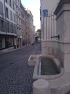
I didn't really have any feeling I am about to start another camino. More like I was travelling in a bubble. But the first thing I saw when I stepped onto the street from the moving stairs in Geneve, were a signpost and a waymark for Via Jacobi. And I felt a little bit like home already.

I reserved a bed in Home st Pierre (or Petershofli) right next to the cathedral, about 20min walk from the train station and right on the route. It was a period stone house with a lovely female-only dorm with nice mattreses and duvets, and a kitchen. €43.75 with tax, there is optional breakfast for €7.

The cathedral happened to be open for a late-night tower visits and I popped inside to get my firet stamp and say hello to the carved medieval stalls.

Ps: if a moderator could put a live sticker to the thread, it will be much appreciated.
IMG_20240624_202225_1.jpg
 
Last edited:
A selection of Camino Jewellery
Buen Camino @caminka !
I thought the distance was enough but apparently swiss signal trumped french one. Then I wanted to be absolutely sure there is no swiss signal anymore, or there is wifi.
Ah yes, in this area, mobile phone signals don't follow borders! In 2018, I was in Evian and I was getting a Swiss signal!

Enjoy!
 
Day 2: Geneve - le Petit Chable 20,5km

Since I had some swiss francs left over from last year's Via Jacobi, I wanted to pay in cash. However, the office opened at 8.30 only, so I devised a plan.
I took of walking, withouty the big backpack, a little past 6h and crossed Geneve and Carouge and stopped at the bus stop Serves, a bit before the route turns away from the roads and becomes lanes and paths. A bit more then an hour of walking. I then took a bus and a tram back to the centre, arranged the payment and met my first pilgrim, Alfred who started in Linz, Austria.

I then took a tram and a bus back to Serves, with my heavy backpack, and continued. It was heavy because I was carrying two days worth of food, picknicks and dinner. There is nothing between Neydens and Frangy. Not the easiest start on my shoulders and hipbones, and I am feeling it now.

When the route - here still yellow lozenges of Via Jacobi - leaves Geneve, it now runs through shady woods along streams and across open fields to Compesieres. I thought it was adequately waymarked and didn't see any signs with a man walking confidently, as Davey reported.

In Compesieres I topped-up water, collected the stamp from the church and when exiting the church, dutyfully looked up and checked that no paint was gonna land on my head from the main repainting the clock.

At the unassuming Franch bordet marked by a ramp and a stream, waymarks changed to white and red GR stickers, yellow arrow stickers and small blue squares with a yellow scallop, pointing the way with the bit where the scallop lanes come together.

The day was hot and getting stuffy. I kept topping-up water whenever I could, there were taps in every village and also at chartreuse de Pomier.
The route was a good mix of quiet roads and forest lanes, with nice views back to Lac Leman when it climbed out of Neydens.
I lost one of my magnetic clips. And I learned of my huge mobile bill when I took a rest at Pomier.

After Pomier I deviated down to le Petit Chable where I reserved a bed and a dinner at family Manin which welcomes pilgrims. They had a most colourful garden and I was welcomed with raspberries.

I was pretty tired - heavy backpack! - so I napped most of the afternoon. Later we chatted a bit. There were granddaughters visiting and I helped the elder one color a castle drawing. She then signed it and gifted it to me to remember her and her little sister. :)

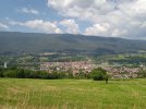
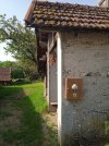
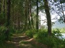
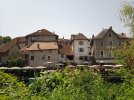
IMG_20240625_062100_1.jpg IMG_20240625_093608_1.jpg IMG_20240625_095602_1.jpg IMG_20240625_131038_1.jpg
 
Last edited:
Join the Camino cleanup. Logroño to Burgos May 2025 & Astorga to OCebreiro in June
Day 3: le Petit Chable - Chaumont 21,5km

The day's weather forecast promised intermittend showers, but it was in fact only mostly overcast, with a sprinkle in the morning and on the final climb. Pretty perfect walking weather.

There is a route directly from le Petit Chable to col du Mont Sion, with some nice sunrise views, if you are lucky.

I made a short detour to Charly to the water fountain and to see if the chapel with stamp is open, but I was too early. Charly looked very pretty with many flower-bedecked stone houses and little colourful art corners. It has a gite d'etape.

On the climb up, the mist rose up or the cloud came down, so there was no view to Mont Blanc.

After storms the previous evening, all forest lanes were very muddy. It was the sticky-and-slippery kind of mud and required a lot of attention. I was glad I had my walking poles.

I took a waymarked variant via Marlioz where instead of a stamp in the chapel that once belonged to a pilgrim hospital, I got more mud and annoying mosquitoes.

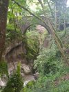
Steep descent lead to a medieval bridge over marmittes - a narrow gorge with cauldrons cut out by gushing water. It was brown with dirt that day, not poster-card blue. The short detour to the waterfall is not worth it, you don't see the waterfall at all, only the top of it.

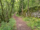
The climb into Chaumont was mostly very steep and partly in rain, but there was a pretty old lane in the middle.

Gite d'etape in Chaumont is on top of the village behind the church and has a nice view of the ruined castle. The toilet is indeed a squatter down some rather precarious stairs (also the shower). I quite like squatters, the cleaning bit is easier then on a hoverer where I usually need to be on my tip-toes.

Arthur from Austria and Yann from France arriver to the gite later. Yann has twisted an ankle and arranged a visit to a local sort-of energy therapist. He was told two days of rest and that the camino is not for him. This was in fact his second attempt at Via Gebenennsis in two months. So we devised a plan with rest days and shorter days to get him started again. He wishes to walk all the way to SdC.

Gite is €16, plus optional breakfast €7. It has blankets and a good kitchen, and fridge stocked with a small selection of dinner foods (at a small cost). The carer can sometimes make dinner too. We cooked pasta with ratatouille and added veggies I brought with me.

My shoulders hurt pretty bad today and I developped 'rocks'. It turned out that Alfred knows massage and he was kind enough to loosen them up. Hopefully, with much less food in my backpack, this is not gonna be a problem from now on.

IMG_20240626_072257_1.jpg IMG_20240626_093040.jpg IMG_20240626_112219_1.jpg IMG_20240626_115558_1.jpg IMG_20240626_123522.jpg IMG_20240626_123105.jpg IMG_20240626_130033.jpg IMG_20240626_193253_1.jpg
 
Last edited:
Ps: how do I add thumbnails from my phone? It takes forever to load pictures.
 
Day 1: transfer & Geneve gare - cathedrale 1,5km

I am coming to this live thread with a bit of a delay. Switzerland is a very expensive pain for my mobile phone package, as I've experienced again two days ago, already 10km into France, when 30sec of roamig costed me €61! I thought the distance was enough but apparently swiss signal trumped french one. Then I wanted to be absolutely sure there is no swiss signal anymore, or there is wifi.

So. After a whole day of training across Austria and Switzerland - with a toilet stop in a tiny station because wc on the train broke down and a spectacular view of Lac Leman from high up vineyard-covered slopes - I arrived in Geneve with only 2h delay (euro football league and trains not stopping where they were meant to stop).
I didn't really have any feeling I am about to start another camino. More like I was travelling in a bubble. But the first thing I saw when I stepped onto the street from the moving stairs in Geneve, were a signpost and a waymark for Via Jacobi. And I felt a little bit like home already.

I reserved a bed in Home st Pierre (or Petershofli) right next to the cathedral, about 20min walk from the train station and right on the route. It was a period stone house with a lovely female-only dorm with nice mattreses and duvets, and a kitchen. €43.75 with tax, there is optional breakfast for €7.

The cathedral happened to be open for a late-night tower visits and I popped inside to get my firet stamp and say hello to the carved medieval stalls.

Ps: if a moderator could put a live sticker to the thread, it will be much appreciated.
How exciting! You starting in Geneva brings back found memories of my 1,5 year in Genėve. As a bank expat I was given an apartment in the Old Town, down the street from the Cathedral. A few years ago I went back with my kids to show them where I lived and what did I see? A blue and yellow Camino sign!

Yes, Switzerland was and is still expensive. Those were the days when the boss paid for housing and a car!

Bon Chemin!
 
3rd Edition. More content, training & pack guides avoid common mistakes, bed bugs etc
Day 4: Chaumont - Seyssel 19km

Today felt a whole lot better without all the extra food. Much like my training sessions with 10kg backpack. Shoulders don't feel laden with rocks, in fact, thet feel pretty good, and hipbones barely hurt. Hopefully this will now be the standard.

There were surprisingly few water points today: Chaumont, Designy and a fountain on the way to Seysell.

After a much less steep than expected descent to Frangy, I popped into the church which should have a stamp, but no, just a nice camino stained-glass window with a big scallop. Frangy is a busy little town, the only one with provisions for the day. I got my first postcard!

The climb out of Frangy was pretty exposed, so make sure to stock on water in a bar on a shop in Frangy, the fountain was dry.
There were also two sections where I wasn't sure at first if I was on the right path.
The first was on top of the steep paths intersecting the road. Reaching a line of trees in front, go left, pass a tree on your right, then veer right before houses, joining a dirt track.
The second section was out of Champagne. On thr gravel road fork twice left, the second time to a dirt track which becomes grassy along the lower edge of a meadow. Keep on to join a track coming from back left.

In Designy I took a longer rest on one of the nice roofed benches of the new multi-purpose hall. Toilets in the mairie were closed, though, because the building was being renovated and the mairie is currently conducting its business from a shipping container.

The route from Designy is almost entirely on quiet asphalt roads, with frequent views down to the valley of the river Rhone and once to a 13C castle of Pelly. It's possible to sleep in the castle for a pilgrim rate of BB €39.

A section of stony lane had a tick warning so I unrolled my pants all the way down and took great care to touch as little vegetation as possible. No ticks seen.

The variant via Seysell is clearly marked. The descent was pretty brutal for knees and ankles, steep stony road in many places ravaged by streams. A fine view from above on Seysell, though.

Camping in Seysell has a pilgrim safari tent with four bunks, blankets, wifi, washing and drying machine, a pool, fridge, microwave and a supermarket across the road. Oh, and mosquitos which are just now becoming a pain. €16.20 for a bed. A pretty lane leads to the town along the Rhone.

Just as I was having my microwave dinner, a whole class of kids on bicycles arrived, set up their little tents and headed for the pool. It might be lively tonight.

IMG_20240627_070028.jpg IMG_20240627_074636_1.jpg IMG_20240627_091719.jpg IMG_20240627_102849_1.jpg IMG_20240627_120752_1.jpg IMG_20240627_121653.jpg IMG_20240627_160034_1.jpg
 
Last edited:
The 2024 Camino guides will be coming out little by little. Here is a collection of the ones that are out so far.
Oh! Wonderful, wonderful. This is one of the only outside-of-Spain routes on my list. So I will be reading your posts with a lot of interest. Bon chemin!

Ps: how do I add thumbnails from my phone? It takes forever to load pictures.
'Attach files' then 'insert' / 'thumbnail.' Sometimes on the phone it does take forever. If the signal is strong, I find turning the wifi off for a while and then turning it back on can help - perhaps stopping something running in the background that's hogging the bandwidth?

It's worth the wait - lovely photos, merci!

It might be lively tonight.
May it not be so...
 
Day 5: Seysell - Chanaz 23km

Today was a proper summer day. Not yet the meseta scorching heat but certainly getting there.

I thought it was going to be a pretty uneventful day, being mostly flat and along a river. Yeah...

It started innocently enough with a flat asphalt bikelane along the Rhone out of Seysell. A friendly shaggy dog and its owner were already having a walk.

At the village vacances a lady with a different dog stopped me and suggested that I take a new road to avoid some unkempt path after the dam. I understood it was overgrown. I thanked her, but was actually looking forward to some off-road walking.
The path turned out to be mostly fine, not overgrown at all, but it was washed away at two places and needed extra care there. There were also several sources sipping onto the path and it was muddy. The stiff climb up to the meadows was quite stony too. So in rain or after heavy rain, it might be prudent to take that road alternative; it starts just before the toilets.
There is a water tab at a circular 'roof' after the tourist info just before village vacanses.

Up on the plateau above the Rhone the route is again a minor road used by cyclists, then grassy tracks for a while. Like yesterday, I tried my fashion walk to avoid the dew without much success.

At a shelter with a rest area in Versieres it's prudent to fill the water bottles because the next water, if working, is three hours away.
A little further on was a box with a stamp for my collection.

A long exposed gravel road with a stone moat on the right (called a roman moat) leads back to the Rhone. I encountered a group of tandem cyclists on the bikelane that followed.
Take a rest somewhere on this bikelane for what is to come.

The route leaves the bikelane into poplar woods along the river and arrives at a nice shady bench. In the bug season, unroll the pants, put on long sleeves, drink and prepare to march. What followed was a narrow path overgrown with brambles and teeming with mosquitos and those annoying midges that buzz before your glasses. The only way I avoided at least some of the mosquitos was to maintain a fast tempo and battle with the brambles. Although it was all shady, my legs started to feel a bit queasy after half an hour.

The path ended through a tunnel from those japanese invading plants, with an abrupt short climb to a stone-built wall/moat. I had a bit too much runup and almost went down the other side. The route follows the moat to the right and a short section was almost impassable because of the japanese invaders.
After another 15-20min of similar overgrown mosquito path up on the moat there was a bridge and a confusing crossroad.

One signpost with GR65 pointed right to Chanaz, another with a scallop pointed left to Chanaz. I checked the map and surmised that the left route probably followed an asphalt bikelane and the right gravel roads and paths. Of course I went right. Take my advice and save yourself another, even narrower, overgrown mosquito path, with extra muddy sections thrown in, plus a whole chain of big muddy puddles.

I practically collapsed onto the bench at the toilets and water tap at the bar at Etang Bleu lake. It was definitely not what I expected from a flat day along a river.

Water tap only works when the bar is open. Fill up because the next 45min are an entirely exposed, but quite pretty, moat between a canal and the river.

Entry into Chanaz was a bit confusing. You need to pass the hotel then turn right to a gravel path by an info board.

Chanaz itself is a really pretty village of flower-bedecked and slate-roofed stone houses climbing a steep slope above canal de Savieres. It has a small museum of roman pottery in a 15C chapel, a cave emanating cold air, a medieval fountain built into the foundation wall of the parish, and a working 19C water mill grinding hazelnuts and walnuts for oil and marmelade.

Alfred, Yann and me are all staying in gite d'etape El Camino, the only pilgrim-friendly accommodation in this touristy town. There are duvets and blankets, a kettle, wifi and a lush garden with space for maybe two tents. €20 for pilgrims, with optional breakfast €7. Madame does not cook dinner anymore, so we went to the local shop and made a nice salad.

IMG_20240628_065630_1.jpg IMG_20240628_092334_1.jpg IMG_20240628_101402.jpg IMG_20240628_103018_1.jpg IMG_20240628_112045_1.jpg IMG_20240628_124618_1.jpg IMG_20240628_161956_1.jpg IMG_20240628_161439.jpg IMG_20240628_162737_BURST1.jpg
 
Last edited:
The path ended through a tunnel from those japanese invading plants, with an abrupt short climb to a stone-built wall/moat. I had a bit too much runup and almost went down the other side. The route follows the moat to the right and a short section was almost impassable because of the japanese invaders.
After another 15-20min of similar overgrown mosquito path up on the moat there was a bridge and a confusing crossroad.
Of course I went right. Take my advice and save yourself another, even narrower, overgrown mosquito path, with extra muddy sections thrown in, plus a whole chain of big muddy puddles.
Ugh. What a day. Whatever doesn't kill us makes us stronger, or something like that, but geeze. I bet the shower felt divine, after all that.
 
Join the Camino cleanup. Logroño to Burgos May 2025 & Astorga to OCebreiro in June
Day 6: Chanaz - Yenne 19km

I didn't sleep very well and it took me a whole hour to prepare and pack in the morning. It was a shortish day, so no worries.

The steep climb out of Chanaz resolved into a nice gravel track undulating past meadows, groves and vineyards.
When I was going around one bend, I spotted an orange-brown four-legged bushy-tailed creature hopping into the grass. It didn't catch whatever it wanted to and started walking towards me. It's big ears pricked up when it spotted me, then it quickly scurried into the bush. It was a young fox!

Lots of green vineyards today, with some nice panoramic views despite the overcast sky.
I like vineyards. They are really handy if you need to pee and usually don't hide mosquitos (as does maiz).
But I was lucky to happen upon a fence-painting job in Joncieux and the coordinator let me use the toilets in the mairie.

Right about here the wind picked up and gushed around pretty strongly for about half an hour. I thought and it looked like rain was coming, but at the end nothing happened.

In Montagnin I missed a turn and ended on the road.
Then later, I chose a self-made alternative and avoided the chapel with the view and the steep and slippery descent afterwards. I don't know why, but that descent didn't sit well in my mind and I learned to listen to such warnings.

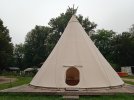
So I reached Yenne at the supermarket, stocked up and crossed all of the town to get to the camping on the other side where the route leaves Yenne. The camping has pilgrim/cyclist accommodation in a big tipi. I've never slept in a tipi before so that will be new. It only has one smallish door, but so far me and Alfred are the only ones in it. €21.25 in high season, some blankets, fully equipped summer kitchen. In the town about 300m back are a small shop, bakery, bars and laundry. Supermarket is about 1km from the camping through the town.

The sun is peeking out now, but in the afternoon and evening storms are forecast.
The forecast for tommorrow is also pretty dodgy. I am really looking forward to tommorrow's more mountaneous paths high above the Rhone. It will not rain, okay? It will not.

IMG_20240629_074807_1.jpg IMG_20240629_082444_1.jpg IMG_20240629_084705.jpg IMG_20240629_091445_1.jpg IMG_20240629_120351_1.jpg IMG_20240629_122432_1.jpg
 
Last edited:
...and ship it to Santiago for storage. You pick it up once in Santiago. Service offered by Casa Ivar (we use DHL for transportation).
Day 7: Yenne - St Genix-sur-Guiers 26,5km (yesterday)

Yesterday was beautiful but tough.

It rained intermittedly during the night. In one of the pauses an owl hooted.

We (Alfred and I) were ready to start by 5h30, because as per the evening forecast, there was supposed to be a good hour of rain-free morning. There wasn't. The rain started at 5h30 and went on solidly for an hour and a half. But the morning forecast said this would be it for the day!

I devised an alternative climb that would avoid the wet and slippery path above the gorge. We started on the GR than stayed on the small road to the village of Chevru, and from there climbed to the ridge on a yellow marked path. It was not so much in the woods as it seemed on the map, and Alfred, who walked first, dried the grasses and other plants in part, and I did the rest. The trees were often clad in lots of green moss and sometimes looked like tentacly wreaths.

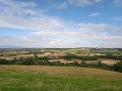
On top we joined GR for the beautiful traverse through more mossy plus dried deciduous woods. At one point, an awesome view opened to the plains ahead, the Rhone below and the mountains back north and east.

After a short unplanned detour down to a meadow, curtesy of me not paying enough attention to the signposts, a lady coming towards us sent us back up on the correct route.

A very muddy section ended with a short break at cabane de Botozel and its water tap (the only for about 20km).

Shortly afterwards we fortunately chose the correct, left, route, at an unhelpful waymark in the middle of a fork.

More climbing on forest trails, sometimes muddy and often stony, lead to a magnificent viewpoint of Recorba a bit to the right off the route. Here we discovered what was the motoring noise we have been hearing for a while. There was a boat competition on the Rhone.

A stiff, stony climb - almost the last one - delivered us to the high point of today at about 870m. After a short descent to a saddle with a mysterious stone in a tiny clearing in the midst of mossy trees, gentler ups and downs with many intersections revealed - finally! - little gardens of wild strawberries! We spent some time making sure not so many were left, but had to give up eventually.

Soon we left the woods for grassy tracks, crossed a hamlet, passed the cross of les Rives (right of it is the first accommodation of the day, 16,5km after Yenne) and descended to St Maurice-de-Rotherens.

I wondered why the mairie was open on a sunday and it turned out that it was a voting day.

Benches were wet and the wind was quite cool, so we spent our hours break in the church. There was a stamp also.

A surprisingly pleasant descent with more nice views passed by the village of Gresin (water, no stamp) and a small pilgrim stand with water, drinks and walnuts to buy, and a stamp. Alfred was so thrilled he bought two packages of walnuts.

By then, we have been walking for almost seven hours and decided to skip the last climb to a chapel (stamp) which may or may not be open. We followed the road into St Genix.

I went straight to gite d'etape a pied a bicyclette some 700m off route, a fine old house with a beautiful garden. I was pretty tired, and my feet and right shoulder were starting to hurt. I spent some two hours just resting. When Alfred arrived, the lady discovered that we are not together together and each got its own room (I reserved for both of us). Bed €21, dinner €16, breakfast €6, picnic €7, very nice mattresses, duvets, wifi.

Two German ladies were also staying the night and we chatted over a good dinner which included a plate of six local cheeses. The ladies are doing the camino in two week chunks and this time also started in Geneve.

It was soon time to head to bed, hence no update yesterday.

IMG_20240630_074053.jpg IMG_20240630_074736.jpg IMG_20240630_081420_1.jpg IMG_20240630_084622_1.jpg IMG_20240630_094518.jpg IMG_20240630_101421.jpg IMG_20240630_105217_1.jpg IMG_20240630_113119.jpg IMG_20240630_140445_1.jpgIMG_20240630_142910_1.jpg
 
Last edited:
Day 8: St Genix-sur-Guiers to Valencogne 20,5km

Despite a good sleep (with two breaks which kinda seems to be becoming a habit) I felt sleepy all morning and walked a bit on autopilot.

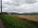
The countryside has changed to rolling fields, steeper slopes in groves, wooded stream valleys, and more isolated farms.

Till les Albrets I followed my own creation with less asphalt and a little shorter. It felt a lot more wiggly then it looked on the map. I was still feeling sleepy when I arrived into this bigger town, took an hour break then spent another hour faffing around a supermarket. I wanted my favourite french pastry, pains aux raisins, but there were no more and I had to do with ready-made pancakes.

That woke me up which was good because the following hills were not innocent at all. Two pretty steep climbs - but also nice views and more strawberries - and I was in Valencogne.

As I was early, I took a long break in front of the church, and when the sun became too much, moved to a shady patch of grass next to a house I am staying in tonight.

It is a retired couple MMe Depardon, themselves avid walkers, who host pilgrims. There is another french couple staying and we are expecting a girl later in the evening. So, quite a few pilgrims on Via Gebenennsis, although the hostess said that the numbers are not as high as last year.

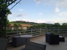
The house is a very nice old building with huge beams in the dining room, a grandfather's clock and a sunny terrace with the view on the tommorrow's route.

IMG_20240701_083635.jpg IMG_20240701_102518_1.jpg IMG_20240701_132042_1.jpg IMG_20240701_132042_1.jpg IMG_20240701_133258_1.jpg IMG_20240701_163711.jpg IMG_20240701_200826_1.jpg IMG-20240701-WA0000.jpg
 
Last edited:
I was wondering how you were doing rain wise, with all of the flooding in Switzerland and elsewhere. Good to hear that it's predominantly just showers.

The European weather is all over the place this year.
 
Train for your next Camino on California's Santa Catalina Island March 16-19
I was wondering how you were doing rain wise, with all of the flooding in Switzerland and elsewhere. Good to hear that it's predominantly just showers.

The European weather is all over the place this year.
So far the weather has been quite cooperative and often very nice for walking, like today, mostly cloudy with more sun in the afternoon.
 
Day 9: Valencogne - le Grand Lemps 22,5km

Morning was a bit fresh and mostly the day remained cloudy, although when sun did peek out it was hot quickly.

The first climb was mild but wet and offered a nice view back towards Savoie and previous days. No Mont Blanc again, it was too cloudy towards the east.

Once up on the broad ridge, a chilly wind picked up and it rained dew down from the trees.
A noise I never heard before was coming from the trees on the right, something like 'boop boop, kal kal kal ... boop boop, kal kal kal'. When the creature came into sight, it turned out to be a raven and it must have practicing its repertoire. As soon as it saw me, however, it chaned the practice to the usual 'kra kra kra'.

Just as I was leaving le Pin, I suddenly found myself in the middle of a group of retirees with (small) backpacks and hiking poles. They were on a short hike trip and we walked together until wr met a curious and vivacious foul where I let them pass.

I took a wrong route today (again), but this time I don't remember seeing any helpful waymarks. As it turned out, I missed a climb and a descent, so nothing drastic.
I encountered an elderly lady out on a walk and she seemed beside herself with joy meeting a pilgrim. So my detour was just right.

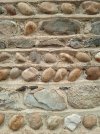
These hills we are crossing are made of big and small round pebbly stones. They might look cute on the houses, but they are far from cute when you are rolling on them down some slope. The last descent into le Grand Lemps especially was quite something. Definitely a must with hiking poles and not recommended in the rain.

As I had some time in le Grand Lemps, I swung by the belfry of a former chapelle st Jacques, popped into mairie for a cool stamp and went to a supermarket before heading to my accueil jacquaire for the night. It's a big house run by a friendly madame Line Chomat with 17 grandchildren (who don't live in the house).
As I was resting late in the afternoon, I heard a familiar voice from the garden. Alfred has cought up! We were again four pilgrims around the dinner table. It was a very nice dinner, I even ate the rhubarb-raspberry pie and it was good.

IMG_20240702_061411_1.jpg IMG_20240702_080719.jpg IMG_20240702_102010_1.jpg IMG_20240702_112505.jpg IMG_20240702_112812_1.jpg IMG_20240702_124906_1.jpg IMG_20240702_131642_1.jpg IMG_20240702_132450.jpg
 
Last edited:
A selection of Camino Jewellery
Loving your posts, ©caminka. And the pictures. It just occurred to me that it would be very helpful if you could include the names of the places you are staying. Your descriptions are so good, they leave me wondering how to find them!
Thank you!

I can but I wasn't sure it would be appropriate as these are private individuals that host pilgrims. ... But since they are already in my itinerary guide, I suppose it would be okay?
 
Thank you!

I can but I wasn't sure it would be appropriate as these are private individuals that host pilgrims. ... But since they are already in my itinerary guide, I suppose it would be okay?
Well, if you think that the hosts would object, don’t do it, especially since we now all know that we’ll just have to get our hands on your guide before we walk!
 
Well, if you think that the hosts would object, don’t do it, especially since we now all know that we’ll just have to get our hands on your guide before we walk!
Okay, I will consider if there are any that would mind. After dinner, though!
 
Join the Camino cleanup. Logroño to Burgos May 2025 & Astorga to OCebreiro in June
Day 10: le Grand Lemps - Faramans, about 25km

Sometime about midnight probably - certainly after the football match was over because no more noises were coming from downstairs - I woke up because I felt a weight by my feet, then soft pads on the cover. The resident cat came to cuddle my hand them curl up by my tummy and purr into sleep. We slept a few hours like this. But when I turned around and presented my back, she silently left through the window.

I was well rested in the morning. It was just as well, because my pole tips didn't come off at all today, there was so much asphalt, only here and there interrupted by lovely tracks.

The route into la Cote-st-Andre has been changed and now involves more climbing and a section along a medieval water channel. I deduced this by studying the map after I missed the turn. I didn't see any signs pointing left to the channel. Perhaps the wooden pole marker fell down. It should start at captage/water reservoir.
I ended up climbing to the top at the main road where I discovered that - not again - there were no scallops or GR waymarks. I found another way down, of course, it even had a nice view of the town.

La Cote-st-Andre has a beautiful and huge wooden medieval market hall, a medieval nobleman's residence and the birthhouse of composer Hector Berlioz. The house now holds a museum about his life which I wanted to visit. But couldn't because they wouldn't let me leave my backpack in the reception area. Cause of measurements against assassination attacks. So I just took a long rest by the church.

After another long road section, a descent and flat grassy tracks I was almost in Faramans. The approach is now by shady paths around the local lake, lovely.

Rain was threatening but my search for a sheltered bench was unsuccessful and I parked on the only one I found. Luckily it didn't rain till I could go to the gite la Milandriere.
At the moment there are only two places available in the owner's house because the gite itself is being rented to a couple who is moving houses. But it is expected to soon be available. Bed €24, dinner €26, duvet, washing machine, in the gite also kitchen.

When I came out of the bathroom, a cat was waiting on me on a chair by the door. It wanted my attention and cuddles immediately, I hardly managed to wash my stuff.

IMG_20240703_072349_1.jpg IMG_20240703_074455.jpg IMG_20240703_083507.jpg IMG_20240703_090558_1.jpg IMG_20240703_095046_1.jpg IMG_20240703_100637_1.jpg IMG_20240703_101314.jpg IMG_20240703_101703_1.jpg IMG_20240703_130342_1.jpg IMG_20240703_141208_1.jpg
 
Hi Caminka, thanks so much for your travel notes. Im going to start the walk early september and was wondering what app your using for navigation on your phone? Accomodation details would also be appreciated. Many thanks
 
...and ship it to Santiago for storage. You pick it up once in Santiago. Service offered by Casa Ivar (we use DHL for transportation).
Hi Caminka, thanks so much for your travel notes. Im going to start the walk early september and was wondering what app your using for navigation on your phone? Accomodation details would also be appreciated. Many thanks
You're welcome. I have mapy.cz with downloaded maps for the appropriate departements so that I can use it in offline mode. The route on it is of someone walking, so doesn't take into account recent changes. It is generally well waymarked. If in doubt, follow yellow scallops on blue squares, not red-white GR marks. In Switzerland, follow yellow lozenges. Route here has been changed and runs as on swissmobil map.

I post accommodation details every day. I have also uploaded my full itinerary with accommodation info in resources.
 
Last edited:
...and ship it to Santiago for storage. You pick it up once in Santiago. Service offered by Casa Ivar (we use DHL for transportation).
@caminka Are you finding that the home-stays tend to be a bit off-route? My experience (2019) was that they tended to be rather suburban (makes sense, that's where people live in houses. Need houses to have home-stays).
 
Day 11: Faramans - Miancon 25,5km

In the night, a sudden loud noise woke me up and I panicked a little before figuring out that it's only a cat scratching its claws on the bed next to me. It then made three rounds of the room before exiting via the window. (I sleep with windows open and here the air was a bit dump and stuffy.)

The morning was again quite chilly.

First the route made a detour across fields to avoid the straight D departmentale road. These two-lane roads are pretty busy and don't have any shoulders so not particularly pleasant to walk on.

Almost on top of the following climb a magnificent view opened to the east, various prealp and alp massifs splendidly outlined against the clear sky. Only Mont Blanc was shily hiding in the clouds.

The forest traverse with muddy patches was a bit monotonous and ahead I was observing grey clouds and rain curtains. Just as I was thinking that I might get away dry, two light showers had me putting up the poncho over the backpack and hat on the head. But when it cleared, it was suddenly summer with warm sun and white puffs sailing across blue skies.

I stopped in Revel-Tourdain's partly romanesque church and in the bakery.
There are no working water taps between chapelle st Michel after la Cote-st-Andre and Revel-Tourdain! You can get water in the toilet in Ornacieux (left after the church), probably in Faramans' cemetery up by the church (or ask in the bar or bakery if they are open), and probably in Pissieu's cemetery en route (which I didn't check because I was breezing past in the rain). In Revel-Tourdain the tap is behind the lavoir.

The route then zigzags past Primarette (accommodation) and climbs beside thr TGV line on an annoying and unsteady round-stonish gravel road.
I was in need of water so I took the low route (unmarked) via Moissieu-sur-Dolon. Tap opposite church, lavoir, cemetery and camping, so plenty of choice. There should be a tap by the shelter on the main route too, but I didn't want to risk it. It was hot.

By chapelle de la Salette with its old graves I took the third rest of the day, and soon I was at the door of family Pras a bit off route in Miancon. Nobody was home so I parked under a tree in the parking space and was just about to bite into an apple when a car stopped by the road. Out came the host who was on his way to tend to the hay in the fields, and let me in. What luck!

It is quite a menagerie here: four hourses, cows, goats, chickens and three dogs. One of the small dogs wants you to throw it a ball or a stone all the time and the other wants cuddles and kisses.

Half pension €50 and I arranged to get my breakfast to-go. Linen, duvet, towel, wifi, and probably washing machine if needed.

IMG_20240704_071804.jpg IMG_20240704_071810_1.jpg IMG_20240704_072250.jpg IMG_20240704_081126.jpg IMG_20240704_081405_1.jpg IMG_20240704_093716_1.jpg IMG_20240704_095206_1.jpg IMG_20240704_103411_1.jpg IMG_20240704_140105_1.jpg IMG_20240704_160927.jpg
 
Last edited:
@caminka Are you finding that the home-stays tend to be a bit off-route? My experience (2019) was that they tended to be rather suburban (makes sense, that's where people live in houses. Need houses to have home-stays).
It totally depends. Le Petit Chable was 1.5km off route (and down, but with a direct connection to col Mont Sion), Valencogne was right on the route, le Grand Lemps was about 1km off route, today Miancon is 700m off route. You need to know the addresses to be able to get there (or probably ask when calling).
 
A selection of Camino Jewellery
You're welcome. I have mapy.cz with downloaded maps for the appropriate departements so that I can use it in offline mode. The route on it is of someone walking, so doesn't take into account recent changes. It is generally well waymarked. If in doubt, follow yellow scallops on blue squares, not red-white GR marks. In Switzerland, follow yellow lozenges. Route here has been changed and runs as on swissmobil map.

I post accommodation details every day. I have also uploaded my full itinerary with accommodation info in resources.
Much appreciated. Very much enjoy your travel notes. Cheers.
 
Day 12: Miancon - Chavanay 26,5km

I changed my itinerary a bit because tommorrow's forecast is a lot of rain and we will try to outwalk it, starting early.

The start of today's walk was ok quiet roads then through woods. Blue skies in the east and south, some white puffies to the north.

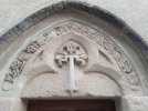
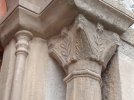
Two romanesque gems were on the menu. The first was a chapel of a former castle now turned to a nun's monastery, Notre-Dame de Surieu. It has a lovely carved lintel with possibly a scrip from which hangs a scallop, more reliefs, carved capitals, a romanesque baptismal font and the original nave. I came just as the nuns were having their silent contemplation, so couldn't poke around.
The second was on the other side of the valley, st Romain de Surieu at the cemetery, with two crude windows and more reliefs inside, but it was locked.
In between is a cool green valley with a source and a stamp, and new compost toilets.

There is no water en route between the cemetery at st Romain and the public toilets in Clonas.

The route after Surieu is different then on mapy.cz, geoportail and walking trails. It is correct in the ARA guide. It turns left on the second road, follows it to the end, becomes a track then a path. Just after the picture with the nice green path is a short steep and slippery descent through brumbles to a small stream, then longer even more slippery climb through brumbles to a forest track. The track leads to intersection les Quatres Chenes where the shorter variant via Allemane joins.

After a shady descent and Assieu the route hits flat fields and hot sun. Here two intersections were not waymarked (or maybe the poles disappeared). At the end of asphalt keep going straight ahead. After a passage through bushes, veer right. The going is very nice, though, in soft grasses.
Via Gebenennsis and GR split in the middle of the fields, well signposted. The Via going left is much shorter and the only equipped with accommodation.

In the midst of fields I spotted a pilgrim. Blue backpack, orange shirt... it cannot be Alfred, can it, he stopped a lot earlier than me two days ago? But it was him! He said that he arrived so early in Ornacieux that he cancelled his reservation and continued to Faramans then took a shorter variant and slept in Allemane. We continued together.

In Clonas-sur-Vareze we stopped in the friendly bar (open till 13h + in the afternoon) to gather the strength for the last part. It was really getting hot now. White puffy clouds were having unusual 'legs'.

This last kms are often along busy shoulderless D roads, but sometimes a tiny path has been walked on the other side of the road fence. In between was a nice view of Chavanay's roofs and bell tower huddled together under green hills covered in woods and vineyards.

After crossing the wide river Rhone - view of the nuclear power plant - we were already in Chavanay. We made a pause on a shady bench then headed for the gite d'etape ARA in an old stone house in the centre of this lovely old village. The only gite on this route staffed by volunteers.
Full kitchen, dinner, breakfast, blankets, washing machine, wifi. Donativo.

For two days now I had rice and fish for dinner, so I am hoping for a pasta.

IMG_20240705_072722_1.jpg IMG_20240705_073043_1.jpg IMG_20240705_073207_1.jpg IMG_20240705_082635_1.jpg IMG_20240705_090844_1.jpgIMG_20240705_095944_1.jpg IMG_20240705_100950.jpg IMG_20240705_122257_1.jpg IMG_20240705_130005_1.jpg IMG_20240705_132247.jpg
 
Last edited:
3rd Edition. More content, training & pack guides avoid common mistakes, bed bugs etc
I changed my itinerary a bit because tommorrow's forecast is a lot of rain and we will try to outwalk it, starting early.

Hi, Caminka,

The post by @Clubpete sent me to wikiloc, but I don’t see your tracks. I hope you are saving them to post later! How else would anyone walking this route be sure of seeing all the romanesque gems and other highlights that may be a bit off the “official route?” ;)
 
Hi, Caminka,

The post by @Clubpete sent me to wikiloc, but I don’t see your tracks. I hope you are saving them to post later! How else would anyone walking this route be sure of seeing all the romanesque gems and other highlights that may be a bit off the “official route?” ;)
Oh, I don't walk with a gps and don't record my tracks. I do that manually at home. Hehe, I'll make sure all of them are included, with pictures too! :)
 
Get a spanish phone number with Airalo. eSim, so no physical SIM card. Easy to use app to add more funds if needed.
Day 13: Chavanay - Saint Julien-Molin-Molette 19,5km

I didn't sleep very well because of snoring and the blinding green exit light. I understand they are mandatory but I am sure that whoever stipulated the brightness never had to sleep with one in his/her eyes.

I left the gite at 5h30, just as the day was starting and dramatic clouds were already visible above.

The climb to chapelle du Calvaire was rewarded with a dramatic view of the Rhone and the first sunrays peeking from a narrow gap between the mountains and the clouds.
Some more climbing and the route meandered on sandy tracks and small walled grassy paths between vineyards and orchards.

The route enters another department when it crosses the Rhone and the signposts change to wooden with green bends with destinations, not really visible until you come right up to them. The signage in general was pretty sparse imo, I had to guess where to go several times and once even backtracked up an unpleasant descent to make sure I was going the correct way.

I kept an eye on the clouds ahead and the upcoming rain, but the majority seemed to bypass us either to the west behind mountain le Pilat or to the south. We got only about half an hour of showers which I waited out under the trees on another lovely walled path.

In Bessey's pilgrim shelter with water fountain I encountered two Czech pilgrims who have been walking the camino from Prague in chunks, this was their seventh year.
Later, on the steep climb to col de sainte Blandine, I chatted with a French guy walking to Jerusalem. He travelled extremely light with only a fliece and a sleeping liner. I assume he also had a phone and a credit card. He asked me about gites d'etapes back on Via Gebenennsis and in Switzerland. He said that in France he often just knocked on passing doors and usually had no trouble getting a bed for the night.

Gite d'etape sainte Blandine on top of the climb is closed this year, I was told by a man who lives on the other side of the building. He had two very sweet border collies who licked my legs all over.
There is a working water tap at the entrance of the gite, one of the only two today.

The descent from the pass is partly on a beautiful forest path then up then steeply down into town.

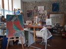
Today I am sleeping in the artist studio of Mme Le Tord, like literally in between canvases, sculptures and painting equipment. It's a bit cramped because her second studio has cought fire or got drowned (I didn't understand her very well) and all the staff from there has migrated to here.
Linen, blankets, towel, washing machine, small useful things in the bathroom with a heated towel rack, full kitchen with food, she even bought a baguette for breakfast.

IMG_20240706_053312.jpg IMG_20240706_055100.jpg IMG_20240706_064447_1.jpg IMG_20240706_065743.jpg IMG_20240706_075438.jpg IMG_20240706_105816.jpg IMG_20240706_110435_1.jpg IMG_20240706_115121_1.jpg IMG_20240706_122101_1.jpg IMG_20240706_171621.jpg
 
Last edited:
Day 14: saint Julien-Molin-Molette - Clavas 26km

A thin mattress on a spring bed resulted in painful hips and shoulders. It's safe to say I wasn't very personable when I left just before six in the morning.

The day started with a stiff (and shadeless, if you will be doing it in the afternoon) climb on a grassy track laden with dew, with last views back towards the Rhone and its plain.
The following descent from col du Banchet is a bit less steep but quite stony and in shade. Shady and along a river is also the nice approach to Bourg-Argental.

Bourg-Argental is the last supply point for about 34km till Montfaucon-en-Velay. On sunday morning, at about 7h40, bakery, shop and open-air veggie/fruit stalls were all doing good business.

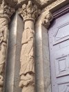
The town's church sports the only real romanesque portal on Via Gebenennsis on what is otherwise much later rebuilding. It has two sculptured pillars on either side, historiated capitals, historiated lintel, three archivolts with reliefs, and a row of corbels. Quite like many in Spain.
One of the pillars sports headless st Jacques holding an inscription scroll, and on the capital above it are represented his capture and decapitation.

After a short hop on the main road, the route started the main - and almost continuous - climb of the day. Most of it was in spruce and fir woods, with blueberries which are just now becoming ripe (as I learned from two passing hikers who were quite surprised seeing me with a mouthfull). Shady, but it was mostly overcast today, with sun only occasionally making an appearance. On hot days it might be a different story.
First a nice and soft forest track, then a long slog on asphalt road/bikelane following a former railway line (minus all the short-cuts via tunnels), then a series of sandy/stony forest roads. Adequately waymarked.
Lots of birds, owl hooting, two deer(s?) and half a carcass of another deer. Surprisingly no annoying midgets.

The only water tap on route (after Bourg-Argental) is at a rest area/playground/big sandy field at a former railway station.

I made two hour-long rests, one at the rest area and one at the end of the woods in the village of les Setoux. Here a pilgrim water fountain and a lovely stamp are waiting at the chapelle st Jacques.

The plan for sleeping in the gite d'etape in les Setoux was changed yesterday because the gite was full. It's the first french holiday weekend. I am actually sleeping in one of the buildings of a former abbey in a nearby village of Clavas, gite d'etape la Clavarine. About 25min from les Setoux on a soft local path.

When I arrived a whole lot was going on. Tables with food were set up, children were running around, adults were gathering. I was offered spinach and salad, and a piece of chocolate cake. I learned there will be a concert in the church.
Then the manager arrived (she lives on a farm nearby) and showed us (me plus Alfred plus four french hikers) to our rooms, we each got our own. She cleaned and prepared our beds (bottom sheet and pillow), prepared our picnics/sandwiches for tommorrow and explained about dinner. She actually prepared food at home and we can heat it up when we like.
In the gite there are full kitchen with condiments (I saw no food), blankets, washing machine and wifi. Linen for rent €3. Half pension €50, picnic €5. Also possible to rent bed only.

After the concert there was a small gathering with drinks and cakes then everyone left and now it's quiet. And cold!

Dinner was... lacking. There were rice and eggs (and meat for the french), a melon, a small pot of sour milk (the good kind) and a flan. No promised vegetables! Luckily, the families who left earlier left a pot of spinach. So it was omelette with spinach and rice, sour milk and melon and flan. Not really up to the price, imo.

IMG_20240707_060734_1.jpg IMG_20240707_075322_1.jpg IMG_20240707_075345.jpg IMG_20240707_075657.jpg IMG_20240707_074023.jpg IMG_20240707_090121.jpg IMG_20240707_110021_1.jpg IMG_20240707_113133_1.jpgIMG_20240707_134128.jpg IMG_20240707_170331_1.jpg
 
Last edited:
Perfect memento/gift in a presentation box. Engraving available, 25 character max.
Day 15: Clavas - Monfaucon-en-Velay 17,5km

Even though today was considerably shorter than yesterday, it was almost as tiring. We crossed three steep fairly deep valleys.

The route was mostly quite beautiful, running through more fir and spruce woods carpeted with moss and blueberries, and along pretty tracks lined with heavily dew-laden grass.
On top of the second valley my legs were wet up to my tights and my socks were sloshing in my shoes. So I changed the socks and pinned them to the top of the backpack.

The third descent was a bit dodgy (and had ticks) and lead to potentially the most difficult part. The infamous stream crossing reported to be on former railway tracks over a fast-flowing stream. I am happy to report there is now a wooden footbridge!
The more precarious would now be the little path between the fast-flowing river and the ruins of a mill. At high water it might be impassable.

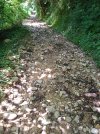
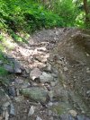
The new footbridge is followed by a truly nasty climb on a former forest track almost completely washed out and turned into a bed of a stream in nice weather and a torrent in the rain. Possibly only about half a kilometer long but strewn with stones of all sizes, heaps of dirt, branches and other material deposited randomly and precariously. Going up was slow and careful.

Towards the end of the nasty climb there was barking in the woods to the left, a fox or a deer. I also spooked two hares.

Finally out of the woods, GR and scallops split. GR makes a detour to the right (as per IGN) but scallops head straigt on on beautiful flowering paths which reminded me of the Aubrac plateau (as per mapy.cz).

Gite d'etape communal in Monfalcon is almost full tonight. Two families have taken up three rooms and Alfred and I are staying in the fourth. Keys are at the mairie and tourist office, both closed 12h-13h30. Not sure how it works on weekends. There are phone numbers on the door but two I've tried didn't respond.
Gite has a full kitchen, disposable sheets and blankets. Bed €12.

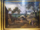
Next to the gite is chapelle Notre-Dame which houses a collection of 12 paintings by a 16C Dutch painter representing 12 months and biblical scenes.

It is Monday and everything apart from a bakery is closed. The one restaurant that was open only does lunches.
There were two left-over pastas in the kitchen and butter in the fridge. So this was my dinner. Plus two apricots and a twix (which I scored at 12h28 just before the tabac kiosk closed for the day).

Wherever you are staying the previous night, stock up on water. There are no water points on this entire stage, with a possible exception of a lavoir (washing place) in Lhermet, the first hamlet you come to. I topped-up there and am fine, bit it might not be everyone's cup of water.

IMG_20240708_083426_1.jpg IMG_20240708_091642_1.jpg IMG_20240708_092651_1.jpg IMG_20240708_095759.jpg IMG_20240708_100154_1.jpg IMG_20240708_114935_1.jpg IMG_20240708_115752.jpg IMG_20240708_143118_1.jpg IMG_20240708_160443.jpg IMG_20240708_183944.jpg
 
Last edited:
Day 16: Monfaucon-en-Velay - Araules 27,7km

Today was a lovely day of grassy tracks across meadows, soft forest roads through more spruce woods and soft gravel roads across rolling hills. This being France, the hill sometimes rolled quite steeply. It was also very windy, headwind and sidewind on the exposed upward sections, of course.

The route was well waymarked but do pay attention as it sometimes makes an unexpected turn and if you are admiring the view - as I did - you might miss it.

In some woods on some descent I met an elderly driver, nice but very chatty. I learned about his travels in Europe and Africa, his children and grandchildren, his expected great-great grandchild, his son's shop... After a while I was a bit rude and took a short goodbye.

I made two deviations today, the first one via a druid rock (rochee druidique), a big boulder in the middle of woods above Tence which is believed to have served as some kind of altar. There are a squaerish rock-cut space that looks man-made, a possible swastika and a possible horseshoe engravings.
The second detour was via a menhir turned into a stone cross, marking a crossing of routes.

The big town of today was Tence, with all services. However, three bakeries didn't have one pain aux raisins left, so I had to do with an apple thingy. It wasn't bad, but... Also, the small supermarket was temporarily closed. Luckily, it was a marked day so I got my fruit.
The town was lovely and its many winding streets and river passages would merit an afternoon of strolling around.

Today's planned destination was St-Jaures, a small hamlet around a church with preserved gothic portal. Buy when I got to gite d'etape and rang the bell, the lady informed me that she can't host us today because she forgot she had a previous appointment. She said she sent me two messages, but I didn't receive anything. She was very apologetic and very releived when I said that this is le chemin, it can happen. So I plonked myself onto a handy chair in the shade and went to call a family in the next village. The lady there was a bit surprised at the sudden and very late call, but when I explained our predicament, she said of course, we won't leave anyone outside. As she wouldn't be home till evening, her husband will show us around.
So here we are, 4km further than anticipated, at family Prebet in a fine old stone house with an enormous fireplace and a roof support made of huge interlocked beams. Dinner, breakfast (at 7h05 because the bakery opens at 7h), blankets, wifi, possibly washing machine, garden.

Again no pictures today, slow internet. :-/

On the other hand, France is playing against Spain tonight...

IMG_20240709_071031_1.jpg IMG_20240709_073442.jpg IMG_20240709_083742.jpg IMG_20240709_090844_1.jpg IMG_20240709_103100.jpg IMG_20240709_113345_1.jpg IMG_20240709_120058_1.jpg IMG_20240709_123623_1.jpg IMG_20240709_133205_1.jpg IMG_20240709_185648.jpg
 
Last edited:
Get a spanish phone number with Airalo. eSim, so no physical SIM card. Easy to use app to add more funds if needed.
Day 17: Araules - st-Julien-Chapteuil 19km (or c. 21km with a needless walk to a closed supermarket)

Today was a day of 'sucs', former volcanoes now conical hills covered in woods (mostly). There were fine panoramas, what looked like round basalt volcanic bombs, lanes paved with slippery dark grey stones, houses built from daek grey stones, and a village curled around an eruption of basalt pipes.

In a deep green valley between two sucs was a lovely water mill.

We also crossed the highest point of Via Gebenennsis at Raffy, at about 1380m.

Just before the water mill, the scallops deviated from the GR waymarks for shady old lanes down a forested valley with a bubbling torrent. This way the route is also about 2km shorter.

On the way, I called the camping again to reserve places in the gite d'etape. The lady said no problem and that if I arrive within two hours she will wait for me. You need to register, pay and collect the keys at the camping municipal which is about 600m north of the gite. The reception is open till 10h30 then from 17h to 19h which is a little inconvenient because the gite is locked up. Bed €15.80, full kitchen, disposable sheets, blankets. Showers are very hot and operate on a button with no way of regulating the temperature.

It was a short day which turned out to be good because on the descent from the basalt pipes a nasty tendenitis sprung out all over my right shin. I've only once had it so bad before, last year when I limped from Lausanne to St-Sulpice.

Before I retired for the afternoon, I visited the mostly romanesque church with some very interesting carved capitals (mostly 12C but also one from 10-11C, one of the oldest in the region), interesting portal with an all-seeing eye amidst other symbols, and a 7C carved baptismal font.

I also limped to the supermarket 15min away and discovered it was closed for the siesta! It was clearly not my day.

When Alfred arrived, he went out shopping for dinner and we both went to the pharmacy. He has a weird bump beneath one knee and it seems something is stuck inside. The pharmacist said it is most likely the head of a tick and that it's best if it comes out one way or another as soon as possible. So Alfred will perform a small surgery tonight.

Pictures are up!

IMG_20240709_144529.jpg IMG_20240710_064119_1.jpg IMG_20240710_080216.jpg IMG_20240710_083623_1.jpg IMG_20240710_100706.jpg IMG_20240710_120100.jpg IMG_20240710_115923.jpg IMG_20240710_115610.jpg
 
Last edited:
...and ship it to Santiago for storage. You pick it up once in Santiago. Service offered by Casa Ivar (we use DHL for transportation).
Day 7: Yenne - St Genix-sur-Guiers 26,5km (yesterday)

Yesterday was beautiful but tough.

It rained intermittedly during the night. In one of the pauses an owl hooted.

We (Alfred and I) were ready to start by 5h30, because as per the evening forecast, there was supposed to be a good hour of rain-free morning. There wasn't. The rain started at 5h30 and went on solidly for an hour and a half. But the morning forecast said this would be it for the day!

I devised an alternative climb that would avoid the wet and slippery path above the gorge. We started on the GR than stayed on the small road to the village of Chevru, and from there climbed to the ridge on a yellow marked path. It was not so much in the woods as it seemed on the map, and Alfred, who walked first, dried the grasses and other plants in part, and I did the rest. The trees were often clad in lots of green moss and sometimes looked like tentacly wreaths.

On top we joined GR for the beautiful traverse through more mossy plus dried deciduous woods. At one point, an awesome view opened to the plains ahead, the Rhone below and the mountains back north and east.

After a short unplanned detour down to a meadow, curtesy of me not paying enough attention to the signposts, a lady coming towards us sent us back up on the correct route.

A very muddy section ended with a short break at cabane de Botozel and its water tap (the only for about 20km).

Shortly afterwards we fortunately chose the correct, left, route, at an unhelpful waymark in the middle of a fork.

More climbing on forest trails, sometimes muddy and often stony, lead to a magnificent viewpoint of Recorba a bit to the right off the route. Here we discovered what was the motoring noise we have been hearing for a while. There was a boat competition on the Rhone.

A stiff, stony climb - almost the last one - delivered us to the high point of today at about 870m. After a short descent to a saddle with a mysterious stone in a tiny clearing in the midst of mossy trees, gentler ups and downs with many intersections revealed - finally! - little gardens of wild strawberries! We spent some time making sure not so many were left, but had to give up eventually.

Soon we left the woods for grassy tracks, crossed a hamlet, passed the cross of les Rives (right of it is the first accommodation of the day, 16,5km after Yenne) and descended to St Maurice-de-Rotherens.

I wondered why the mairie was open on a sunday and it turned out that it was a voting day.

Benches were wet and the wind was quite cool, so we spent our hours break in the church. There was a stamp also.

A surprisingly pleasant descent with more nice views passed by the village of Gresin (water, no stamp) and a small pilgrim stand with water, drinks and walnuts to buy, and a stamp. Alfred was so thrilled he bought two packages of walnuts.

By then, we have been walking for almost seven hours and decided to skip the last climb to a chapel (stamp) which may or may not be open. We followed the road into St Genix.

I went straight to gite d'etape a pied a bicyclette some 700m off route, a fine old house with a beautiful garden. I was pretty tired, and my feet and right shoulder were starting to hurt. I spent some two hours just resting. When Alfred arrived, the lady discovered that we are not together together and each got its own room (I reserved for both of us). Bed €21, dinner €16, breakfast €6, picnic €7, very nice mattresses, duvets, wifi.

Two German ladies were also staying the night and we chatted over a good dinner which included a plate of six local cheeses. The ladies are doing the camino in two week chunks and this time also started in Geneve.

It was soon time to head to bed, hence no update yesterday.

View attachment 173647 View attachment 173648 View attachment 173649 View attachment 173650 View attachment 173651 View attachment 173652 View attachment 173653 View attachment 173654 View attachment 173655View attachment 173656
Sorry, I'm late to the party. This route seems stunning but oh so challenging! I see prices for accomodation are still manageable, contrary to what I've been experiencing myself recently in Spain!

Love the pictures! So many Caminos, so little time...
 
He has a weird bump beneath one knee and it seems something is stuck inside. The pharmacist said it is most likely the head of a tick and that it's best if it comes out one way or another as soon as possible. So Alfred will perform a small surgery tonight.
Oh no! Ticks are nasty! I hope surgery went well and that all parts of that little menace got out.

Fascinating route. Please keep posting.
 
Sorry, I'm late to the party. This route seems stunning but oh so challenging! I see prices for accomodation are still manageable, contrary to what I've been experiencing myself recently in Spain!

Love the pictures! So many Caminos, so little time...
Thank you for joining me, BP! I love your reports, you have such gift for writing.

It is a fine route, I chose it especially because it does not have many medieval and prehistoric sites so that I don't run around like crazy and manage to decompress more.

I don't think it is that challenging? Not terrain-wise, perhaps more accommodation-wise and certainly services-wise. But there is very good support for pilgrims provided by many wonderful locals.

You need to be a little creative, but it was possible to not spend a fortune :-D.

Yeah, I know. My list keeps growing and growing...
 
Train for your next Camino on California's Santa Catalina Island March 16-19
I need to ask if the head got out in the end, I am not entirely sure actually.

I will. I am starting another route tommorrow, though, south towards Carcassonne.
I never heard of these Caminos but they seem wonderful. What is the name of this new route?
 
€2,-/day will present your project to thousands of visitors each day. All interested in the Camino de Santiago.
Day 18: st-Julien-Chapteuil - le Puy-en-Velay c.20km

We woke to a low cloud today, so it was a bit misty but not too wet. The route was on tracks and quiet local roads, nothing spectacular like the day before (or just not visible). The rock above Eynac was barely visible.

In st-Germain-Laprade with a lovely romanesque portal, a sweet white fluffy dog joined me for a while, until I met someone who distracted it for long enough that I could walk on.

There was no Montjoie moment on the last descent, cause of the cloud. Then suddenly, between two old stone bridges in Brives-Charensac, the cloud disappeared and left behind a few white puffs on a blue sky.

After the beautiful medieval Pont de Chartreuse the route follows the river but is not very shady. Two very low bridges across the river could be problematic at high waters.

The entry into le Puy is by the magnificent Rocher d'Aiguilhe. A little higher is the interesting chapelle ste Claire with the portal representing moon phases.

I arrived at about 11h30 and went straight to Decathlon to buy socks because mine developped holes on the heels. I passed by my favourite pilgrim on Rue Farges.

After buying a picnic for tommorrow I stopped in Le Camino, a cafe-shop-pilgrim meeting place next to the cathedral.

Then it was time to go to gite d'etape le Relais de st Jacques run by camino volunteers. I have stayed here before and liked it a lot. It's practically under the cathedral in a 17C mansion. It has beds in individual compartments, linen, blankets, breakfast, wifi, microwave and utensils (sometimes the whole kitchen too). Donativo.

As soon as I got here, it started to rain and since then there have been several short showers. But I still managed to visit the cathedral and the remains of the basalt dolmen/menhir there.

As I was peering out the window from the top floor where the dorms are, who did I see? Alfred was making his way slowly up the steep street. He also went to Decathlon to pick up a light sleeping bag. We went to the pizza together, it was to be our last day together on the route because he continues on Voie du Puy. Pizza was really good, lots of veggies.

How to get to Decathlon: take bus A in the direction of Malpas from bus stop Avenue Foch and get down at Coste Deferne. Ask the driver, it is a bit complicated. Out of the bus, cross the road and head left down a path to a footbridge. Cross it and head straight ahead to Decathlon. Bus stop for returning to the centre is on the right as you crossed the bridge. Get down at stop Michelet. Buses run one per hour. You need to wave at it to stop. You buy the ticket on the bus, change only, for €1.60 and it's valid for two hours.

I never heard of these Caminos but they seem wonderful. What is the name of this new route?
It is not one route, I cobbled several routes together. I start with Regordane then switch to GR 6 or 7, then join Chemin st Guilhem le Desert, then I follow several petites randonees with some unmarked stretches in between, then I join Voie du Piemont. It's a bit complicated but it's all in the two mish-mash itineraries I uploaded to resources.

My goal was to connect le Puy and Carcassonne where I finished two years ago when I walked backwards on Voie du Piemont.

IMG_20240711_064826.jpg IMG_20240711_081536.jpg IMG_20240711_082336.jpg IMG_20240711_094655_1.jpg IMG_20240711_104853_1.jpg IMG_20240711_111528.jpg IMG_20240711_112434.jpg IMG_20240711_172741.jpg IMG_20240711_174126.jpg
 

Attachments

  • IMG_20240711_110206.jpg
    IMG_20240711_110206.jpg
    4 MB · Views: 8
Last edited:
I presume you're taking the Chemin de Régordane. I didn't think there was much infrastructure enroute, or do you have your tent with you?
Will you continue on to Barcelona ?
At the beginning, yes, then I deviate more to the west past some very cool megaliths and emerge out of Massif Central at st-Guilhem-le-Desert.
No, after Carcassonne I go to the beach for a day then transfer to Conques for Via Occitania.
 
Day 18: st-Julien-Chapteuil - le Puy-en-Velay c.20km

We woke to a low cloud today, so it was a bit misty but nit too wet. The route was on tracks and quiet local roads, nothing spectacular like the day before (or just not visible). The rock above Eynac was barely visible.

In st-Germain-Laprade with a lovely romanesque portal, a sweet white fluffy dog joined me for a while, until I met someone who distracted it for long enough that I could walk on.

There was no Montjoie moment on the last descent, cause of the cloud. Thrn suddenly, between two old stone bridges in Brives-Charensac, the cloud disappeared and left behind a few white puffs on a blue sky.

After the beautiful medieval Pont de Chartreuse the route follows the river bit is not very shady. Two very low bridges across the river could be problematic at high waters.

The entry into le Puy is by the magnificent Rocher d'Aiguilhe. A little higher is the interesting chapelle ste Claire with the portal representing moon phases.

I arrived at about 11h30 and went straight to Decathlon to buy socks because mine developped holes on the heels. I passed by my favourite pilgrim on Rue Farges.

After buying a picnic for tommorrow I stopped in Le Camino, a cafe-shop-pilgrim meeting place next to the cathedral.

Then it was time to go to gite d'etape le Relais de st Jacques run by camino volunteers. I have stayed here before and liked it a lot. It's practically under the cathedral in a 17C mansion. It has beds in individual boxes, linen, blankets, breakfast, wifi, microwave and utensils (sometimes the whole kitchen too). Donativo.

As soon as I got here, it started to rain and since then there have been several short showers.

As I was peering out the window from the top floor where the dorms are, who did I see? Alfred was making his way slowly up the steep street. He also went to Decathlon to pick up a light sleeping bag. We went to the pizza together, it was to be our last day together on the route because he continues on Voie du Puy. Pizza was really good, lots of veggies.

How to get to Decathlon: take bus A in the direction of Malpas from bus stop Avenue Foch and get down at Coste Deferne. Ask the driver, it is a bit complicated. Out of the bus, cross the road and head left down a path to a footbridge. Cross it and head straight ahead to Decathlon. Bus stop for returning to the centre is on the right as you crossed the bridge. Get down at stop Michelet. Buses run one per hour. You need to wave at it to stop. You buy the ticket on the bus, change only, for €1.60 and it's valid for two hours.


It is not one route, I cobbled several routes together. I start with Regordane then switch to GR 6 or 7, then join Chemin st Guilhem le Desert, then I follow several petites randonees with some unmarked stretches in between, then I join Voie du Piemont. It's a bit complicated but it's all in the two mish-mash itineraries I uploaded to resources.

My goal was to connect le Puy and Carcassonne where I finished two years ago when I walked backwards on Voie du Piemont.

View attachment 174402 View attachment 174403 View attachment 174404 View attachment 174405 View attachment 174406 View attachment 174408 View attachment 174409 View attachment 174410 View attachment 174411
Aww, I made a mess of this post. 😳
 
Ideal pocket guides for during & after your Camino. Each weighs only 1.4 oz (40g)!
Via Occitania? That’s a new one on me, another rabbit hole to go down! I look forward to reading your posts on it in due course.
Thanks again for your coverage of the VG, I’ve enjoyed the post’s/ photos

Edited to add: I see you have created a resource for it, thanks!
 
I presume you're taking the Chemin de Régordane. I didn't think there was much infrastructure enroute, or do you have your tent with you?
Will you continue on to Barcelona ?
I saw I didn't answer your question. I follow the Regordane just past le Bastide Puylarent and because in this section it intersects with the Stevenson a lot, there is accommodation almost in every village. I don't know for further down.
 
Via Occitania? That’s a new one on me, another rabbit hole to go down! I look forward to reading your posts on it in due course.
Thanks again for your coverage of the VG, I’ve enjoyed the post’s/ photos

Edited to add: I see you have created a resource for it, thanks!
I didn't know about it either until maybe January when it popped on my search for something else. It looks really cool and I even found a few historic pilgrim itineraries for part of it!

Thank you! :)

I plan to update the resource when I get home.
 
Get a spanish phone number with Airalo. eSim, so no physical SIM card. Easy to use app to add more funds if needed.
As it's raining and storming outside, I will use this time for a little recap of Via Gebenennsis.

I chose this route for two reasons. Last year, I finished the swiss Via Jacobi in Geneve, so I wished to continue from there. I also was searching for a route with not much historic interest because I need about two to three weeks to decompress first before I can start really running around medieval and prehistoric gems. Oh, it will also look really cool on my map when I have an entire uninterrupted line from Bodensee to Santiago. 😁

I liked most of the route but it was not as spectacular as Via Podiensis, for example. The terrain is very varied, different almost day to day, as you traverse from the foothills of the Alps, cross the hills, the Rhone and its plains, and enter Massif Central and the Velay with its extinct volcanoes. It is not difficult, though there are steep descends and steep climbs, and these are sometimes very stony.

The waymarking depends a lot on the department and it changes. In Switzerland it's yellow lozenges and very good. In France are red-and-white GR splashes and crosses for the wrong turns. Sometimes these are a bit lacking. The one consistency in France are small blue squares with a yellow scallop. The waymarkings compliment each other, but when in doubt, follow the scallops. (I was told that GR routes and camino routes are in fact not the same, they just often follow the same trails.)

Perhaps the most enjoyable aspect of this route are the accueils jacquaires, families which receive pilgrims for the night and often offer dinner and breakfast. Some are well known and have done this for decades. These may be some way off route and the address is needed. It is imperative to call in advance as they are not obliged to host pilgrims and they do have a life of their own.

There are sufficient water points along the entire route but it pays to know them in advance.

The most challenging aspect are the services, especially shops. Many small villages don't have one. Sometimes there is a bakery or a butcher's which may stock a small selection of food. Invariably, almost everything is closed on Mondays and Sunday afternoons and for the siesta between roughly 12h30 and 15h, but not everywhere. Supermarkets tend to be open on Mondays but they may have a siesta too.

All in all, I enjoyed walking Via Gebenennsis.
 
Last edited:
Thank you for this amazing recount of your camino, Caminka, it was a great read. It is good to note that you are able to find accommodations 'mid stage' according to the stages set out in Gronze. I wonder, do you have a blog? Thank you again, this was a great read.
 
Last edited:
Thank you for this amazing recount of your camino, Caminka, it was a great read. It is good to note that you are able to find accommodations 'mid stage' according to the stages set out in Gronze. I wonder, do you have a blog? Thank you again, this was a great read.
@caminka is not done! You can follow her as she makes her way to Carcassonne on this thread.
 
Get a spanish phone number with Airalo. eSim, so no physical SIM card. Easy to use app to add more funds if needed.
Thank you for this amazing recount of your camino, Caminka, it was a great read. It is good to note that you are able to find accommodations 'mid stage' according to the stages set out in Gronze. I wonder, do you have a blog? Thank you again, this was a great read.
Thank you for commenting. Gronze has some weird stages. I mostly followed what worked best for me, which was more or less the stages as per les Amis.
I don't have a blog (long anymore), this is now my blog, sort of.
 
...and ship it to Santiago for storage. You pick it up once in Santiago. Service offered by Casa Ivar (we use DHL for transportation).

❓How to ask a question

How to post a new question on the Camino Forum.

Featured threads

❓How to ask a question

How to post a new question on the Camino Forum.

Featured threads

Forum Rules

Forum Rules

Camino Updates on YouTube

Camino Conversations

Most downloaded Resources

This site is run by Ivar at

in Santiago de Compostela.
This site participates in the Amazon Affiliate program, designed to provide a means for Ivar to earn fees by linking to Amazon
Official Camino Passport (Credential) | 2024 Camino Guides
Back
Top