Search 74,075 Camino Questions

Is AllTrails useful on the Norte?

Silvermomma

VP 2021 CP 2022 CF 2023 CdN 2024
Time of past OR future Camino
aspiring to be always on camino
I use Alltrails a lot here in the US, in Iceland, on the Via Podiensis and a bit on the CF. Will it be useful on the Norte? For example, people here say the "warm up" from Biarritz to Irun (or Hondarribia) is easy, but Alltrains calls Biarritz-St Jean to Luz difficult. I'm already confused! Thanks for your thoughts.
 
The one from Galicia (the round) and the one from Castilla & Leon. Individually numbered and made by the same people that make the ones you see on your walk.
Biarritz to St Jean de Luz is easy. It's mostly flat, and mostly on trails and paved paths near along the coast. You can use Gronze for descriptions and elevations, and Gronze maps for GPS. Two caveats - Gronze is only in Spanish, but if you use the Chrome browser it will automatically translate to English, and Gronze maps needs an internet connection to work.

Another useful app is mapy.cz. All of the major hiking trails are already on it. You don't need to download anything extra, but once installed you can also download entire regions to use offline. In the settings under "map" you can change the default to the Outdoor map.
Thanks so much for the maps info. You made my day confirming that my first stage will be manageable.
 
The one from Galicia (the round) and the one from Castilla & Leon. Individually numbered and made by the same people that make the ones you see on your walk.
Thanks so much for the maps info. You made my day confirming that my first stage will be manageable.
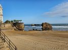
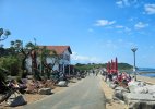
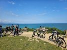
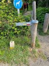
I started from the Biarritz lighthouse last year. I had spent the night in Bayonne, and took the train to Biarritz, then a bus to the lighthouse. The distance walked was about 13 miles.

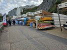
Here are some pictures from that day

Biarritz lighthouse.jpg

20230519_083753.jpg

20230519_123742.jpg

20230519_102120.jpg

20230519_101220.jpg

20230519_090213.jpg
 
For example, people here say the "warm up" from Biarritz to Irun (or Hondarribia) is easy, but Alltrains calls Biarritz-St Jean to Luz difficult. I'm already confused! Thanks for your thoughts.
I think that it is worth remembering that the difficultly level shown on an Alltrails route is an opinion expressed by one or more people rather than by Alltrails itself (a bit like opinions on this forum).

As a result the level of difficulty that is described is relative to that person's background. One persons difficult might be another person's easy.

For example, two weeks ago I walked the Comans Track which is close to Piha Beach in West Auckland with a group of other 70 and 80 year old trampers (hikers to you). I was the youngest in the party at age 70, with four women and two men.

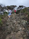
This is not a technically difficult walk although it is occasionally steep and in one spot there is a chain to aid ascent or descent.

PXL_20240411_012502340.MP.jpg

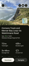
Alltrails lists this track as "Hard".

Screenshot_20240424-211217.png

While a local app with track descriptions lists it as "Intermediate".

Screenshot_20240424-211234.png

And I would rate it as "Easy".
 
...and ship it to Santiago for storage. You pick it up once in Santiago. Service offered by Casa Ivar (we use DHL for transportation).
I used the All Trails app last year on the Norte between Bilbao and Santander. Yes the app had the features that I needed, but you also need to look at the track you plan to follow. The Norte has many options and variations where you can stay closer to the coast or stick to paved roads. I looked at a couple of the saved tracks on Alltrails and compared them to the routes in Gronze and Wise Pilgrim. In the end I plotted my own combination of the options I wanted to walk and saved that route and downloaded it in advance to use offline.
 
I used the All Trails app last year on the Norte between Bilbao and Santander. Yes the app had the features that I needed, but you also need to look at the track you plan to follow. The Norte has many options and variations where you can stay closer to the coast or stick to paved roads. I looked at a couple of the saved tracks on Alltrails and compared them to the routes in Gronze and Wise Pilgrim. In the end I plotted my own combination of the options I wanted to walk and saved that route and downloaded it in advance to use offline.
Thanks! I have a lot of notes and suggestions from people here about the alternate routes. It involves some planning! And co-operative weather, i think.
 
Join the Camino cleanup. Logroño to Burgos May 2025 & Astorga to OCebreiro in June
I used the All Trails app last year on the Norte between Bilbao and Santander. Yes the app had the features that I needed, but you also need to look at the track you plan to follow. The Norte has many options and variations where you can stay closer to the coast or stick to paved roads. I looked at a couple of the saved tracks on Alltrails and compared them to the routes in Gronze and Wise Pilgrim. In the end I plotte
I used the All Trails app last year on the Norte between Bilbao and Santander. Yes the app had the features that I needed, but you also need to look at the track you plan to follow. The Norte has many options and variations where you can stay closer to the coast or stick to paved roads. I looked at a couple of the saved tracks on Alltrails and compared them to the routes in Gronze and Wise Pilgrim. In the end I plotted my own combination of the options I wanted to walk and saved that route and downloaded it in advance to use offli
I hope to do this section in June and prefer to stay as close to the coast as possible. Would you be able to share the route you took please @SFletcher as I am not very good with maps or planning routes.
Gracias
 
Hi.
I plan to walk from Bilbao to Santander in June and hope to stay as close to the coast as possible.
Would you mind sharing the route you downloaded please as I am useless with maps and would appreciate the assistance.😉
Muchas gracias
 
3rd Edition. Vital content training & pack guides avoid common mistakes, bed bugs etc
Biarritz to St Jean de Luz is easy. It's mostly flat, and mostly on trails and paved paths near along the coast. You can use Gronze for descriptions and elevations, and Gronze maps for GPS. Two caveats - Gronze is only in Spanish, but if you use the Chrome browser it will automatically translate to English, and Gronze maps needs an internet connection to work.

Another useful app is mapy.cz. All of the major hiking trails are already on it. You don't need to download anything extra, but once installed you can also download entire regions to use offline. In the settings under "map" you can

It took a bit but I was finally able to get mapy.cz to work. What is the best way to search for a route on this app? I plugged in Camino del Norte and no trails came up, then tried just point to point (Biarritz - St Jean de Luz) and no route either. Thx.
 
I use Alltrails a lot here in the US, in Iceland, on the Via Podiensis and a bit on the CF. Will it be useful on the Norte? For example, people here say the "warm up" from Biarritz to Irun (or Hondarribia) is easy, but Alltrains calls Biarritz-St Jean to Luz difficult. I'm already confused! Thanks for your thoughts.
I used all trail in the Norte and it worked fine
 
Get a spanish phone number with Airalo. eSim, so no physical SIM card. Easy to use app to add more funds if needed.
It took a bit but I was finally able to get mapy.cz to work. What is the best way to search for a route on this app? I plugged in Camino del Norte and no trails came up, then tried just point to point (Biarritz - St Jean de Luz) and no route either. Thx.
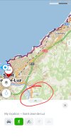
I think the easiest way to find the route is to search for Saint Jean-de-Luz then look at the shoreline of the harbor. You will see the Camino marked with a blue line and here-and-there labeled CdN (Camino del Norte). Some places it seems to disappear as it coincides with other routes marked with other colors. Searching for other places should bring it up too. You may have a harder time finding the blue line at those places so practice with Saint Jean-de-Luz.
 
Last edited:
I use Alltrails a lot here in the US, in Iceland, on the Via Podiensis and a bit on the CF. Will it be useful on the Norte? For example, people here say the "warm up" from Biarritz to Irun (or Hondarribia) is easy, but Alltrains calls Biarritz-St Jean to Luz difficult. I'm already confused! Thanks for your thoughts.
I also use All Trails extensively in the US but I used Far Out for the Norte (and Frances) and loved it. I did use All Trails on the Primitivo and it worked as well as it does for local trails in the US. Again, I prefer Far Out when they have maps available for the trail I'm hiking.
 
It took a bit but I was finally able to get mapy.cz to work. What is the best way to search for a route on this app? I plugged in Camino del Norte and no trails came up, then tried just point to point (Biarritz - St Jean de Luz) and no route either. Thx.
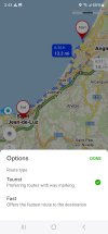
In mapy search for directions just as you would on Google Maps. The "from" location will default to your current location, but tap on the little green area to choose a different starting point.

(Click on images to enlarge)

Screenshot_20240424_154511_Mapycz.jpg
For the route type choose "tourist."

Screenshot_20240424_154306_Mapycz.jpg

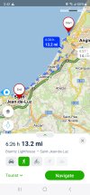
Here's the result.

Screenshot_20240424_154249_Mapycz.jpg

I found that I didn't usually need to actually '"navigate " along the route. While you are there you will see your dot on the trail, which in this case is called Sentier Littoral Bidart-Hendaye.

Screenshot_20240424_155038_Mapycz.jpg
 
The one from Galicia (the round) and the one from Castilla & Leon. Individually numbered and made by the same people that make the ones you see on your walk.
I hope to do this section in June and prefer to stay as close to the coast as possible. Would you be able to share the route you took please @SFletcher as I am not very good with maps or planning routes.
Gracias
We followed the solid line routes marked on the Gronze maps, with one exception - on the approach to Laredo, some of our group took the coastal route via Isequilla.
 
I use Alltrails a lot here in the US, in Iceland, on the Via Podiensis and a bit on the CF. Will it be useful on the Norte? For example, people here say the "warm up" from Biarritz to Irun (or Hondarribia) is easy, but Alltrains calls Biarritz-St Jean to Luz difficult. I'm already confused! Thanks for your thoughts.
Hi Silvamomma, I’ve never used Alltrails so can’t comment. After 4 days on the trail trail my experience so far is that the reviews are aimed at Pilgrims of all ages and capability. If you’re an experienced hill walker these trails are moderate with some strenuous sections. By the time you have reach the top of these sections the views are so rewarding that you forget how tough it was. Don’t worry it’s far exceeding my expectations already. Buen Camino
 
Get a spanish phone number with Airalo. eSim, so no physical SIM card. Easy to use app to add more funds if needed.
I use Alltrails a lot here in the US, in Iceland, on the Via Podiensis and a bit on the CF. Will it be useful on the Norte? For example, people here say the "warm up" from Biarritz to Irun (or Hondarribia) is easy, but Alltrains calls Biarritz-St Jean to Luz difficult. I'm already confused! Thanks for your thoughts.

If anyone is planning to walk the Norte be sure you read ourblog
Caminowalkaboutnorte.blogspot.com
 

❓How to ask a question

How to post a new question on the Camino Forum.

Most read last week in this forum

Hi all, I have walked the full Norte; first in 2016 to the Primitivo, and then the remainder last year. For some background, I walked the Via Podiensis with two friends in 2018. They have not...
Hi all, I am just starting to book for Camino del Norte for May 2025. We will be starting in Bidart. Has anyone got a recommendations for accommodation in Biarritz, Bidart & Saint Jean de luz ...
Hello! I've have searched hours for a way to split the much dreaded stage between Deba and Markina-Xemein into two days, to lessen its impact on my already-not-great-knees, but to no avail. I...
Hello! My title for my query is a. It misleading but I could not think of another way to word it! I am working on a different kind of itinerary for my Camino del Norte next summer. Rather than...

Featured threads

❓How to ask a question

How to post a new question on the Camino Forum.

Featured threads

Forum Rules

Forum Rules

Camino Updates on YouTube

Camino Conversations

Most downloaded Resources

This site is run by Ivar at

in Santiago de Compostela.
This site participates in the Amazon Affiliate program, designed to provide a means for Ivar to earn fees by linking to Amazon
Official Camino Passport (Credential) | 2024 Camino Guides
Back
Back
Top